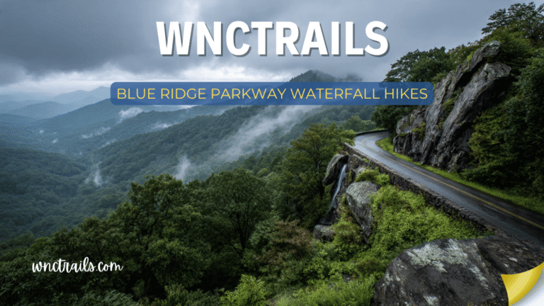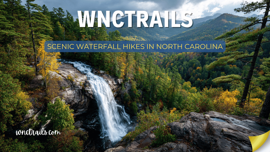
Scenic Waterfall Hikes In North Carolina
The best waterfall hikes in North Carolina are not just about the waterfall. They are about the forest you walk through to get there — the old-growth hemlocks, the rhododendron tunnels, the granite outcrops catching morning light. They are about the mountain views that open suddenly from a ridge. The river gorge that drops away below your feet. The wildflowers in April, the flame azaleas in June, the hardwoods turning amber and crimson in October.
A truly scenic waterfall hike delivers two experiences in one: a beautiful journey and a beautiful destination. This guide covers the best scenic waterfall hikes in North Carolina — trails where the scenery en route is as compelling as the cascade at the end, and where the overall visual experience is exceptional from the first step to the last.
What makes a hike “scenic”: Every hike on this list was selected for the quality of the landscape throughout the full route — not just at the falls. Criteria include forest character, geological interest, seasonal color, long-range views, and the overall sensory richness of the hiking environment.
Scenic Waterfall Hikes in North Carolina (2026 Guide)
Recommended Tools
Disclosure: This page may contain affiliate links.
- Water Shoes — Check current pricing
- Rain Jacket — Check current pricing
- Dry Bag — Check current pricing
Quick Reference: Scenic Waterfall Hikes
| Hike | Waterfall | Scenic Feature | Distance | Difficulty | Best Season |
|---|---|---|---|---|---|
| Graveyard Fields Loop | Lower + Upper Falls | Alpine meadow + mountain views | 3.2 mi | Easy–Moderate | Summer, Fall |
| Crabtree Falls Loop | Crabtree Falls | Old-growth forest + ridge views | 2.5 mi | Moderate | Spring, Fall |
| Linville Gorge Wilderness | Linville Falls | Deepest gorge in the East | 8.0+ mi | Strenuous | Spring, Fall |
| Rainbow Falls | Rainbow Falls | Wild & Scenic River gorge | 5.4 mi | Strenuous | Spring, Summer |
| Panthertown Valley | Schoolhouse + more | Granite domes + backcountry | 7.5 mi | Moderate | Summer, Fall |
| Hickory Nut Falls | Hickory Nut Falls | Dramatic cliff gorge + film location | 2.0 mi | Moderate | Fall, Spring |
| DuPont Waterfall Circuit | 5 major falls | River corridor + granite slabs | 7.0 mi | Moderate | Spring, Summer |
| Big Creek Trail | Mouse Creek Falls | Smoky Mtns old-growth forest | 10.0 mi | Strenuous | Spring, Fall |
| Art Loeb / Black Balsam | Davidson R. headwaters | 6,000-ft balds + panoramic views | 8.0 mi | Very Strenuous | Summer, Fall |
| Glen Falls | 3-tiered falls | Rhododendron gorge + overflow creek | 2.0 mi | Moderate | Spring, Fall |
| Stone Mountain Falls Loop | Stone Mountain Falls | Exposed granite dome landscape | 4.9 mi | Moderate | Fall, Spring |
| Catawba Falls | Catawba Falls | River corridor + hardwood canopy | 2.8 mi | Moderate | Fall, Spring |
1. Graveyard Fields Loop — Blue Ridge Parkway (MP 418.8)
Distance: 3.2-mile loop | Difficulty: Easy–Moderate | Best Season: Summer, Fall Waterfall: Lower Falls (60 ft) + Upper Falls (60+ ft) Signature Scenery: Open alpine meadow basin at 5,000 feet, surrounded by mountain ridgelines
One of the most visually distinctive landscapes in the entire Blue Ridge Mountains. Graveyard Fields sits in a high bowl at nearly 5,000 feet elevation — an open, grassy basin drained by Yellowstone Prong Creek, ringed by forested ridgelines that frame the sky like walls of a natural amphitheater. The name comes from moss-covered tree stumps that once resembled grave markers after a historic fire and windstorm.
The 3.2-mile loop descends from the Parkway into the basin, follows the creek downstream to Lower Falls, climbs to Upper Falls, and returns along a ridge with views across the bowl. Every section offers a different visual character — open meadow, creek gorge, waterfall, and ridge panorama.
What makes the scenery exceptional: At nearly 5,000 feet, Graveyard Fields has an alpine quality rare in the southern Appalachians. The open meadow feels more like the high West than the forested East. In late summer, the basin erupts in blueberries that attract bears, birds, and hikers alike. In October, the combination of yellow grasses, crimson blueberry bushes, and orange hardwoods on the surrounding ridges produces color that photographs cannot fully capture.
Photography notes:
- The golden hour view looking west across the meadow basin from the Parkway overlook is one of the finest landscape shots in WNC
- Lower Falls photographs beautifully from the downstream rock slabs in mid-morning light
- October 10–20 is typically peak color at this elevation — one of the finest fall hike experiences in the state
Logistics:
- Blue Ridge Parkway Milepost 418.8; large parking area
- Free; no dogs on trails; no fees on the Parkway
- Extremely busy on summer weekends — arrive before 8 AM
Coordinates: 35.3272° N, 82.8600° W
2. Crabtree Falls Loop — Blue Ridge Parkway (MP 339.5)
Distance: 2.5-mile loop | Difficulty: Moderate | Best Season: Spring, Fall Waterfall: Crabtree Falls (70 ft) Signature Scenery: Old-growth hemlock gorge, spring wildflowers, ridge views toward Black Mountains
The most complete scenic waterfall hike on the entire Blue Ridge Parkway. The Crabtree Falls loop descends through one of the finest remaining old-growth hemlock forests on the Parkway — a cathedral of tall, dark conifers draped in ferns and moss that creates an atmosphere entirely different from the surrounding mixed hardwood ridges. The 70-foot falls plunge in a single elegant curtain into a hemlock-framed pool.
The return route climbs out of the gorge via a ridge trail that opens to views of the Black Mountains — the highest range in the eastern United States — before returning to the Parkway.
What makes the scenery exceptional: The contrast between the two trail sections is dramatic. The descent through the hemlock gorge is dark, cool, and ancient-feeling — old-growth timber, dense understory, and the sound of the creek growing louder with every step. The return ridge is open, bright, and airy, with views that remind you how high on the mountain you actually are. The two halves of the loop feel like different worlds.
In April and May, the wildflower display in the gorge is extraordinary — trout lilies, trillium, wild ginger, and bloodroot carpet the forest floor before the canopy fills in.
Photography notes:
- The hemlock gorge photographs best in overcast light — heavy shade makes direct sun create harsh contrast
- The falls itself photographs well from the pool base in late morning
- Spring wildflowers (April–May) add a foreground element that elevates waterfall photography significantly
Logistics:
- Blue Ridge Parkway Milepost 339.5; moderate parking area
- Crabtree Meadows Campground adjacent — excellent overnight base
- Dogs allowed on leash; free to visit
- Less crowded than Linville or Graveyard Fields — a genuine advantage
Coordinates: 35.8076° N, 82.1418° W
3. Linville Gorge Wilderness
Distance: 8.0+ miles | Difficulty: Strenuous | Best Season: Spring, Fall Waterfall: Linville Falls (90 ft) Signature Scenery: Deepest gorge in the eastern United States, ancient rock formations, wilderness river corridor
The most geologically dramatic scenic waterfall hike in North Carolina. The Linville Gorge drops 2,000 feet from rim to river — the deepest gorge east of the Grand Canyon — and the full wilderness experience places Linville Falls not as a roadside attraction but as the natural climax of one of the most extraordinary landscapes in the Appalachians.
Ancient quartzite and granite walls rise vertically on both sides of the river, forested to the rim with old-growth timber in the most inaccessible sections. The Linville River runs cold and clear far below, visible as a silver thread from the rim trails.
What makes the scenery exceptional: The gorge has a primordial quality unlike anything else in Western NC — the scale, the ancient rock, the unbroken forest, and the wilderness designation combine to create an environment that feels genuinely remote even though it’s minutes from the Blue Ridge Parkway. The changing light inside the gorge throughout the day creates dramatically different visual experiences morning to afternoon.
In fall, the gorge walls turn gold, orange, and red from rim to river — a view that requires standing on the opposite rim to fully appreciate. The Chimneys, a series of quartzite spires rising from the gorge floor, are one of the most photogenic geological features in the state.
Photography notes:
- The Babel Tower Trail overlook at sunrise — with mist in the gorge below — is one of the finest landscape photography opportunities in North Carolina
- Fall color in the gorge (typically mid-October) is extraordinary from both rim trails
- The gorge floor in early morning light, with the river visible and mist rising, requires a strenuous descent to reach but rewards the effort
Logistics:
- Wilderness permits required on weekends May–October (Grandfather Ranger District)
- Multiple trailhead options on both rims; Babel Tower Trail on west rim recommended
- Strenuous and requires navigation experience — not a beginner wilderness hike
- Dogs allowed on leash on non-wilderness access trails
Coordinates (Babel Tower Trailhead): 35.9513° N, 81.9378° W
4. Rainbow Falls — Horsepasture River, Gorges State Park
Distance: 5.4 miles round-trip | Difficulty: Strenuous | Best Season: Spring, Summer Waterfall: Rainbow Falls (150 ft) Signature Scenery: Wild & Scenic River gorge, rainforest-like biodiversity, afternoon rainbow light
The lushest, most biologically extraordinary scenic waterfall hike in North Carolina. The Horsepasture River gorge receives over 80 inches of rainfall annually — more than any comparable area in the eastern United States — and the result is a landscape that approaches tropical richness in summer. Massive old-growth hemlocks, walls of rhododendron, hundreds of rare wildflower species, and a constant soundtrack of rushing water define the descent into the gorge.
The 150-foot Rainbow Falls plunges off a granite shelf into a mist-filled pool where rainbows form almost every afternoon — a phenomenon so reliable it named the falls.
What makes the scenery exceptional: The biodiversity of the Horsepasture gorge is literally world-class — botanists study this corridor specifically because of its unusual concentration of rare plant communities. The moss-covered boulders, the ancient hemlock canopy, and the roaring river create an environment unlike anywhere else in the Appalachians. Walking through it feels genuinely different from other waterfall hikes — more alive, more lush, more abundant.
Photography notes:
- Rainbow Falls is best photographed between 1–3 PM in summer when direct sunlight enters the gorge at the right angle to create the rainbow in the mist
- Wide-angle compositions from the gorge floor capture the full height of the falls with forest framing
- The approach trail has extraordinary moss-and-rhododendron compositions throughout — carry a camera for the entire descent, not just at the falls
Logistics:
- Gorges State Park trailhead near Sapphire, NC
- No entry fee; dogs allowed on leash
- Start early — allow 4–5 hours and expect a demanding return climb
- Combine with Turtleback Falls (0.5 mi further) for a complete gorge experience
Coordinates (Trailhead): 35.1063° N, 82.9615° W
5. Panthertown Valley — Granite Domes & Waterfall Loop
Distance: 7.5-mile loop | Difficulty: Moderate | Best Season: Summer, Fall Waterfalls: Schoolhouse Falls, Wilderness Falls, Mac’s Falls + more Signature Scenery: Open granite domes, backcountry valley, High Country panoramas
The most visually unique waterfall hiking landscape in North Carolina — and one of the most unusual natural landscapes in the entire eastern United States. Panthertown Valley contains exposed granite domes rising from the valley floor, open rock slabs with sweeping views, a backcountry creek corridor with multiple waterfalls, and a forest composition that shifts dramatically between the open rock terrain and the sheltered valley bottoms.
The “Yosemite of the East” comparison is apt — not in scale, but in the feeling of walking through an open, rocky, high-elevation landscape where long views appear unexpectedly.
What makes the scenery exceptional: Most WNC waterfall hikes are entirely forested — you walk through trees to a falls and walk back through trees. Panthertown breaks this pattern dramatically. The open granite domes provide views across the valley and to surrounding ridgelines. The transition between rock slab terrain and the sheltered creek corridor creates a visual variety that most single-destination waterfall hikes cannot match.
The waterfall density adds another dimension — five or six named waterfalls in a single day, each different in character, create a cumulative scenic experience rather than a single-point destination.
Photography notes:
- The granite domes at golden hour produce extraordinary light — warm rock, long shadows, sweeping valley views
- Schoolhouse Falls from above, looking down into the circular pool, is one of the most compositionally striking waterfall shots in WNC
- Fall color in the valley (mid-October) against the pale granite domes creates a color contrast unlike anywhere else in the region
Logistics:
- Access via Cold Mountain Road trailhead above Cashiers (unpaved, manageable in most vehicles)
- Free on National Forest land; dispersed camping available
- Download offline map — cell service unreliable; junctions are numerous
- Dogs allowed on leash
Coordinates (Cold Mountain Trailhead): 35.1063° N, 83.0547° W
6. Hickory Nut Falls — Chimney Rock State Park
Distance: 2.0 miles round-trip | Difficulty: Moderate | Best Season: Fall, Spring Waterfall: Hickory Nut Falls (404 ft) Signature Scenery: Sheer granite gorge walls, Rocky Broad River corridor, dramatic cliff formations
The most dramatically framed waterfall hike in North Carolina. The trail to Hickory Nut Falls follows the Rocky Broad River upstream through a narrow granite gorge where the cliff walls rise hundreds of feet on both sides — creating a visual corridor that builds anticipation with every bend. The 404-foot falls appear as a white line on the granite face above before the trail brings you to the base.
This is the gorge made famous in The Last of the Mohicans (1992) — and the dramatic scenery that drew filmmakers here remains unchanged.
What makes the scenery exceptional: The gorge geology at Chimney Rock is exceptional — ancient metamorphic rock polished by millennia of river action, with the Rocky Broad cutting through a landscape that feels carved rather than grown. The combination of vertical cliff walls, the boulder-strewn river corridor, and the sheer height of the falls creates a visual drama that most WNC waterfall hikes don’t approach.
In fall, the narrow gorge concentrates the color — with leaves turning at different times at different elevations, the gorge can display three or four distinct color stages simultaneously across its walls.
Photography notes:
- The trail approaching the falls base offers progressive reveals of the 404-foot cascade — compose multiple shots on the approach rather than waiting for the base
- The Rocky Broad River at the base of the gorge, with the falls visible above, produces excellent wide-angle compositions in late-afternoon light
- Fall color (mid-to-late October) in the gorge is among the finest in WNC due to the concentrated walls
Logistics:
- Chimney Rock State Park admission required: ~$17/adult, ~$10/child (ages 5–15)
- Seasonal hours — check the state park website before visiting
- The park also offers elevator access to the Chimney Rock summit for additional views
- Reservations recommended for peak fall weekends
Coordinates: 35.4334° N, 82.2451° W
7. DuPont Full Waterfall Circuit — DuPont State Recreational Forest
Distance: 7.0-mile loop | Difficulty: Moderate | Best Season: Spring, Summer Waterfalls: Hooker Falls, Triple Falls, High Falls, Bridal Veil (DuPont), Wintergreen Falls Signature Scenery: Granite river slabs, pine forest, open rock ledges, Little River corridor
The most varied scenic waterfall experience in a single trail system in North Carolina. The DuPont full waterfall circuit connects five distinct falls through a landscape that transitions between flat pine forest, granite river corridors, open rock slabs with downstream views, and dense rhododendron tunnels — each section visually distinct from the last.
Where most waterfall hikes are a single ecosystem, DuPont is a sampler of WNC forest and river landscapes within 7 miles.
What makes the scenery exceptional: The Little River’s interaction with the exposed granite bedrock throughout DuPont creates a series of visually extraordinary water-on-rock compositions — smooth slabs polished by the river, falls dropping over geometric granite ledges, and clear pools reflecting the surrounding forest. High Falls, in particular, presents a broad sheet of water over a massive granite face that is one of the most compositionally beautiful waterfall views in the state.
Photography notes:
- High Falls from downstream — the broad cascade reflected in the still pool below — is one of the most reproducible stunning waterfall shots in WNC
- Triple Falls in morning light with mist rising from the gorge is the classic “Hunger Games waterfall” shot
- The granite slabs above Hooker Falls catch afternoon light beautifully in late summer
Logistics:
- Start at Hooker Falls trailhead; multiple trailhead options
- Free to enter DuPont; dogs allowed on leash
- Busy on summer weekends — arrive before 8:30 AM for parking
- Mountain biking trails in the forest can be combined with the waterfall circuit for multi-sport days
Coordinates (Hooker Falls Trailhead): 35.1906° N, 82.6380° W
8. Big Creek Trail — Great Smoky Mountains National Park (NC Side)
Distance: 10.0 miles round-trip | Difficulty: Strenuous | Best Season: Spring, Fall Waterfall: Mouse Creek Falls (35 ft) + Midnight Hole Signature Scenery: Old-growth Smokies forest, ancient tulip poplars, pristine mountain creek
The most ecologically ancient scenic waterfall hike in North Carolina. Big Creek Trail on the NC side of the Smokies traverses one of the finest intact old-growth corridors in the eastern United States — a river valley where the logging era never reached and 400-year-old tulip poplars and hemlocks rise from a forest floor that has not been disturbed in centuries.
The trail follows Big Creek for 5 miles, passing Midnight Hole (a stunning deep swimming pool in carved bedrock), multiple cascades, and reaching Mouse Creek Falls — a 35-foot waterfall dropping from a side tributary into the main creek — before entering the old-growth Walnut Bottom area.
What makes the scenery exceptional: Old-growth forest has a presence that second-growth forest does not — the scale of the trees, the layered understory, the richness of the moss and fern communities. Walking through genuine old-growth is a qualitative experience that is increasingly rare. Big Creek’s old-growth sections are among the finest remaining in the Southeast.
In spring, the Smokies wildflower display along Big Creek is among the best in the entire national park system — trout lilies, hepatica, trillium, and wake-robin in successive waves from March through May.
Photography notes:
- The old-growth tulip poplar groves in the upper trail section (beyond Walnut Bottom) have a cathedral quality — wide-angle shots looking up into the canopy in filtered light
- Midnight Hole from above, with the deep blue pool and surrounding carved bedrock, is one of the finest swimming hole photographs in the Smokies
- Spring wildflower carpets along the creek bank in April produce extraordinary foreground for waterfall compositions
Logistics:
- Trailhead at Big Creek Campground/Picnic Area near I-40 exit 451
- No dogs allowed anywhere in Great Smoky Mountains National Park
- Free entry at this trailhead; NPS annual pass not required for parking here
- Allow a full day — 10 miles round-trip with significant scenery throughout
Coordinates (Trailhead): 35.7563° N, 83.1017° W
9. Art Loeb Trail — Black Balsam to Davidson River
Distance: 8.0 miles one-way (shuttle) | Difficulty: Very Strenuous | Best Season: Summer, Fall Waterfalls: Davidson River headwaters cascades Signature Scenery: 6,000-ft open balds, Shining Rock Wilderness, panoramic Blue Ridge views
The most scenically dramatic long waterfall hike in North Carolina — and one of the finest day hikes in the entire southern Appalachians. This section of the Art Loeb Trail begins above treeline on the Black Balsam Knob bald (6,214 ft) with 360-degree panoramic views of the Blue Ridge, descends through the Shining Rock Wilderness, and finishes in the Davidson River headwaters gorge where multiple cascades and waterfalls tumble through a dense rhododendron and hemlock corridor.
The hike transitions from an open, windswept ridgeline to a closed, intimate gorge — two completely different landscapes in a single route.
What makes the scenery exceptional: The Black Balsam bald section is among the finest high-elevation views in the eastern United States — open, treeless, with the entire Blue Ridge spread in every direction. Few waterfall hikes anywhere begin with this kind of panoramic scenery. The subsequent descent through Shining Rock Wilderness and into the gorge creates a journey through elevation zones that most hikers never experience in a single day.
The Davidson River gorge section, where the waterfalls are concentrated, is dense with rhododendron that tunnels over the creek in summer and frames every cascade with white blooms in late June.
Photography notes:
- Black Balsam summit at sunrise is one of the finest high-elevation photography spots in the East — bring a headlamp to start before dawn
- The Shining Rock formation itself (white quartz) is a striking photographic subject in mid-morning light
- Rhododendron bloom (late June–early July) in the Davidson gorge section creates a floral waterfall frame unique in WNC
Logistics:
- Shuttle required: upper trailhead at Black Balsam Knob parking (Blue Ridge Pkwy MP 420.2); lower trailhead at Davidson River Campground area
- Experienced hikers only — exposed ridgeline, weather changes rapidly above 5,500 ft
- Lightning risk on the balds — start early and be below treeline by noon if thunderstorms possible
- Allow 7–9 hours for the full one-way traverse
Coordinates (Upper Trailhead): 35.3237° N, 82.8977° W
10. Glen Falls — Near Highlands, NC
Distance: 2.0 miles round-trip | Difficulty: Moderate | Best Season: Spring, Fall Waterfalls: Three-tiered cascade (25 ft, 60 ft, 15 ft) Signature Scenery: Rhododendron tunnel gorge, East Fork Overflow Creek, Highlands plateau
The finest rhododendron gorge waterfall hike in North Carolina. Glen Falls descends through a dense rhododendron tunnel on the East Fork Overflow Creek — a corridor so thickly canopied by rhododendron that it creates a green tunnel effect in summer and an extraordinary bloom corridor in late spring. Three waterfalls in succession punctuate the descent, each with its own character and pool.
What makes the scenery exceptional: The rhododendron corridor is the defining visual feature — Glen Falls is specifically compelling in late May and early June when the rhododendron is in full bloom, creating a pink and white floral arch over the trail and falls. Outside of bloom season, the dense evergreen canopy creates a lush tunnel effect that is beautiful in its own right.
The Highlands plateau setting gives the upper trailhead an unusually high elevation (around 3,800 ft), producing a cooler, clearer atmosphere than lower-elevation gorge hikes.
Photography notes:
- Rhododendron bloom peak (late May–early June) turns this into one of the most visually extraordinary waterfall hikes in the state — blooms framing every waterfall composition
- The 60-foot middle falls from below, with rhododendron in the frame, is one of the most distinctive waterfall shots in WNC
- Overcast light works best throughout this shaded gorge
Logistics:
- Trailhead off Overflow Road near Highlands; gravel parking area
- Free on National Forest land; dogs allowed on leash
- Steep descent — 600 ft one-way; the return climb is the hard part
- Budget 2–3 hours including time at each waterfall
Coordinates: 35.0208° N, 83.1714° W
11. Stone Mountain Falls Loop — Stone Mountain State Park
Distance: 4.9-mile loop | Difficulty: Moderate–Strenuous | Best Season: Fall, Spring Waterfall: Stone Mountain Falls (200 ft seasonal cascade) Signature Scenery: Massive exposed granite monolith, open rock face, foothills panorama
The most geologically dramatic scenic waterfall hike in the NC foothills. Stone Mountain is a massive exposed granite dome — one of the largest in the eastern United States — and the loop trail circumnavigates it while descending to the 200-foot seasonal cascade that slides down the open rock face. The sight of a waterfall on a bare granite mountain is genuinely unlike anything else in North Carolina.
What makes the scenery exceptional: The granite dome itself dominates everything — a pale, rounded mass of ancient rock rising from the surrounding forest like a geological monument. Walking the loop trail means spending extended time at the base of this formation, with the dome filling your entire horizon. The waterfall, sliding down the open face, adds a dynamic element to a landscape that is already extraordinary in its static geology.
In fall, the surrounding forest turns gold and orange while the dome remains pale gray — a color contrast that makes the falls and dome together a striking visual composition.
Photography notes:
- The dome from the western forest approach in fall light — pale granite against orange and gold trees — is one of the finest geological landscape shots in NC
- Stone Mountain Falls from the trail below, with the full dome visible above, benefits from a wide-angle lens and overcast light
- Morning light catches the dome face best — plan arrival for the first two hours after sunrise
Logistics:
- Stone Mountain State Park; $8/adult day-use fee
- The falls are seasonal — best January through May; can be minimal in summer drought
- Loop can be done in either direction — counterclockwise gives the better descent to the falls
- Dogs allowed on leash
Coordinates: 36.3931° N, 81.0460° W
12. Catawba Falls — Old Fort, NC
Distance: 2.8 miles round-trip | Difficulty: Moderate | Best Season: Fall, Spring Waterfall: Catawba Falls (100 ft) Signature Scenery: Catawba River corridor, mixed hardwood canopy, creek crossing adventure
The finest river corridor waterfall hike in the eastern Pisgah. The trail follows the Catawba River upstream through a beautiful mixed hardwood forest — old tulip poplars, large-diameter oaks, and river birches — with the river always audible and frequently visible through the trees. Multiple creek crossings add a playful adventure element to the approach, and the 100-foot plunge at the end is genuinely powerful.
What makes the scenery exceptional: The Catawba River corridor has a richness of tree form and river dynamics rarely found on shorter waterfall trails. The large-diameter tulip poplars in the approach section are particularly impressive — some exceed four feet in diameter. The river itself, tumbling over boulders and pooling in clear plunge pools throughout the hike, creates a continuous water feature rather than a single destination waterfall.
In fall, the mixed hardwood canopy produces spectacular color that frames the river beautifully — this is one of the finest fall foliage waterfall hikes in WNC.
Photography notes:
- The Catawba River at the larger boulders mid-trail photographs exceptionally in fall — leaf color in the canopy, clear water, and interesting foreground rock
- Catawba Falls from the base with the autumn trees visible above the plunge is a classic WNC fall shot
- Morning light reaches the falls base better than afternoon — plan accordingly
Logistics:
- Trailhead 5 miles from I-40 exit 73 near Old Fort — excellent highway access
- Dogs allowed on leash; free on National Forest land
- Creek crossings can be knee-deep after rain — check conditions before visiting
- Parking can fill on fall weekends — arrive early
Coordinates: 35.6281° N, 82.1668° W
Scenic Waterfall Hikes by Season
Spring (March–May): Peak Flow, Peak Color
Spring is the finest overall season for scenic waterfall hiking in NC. Snowmelt and consistent rainfall bring streams to maximum volume — falls are louder, wider, and more powerful than any other time of year. The forest transitions from bare branch to full leaf through April and May, creating a progressive visual show alongside the water.
Best spring picks: Crabtree Falls (wildflowers), Big Creek Trail (Smokies wildflower peak), Glen Falls (rhododendron beginning), Catawba Falls (full river flow)
Spring tip: The week after significant April rainfall produces the most dramatic waterfall conditions of the year. Check weather and plan accordingly — wet approaches are worth it.
Summer (June–August): Lush Green, High Elevation
Summer brings full forest canopy, high-elevation relief from heat, and the rhododendron bloom that peaks in late June–early July. Water levels drop from spring but remain substantial through July in most years. High-elevation hikes (Graveyard Fields, Art Loeb, Black Balsam) are cooler than the valley by 15–20°F.
Best summer picks: Graveyard Fields (alpine meadow scenery), Panthertown Valley (granite domes + swimming), Art Loeb (above-treeline views), Rainbow Falls (afternoon rainbows)
Summer tip: Afternoon thunderstorms are common on exposed ridgelines June–August. Start strenuous high-elevation hikes before 7 AM and be below treeline by noon.
Fall (September–November): The Premier Season
Western North Carolina’s fall color is among the finest in the eastern United States — and waterfall hikes in fall combine peak color with the visual drama of cascading water. High-elevation color peaks mid-October; lower elevations follow through early November.
Best fall picks: Linville Gorge (gorge walls in color), Hickory Nut Falls (concentrated gorge color), Stone Mountain Falls (granite dome + orange forest), Catawba Falls (river corridor color)
Fall tip: Elevation determines timing. Plan higher-elevation hikes (above 4,000 ft) for October 5–15; mid-elevation hikes for October 15–25; foothills sites for late October to early November.
Winter (December–February): Ice and Solitude
Winter brings dramatically reduced crowds, the possibility of ice formations on falls and cliffs, and a stark visual clarity when leaves are down. Linville Gorge, in particular, is extraordinary in winter — the bare rock walls and ice-draped cliffs visible through leafless trees create a completely different visual character.
Best winter picks: Linville Gorge (ice formations, bare gorge walls), Crabtree Falls (ice on hemlock gorge), Looking Glass Falls (occasional ice framing), Graveyard Fields (snow-covered alpine basin)
Winter tip: Carry microspikes or traction devices for any hike above 3,000 ft from December through February — black ice on trail surfaces is common and dangerous without them.
Photography Guide: Getting the Best Waterfall Shot
Light
Overcast light is the waterfall photographer’s best friend. Direct sunlight on white water creates blown-out highlights and deep shadows simultaneously — overcast produces even, soft light that renders the full tonal range of the scene. Cloudy days are ideal for waterfall photography even when they seem less appealing for hiking.
Golden hour (first and last hour of daylight) works beautifully for waterfalls in open settings — Graveyard Fields meadow, Stone Mountain dome, Black Balsam bald. For gorge waterfalls, golden hour light often doesn’t reach the falls base at all.
Long Exposure
A long exposure (0.5–2 seconds) blurs moving water into a silky motion effect. For this you need a tripod and either a neutral density filter or shooting in low light. Many of the most iconic waterfall photos you’ve seen use this technique.
Without a tripod: Brace the camera against a rock or tree and use burst mode — some frames will be sharp enough for a moderate motion blur.
Composition
Include something other than the falls — a framing tree, a mossy boulder, a person for scale. The most compelling waterfall photos have a relationship between the cascade and its environment.
Get low — shooting from ground level with foreground rock or water in the frame produces a sense of depth that eye-level shots often lack.
Step back — the impulse is to get close, but many waterfalls are best captured from further away where more of the gorge or forest is visible.
Key Considerations
When planning a scenic waterfall hike in North Carolina, a few practical factors can help ensure a safe and enjoyable experience:
- Trail Difficulty: Waterfall hikes range from paved, wheelchair-accessible paths to rugged, steep climbs. Check trail length, elevation gain, and technical features before you go.
- Seasonal Conditions: Water flow is often strongest in spring and after heavy rains. Leaf-off seasons (late fall, early spring) can offer clearer views, while summer brings lush greenery and the chance to cool off in misty spray.
- Safety: Rocks near waterfalls are slippery year-round. Stay on marked trails, supervise children closely, and avoid climbing on or swimming near the falls unless specifically permitted.
- Parking and Access: Some popular trailheads fill quickly, especially on weekends. Arrive early or consider less-visited waterfalls for solitude.
- Leave No Trace: Pack out all trash, respect posted signs, and help preserve these special places for future hikers.
Common Use Cases
Scenic waterfall hikes in North Carolina appeal to a wide range of outdoor enthusiasts. Here are some typical ways hikers enjoy these trails:
- Family Outings: Many falls, such as Looking Glass or Hooker Falls, are suitable for all ages and offer short, accessible walks.
- Photography: Waterfalls provide dynamic subjects for landscape photography. Early morning and late afternoon light often yield the best images.
- Fitness and Adventure: Longer hikes like those to Rainbow Falls or Upper Whitewater Falls challenge experienced hikers with elevation and distance.
- Nature Observation: Waterfall environments support diverse plant and animal life. Watch for wildflowers, salamanders, and birds along the trails.
- Picnicking and Relaxation: Many waterfall areas have nearby picnic spots and benches, perfect for a restful break with a view.
Hiking to waterfalls is also a popular way to introduce newcomers to the outdoors, thanks to the immediate reward of a scenic destination. Many local hiking groups and outdoor organizations offer guided waterfall hikes, especially during peak wildflower or autumn leaf seasons.
Final Thoughts
The greatest waterfall hikes in North Carolina are not simple transactions — drive here, walk to falls, take photo, leave. They are full environmental experiences where the journey is inseparable from the destination.
The forest you walk through, the gorge you descend into, the ridgeline you cross to reach the drainage — these things matter. They are what transforms a waterfall visit from a checklist item into a memory that stays with you.
Find the hike where the whole thing is beautiful. Go slowly. Look around.
Frequently Asked Questions
- Which waterfall hikes are best for beginners?
Looking Glass Falls, Hooker Falls, and Dry Falls all offer easy access and short trails suitable for beginners and families. - Are dogs allowed on waterfall trails?
Most public lands in North Carolina allow leashed dogs on trails, but always check specific area regulations before visiting. - When is the best time to hike to waterfalls?
Spring and early summer typically provide the most dramatic water flow, but falls are beautiful year-round. Early mornings and weekdays see fewer crowds. - Is swimming allowed at North Carolina waterfalls?
Swimming is permitted at some locations, such as Sliding Rock and Hooker Falls, but can be dangerous elsewhere. Always observe posted warnings and use caution. - How can I find less-crowded waterfall hikes?
Explore lesser-known trails in Nantahala or Pisgah National Forests, or visit popular sites early or during off-peak times. Local ranger stations and trail guides can suggest quieter options. - What should I bring on a waterfall hike?
Sturdy shoes, water, snacks, a map or GPS, rain gear, and a camera are recommended. Trekking poles can help on steeper or slippery sections.
For more detailed trail guides, seasonal tips, and local recommendations, explore the WNC Trails website or reach out to our team for personalized advice on planning your next scenic waterfall hike in North Carolina.
Related Pages
Have a scenic waterfall hike in NC with scenery that rivals the falls? Share it in the comments below!
Explore more of Western North Carolina’s most beautiful trails at WNCTrails.com →