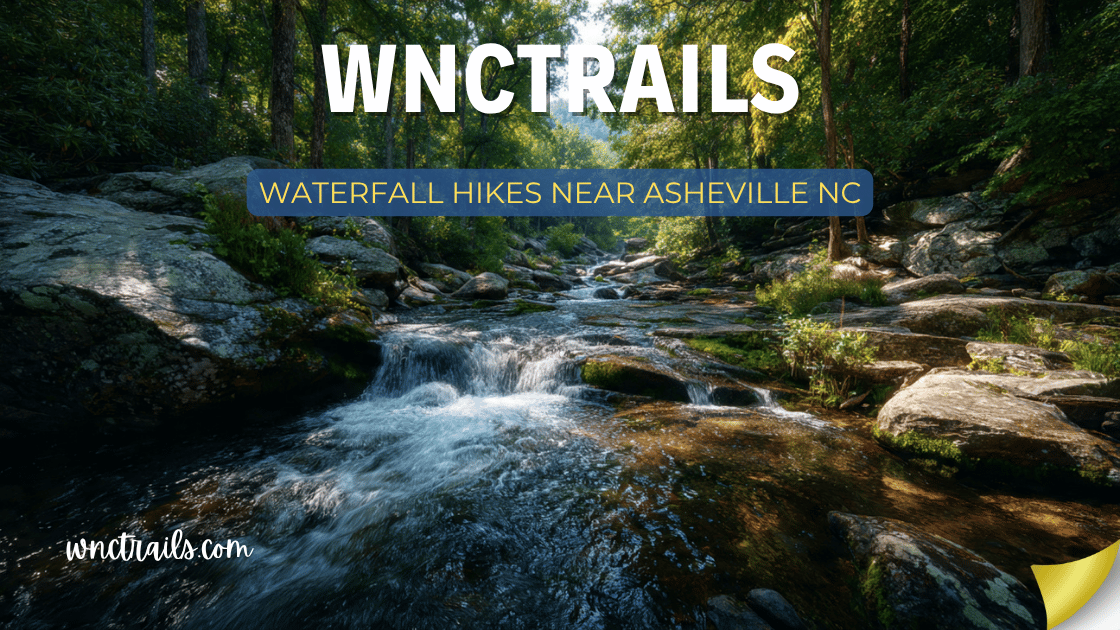
Waterfall Hikes Near Asheville Nc
Asheville sits at the center of one of the most waterfall-dense regions in North America — and the best ones are closer than most visitors ever realize.
Within 60 miles of downtown Asheville, more than 50 named waterfalls pour off the Blue Ridge, the Pisgah ridgeline, the Black Mountains, and the gorges of the French Broad watershed. Within 30 miles, you have enough waterfalls to fill a week of serious hiking. Within 15 miles, you have enough to fill a long weekend without repeating yourself.
This guide covers the 15 best waterfall hikes within one hour of Asheville, organized by drive time so you can match the outing to your schedule — whether you have 90 minutes or a full day.
Waterfall Hikes Near Asheville NC: 15 Best Waterfalls Within 1 Hour of the City
Recommended Tools
Disclosure: This page may contain affiliate links.
- Water Shoes — Check current pricing
- Rain Jacket — Check current pricing
- Dry Bag — Check current pricing
Quick Reference: Waterfalls Near Asheville by Drive Time
| Waterfall | Drive from Asheville | Distance (RT) | Difficulty | Height | Parking | GPS |
|---|---|---|---|---|---|---|
| Graveyard Fields (Second Falls) | 35 min | 1.0 mi | Easy | 60 ft | $20 BRP | 35.3230°N, 82.8552°W |
| Looking Glass Falls | 40 min | 0.1 mi | Easy | 60 ft | $5 | 35.3113°N, 82.7681°W |
| Sliding Rock | 40 min | 0.2 mi | Easy | 60 ft | $5 | 35.3275°N, 82.7836°W |
| Moore Cove Falls | 42 min | 1.4 mi | Easy | 50 ft | Free | 35.3097°N, 82.7545°W |
| Graveyard Fields (Upper Falls) | 35 min | 3.4 mi | Moderate | 50 ft | $20 BRP | 35.3240°N, 82.8482°W |
| Courthouse Falls | 55 min | 0.6 mi | Easy-Mod | 40 ft | Free | 35.2437°N, 82.9319°W |
| Twin Falls | 55 min | 3.2 mi | Moderate | 125 ft | Free | 35.2301°N, 82.9541°W |
| Catawba Falls | 45 min | 3.4 mi | Moderate | 100 ft | Free | 35.6459°N, 82.2137°W |
| Setrock Creek Falls | 50 min | 1.2 mi | Easy | 80 ft | Free | 35.7125°N, 82.2489°W |
| Hickory Nut Falls | 25 min | 1.5 mi | Moderate | 404 ft | $10 | 35.4321°N, 82.2369°W |
| Bridal Veil Falls (Chimney Rock) | 25 min | 0.5 mi | Easy | 404 ft trail adj. | $10 | 35.4298°N, 82.2402°W |
| Rainbow Falls (Gorges SP) | 60 min | 5.0 mi | Hard | 150 ft | Free | 35.0883°N, 82.9429°W |
| Turtleback Falls | 60 min | 0.4 mi | Easy | 20 ft | Free | 35.0956°N, 82.9528°W |
| Laurel River Falls | 30 min | 2.2 mi | Easy-Mod | 35 ft | Free | 35.8012°N, 82.6121°W |
| Glenn Falls | 55 min | 1.6 mi | Moderate | 60 ft | Free | 35.0823°N, 82.9819°W |
BRP = Blue Ridge Parkway fee. America the Beautiful Pass covers all federal fees.
Under 30 Minutes from Asheville
These waterfalls are within a short drive — close enough to fit before lunch, after work, or on a half-day when you don’t want to commit to a full mountain excursion.
1. Hickory Nut Falls — Chimney Rock State Park
The Tallest Waterfall Near Asheville
Drive: 25 min | Distance: 1.5 miles RT | Elevation Gain: 800 ft | Difficulty: Moderate | Time: 1.5–2.5 hours
GPS: 35.4321°N, 82.2369°W | Parking: Chimney Rock State Park main entrance, $10/person
At 404 feet, Hickory Nut Falls is the tallest waterfall within 30 minutes of Asheville, the backdrop of the climactic scene in The Last of the Mohicans (1992), and by any measure one of the most dramatic vertical drops in the eastern United States.
The trailhead sits inside Chimney Rock State Park — the same park where you can hike to the 315-foot granite dome — and the Hickory Nut Falls Trail climbs directly up the gorge wall to a viewing platform at the base of the falls. The climb is steep and sustained, gaining 800 feet in less than a mile, but it’s on a good trail with handrails in the steepest sections.
The falls drop off the rim of the Blue Ridge escarpment in a single free-fall plunge. In dry weather, the falls become more of a ribbon; after heavy rain they expand to a curtain of significant volume and sound. The viewing platform puts you within 100 feet of the base — spray is guaranteed in spring.
Park entry note: Chimney Rock charges per-person admission ($10 adults, $5 children ages 5–15). An America the Beautiful Annual Pass does NOT cover this park — it’s a North Carolina State Park. NC State Parks have their own fee structure. Your park entry also covers access to Chimney Rock summit trails and other park features.
Photography: The falls face roughly west, making late-afternoon light ideal for illuminating the drop face. Morning visits see the falls in shade, which works well for long-exposure photography but less well for dramatic backlit shots.
Combined trip: Pair Hickory Nut Falls with the Chimney Rock summit trail for a full morning. The summit offers a 75-mile panoramic view of the Piedmont and is arguably the most dramatic overlook within an hour of Asheville.
2. Bridal Veil Falls — Chimney Rock State Park
The Easy Companion
Drive: 25 min | Distance: 0.5 miles RT | Elevation Gain: 100 ft | Difficulty: Easy | Time: 20–40 min
GPS: 35.4298°N, 82.2402°W | Parking: Chimney Rock State Park (same $10 entry)
Bridal Veil Falls sits on the opposite wall of Hickory Nut Gorge from the main falls — a 120-foot lace waterfall that spills off an overhang and drifts in the gorge thermals like smoke. The falls are accessible on the Opera Box Trail, a short, relatively flat path from the park’s main trail network.
While Hickory Nut Falls is about scale and impact, Bridal Veil is about delicacy — the water disperses into fine spray before reaching the gorge floor, and the overhang creates a dry shelter beneath it similar to Moore Cove Falls in Pisgah. In winter, the spray builds elaborate ice formations on the surrounding cliff face.
Combine both falls in a single Chimney Rock visit: start with Bridal Veil (easy, short, get it done), then climb to Hickory Nut Falls, then optionally continue to the Chimney Rock summit.
3. Laurel River Falls
The Local Secret
Drive: 30 min | Distance: 2.2 miles RT | Elevation Gain: 280 ft | Difficulty: Easy-Moderate | Time: 1–2 hours
GPS: 35.8012°N, 82.6121°W | Parking: Laurel River Trail trailhead off US-25/70 in Hot Springs area, free
The Laurel River Trail follows the Big Laurel Creek — a clear, cold mountain stream — through a deep gorge north of Marshall before reaching a 35-foot cascade where the river narrows through a fractured rock channel.
The falls themselves are modest in height but dramatic in setting: hemlock forest on both sides, the river loud and white through the gorge, and the surrounding walls shutting out much of the sky. The trail is gentle enough that it works for most fitness levels, with the creek as a constant companion.
What makes this special for Asheville residents: It’s genuinely not on most tourist itineraries. The Hot Springs corridor (US-25/70) is primarily known as a through-route to Tennessee rather than as a hiking destination. The Laurel River Trail gets a fraction of the traffic of any Pisgah waterfall despite being a superior hiking experience for those who care about the journey rather than just the destination.
Side note: Hot Springs (6 miles further up US-25/70) has natural hot spring mineral baths operated by a resort — an easy add-on if you want to soak after hiking.
30–45 Minutes from Asheville
4. Graveyard Fields — Second Falls + Upper Falls
The High-Elevation Crown Jewel
Drive: 35 min | Distance: 1.0 mi to Second Falls / 3.4 mi to both | Elevation Gain: 150 ft / 425 ft | Difficulty: Easy / Moderate | Time: 1–3 hours
GPS: 35.3230°N, 82.8552°W | Parking: Graveyard Fields Overlook, Milepost 418.8, Blue Ridge Parkway, $20 fee
Graveyard Fields is the single most popular Asheville-area waterfall destination — a high-elevation plateau at 5,120 feet on the Blue Ridge Parkway where two waterfalls bracket a wide, open meadow of bog and grass that feels nothing like the rest of the southern Appalachians.
Second Falls (the main attraction for casual visitors) drops 60 feet into a broad swimming pool in less than half a mile from the parking area. It’s accessible enough that families with strollers and older adults make the walk regularly — the first section of trail is paved.
Upper Falls (the better waterfall) requires the additional 1.2-mile extension upstream. The falls drop 50 feet in a curtain over a horizontal rock ledge into a clean plunge pool surrounded by spruce-fir forest. The creek crossing before Upper Falls has no bridge — wet feet are likely in spring. The payoff is nearly complete solitude even when Second Falls is crowded.
The Graveyard Fields problem: This is the most overcrowded hiking destination within an hour of Asheville. On summer and fall weekends, the parking lot fills by 9 AM and cars line the Parkway for half a mile. The single most effective strategy: arrive before 8 AM, or visit on a weekday.
High-elevation bonus: At 5,100 feet, Graveyard Fields is 15–20°F cooler than Asheville on summer afternoons. It’s genuinely alpine in character — the spruce-fir forest, the open boggy meadows, the absence of hardwoods. In fall, the Parkway corridor here hits peak color 2–3 weeks before downtown Asheville.
Blue Ridge Parkway fee note: The BRP charges $20/vehicle. An America the Beautiful Annual Pass ($80) covers this fee and pays for itself after four Parkway visits.
5. Catawba Falls
The Eastern Surprise
Drive: 45 min | Distance: 3.4 miles RT | Elevation Gain: 600 ft | Difficulty: Moderate | Time: 2–3.5 hours
GPS: 35.6459°N, 82.2137°W | Parking: Catawba Falls Trailhead off Old Fort Road, free
Catawba Falls sits in the eastern shadow of the Black Mountains, accessed from Old Fort (I-40 Exit 73) rather than from the mountain roads Asheville visitors typically use. The result: a 100-foot multi-tiered waterfall in a narrow river gorge that sees far less traffic than Pisgah despite being equally accessible.
The trail follows the Catawba River through a hardwood gorge with excellent fall color, two creek crossings (no bridges, plan for wet feet in high water), and a final approach to a dramatic upper tier visible from 100 feet away. The main basin holds two primary drops — a 40-foot upper cascade and a 60-foot lower plunge — which together create one of the most photogenic waterfall scenes within an hour of Asheville.
Why this belongs on your Asheville itinerary: It’s in the opposite direction from where most visitors go (east toward Chimney Rock / Old Fort rather than west toward Pisgah), which means dramatically lower crowds. On a busy Saturday when Looking Glass Falls has 200 people and Graveyard Fields is standing-room-only, Catawba Falls might have 20.
40–55 Minutes from Asheville: The Pisgah Corridor
6. Looking Glass Falls
The Iconic Standard
Drive: 40 min | Distance: 0.1 miles RT | Elevation Gain: 30 ft | Difficulty: Easy | Time: 15–30 min
GPS: 35.3113°N, 82.7681°W | Parking: Roadside pullout on US-276, $5
Looking Glass Falls drops 60 feet over a full-width granite face into a broad pool at the bottom — the most symmetrical, most photographed, most recognizable waterfall in North Carolina. The viewing platform is 100 feet from the base. Stone steps descend to the pool edge for closer views.
The combination of accessibility (literally park and walk 50 feet) with genuine natural drama (60-foot curtain drop, wide pool, framed by hemlocks) makes this the single most important waterfall stop in the Pisgah-Brevard corridor for first-time visitors.
For Asheville visitors: The drive down US-276 from the Parkway through the Davidson River valley is itself worth the trip — one of the most scenic roads in western North Carolina.
7. Moore Cove Falls
Walk Behind the Waterfall
Drive: 42 min | Distance: 1.4 miles RT | Elevation Gain: 180 ft | Difficulty: Easy | Time: 45–75 min
GPS: 35.3097°N, 82.7545°W | Parking: Roadside lot on US-276, free
Moore Cove Falls provides the most unique physical experience of any waterfall near Asheville: you walk behind it. The 50-foot drop falls from an overhanging ledge, sending the water outward from the rock face and creating a dry alcove large enough to stand in. The surrounding forest is excellent for spring wildflowers (late March through early May).
The short trail makes this appropriate for almost any fitness level. Pair it with Looking Glass Falls for a complete Pisgah morning.
8. Sliding Rock
The Natural Water Slide
Drive: 40 min | Distance: 0.2 miles RT | Elevation Gain: Minimal | Difficulty: Easy | Time: 30 min–2 hours
GPS: 35.3275°N, 82.7836°W | Parking: Dedicated USFS lot, $5
Sliding Rock is where the Davidson River drops 60 feet over a smooth granite face into a deep pool — and where, on any summer weekend, hundreds of people line up to ride that 23-foot descent in 50°F water. It’s equal parts attraction and waterfall. Arrive before 10 AM to avoid the line.
9. Courthouse Falls
The Circular Plunge Pool
Drive: 55 min | Distance: 0.6 miles RT | Elevation Gain: 80 ft | Difficulty: Easy-Moderate | Time: 30–60 min
GPS: 35.2437°N, 82.9319°W | Parking: FR-140 pullout, free
Courthouse Falls drops 40 feet into a perfectly circular plunge pool — a geological curiosity formed by erosional grinding over millennia. The pool is swimmable in summer, the trail is short, and the waterfall’s unusual geometry makes it one of the most interesting-looking drops in the Pisgah corridor despite its modest height.
10. Twin Falls
Double the Drama
Drive: 55 min | Distance: 3.2 miles RT | Elevation Gain: 650 ft | Difficulty: Moderate | Time: 2–3.5 hours
GPS: 35.2301°N, 82.9541°W | Parking: End of FR-225B, free
Twin Falls delivers two waterfalls dropping 125 combined feet from separate forks into the same pool — a natural amphitheater of considerable drama. This is the best full hike in the southern Pisgah corridor for Asheville day-trippers willing to put in a couple of hours.
11. Setrock Creek Falls
The Historical Stop
Drive: 50 min | Distance: 1.2 miles RT | Elevation Gain: 150 ft | Difficulty: Easy | Time: 45–75 min
GPS: 35.7125°N, 82.2489°W | Parking: Curtis Creek Campground, free
Setrock Creek Falls spreads 80 feet across a wide fan of rock in the Curtis Creek watershed — the oldest National Forest land in the eastern United States, purchased in 1911. The trail is short, the falls are distinctive (that fan spread is unusual), and the historical context adds an educational dimension to what would otherwise be a straightforward waterfall walk.
55–60 Minutes from Asheville: The Gorges
The Gorges State Park area, in the far southwestern corner of Transylvania County near the South Carolina border, contains the most dramatic topography in the Carolinas. The Blue Ridge escarpment here drops 2,000 feet in less than 3 miles — creating waterfalls of unusual height and force. It’s the far edge of the “one hour” range from Asheville but worth including for the sheer scale.
12. Rainbow Falls — Gorges State Park
The Powerful One
Drive: 60 min | Distance: 5.0 miles RT | Elevation Gain: 1,100 ft | Difficulty: Hard | Time: 3–5 hours
GPS: 35.0883°N, 82.9429°W | Parking: Gorges State Park trailhead off Bald Rock Road, free
Rainbow Falls drops 150 feet into a massive plunge basin — one of the most powerful waterfalls in the Carolinas, fed by the Horsepasture River as it descends the escarpment. The name comes from the permanent rainbow generated by the mist on sunny afternoons (typically 1–4 PM).
The hike is the longest and most demanding in this guide — 5 miles round-trip with 1,100 feet of elevation gain, including a steep descent to the river gorge and an equally steep return. The trail is well-maintained but relentless on the return climb. This is a serious half-day hike, not a casual waterfall walk.
What makes it worth the effort: Rainbow Falls is in a genuinely different class from the other waterfalls near Asheville. The volume, the height, the mist field, and the gorge setting combine into an experience closer to standing near a major western waterfall than anything else in the southern Appalachians.
Seasonal note: Visit on a sunny afternoon (1–3 PM) to see the rainbow. Overcast days are fine for photography but miss the rainbow effect entirely.
13. Turtleback Falls — Gorges State Park
The Slide Waterfall
Drive: 60 min | Distance: 0.4 miles RT | Elevation Gain: 80 ft | Difficulty: Easy | Time: 20–40 min
GPS: 35.0956°N, 82.9528°W | Parking: Gorges State Park, free (same access road as Rainbow Falls)
Turtleback Falls is a natural water slide similar to Sliding Rock but in a wilder, less managed setting. The Horsepasture River slides 20 feet over a smooth, turtle-shell-curved rock face into a deep green pool. Swimming and sliding are permitted (no lifeguards, no fees, use judgment).
Because it’s 0.4 miles from the Gorges parking area, Turtleback can be visited in under an hour. If you’re making the Rainbow Falls trip anyway, add Turtleback on the approach — it’s on the same trail, before the serious climbing begins.
Important: The Horsepasture River Gorge has claimed multiple lives from people who went too far past Turtleback Falls and were swept over the upper portion of the gorge. Stay on the designated trail, stay away from the river bank above the falls, and treat the “no entry” signs as absolute.
14. Glenn Falls
The Overlooked Gorges Entry
Drive: 55 min | Distance: 1.6 miles RT | Elevation Gain: 350 ft | Difficulty: Moderate | Time: 1–2 hours
GPS: 35.0823°N, 82.9819°W | Parking: Glenn Falls Trailhead on Glenn Falls Road near Highlands, free
Glenn Falls is technically closer to Highlands than to Asheville, but the drive from Asheville via US-64 is under an hour. The trail descends steeply from the trailhead to three consecutive tiers of falls — 15 feet, 20 feet, and 60 feet — visible from a single viewpoint at the bottom.
The three-tier structure makes Glenn Falls unusual: most waterfalls show one drop from the base; here you look up through a cascade sequence. The surrounding vegetation is dense rhododendron and hemlock, creating a tunnel effect on the trail approach.
Top Asheville Waterfall Day-Trip Itineraries
The Classic Half-Day (3–4 Hours, Best for First Timers)
Perfect for: Visitors with limited time, families with young children, anyone seeing Pisgah for the first time
Drive time from Asheville: 40 minutes to start
- Looking Glass Falls (0.1 mi, 20 min) — Photos from the platform, walk to the pool
- Moore Cove Falls (1.4 mi, 60 min) — Walk behind the waterfall
- Sliding Rock (0.2 mi, 45–90 min) — Slide if it’s warm, watch if not
Total: ~3 hours, ~2 miles hiking, $5 parking (Looking Glass) + $5 (Sliding Rock)
The Elevation Loop (Full Day, Best for Views + Waterfalls)
Perfect for: Active visitors who want both hiking and scenery, fall color season
Drive: Start with the Blue Ridge Parkway south from Asheville
- Drive the BRP south from Asheville (US-74A to BRP via Bat Cave or I-26 to Hwy 191 to BRP)
- Graveyard Fields — Second Falls (30 min) + Upper Falls (add 1.5 hours)
- Lunch at the Parkway overlook near MP 422
- Drive down US-276 to Looking Glass Falls and Moore Cove Falls
- Dinner in Brevard — then return to Asheville via US-276 north to I-26
Total: Full day, 35–45 miles of driving, 4–5 miles hiking, dramatic scenery throughout
The Gorges Adventure (Full Day, Best for Serious Hikers)
Perfect for: Fit hikers wanting a real challenge and maximum waterfall drama
Drive: Southwest from Asheville on I-26 to US-64 (approximately 60 miles)
- Turtleback Falls (0.4 mi, 30 min) — Easy warm-up
- Rainbow Falls (5.0 mi, 3–4 hours) — The main event
- Glenn Falls (1.6 mi, 1.5 hours) — Add if energy remains
- Dinner in Highlands on the drive back
Total: Full day, 7+ miles hiking, 1,100+ feet elevation gain
The Local Insider Loop (Half Day, Best for Escaping Crowds)
Perfect for: Asheville residents or repeat visitors who’ve done the standard stops
Drive: North toward Hot Springs, east toward Old Fort (opposite direction from Pisgah)
- Laurel River Falls via Hot Springs (2.2 mi, 1.5 hours)
- Catawba Falls via Old Fort (3.4 mi, 2.5 hours)
Why this works: Both trails are far from the tourist orbit of US-276 and the Blue Ridge Parkway, meaning dramatically lower crowds. The scenery is equally good. You’ll drive through Hot Springs (potential mineral soak add-on) and over the Black Mountain foothills — different landscapes from the standard Pisgah run.
Practical Information for Asheville Waterfall Trips
Fees and Passes Summary
| Location | Fee | America the Beautiful? |
|---|---|---|
| Looking Glass Falls | $5/vehicle | No (USFS day use) |
| Sliding Rock | $5/vehicle | No (USFS day use) |
| Moore Cove Falls | Free | N/A |
| Graveyard Fields (BRP) | $20/vehicle | Yes — covers BRP |
| Chimney Rock (Hickory Nut Falls) | $10/person | No (NC State Park) |
| Gorges State Park | Free | No (NC State Park) |
| All other USFS trailheads | Free | N/A |
An America the Beautiful Annual Pass ($80 at Recreation.gov or any NPS entrance station) covers Blue Ridge Parkway fees and most National Forest day-use fees. It does NOT cover NC State Parks (Chimney Rock, Gorges).
Driving from Downtown Asheville
Key routes to waterfall areas:
To Pisgah / US-276 corridor: Take I-26 East to Exit 33 (Hwy 280 / Brevard Road). Follow Hwy 280 south through Arden and Mills River to Brevard Road junction, then US-276 north into the forest. Total: 40–45 minutes.
To Blue Ridge Parkway / Graveyard Fields: Take I-26 East to Exit 33 (Hwy 280), then follow signs to Blue Ridge Parkway southbound. Or: take I-40 West to Exit 37, north on US-74A to the BRP. Total: 30–40 minutes depending on access point.
To Chimney Rock: Take I-26 East to US-74A East (Exit 51), follow US-74A through Bat Cave to Chimney Rock. Total: 25 minutes.
To Catawba Falls / Old Fort: Take I-26 East to I-40 East, then Exit 73 (Old Fort). Total: 40–45 minutes.
To Gorges State Park / Turtleback / Rainbow Falls: Take I-26 East to US-64 West toward Brevard and Highlands. Total: 55–65 minutes.
Asheville’s Weather and Your Waterfall Trip
Asheville sits at 2,134 feet elevation, which means it’s already cooler than most of the NC Piedmont — but the surrounding waterfall destinations climb another 2,000–3,000 feet above the city.
Key patterns:
- Graveyard Fields (5,120 ft) is 15–20°F cooler than downtown Asheville. In summer, this is refreshing. In fall and spring, bring layers.
- Afternoon thunderstorms are common June through September throughout the mountains. Plan outdoor activities for mornings. The National Weather Service Asheville forecast covers the region accurately.
- The Blue Ridge Parkway closes sections for ice and rockslides from November through April. Check current Parkway status at nps.gov/blri before any Graveyard Fields trip in shoulder season.
Cell Service and Navigation
Cell service is unreliable on most Pisgah forest roads and along the Blue Ridge Parkway. Download offline maps (Google Maps, Maps.me, or Gaia GPS) before leaving Asheville. The GPS coordinates in this guide are accurate — screenshot or download them before heading into the forest.
AllTrails has offline map capability on its Pro tier and covers most trails in this guide with recent user-reported conditions — worth checking the night before for bridge status and trail closures.
Where to Stay in Asheville for Waterfall Day Trips
Asheville offers the widest range of accommodation options in western North Carolina, making it an ideal hub for exploring the surrounding waterfalls.
Downtown Asheville: The most convenient base for restaurant access and nightlife, 40–45 minutes to most Pisgah waterfalls. Search downtown Asheville hotels on Booking.com →
South Asheville / Arden: Closer to the I-26/Hwy 280 junction that leads into Pisgah — shaves 10–15 minutes off morning drives. Budget-friendly chain hotels concentrated along Airport Road.
Vacation Rentals in the Surrounding Area: Dozens of mountain cabins, riverside cottages, and farmhouses are available in the Swannanoa Valley, Black Mountain, and Mills River areas — all within 20 minutes of Asheville with excellent waterfall access. Browse Asheville-area vacation rentals on Booking.com →
Camping:
- Davidson River Campground (Pisgah) — 40 min from Asheville, best-positioned for waterfall hiking. Reserve well ahead on Recreation.gov.
- Black Mountain Campground (Pisgah) — Near Catawba Falls access. Free, first-come-first-served, primitive.
- Blue Ridge Parkway — Multiple primitive pull-offs and developed campgrounds along the Parkway between Asheville and the Tennessee border.
Guided Waterfall Tours from Asheville
If you’d rather not navigate forest roads independently, several outfitters run guided waterfall day trips from Asheville:
Asheville Hiking Tours — Half-day and full-day guided hikes with transportation from downtown hotels, covering Looking Glass, Graveyard Fields, and custom routes. Available on Viator →
Blue Ridge Outdoor Guides — Guided hikes with naturalist interpretation, small groups (6–8 max), covering Pisgah and Black Mountains.
REI Asheville — Periodic guided waterfall hikes as part of their local events calendar, typically priced at cost.
Browse Asheville waterfall tours on Viator →
Gear Recommendations for Asheville Waterfall Trips
Footwear: Trail runners work for all the easy/short waterfalls in this guide. For Rainbow Falls, Upper Creek, or John Rock-adjacent trails, ankle-support hiking boots make a real difference.
Layers: Even in summer, a fleece or packable down layer for Graveyard Fields (5,100 ft) is smart. The temperature difference from downtown Asheville to the Parkway is reliable and significant.
Rain gear: A packable rain jacket weighs nothing and matters frequently. Mountain weather generates afternoon thunderstorms on a schedule that ignores forecasts.
Trekking poles: For Rainbow Falls (1,100 ft gain/loss) and the John Rock Loop, poles reduce knee stress on the descents. Optional for everything else.
Water: 1.5–2 liters per person for any hike over 2 miles. The Davidson River has water but requires filtering.
Looking for gear? REI Asheville (located on Merrimon Avenue) carries a full selection of hiking footwear, packs, and rain gear. Staff regularly hike these trails and give genuinely useful local advice — worth a stop before your first Pisgah trip. Browse hiking gear at REI.com →
Frequently Asked Questions
What’s the closest waterfall to downtown Asheville? Laurel River Falls (30 minutes via US-25/70 north) is the closest waterfall with a real trail experience. For maximum impact-per-minute, Hickory Nut Falls at Chimney Rock (25 minutes via I-26/US-74A) is the closest dramatic waterfall, though it requires a 1.5-mile climb.
Which Asheville-area waterfall is best for swimming? Courthouse Falls (circular plunge pool, safe current, moderate hike) and Graveyard Fields Second Falls (broad rocky basin, cold but swimmable) are the best safe swimming options. Turtleback Falls in the Gorges is excellent but requires a 60-minute drive. Do NOT swim at Looking Glass Falls — the current beneath the falls is dangerous despite the pool appearing calm.
When is the best time of year to visit Asheville’s waterfalls? April–May for peak flow and wildflowers. October for fall color. Summer works well but arrive early to beat crowds at Graveyard Fields and Pisgah. Winter is underrated — ice formations at high-elevation falls are spectacular.
Are the waterfalls near Asheville pet-friendly? Most USFS trails (Pisgah corridor, Catawba Falls, Laurel River) allow leashed dogs. Sliding Rock prohibits dogs during staffed season (Memorial Day–Labor Day). Chimney Rock State Park and Gorges State Park have specific pet policies — check before going.
Do I need hiking experience for these waterfalls? Half the waterfalls in this guide require minimal effort (Looking Glass, Moore Cove, Turtleback, Second Falls, Bridal Veil). The other half range from moderate to genuinely challenging (Rainbow Falls, John Rock Loop, Upper Creek). Be honest about your fitness level and match accordingly.
Key Considerations
- Trail Difficulty: Waterfall trails vary greatly in length and elevation gain. Some, like Looking Glass Falls, are visible from the roadside, while others require moderate to strenuous hikes. Check trail details before heading out.
- Safety: Rocks near waterfalls are often slippery, especially after rain. Stay on marked trails and resist the urge to climb around the falls. Flash flooding can occur, particularly in summer, so always check the weather forecast.
- Parking and Access: Some trailheads fill quickly, especially on weekends and holidays. Arrive early or consider less-visited spots if you want a quieter experience. Some areas may require a small parking fee or permit; check current requirements before your trip.
- Leave No Trace: Preserve the beauty and health of these natural areas by packing out trash, staying on trails, and respecting posted signs.
- Seasonal Conditions: Trails can become muddy or icy depending on the season. Spring and early summer often bring higher water flow, while autumn features colorful foliage. Winter can be magical but requires extra caution for ice.
Common Use Cases
- Family Outings: Easy-access waterfalls near Asheville NC, such as Moore Cove Falls or Triple Falls in DuPont State Forest, are ideal for families with children or those looking for a short walk with a rewarding view.
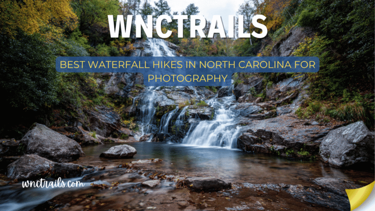
- Photography Expeditions: The variety of falls, changing light, and lush forest surroundings make these hikes popular with photographers. Early morning and late afternoon offer the best lighting and fewer crowds.
- Fitness and Adventure: For those seeking a workout, longer hikes like the trek to Rainbow Falls or the multi-falls loop in DuPont State Forest provide both physical challenge and dramatic scenery.
- Nature Study: Many trails pass through diverse habitats, making them excellent for birding, wildflower spotting, and learning about local geology and ecology.
- Peaceful Retreats: Lesser-known trails, such as those to Douglas Falls or Log Hollow Falls, offer quiet, meditative hikes for those looking to escape crowds and enjoy solitude.
Final Thoughts: Asheville as a Waterfall Basecamp
No city in the eastern United States sits at a better position for waterfall access than Asheville. Within a single tank of gas, you can reach waterfalls ranging from 20 feet to 404 feet, from five-minute walks to five-hour challenges, from family-friendly swimming holes to remote wilderness cascades.
The key is matching the waterfall to your day. On a morning when you want coffee and a short walk, Looking Glass Falls and Moore Cove are waiting 40 minutes south. When you want to genuinely tire yourself out and earn the view, Rainbow Falls will do it. When the grandparents are visiting and you need something for everyone, Chimney Rock’s Hickory Nut Falls gives them the most dramatic view in the region with manageable effort.
You don’t need to choose between Asheville’s restaurants, music, and arts scene and the surrounding mountains — the distances are short enough that you can have both in the same day.
Frequently Asked Questions
- What are the best waterfall hikes near Asheville NC for beginners?
Looking Glass Falls, Moore Cove Falls, and Hooker Falls are all accessible via short, relatively flat trails suitable for most ages and abilities. - Are dogs allowed on waterfall trails?
Most trails in Pisgah and DuPont allow dogs on a leash. Always check specific regulations for each park or forest before visiting. - When is the best time to visit waterfalls near Asheville?
Spring offers high water flow and wildflowers, while autumn features colorful foliage. Many falls run year-round, but some may slow to a trickle in late summer or freeze partially in winter. - Can you swim at the base of waterfalls?
Some areas, like Hooker Falls, have designated swimming holes, but many do not. Exercise caution, as currents can be strong and rocks slippery. Always obey posted signs and warnings. - How crowded do these trails get?
Popular falls can be busy on weekends and holidays. For a quieter experience, try visiting early in the morning, on weekdays, or explore less-known trails further from Asheville. - What should I bring on a waterfall hike?
Water, sturdy footwear, a map or trail app, rain gear, snacks, and a camera are recommended. Insect repellent and sun protection are also useful, especially in warmer months.
Exploring waterfall hikes near Asheville NC is one of the best ways to experience the natural beauty of Western North Carolina. With a bit of planning and respect for the environment, these trails provide rewarding adventures for hikers of all backgrounds and interests.
Related Guides
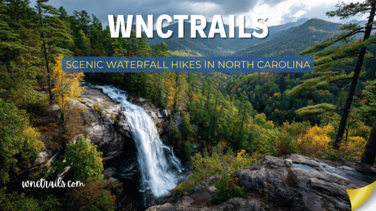
- Scenic Waterfall Hikes in North Carolina — Photography-focused coverage of Hickory Nut, Graveyard Fields
- Waterfall Hikes Near Brevard, NC — 40 minutes from Asheville, deepest concentration of waterfalls in the region
- Pisgah Waterfall Hikes — Complete Pisgah National Forest coverage
- Easy Waterfall Hikes in North Carolina — For first-timers and families
- Best Waterfall Hikes in North Carolina — The statewide overview
- Waterfall Hikes With Swimming Holes in NC — Courthouse Falls, Graveyard Fields, Turtleback
WNCTrails.com — Your guide to Western North Carolina trails, waterfalls, and outdoor adventure.
Trail conditions change seasonally. Always check current conditions with the Pisgah Ranger District and Blue Ridge Parkway road status before your trip.