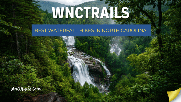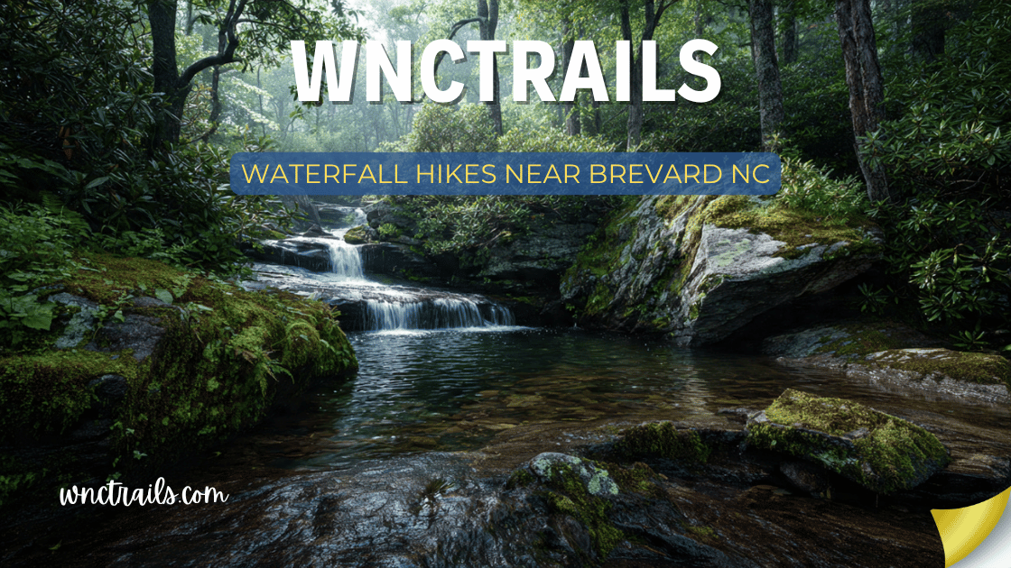
Waterfall Hikes Near Brevard Nc
Brevard, North Carolina is the waterfall capital of the eastern United States. That is not marketing language — it is simple geography. The small city of roughly 10,000 residents sits at the center of a waterfall concentration that no other town in the East can match: Pisgah National Forest to the north and west, DuPont State Recreational Forest to the south, and Gorges State Park to the southwest. Within 30 minutes of downtown Brevard, there are more than 40 named waterfalls. Within 45 minutes, that number exceeds 60.
The locals call Transylvania County — where Brevard sits — the “Land of Waterfalls.” The county has officially documented over 250 named cascades within its boundaries. Visitors who base themselves in Brevard can hit multiple waterfalls before lunch, swim at a different swimming hole each afternoon, and still have destinations left to explore on day three.
This guide organizes the best waterfall hikes near Brevard, NC by distance from town — from the DuPont falls that are practically in Brevard’s backyard to the spectacular Highlands and Gorges sites within a 45-minute drive.
Waterfall Hikes Near Brevard, NC (2026 Guide)
Recommended Tools
Disclosure: This page may contain affiliate links.
- Water Shoes — Check current pricing
- Rain Jacket — Check current pricing
- Dry Bag — Check current pricing
Why Brevard Is the Waterfall Basecamp of the East
Brevard’s geography is almost unreasonably good for waterfall access:
- DuPont State Forest begins 10 miles south of town — five major waterfalls on the same trail system, the closest significant waterfall cluster to any town in WNC
- Pisgah National Forest begins practically at the town limits to the north — US-276 through Pisgah passes Looking Glass Falls, Sliding Rock, and Moore Cove Falls within 15 miles
- Gorges State Park is 20 miles southwest — Rainbow Falls and Turtleback Falls in a Wild and Scenic River gorge
- Highlands/Cashiers corridor is 30–45 miles south — Dry Falls, Bridal Veil, Whitewater Falls, Silver Run Falls, Glen Falls
No other town in the eastern United States sits at the intersection of this many quality waterfall destinations in this small a radius.
Quick Reference: Waterfalls Near Brevard
| Waterfall | Distance from Brevard | Hike Distance | Difficulty | Best Feature |
|---|---|---|---|---|
| Hooker Falls (DuPont) | 10 mi / 20 min | 0.8 mi | Easy | Best family swim hole |
| Triple Falls (DuPont) | 10 mi / 20 min | 3.5 mi | Easy–Moderate | Hunger Games location |
| High Falls (DuPont) | 10 mi / 20 min | 3.5 mi | Easy–Moderate | Broadest cascade |
| Looking Glass Falls | 15 mi / 20 min | 0.2 mi | Easy | Most iconic in WNC |
| Sliding Rock | 15 mi / 20 min | 0.1 mi | Easy | Natural waterslide |
| Moore Cove Falls | 14 mi / 20 min | 1.5 mi | Easy | Walk-behind falls |
| Courthouse Falls | 18 mi / 25 min | 1.0 mi | Moderate | Hidden swim hole |
| Rainbow Falls | 20 mi / 30 min | 5.4 mi | Strenuous | 150-ft Wild & Scenic |
| Turtleback Falls | 20 mi / 30 min | 1.0 mi | Moderate | Natural granite slide |
| Graveyard Fields | 30 mi / 40 min | 1.0–3.2 mi | Easy–Moderate | Alpine meadow escape |
| Dry Falls | 35 mi / 45 min | 0.1 mi | Easy | Walk-behind 75 ft |
| Whitewater Falls | 40 mi / 50 min | 0.2 mi | Easy | Tallest in eastern US |
| Silver Run Falls | 38 mi / 50 min | 0.5 mi | Easy | Best clear swim pool |
| Glen Falls | 35 mi / 45 min | 2.0 mi | Moderate | Rhododendron gorge |
| Catawba Falls | 45 mi / 55 min | 2.8 mi | Moderate | Best river corridor |
Zone 1: DuPont State Recreational Forest (10–15 Miles / 15–20 Min)
The closest major waterfall cluster to Brevard — and the finest concentrated waterfall trail system in Western NC. DuPont State Recreational Forest begins just 10 miles south of Brevard and contains five major named waterfalls on the Little River, all accessible from the same trailhead network. No other location within 15 minutes of any WNC town offers this density of significant waterfalls.
Hooker Falls
Hike Distance: 0.8 miles round-trip | Difficulty: Easy Distance from Brevard: 10 miles / 20 min
The most accessible swimming waterfall near Brevard. The flat, wide gravel trail to Hooker Falls is the easiest quality waterfall hike in the entire DuPont system — practically stroller-accessible in dry conditions, and ending at a 12-foot cascade that spills into a wide, clear swimming pool on the Little River. The pool is one of the finest easy-access swimming holes in WNC: broad, calm at the edges, and surrounded by flat granite slabs for sunbathing.
For Brevard visitors who want maximum waterfall enjoyment with minimum trail effort — families, older visitors, or simply those who want to swim more than hike — Hooker Falls is the default recommendation.
Seasonal highlights:
- Spring: Highest water volume — pool is fuller and the cascade wider than any other season
- Summer: Peak swimming season; pool temperature reaches the mid-60s°F by mid-July; arrive before 9:30 AM for parking
- Fall: Hardwood color over the granite river slabs; quieter than summer
- Winter: Beautiful and nearly empty; pool too cold for swimming but photogenic in frost
Tips: Parking fills by 9:30 AM on summer weekends. Free to enter DuPont. Dogs welcome on leash.
Coordinates: 35.1906° N, 82.6380° W
Triple Falls
Hike Distance: 3.5-mile loop (from Hooker Falls trailhead) | Difficulty: Easy–Moderate Distance from Brevard: 10 miles / 20 min
The most photographed waterfall in DuPont — and the one you recognize from The Hunger Games film series. Triple Falls drops in three distinct tiers through a rocky gorge on the Little River, with each tier dropping into its own pool before the water cascades to the next. The three-tiered geometry creates a staircase effect that is visually extraordinary and endlessly photogenic.
The loop trail from Hooker Falls to Triple Falls and back is the most popular hike in DuPont — approximately 3.5 miles with modest elevation change and good trail surfaces throughout.
What makes it special: The filming location recognition aside, Triple Falls earns its reputation on its own visual merits. Three distinct plunge pools stacked in a gorge, each with a different water depth and current character, create a multi-level waterfall experience unavailable elsewhere in WNC. The upper tier is the widest and most accessible for wading; the lower tier is the most dramatic.
Seasonal highlights:
- Spring: Full flow in all three tiers simultaneously — the most dramatic Triple Falls of the year
- Summer: Middle pool is the best wading destination; stay out of the lower pool where current is strong
- Fall: Gold and amber hardwood color over the granite ledges; the staircase composition in fall light is exceptional
- Winter: Ice formations on the tier faces in cold snaps; nearly no other visitors
Tips: Do not attempt to climb above the upper tier — the current above the falls is deceptively dangerous. Combine with High Falls (0.5 mi further) to see both in the same hike.
Coordinates: 35.1981° N, 82.6247° W
High Falls
Hike Distance: Included in Triple Falls loop (3.5–4.0 mi total) | Difficulty: Easy–Moderate Distance from Brevard: 10 miles / 20 min
The broadest and most powerful waterfall in DuPont. High Falls sends the Little River over a massive granite face in a broad, powerful sheet — approximately 150 feet of total drop that is more impressive in sheer volume than any other DuPont cascade. Standing at the downstream viewpoint, the width of the falls against the granite face is a composition that simple numbers cannot convey.
High Falls is most often visited as part of the DuPont waterfall loop — add 0.5 miles from Triple Falls — making it a natural extension of the standard DuPont day hike.
What makes it special: The granite face setting gives High Falls a character unlike the gorge-framed waterfalls typical of WNC — the open rock face, the width of the cascade, and the reflective pool below create a visual that feels closer to the waterfalls of the Pacific Northwest than the forested East. In spring, with the river at full volume, the full face of High Falls is arguably the most powerful waterfall view in WNC.
Seasonal highlights:
- Spring: The most dramatic version — full river volume spreads across the entire granite face
- Photography: Overcast light on the granite face eliminates harsh shadows; cloudy days are ideal
Tips: The overlook above High Falls is unfenced in places — stay on designated areas and supervise children and dogs closely. Strong current above the falls.
Coordinates: 35.1978° N, 82.6192° W
Bridal Veil Falls (DuPont Version)
Hike Distance: Part of the full DuPont circuit (7.0 mi) | Difficulty: Moderate Distance from Brevard: 10 miles / 20 min
Not to be confused with the US-64 Bridal Veil Falls near Highlands, DuPont’s Bridal Veil Falls is a 120-foot cascade on the Little River — taller than its more famous namesake — accessible via the full DuPont waterfall circuit. The falls drop in a thin, elegant curtain from a rock ledge into a pool below, earning the name from the delicate veil-like quality of the flow at moderate water levels.
DuPont’s Bridal Veil is best visited as part of the full 7-mile waterfall circuit that also includes Hooker, Triple, High, and Wintergreen Falls — the most complete DuPont experience available in a single day.
Coordinates: 35.1943° N, 82.6141° W
Zone 2: Pisgah National Forest / US-276 Corridor (14–20 Miles / 20–25 Min)
The most famous waterfall road in North Carolina — US-276 through Pisgah National Forest passes three exceptional waterfalls within 10 miles of each other, all within 20–25 minutes of downtown Brevard. This corridor is the route most visitors take when leaving Brevard for the Parkway, and the waterfalls along it are among the most-visited in the state.
Looking Glass Falls
Hike Distance: 0.2 miles round-trip | Difficulty: Easy Distance from Brevard: 15 miles / 20 min
The most iconic waterfall in Western North Carolina — and the first one most Brevard visitors see. Looking Glass Falls drops 60 feet in a wide, powerful curtain directly off US-276, visible from the car and reached by a short staircase with railings. It is the postcard waterfall of WNC: recognizable, beautiful, reliable, and powerful in all seasons.
For first-time WNC visitors based in Brevard, Looking Glass Falls is the essential first stop. It establishes a visual benchmark for the dozens of waterfalls that follow — and for many visitors it remains their favorite of the trip despite being the first one they see.
Seasonal highlights:
- Spring: Maximum volume — the 60-foot curtain spreads to its full width in March and April
- Summer: Most crowded; arrive before 9 AM for parking; mist makes it refreshing on hot days
- Fall: Gold hardwood color on the surrounding bank; leaves floating in the pool
- Winter: Ice formations possible on surrounding rock faces in cold snaps; accessible year-round
Tips: Parking fills by 9 AM on summer and fall weekends — genuinely the most time-sensitive parking situation in WNC. Free; no fees.
Coordinates: 35.3025° N, 82.7648° W
Sliding Rock
Hike Distance: 0.1 miles | Difficulty: Easy Distance from Brevard: 15 miles / 20 min
The most beloved summer waterfall experience near Brevard. The Davidson River flows over 60 feet of sloping granite into a natural pool — a waterslide that has been used by generations of WNC families and that runs under lifeguard supervision from Memorial Day through Labor Day. The experience is simple, joyful, and uniquely WNC: sliding down a real waterfall into a cold mountain pool.
For Brevard families or visitors with children, Sliding Rock is essentially mandatory in summer. The combination of ease, fun, and genuine mountain beauty makes it one of the finest supervised outdoor water experiences in the Southeast.
Seasonal highlights:
- Summer: Full supervised operation; arrive before 10 AM for manageable crowds
- Spring/Fall/Winter: Sliding at your own risk — no lifeguards but the rock remains and the water runs
Tips: $5/vehicle or $3/person; America the Beautiful Pass accepted. No dogs during operating season.
Coordinates: 35.3372° N, 82.7572° W
Moore Cove Falls
Hike Distance: 1.5 miles round-trip | Difficulty: Easy Distance from Brevard: 14 miles / 20 min
Brevard’s finest walk-behind waterfall — and one of the most undervisited quality hikes on the US-276 corridor. Moore Cove Falls drops 50 feet off a mossy overhang on Moore Creek, and a gentle 0.75-mile trail through old-growth hemlock and rhododendron leads directly behind the curtain. The experience of walking behind a 50-foot waterfall on natural rock — no paved path, no railing, just the falls overhead — is uniquely intimate.
The trail itself is one of the most pleasant easy forest walks near Brevard: flat, creek-side, shaded, and beautiful throughout.
Seasonal highlights:
- Spring: Full volume behind the falls creates the most immersive experience
- Summer: The cool hemlock gorge provides relief from heat; one of the coolest short trails near Brevard
- Rhododendron: The rosebay rhododendron along Moore Creek blooms white in late June–early July — the approach through bloom corridor is extraordinary
Tips: Free; trailhead pull-off on US-276 approximately 1 mile north of the US-276/US-64 junction. Dogs allowed on leash.
Coordinates: 35.2569° N, 82.8064° W
Courthouse Falls
Hike Distance: 1.0 mile round-trip | Difficulty: Moderate Distance from Brevard: 18 miles / 25 min
Brevard’s best-kept swimming hole secret. Courthouse Falls drops 40 feet into a wide, circular plunge pool on Courthouse Creek — a pool shaped by the gorge into a natural bowl where the outer ring stays calm while the falls impact zone churns in the center. The hemlock and rhododendron gorge setting is intimate and beautiful, and the relatively rough access road keeps crowds minimal.
For Brevard visitors who want excellent swimming without the Hooker Falls crowds, Courthouse Falls is the answer.
Seasonal highlights:
- Summer: The shaded circular pool is one of the coolest swimming holes near Brevard — reliably in the mid-50s°F even in August
- Spring: Peak flow in the circular basin is impressive; the gorge setting amplifies the falls sound significantly
Tips: Forest service road (FR 140B) access — unpaved but manageable in most vehicles. Free; dogs allowed on leash. Download offline navigation.
Coordinates: 35.3444° N, 82.9213° W
Zone 3: Gorges State Park (20 Miles / 30 Min)
The wildest waterfall zone near Brevard — Gorges State Park protects a section of the Horsepasture River designated Wild and Scenic by U.S. Congress, in a gorge that receives more annual rainfall than almost anywhere in the eastern United States. Two waterfalls here — Rainbow Falls and Turtleback Falls — are among the finest in the state.
Rainbow Falls
Hike Distance: 5.4 miles round-trip | Difficulty: Strenuous Distance from Brevard: 20 miles / 30 min
The most dramatic waterfall experience within range of Brevard — a 150-foot plunge in a Wild and Scenic River gorge that descends nearly 1,000 feet from the trailhead. The gorge environment is extraordinary: lush, perpetually damp, biologically rich beyond most WNC forests due to the extraordinary rainfall. Afternoon rainbows in the mist at the falls base are a near-daily summer occurrence.
For hikers based in Brevard who want one strenuous, unforgettable waterfall experience, Rainbow Falls is the choice.
Seasonal highlights:
- Spring: Maximum volume — the 150-foot plunge at full spring flow is one of the most powerful waterfall views in WNC
- Summer: Afternoon rainbows (1–3 PM) most reliable; gorge stays cool even on hot days
- Rhododendron: White rosebay rhododendron fills the gorge corridor in late June–early July — the combination of bloom tunnel and 150-foot falls is extraordinary
Tips: Start before 8 AM; allow 4–5 hours; bring 2+ liters of water per person. The return climb is demanding. Dogs allowed on leash; no entry fee.
Coordinates (Trailhead): 35.1063° N, 82.9615° W
Turtleback Falls
Hike Distance: 1.0 mile from trailhead | Difficulty: Moderate Distance from Brevard: 20 miles / 30 min
Brevard’s finest swimming and sliding waterfall — the Horsepasture River slides over a smooth granite dome into a deep pool below, creating a natural waterslide that generations of WNC locals have enjoyed. Often combined with Rainbow Falls for a full Gorges day, Turtleback can also be visited on its own for a shorter outing focused on the pool and slide.
Seasonal highlights:
- Summer: The slide and pool are at their most enjoyable June through August when water volume stabilizes
- Spring: High water makes the slide more powerful — assess conditions carefully before entering
Tips: Always slide feet-first; the pool below is deep. Dogs allowed on leash. No entry fee. See the full Turtleback Falls guide in our swimming holes article.
Coordinates: 35.1019° N, 82.9546° W
Zone 4: Blue Ridge Parkway (25–35 Miles / 35–45 Min)
Graveyard Fields — Lower Falls
Hike Distance: 1.0–3.2 miles | Difficulty: Easy–Moderate Distance from Brevard: 30 miles / 40 min
The finest high-elevation waterfall escape from Brevard summer heat. At nearly 5,000 feet, Graveyard Fields runs 15–20°F cooler than Brevard on hot summer days. The Lower Falls wading pool is one of the best family waterfall destinations in WNC, and the Upper Falls extension adds a strenuous option for those wanting more.
Seasonal highlights:
- Summer: The cool alpine air and wading pool make this the best heat-escape waterfall from Brevard
- Fall: Peak color at Graveyard Fields (early-to-mid October) precedes lower-elevation color — plan Brevard-area falls color trips for early October here, mid-October everywhere else
Tips: Arrive before 8 AM on summer weekends; the parking lot is routinely full by 9 AM. No dogs on trails. Free on the Parkway.
Coordinates: 35.3272° N, 82.8600° W
Zone 5: Highlands & Cashiers Corridor (30–50 Miles / 40–55 Min)
Dry Falls & Bridal Veil Falls — US-64 Near Highlands
Distance from Brevard: 35 miles / 45 min
Two walk-behind waterfalls in 10 minutes of each other — Dry Falls (75 ft, fully accessible paved path, walk-behind) and Bridal Veil Falls (45 ft, flat pavement, drive-through optional) sit 2 miles apart on US-64. Together they form the finest accessible waterfall duo in WNC and a natural 30-minute Highlands detour for Brevard visitors.
See the full guide in our accessible waterfall article and easy waterfall article.
Dry Falls Coordinates: 35.0574° N, 83.2219° W Bridal Veil Falls Coordinates: 35.0639° N, 83.2389° W
Whitewater Falls
Hike Distance: 0.2 miles to upper overlook | Difficulty: Easy Distance from Brevard: 40 miles / 50 min
The tallest cascading waterfall east of the Rocky Mountains (411 ft) — on a 0.2-mile paved path from the parking area. For Brevard visitors doing a Cashiers/Highlands day trip, Whitewater Falls is the essential anchor stop: the scale is genuinely stunning, the access is easy, and nothing else in the region compares for raw vertical impact.
Tips: $5/vehicle; America the Beautiful Pass accepted. Paved accessible path. Do not climb beyond overlook barriers.
Coordinates: 35.0338° N, 83.0004° W
Silver Run Falls
Hike Distance: 0.5 miles round-trip | Difficulty: Easy Distance from Brevard: 38 miles / 50 min
The finest clear swimming pool waterfall near Brevard — a 40-foot cascade into a wide, luminescent pool on Silver Run Creek just south of Cashiers. The pale granite streambed gives the water an almost silver-blue clarity that is exceptional even by WNC standards. An easy 0.5-mile walk, free, and swimmable from June through September.
Coordinates: 35.0712° N, 83.0991° W
Glen Falls
Hike Distance: 2.0 miles round-trip | Difficulty: Moderate Distance from Brevard: 35 miles / 45 min
Three waterfalls in a rhododendron gorge near Highlands — 25-foot, 60-foot, and 15-foot cascades on East Fork Overflow Creek. The rhododendron bloom in late June–early July makes this one of the most spectacular waterfall hikes in the region. A natural addition to any Highlands day trip from Brevard.
Coordinates: 35.0208° N, 83.1714° W
The Best Brevard Waterfall Day Itineraries
Itinerary 1 — The Classic Brevard Half-Day (2–3 Hours)
Perfect for: First-time visitors, families, casual hikers Total driving: ~30 miles | Total hiking: ~2 miles | Waterfalls: 3
Drive north on US-276 from Brevard:
- Moore Cove Falls (1.5 mi, walk-behind, 20 min from Brevard) — morning light in the hemlock gorge
- Looking Glass Falls (0.2 mi, 4 miles further north) — the iconic WNC postcard
- Sliding Rock (0.1 mi, 4 miles further) — swim or watch the slide action
Return to Brevard for lunch downtown. Done by noon.
Itinerary 2 — The DuPont Full Day (5–6 Hours)
Perfect for: Active families, hikers wanting multiple waterfalls, swimmers Total driving: ~20 miles | Total hiking: 3.5–7.0 miles | Waterfalls: 3–5
Drive south from Brevard to DuPont State Forest (Hooker Falls trailhead):
- Hooker Falls (0.8 mi) — morning swim while it’s quiet
- Triple Falls (loop, 3.5 mi total) — the signature DuPont hike
- High Falls (add 0.5 mi from Triple Falls) — broadest cascade in DuPont
- Optional: Continue for Bridal Veil (DuPont) and Wintergreen Falls for the full 7-mile circuit
Return to Brevard for dinner. This is the quintessential full Brevard waterfall day.
Itinerary 3 — The Gorges & Swim Day (Full Day, Early Start)
Perfect for: Experienced hikers wanting the wild gorge experience + swimming Total driving: ~40 miles | Total hiking: 5–7 miles | Waterfalls: 2–3
7 AM: Leave Brevard for Gorges State Park trailhead (30 min drive) 8 AM: Begin Rainbow Falls hike — reach the falls by 10:30–11 AM Noon: Return to Turtleback Falls for swimming in the pool 2 PM: Drive back toward Brevard 3 PM: Stop at Courthouse Falls (18 mi from Brevard) for a final cool swim Return to Brevard for dinner
Itinerary 4 — The Highlands Waterfall Road Trip (Full Day)
Perfect for: Road trippers, those wanting maximum variety and scenery Total driving: ~90 miles loop | Total hiking: 2–3 miles | Waterfalls: 4–5
From Brevard:
- Drive US-64 west toward Highlands
- Glen Falls (35 mi, 2.0 mi hike) — rhododendron gorge + tiered falls
- Dry Falls (35 mi, 0.1 mi) — walk behind 75-foot falls
- Bridal Veil Falls (35 mi, flat walk) — the walk-through waterfall
- Continue to Whitewater Falls (40 mi, 0.2 mi) — tallest in the East
- Return via SC-107 north to Silver Run Falls (38 mi, 0.5 mi) — swim
- Return to Brevard via US-64 east
Itinerary 5 — The Waterfall Photography Day (Full Day, Early Start)
Perfect for: Photographers wanting the best light at multiple locations Total driving: ~50 miles | Total hiking: 3–5 miles
Pre-sunrise: Drive to Looking Glass Falls — arrive before the parking lot fills and catch the east-facing morning light on the falls face (best 7:30–9:30 AM) Mid-morning: Drive to Moore Cove Falls — overcast light is ideal; shoot the walk-behind experience Noon: Lunch in Brevard Early afternoon: Drive to DuPont — Triple Falls and High Falls in afternoon light on the granite slabs Late afternoon: Return to Looking Glass or Sliding Rock for evening light on the water
Seasonal Guide for Brevard Waterfall Visitors
Spring (March–May) — Peak Flow, Wildflowers
Spring is the finest overall season for Brevard waterfall hiking. DuPont’s High Falls at full spring volume is one of the most powerful waterfall views in WNC. Looking Glass Falls spreads to its full width. The wildflower bloom along the Pisgah creek corridors — trillium, trout lily, wild blue phlox — coincides with the best waterfall flow.
Don’t miss in spring: DuPont High Falls at maximum volume; Moore Cove Falls with spring ephemerals along the approach; Catawba Falls (45 min) with trillium carpet on the river banks.
Summer (June–August) — Swimming Season
Brevard’s summer waterfall scene is centered on swimming: Hooker Falls for easy family swimming, Indian Creek (Bryson City) for a day trip, Courthouse Falls for a cooler alternative to the crowds, Turtleback Falls for the slide experience. The rhododendron bloom in late June–early July transforms every rhododendron-corridor hike.
Don’t miss in summer: Hooker Falls and Sliding Rock for the summer staples; Rainbow Falls for afternoon rainbows; Graveyard Fields for cool alpine relief.
Fall (October–November) — Color + Crowds
Fall brings exceptional color to the waterfall corridors near Brevard. DuPont’s granite river slabs in October color are extraordinary. The Blue Ridge Parkway (Graveyard Fields, 40 min) peaks in early October. The US-276 Pisgah corridor peaks mid-October.
Don’t miss in fall: DuPont waterfall circuit in mid-October hardwood color; Looking Glass Falls with gold bank color and floating leaves; Graveyard Fields for high-elevation early October color.
Winter (December–February) — Solitude + Ice
Winter near Brevard offers something summer cannot: genuine solitude at spectacular waterfalls. Hooker Falls, Courthouse Falls, Looking Glass Falls — all accessible with minimal visitors and the possibility of ice formations on the surrounding rock. Lower-elevation DuPont sites are accessible even in cold weather; Parkway sites may close with snow or ice.
Don’t miss in winter: Courthouse Falls with ice formations on the circular basin walls; Looking Glass Falls on a cold clear morning with ice framing the main falls face; Moore Cove Falls with frost on the hemlock gorge vegetation.
Where to Stay in Brevard for Waterfall Hiking
Brevard’s size and tourism infrastructure make it one of the best-organized outdoor destination towns in WNC:
Downtown hotels and inns: Brevard has several well-reviewed inns and bed-and-breakfasts within walking distance of restaurants and the Pisgah Music Hall. The downtown core is compact and walkable — Brevard is genuinely one of the more pleasant small towns in WNC to be based in.
Camping near the waterfalls:
- Davidson River Campground (Pisgah NF): The closest campground to the US-276 waterfall corridor — Looking Glass Falls, Sliding Rock, and Moore Cove Falls are all within 10 miles. Reservations required; books up months in advance for summer. Reserve at recreation.gov
- DuPont State Forest dispersed camping: Backcountry camping available within DuPont — wake up within a mile of five major waterfalls
- Standing Indian Campground (Nantahala NF): Further away but excellent and well-maintained for those doing the Highlands corridor
Vacation rentals: Transylvania County has extensive cabin rental inventory in creek corridor and forest-edge settings. Staying in a creek-side cabin near Brevard is one of the finest WNC accommodation experiences available.
Practical Visitor Information
Driving Brevard’s Waterfall Corridors
US-276 North (toward Pisgah): The most important road for Brevard waterfall visitors. Looking Glass Falls, Sliding Rock, and Moore Cove Falls are all on this road within 15 miles of downtown. The road narrows significantly above Looking Glass Falls — RVs and large trailers are not recommended above that point.
US-64 West (toward Highlands): The second major corridor — leads to Glen Falls, Dry Falls, Bridal Veil, and continues to Whitewater Falls and Silver Run. A spectacular drive even between the waterfall stops.
Dupont Road (south): The access route to DuPont State Forest — paved to the Hooker Falls trailhead parking area.
Fees
- DuPont State Recreational Forest: Free
- Pisgah National Forest (Looking Glass, Sliding Rock, Moore Cove, Courthouse): Looking Glass and Moore Cove are free; Sliding Rock is $5/vehicle; Courthouse Falls free
- Gorges State Park: Free
- Blue Ridge Parkway: Free
- Dry Falls and Whitewater Falls: $5/vehicle (America the Beautiful Pass accepted)
America the Beautiful Annual Pass ($80): Covers the Dry Falls and Whitewater Falls fees, Sliding Rock, and any other federal recreation sites. If visiting multiple times, it pays for itself quickly.
Cell Service
Cell service in downtown Brevard is reliable. On US-276 in Pisgah, service drops significantly above Looking Glass Falls. In DuPont, service is limited at the trailheads. In Gorges State Park, service is essentially nonexistent. Download AllTrails or Gaia GPS maps for offline use before leaving Brevard. This is especially important for Gorges State Park and any off-corridor Pisgah destinations.
Key Considerations
- Trail Difficulty: Waterfall hikes in this area range from accessible walks (such as the short path to Looking Glass Falls) to steeper, rocky climbs (like the hike to Rainbow Falls). Always check trail ratings and elevation changes before setting out.
- Weather and Seasonal Access: Heavy rainfall can lead to slippery rocks, swift currents, or temporary trail closures. Winter months may bring icy spots, especially on shaded trails. Spring and fall are popular for milder weather and scenic beauty.
- Parking and Crowds: Many waterfall trailheads near Brevard have limited parking, especially on weekends and holidays. Arriving early or visiting on weekdays can help avoid congestion.
- Safety: Rocks near waterfalls are often slick. Stay on marked trails, avoid climbing on rocks near the water, and supervise children closely. Swimming is permitted in some areas but always check posted signs and be aware of strong currents.
- Leave No Trace: Preserving the natural beauty of these sites is essential. Pack out all trash, stay on established paths, and avoid picking plants or disturbing wildlife.
Common Use Cases
- Family Outings: Trails like Moore Cove Falls and Looking Glass Falls are ideal for families with young children or those seeking a gentle walk. Both offer short distances and rewarding views.
- Photography: The mist, light, and lush surroundings of waterfalls near Brevard provide excellent opportunities for landscape and nature photography. Early morning and late afternoon often yield the best lighting and fewer crowds.
- Fitness and Adventure: Hikers looking for a workout can tackle longer routes such as the hike to Rainbow Falls or the multi-waterfall trek in DuPont State Forest, which includes High Falls, Triple Falls, and Bridal Veil Falls.
- Wildlife and Botany: Many waterfall trails pass through habitats rich with flora and fauna. Spring wildflowers and fall colors are highlights, and birdwatchers may spot a variety of species along the way.
- Cooling Off in Summer: Some falls, like Sliding Rock, are popular natural swimming spots. Always check current conditions and safety guidelines before entering the water.
Final Thoughts
Brevard does not need to oversell itself. The geography does the work. Sitting at the center of the highest waterfall density in the eastern United States, with DuPont to the south and Pisgah to the north and Gorges to the southwest, Brevard is simply the finest waterfall basecamp on the eastern seaboard.
Three days in Brevard — with proper planning and early starts — can deliver more waterfall experiences than most visitors would find in a week anywhere else in the East. And the downtown, with its music scene, excellent restaurants, and friendly pace, makes the evenings as good as the hiking days.
Come for a weekend. Plan for more time. You will need it.
Frequently Asked Question
- What are the easiest waterfall hikes near Brevard NC?
Looking Glass Falls requires no hike at all—it’s visible from the roadside, with a short path for closer views. Moore Cove Falls is a family-friendly, mostly flat 1.5-mile round-trip walk. - Are dogs allowed on waterfall trails?
Most public waterfall trails near Brevard permit leashed dogs, but always check specific trail rules before visiting. - Is swimming allowed at these waterfalls?
Swimming is permitted at some locations, such as Sliding Rock, but can be dangerous at others due to currents or slippery rocks. Always observe posted signs and exercise caution. - When is the best time to visit waterfalls near Brevard?
Spring and early summer offer high water flow and wildflowers. Autumn brings colorful foliage. Weekdays and early mornings are best for avoiding crowds. - Are there fees or permits required?
Most waterfall hikes near Brevard are free, but some areas (like certain DuPont State Forest parking lots) may charge a modest parking fee. Check current requirements before your visit. - What should I bring on a waterfall hike?
Essentials include sturdy footwear, drinking water, a map or GPS, snacks, and rain gear. Insect repellent and a camera are also recommended. - How do I find up-to-date trail conditions?
Check official park websites or local visitor centers for the latest information on closures, weather, or maintenance affecting waterfall trails.
Exploring waterfall hikes near Brevard NC is one of the most rewarding ways to experience Western North Carolina’s natural beauty. With thoughtful planning and respect for the environment, these trails offer lasting memories for hikers of all skill levels.
Related Pages
Know a waterfall near Brevard we should add to this guide? Share it in the comments below!
Explore the full waterfall landscape of Western NC at WNCTrails.com