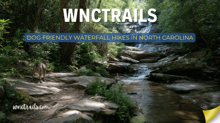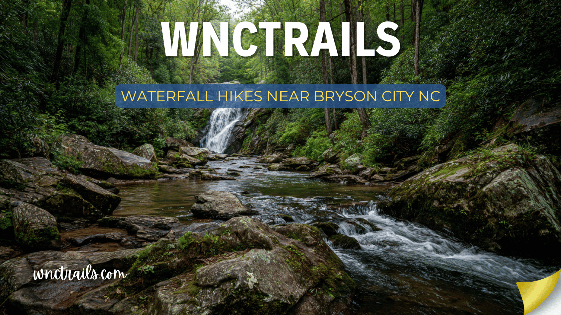
Waterfall Hikes Near Bryson City Nc
Bryson City is one of the finest basecamp towns for waterfall hiking in the entire eastern United States. Tucked inside a bend of the Tuckasegee River in Swain County, it sits at the gateway to the North Carolina side of the Great Smoky Mountains National Park, the Nantahala National Forest, and the Nantahala Gorge — three wild landscapes that together contain dozens of waterfalls within a 45-minute radius of town.
Unlike the busier Tennessee side of the Smokies, the NC approaches managed from Bryson City are quieter, less developed, and more intimate. The Deep Creek area — just 3 miles from downtown — puts three named waterfalls within a 2-mile walk. Mingo Falls, one of the tallest in the southern Appalachians, is a 25-minute drive. And Slickrock Creek, one of the wildest backcountry waterfall corridors in the region, is reachable for serious hikers willing to earn the miles.
This guide covers the best waterfall hikes near Bryson City, NC — organized by distance from town, with full trail details, driving directions, and seasonal notes.
Recommended Tools
Disclosure: This page may contain affiliate links.
- Water Shoes — Check current pricing
- Rain Jacket — Check current pricing
- Dry Bag — Check current pricing
Waterfall Hikes Near Bryson City, NC (2026 Guide)
Why Bryson City for Waterfall Hiking?
Bryson City occupies a rare geographic position: within 45 minutes of the convergence of three major wild land units — Great Smoky Mountains National Park (NC side), Nantahala National Forest, and the Joyce Kilmer-Slickrock Wilderness. Each offers a completely different waterfall experience. The town itself has excellent lodging, good restaurants, and the Great Smoky Mountains Railroad — making it one of the best organized outdoor destinations in WNC.
Key advantages of Bryson City as a waterfall base:
- Deep Creek area (3 miles from town) provides 3 named waterfalls on an easy 2-mile walk
- No Tennessee-side Smokies crowds — the NC approaches are significantly quieter
- Nantahala Gorge passes through town — one of the most dramatic river corridors in the East
- Access to serious backcountry (Slickrock, Joyce Kilmer) for experienced hikers
- Year-round waterfall access at most sites — lower elevations than Parkway-adjacent towns
Quick Reference: Waterfall Hikes Near Bryson City
| Waterfall | Distance from Town | Hike Distance | Difficulty | Park/Forest |
|---|---|---|---|---|
| Tom Branch Falls | 3 miles | 0.1 mi | Very Easy | GSMNP |
| Juney Whank Falls | 3 miles | 0.6 mi loop | Easy | GSMNP |
| Indian Creek Falls | 3 miles | 2.0 mi | Easy | GSMNP |
| Mingo Falls | 25 miles | 0.4 mi | Easy | Qualla Boundary |
| Rufus Morgan Falls | 30 miles | 0.6 mi | Easy | Nantahala NF |
| Panther Creek Falls | 20 miles | 3.0 mi | Moderate | Nantahala NF |
| Slickrock Creek | 35 miles | 13.0 mi | Very Strenuous | Joyce Kilmer Wilderness |
| Courthouse Falls | 55 miles | 1.0 mi | Moderate | Pisgah NF |
| Long Creek Falls | 40 miles | 2.5 mi | Moderate | Nantahala NF |
| Soco Falls | 30 miles | 0.3 mi | Easy | Roadside |
The Deep Creek Area — Bryson City’s Waterfall Backyard
The most accessible waterfall cluster in the NC Smokies — and one of the finest easy waterfall walking areas in the entire national park system. The Deep Creek trailhead is just 3 miles from downtown Bryson City, and from the parking area three named waterfalls are reachable within 2 miles of easy walking. In summer, Deep Creek is one of the most popular tubing destinations in WNC — the gentle creek current carries inflatable tubes through a beautiful mountain corridor.
All three Deep Creek waterfalls are covered in detail below. They can be visited individually or combined in a single 3-mile round-trip walk that hits all three in sequence.
1. Tom Branch Falls — Deep Creek, GSMNP
Distance from Bryson City: 3 miles Hike Distance: 0.1 miles round-trip | Difficulty: Very Easy | Elevation Gain: Minimal
The easiest significant waterfall in the Great Smoky Mountains — a 60-foot cascade visible almost directly from the Deep Creek parking area, reached by a 100-foot walk on a flat, paved path. Tom Branch Creek drops in two tiers off a mossy rock face into Deep Creek below, framed by the dense rhododendron and hemlock that characterize the lower Deep Creek corridor.
For visitors based in Bryson City who want a waterfall stop without any real hiking — families with very young children, visitors with mobility limitations, or anyone wanting a quick morning stop before driving elsewhere — Tom Branch Falls is the answer. Walk to the creek, see a 60-foot waterfall, return to the car in under five minutes.
What makes it special: The falls are entirely visible from the near side of Deep Creek without crossing — the two-tiered cascade, the mossy cliff face, and the rhododendron framing create a genuinely beautiful scene that rewards the minimal effort. In spring when water is high, the lower tier floods into Deep Creek dramatically.
Trail details:
- Start at the Deep Creek trailhead parking area (3 miles from downtown Bryson City via Fontana Road / Deep Creek Road)
- Walk the flat trail along Deep Creek for approximately 100 yards — Tom Branch Falls is visible on the left (west) bank
- No creek crossing required — the falls are viewable from the main trail
- Paved trail surface; accessible for most visitors
Seasonal notes:
- Best spring through early summer when water volume is highest
- Summer tubing season means the parking area and creek corridor are busy — visit early morning for quietest experience
- Falls remain beautiful year-round; winter visits with ice formations on the cliff face are exceptional
Logistics:
- GSMNP free entry at Deep Creek; no fee for day use
- No dogs allowed in Great Smoky Mountains National Park
- Parking area has restrooms — well-maintained year-round
- Tubing rentals available near the trailhead in summer
Coordinates (Deep Creek Trailhead): 35.4586° N, 83.4338° W
2. Juney Whank Falls — Deep Creek, GSMNP
Distance from Bryson City: 3 miles Hike Distance: 0.6-mile loop | Difficulty: Easy | Elevation Gain: ~200 ft
A hidden gem within walking distance of downtown Bryson City. Juney Whank Falls drops 90 feet in two tiers on Juney Whank Branch — a side tributary of Deep Creek — and is reached via a pleasant 0.6-mile loop trail that climbs briefly from the creek corridor before delivering the falls at a viewing bridge directly above the lower plunge.
The name is a corruption of “Johnny White” — the name of a Cherokee leader who once lived in the area — and the falls are one of the most undervisited significant waterfalls in the NC Smokies despite being minutes from town.
What makes it special: The viewing bridge over the lower tier of the falls provides a unique perspective — looking down into a two-story cascade from above rather than up from the base. The upper tier is visible from the bridge as well, giving a simultaneous top-to-bottom view of the full 90-foot fall. The loop structure means no backtracking, and the loop passes through a beautiful mature hardwood forest.
Trail details:
- From the Deep Creek trailhead, take the Juney Whank Falls Trail (signed at the trailhead)
- The trail climbs ~200 feet before reaching the falls bridge — moderate effort but short
- The loop returns via a different path back to the trailhead — no backtracking
- Trail surface is dirt and forest floor — manageable in regular hiking shoes in dry conditions
Seasonal notes:
- Spring is the peak flow season — the upper tier runs most powerfully from March through May
- Fall brings excellent color on the surrounding hardwoods visible from the bridge viewpoint
- The sheltered hollow stays cool in summer — a comfortable hike even on warm days
- Winter: the bridge viewpoint in ice and snow is atmospheric and rarely visited
Logistics:
- Same trailhead as Tom Branch and Indian Creek Falls — combine all three in one outing
- No dogs; no fee; restrooms at the trailhead parking area
- Loop direction: counterclockwise (right fork first) reaches the falls earlier in the hike
Coordinates (Juney Whank Trail Start): 35.4586° N, 83.4338° W (same trailhead as Deep Creek)
3. Indian Creek Falls — Deep Creek, GSMNP
Distance from Bryson City: 3 miles Hike Distance: 2.0 miles round-trip | Difficulty: Easy | Elevation Gain: ~200 ft
The most beautiful of the three Deep Creek waterfalls — a wide, 25-foot cascade on Indian Creek that drops in a broad, fan-shaped plunge into a large, clear pool. The flat trail along Deep Creek to reach it is one of the finest easy waterfall walks in the NC Smokies, with the creek always audible and frequently visible through the rhododendron and hemlock corridor.
Indian Creek Falls is also one of the best swimming hole waterfalls accessible from Bryson City — the pool below the falls is broad, clear, and deep enough for swimming in summer.
What makes it special: The fan-shaped cascade geometry — water spreading wide as it falls rather than concentrating in a narrow plunge — creates a broad, full composition that photographs exceptionally. The large clear pool at the base, surrounded by smooth creek stones and flat rock slabs, is the finest swimming hole in the Deep Creek corridor and one of the better ones in the NC Smokies.
Trail details:
- From the Deep Creek trailhead, take the Deep Creek Trail (main trail, not the Juney Whank spur)
- Trail is flat and well-maintained along the creek corridor for 1.0 mile to the falls
- Tom Branch Falls is visible on the left at 0.1 miles — see both on the same walk
- Trail surface is compacted dirt — wide, clear, and easy throughout
Seasonal notes:
- Swimming is best June through September when water temperature is most comfortable
- Spring: highest water volume and most powerful falls — the fan spread is widest in peak flow
- Fall: hardwood color along the creek corridor; pool is calmer for reflection photography
- Winter: pool runs clear and cold; the falls are accessible but swimming is not advisable
Logistics:
- 1.0 mile from the Deep Creek trailhead — the easiest significant swimming hole waterfall from Bryson City
- No dogs; no fee; restrooms at the trailhead
- Combine with Tom Branch Falls (0.1 mi) and optionally Juney Whank Falls loop for a complete Deep Creek waterfall morning
Coordinates: 35.4667° N, 83.4419° W
4. Mingo Falls — Cherokee, NC (Qualla Boundary)
Distance from Bryson City: ~25 miles (30–35 min drive via US-19) Hike Distance: 0.4 miles round-trip | Difficulty: Easy | Elevation Gain: ~200 steps
The most dramatic short waterfall hike from Bryson City — a 120-foot cascade, one of the tallest in the Southern Appalachians, reached by a well-maintained staircase of approximately 200 steps from a roadside parking area in Cherokee. The falls thunder through a narrow, lush gorge on Big Cove Road in the heart of the Eastern Band of Cherokee Indians’ Qualla Boundary.
For Bryson City visitors doing the US-19 corridor, Mingo Falls is a 30-minute detour that delivers one of the most impressive waterfalls in the region for a 0.4-mile walk.
What makes it special: The height-to-effort ratio is extraordinary — 120 feet of cascade for a 200-step staircase. The narrow gorge setting means the full height appears suddenly and impressively when the viewing platform comes into view. The cultural context — a waterfall of deep significance to the Cherokee people, within an active tribal community — adds a dimension unavailable at national forest or park sites.
Trail details:
- Drive US-19 west from Bryson City to Cherokee, then follow signs for Big Cove Road
- Parking area is on Big Cove Road approximately 3 miles north of downtown Cherokee
- Staircase ascends with continuous railings to the viewing platform
- Paved road all the way to the trailhead
Seasonal notes:
- Accessible year-round; the falls are powerful in all seasons
- Spring brings highest volume — the 120-foot plunge is most thunderous in March–May
- Fall foliage frames the upper falls beautifully in mid-to-late October
- Consider pairing with the Museum of the Cherokee Indian in downtown Cherokee
Logistics:
- Free to visit; no fees
- No facilities at the trailhead — restrooms available in downtown Cherokee
- Drive continues to the Smoky Mountains via Big Cove Road for a scenic loop
- Dogs allowed on leash
Coordinates: 35.5665° N, 83.2662° W
5. Rufus Morgan Falls — Nantahala National Forest
Distance from Bryson City: ~30 miles (40 min drive) Hike Distance: 0.6 miles round-trip | Difficulty: Easy | Elevation Gain: ~100 ft
One of the most undervisited easy waterfall hikes in the Nantahala — named for the Reverend A. Rufus Morgan, an Episcopal priest and beloved trailbuilder who maintained Appalachian Trail sections in this region into his 90s and hiked to this falls on his 92nd birthday. The falls drop approximately 70 feet on an unnamed tributary of the Nantahala River in a quiet, mossy gorge.
The short approach trail passes through a beautiful mature forest with rhododendron and hemlock before revealing the falls in a narrow, intimate gorge setting.
What makes it special: The combination of an easy approach, a beautiful gorge setting, and the near-total absence of other visitors makes Rufus Morgan Falls feel like a genuine discovery even though it is on a signed trail. Named for a locally legendary figure, it carries a human story that most waterfall stops lack.
Trail details:
- Access via US-74 west from Bryson City, then south on Wayah Road (NC-1310) to the trailhead
- Short, well-maintained trail with modest elevation gain
- Forest service signed trailhead with small parking area
- Trail surface is dirt — manageable in regular hiking shoes in dry conditions
Seasonal notes:
- Spring brings the highest water volume — the 70-foot falls is most impressive March through May
- The rhododendron along the trail blooms white in late June–early July
- Quiet in all seasons — one of the least-visited accessible falls near Bryson City
Logistics:
- Free on Nantahala National Forest land
- Dogs allowed on leash
- Download offline navigation — cell service unreliable in the Wayah Road area
- Combine with the Wayah Bald area (fire tower with panoramic views) for a fuller Nantahala day
Coordinates: 35.1706° N, 83.6184° W
6. Panther Creek Falls — Nantahala National Forest
Distance from Bryson City: ~20 miles (25 min drive) Hike Distance: 3.0 miles round-trip | Difficulty: Moderate | Elevation Gain: ~400 ft
A beautiful multi-tiered waterfall in the Nantahala National Forest that most visitors from Bryson City miss entirely. Panther Creek drops in multiple cascades totaling over 100 feet through a rocky gorge, with several distinct viewing spots along the descent trail. The approach follows Panther Creek upstream through a classic southern Appalachian hardwood corridor.
What makes it special: The multi-tier cascade system — several distinct drops rather than one single plunge — creates a waterfall experience that evolves as you descend. Each tier has its own character: wider and lower at the top, narrower and more dramatic in the lower sections. The gorge walls close in progressively as you approach the main falls.
Trail details:
- Access via US-74 west, then south on Panther Creek Road (forest service road)
- Trail descends from the ridge to the creek, then follows the creek to the falls
- Moderate elevation change with some rocky sections
- Total round-trip approximately 3.0 miles with the main falls at the bottom
Seasonal notes:
- Spring peak flow (March–May) is the best season for full cascade volume
- Fall hardwood color along the creek corridor makes October visits excellent
- Summer is pleasant but water volume lower — the upper tiers may be reduced
Logistics:
- Free on National Forest land; dogs allowed on leash
- Forest service road access — manageable in most vehicles
- Download offline navigation and trail map before departure
Coordinates: 35.3217° N, 83.5982° W
7. Long Creek Falls — Appalachian Trail / Nantahala NF
Distance from Bryson City: ~40 miles (50 min drive) Hike Distance: 2.5 miles round-trip | Difficulty: Moderate | Elevation Gain: ~400 ft
One of the finest waterfall hikes accessible from the Appalachian Trail near Bryson City. Long Creek Falls drops about 50 feet on Long Creek in the Nantahala National Forest near the Georgia–North Carolina border. The approach follows the Appalachian Trail southbound from the Bly Gap area — giving this hike a quality of wilderness feel that non-AT approaches rarely match.
What makes it special: Walking a section of the Appalachian Trail to reach a waterfall changes the character of the hike — you’re on the same footpath that runs from Georgia to Maine, and that context is palpable. The falls themselves are in a pristine gorge setting, with the AT continuing south across the ridge above.
Trail details:
- Access from the Bly Gap / Deep Gap trailhead on the NC–GA border near Hayesville
- Follow the AT south for approximately 1.25 miles to the falls spur
- Moderate terrain with consistent elevation change
- Well-maintained trail with AT blazing throughout
Seasonal notes:
- Spring is best for water volume; fall for AT corridor color
- The AT in this section sees through-hikers in spring (northbound) and fall (southbound) — an interesting cultural dimension of the hike
Logistics:
- Free; no fee on National Forest/AT corridor land
- Dogs allowed on leash on the AT in Nantahala NF
- This is one of the longer drives from Bryson City on this list — plan accordingly
Coordinates: 35.0347° N, 83.6428° W
8. Soco Falls — US-19 Near Maggie Valley
Distance from Bryson City: ~30 miles (35 min drive) Hike Distance: 0.3 miles round-trip | Difficulty: Easy | Elevation Gain: Minimal
Twin waterfalls just off the highway — a pair of parallel cascades dropping 50 feet on Soco Creek through a rhododendron-framed gorge, accessible via an unmarked pull-off on US-19. For Bryson City visitors driving toward Maggie Valley or the Blue Ridge Parkway, Soco Falls is the perfect 15-minute detour.
What makes it special: The twin-falls geometry — two streams dropping side by side into a shared pool — is genuinely unusual and photogenic. The rhododendron framing is spectacular in late May–June when it blooms. The near-total absence of signage and formal infrastructure keeps crowds minimal.
Trail details:
- Pull off on the roadside along US-19 approximately 5 miles west of Maggie Valley
- Short, informal trail descends steeply to the falls viewing area
- Unmarked — GPS coordinates are essential for finding the pull-off
Logistics:
- Free; informal pull-off with no facilities
- Use caution when pulling onto and off US-19 — traffic is fast
- Dogs allowed; no fees
Coordinates: 35.5011° N, 83.1658° W
Day Trip Itineraries from Bryson City
Half-Day: The Deep Creek Waterfall Walk
Perfect for: Families, first-time visitors, those wanting maximum waterfalls for minimum effort
Drive 3 miles from downtown Bryson City to the Deep Creek trailhead. Walk to Tom Branch Falls (0.1 mi, 5 min). Continue to Indian Creek Falls (1.0 mi, 20–25 min). Optional: return via the Juney Whank Falls loop (adds 0.6 mi). Return to town for lunch. Total walking: 2.0–3.0 miles, all easy. Three named waterfalls from a single trailhead, 3 miles from downtown.
Best season: May–September for Indian Creek swimming; October for fall color on the creek corridor.
Full Day: Bryson City + Cherokee Waterfall Circuit
Perfect for: Visitors spending a full day in the area, interested in both waterfalls and Cherokee cultural sites
Morning: Drive to Deep Creek area for the full waterfall walk (Tom Branch + Indian Creek + Juney Whank). Allow 2–3 hours including swimming at Indian Creek.
Midday: Drive to Cherokee (US-19 east, 25 min) for lunch in downtown Cherokee.
Afternoon: Mingo Falls (25 min hike, 120 ft cascade). Combine with the Museum of the Cherokee Indian for cultural context.
Total miles driven: ~60 miles round-trip from Bryson City Total waterfalls: 4 named falls Total hiking: ~3.5 miles easy terrain
Serious Hiker Day: Nantahala Backcountry
Perfect for: Experienced hikers wanting solitude and a wild waterfall experience
Drive west from Bryson City on US-74 into the Nantahala Gorge. Take the forest service roads south toward Rufus Morgan Falls (0.6 mi easy, 70 ft) for a morning warm-up. Continue to the Panther Creek Falls trailhead for a 3.0-mile moderate hike to the multi-tiered cascade. Return via US-74 through the Nantahala Gorge for the scenic drive home.
Total miles driven: ~75 miles round-trip Total waterfalls: 2 destinations (4+ cascade features at Panther Creek) Total hiking: ~3.6 miles
Multi-Day Waterfall Basecamp (3 Days from Bryson City)
Day 1 — Deep Creek & Cherokee: Morning at Deep Creek (Tom Branch + Indian Creek + Juney Whank). Afternoon at Mingo Falls + Museum of the Cherokee Indian.
Day 2 — Nantahala & Slickrock: Morning drive to Rufus Morgan Falls. Afternoon begin Slickrock Creek Trail (serious hikers only — turn around at your chosen distance; the creek cascades begin within the first mile).
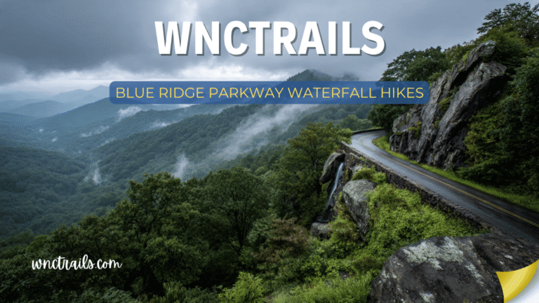
Day 3 — Blue Ridge Parkway Waterfalls: Drive north to the Parkway. Hit Graveyard Fields (Lower Falls, 1.0 mi) and Linville Falls (Upper Overlook, 0.8 mi) on a northward Parkway drive. Return via US-74 through the gorge.
Slickrock Creek Trail — For Serious Adventurers
Distance from Bryson City: ~35 miles | Hike Distance: Up to 13.0 miles | Difficulty: Very Strenuous
The most challenging and most rewarding waterfall hike accessible from Bryson City. The Slickrock Creek Trail penetrates the Joyce Kilmer–Slickrock Wilderness — one of the most remote and biologically diverse wilderness areas in the eastern United States — along a creek corridor that features dozens of cascades, waterfalls, and swimming holes over 6.5 miles of rugged trail. The creek earns its name on every crossing: smooth, algae-covered rock makes every ford an exercise in careful footing.
This is not a destination-waterfall hike. The entire creek is a waterfall experience — cascades appear continuously, swimming holes punctuate the route, and the forest canopy above is old-growth timber that logging never reached.
Trail details:
- Trailhead near Robbinsville, NC (approximately 35 miles and 50 minutes from Bryson City via US-74 and NC-143)
- Multiple creek crossings unavoidable — waterproof boots or water shoes essential
- Experienced hikers only — remote, unmaintained in sections, no facilities
- Backcountry camping available for overnight trips
Know before you go: File a trip plan with a contact before entering the Joyce Kilmer–Slickrock Wilderness. Cell service is nonexistent. Water is abundant but must be filtered. Flash flooding risk in narrow canyon sections after heavy rain — do not enter during or immediately after significant rainfall.
Coordinates (Trailhead): 35.3517° N, 84.0115° W
Where to Stay in Bryson City for Waterfall Hiking
Bryson City has excellent lodging options that position you well for the waterfall hikes in this guide:
In town / walkable:
- Downtown Bryson City has several inns and bed-and-breakfasts within walking distance of restaurants and the Tuckasegee River
- The Nantahala Outdoor Center (NOC) campus, approximately 13 miles west on US-74, offers lodging directly on the Nantahala River — an excellent base for western Nantahala waterfall access
Camping:
- Deep Creek Campground (GSMNP): The most convenient campsite for waterfall hikers — directly at the Deep Creek trailhead, 3 miles from town. Reserve well in advance for summer and fall weekends at recreation.gov
- Horse Cove Campground (Nantahala NF): Smaller, quieter, free primitive camping near the Nantahala River
- Tsali Recreation Area: Beautiful lakeside camping on Fontana Lake, 15 miles from Bryson City
Cabins: Swain County has numerous cabin rentals along creek corridors and ridge sites. Proximity to Deep Creek Road provides both creek ambiance and easy waterfall access.
Practical Information for Bryson City Waterfall Visitors
Getting There
From Asheville: US-74 west through the Nantahala Gorge — approximately 65 miles, 1.5 hours. The Gorge itself is a spectacular drive that hints at what lies ahead.
From Charlotte: US-74 west all the way — approximately 160 miles, 2.5–3 hours.
From Knoxville/Tennessee: US-441 south through Cherokee, NC, then US-19 south to Bryson City — approximately 75 miles from Knoxville, 1.5 hours.
From Atlanta: US-76 north to US-74 east — approximately 150 miles, 2.5 hours.
Cell Service
Cell service in Bryson City proper is adequate. In the Nantahala Gorge, Deep Creek, and any of the more remote waterfall trailheads on this list, service ranges from limited to nonexistent. Download offline maps before leaving town. AllTrails and Gaia GPS both support full offline map packages for WNC.
National Park Regulations
Great Smoky Mountains National Park (Deep Creek area) has specific regulations relevant to waterfall hikers:
- No dogs on any trails — this applies regardless of leash; dogs are allowed in the parking areas and on paved roads only
- No entry fee — the Smokies is one of the few national parks with no admission charge
- Leave No Trace — pack out everything; the Smokies receive 12+ million visitors annually and the ecological pressure is significant
Nantahala National Forest Regulations
- Dogs allowed on leash on all Nantahala NF trails
- No fee for most day use; some campgrounds charge
- Wilderness permit not required for day hikes in the Joyce Kilmer–Slickrock Wilderness
- Fires prohibited in wilderness areas during dry conditions — check current fire restrictions
Best Seasons for Waterfall Hiking Near Bryson City
Spring (March–May): Peak water flow across all sites. Deep Creek is particularly powerful in March and April. Wildflowers bloom in the creek corridors from late March through May. The Smokies wildflower display — visible on Big Creek and Deep Creek trails — is among the finest in the national park system.
Summer (June–August): Indian Creek Falls swimming hole season. The Deep Creek tubing scene makes the trailhead area busy but the waterfall corridor itself is manageable with early morning visits. Nantahala River white water attracts significant visitor volume along US-74 but the waterfall trailheads remain quieter.
Fall (September–November): The Smokies fall color is one of the most-visited natural events in the United States. Deep Creek corridor color peaks in mid-to-late October. The NC side of the park is dramatically less crowded than the Tennessee side during fall peak — a significant advantage for Bryson City-based visitors.
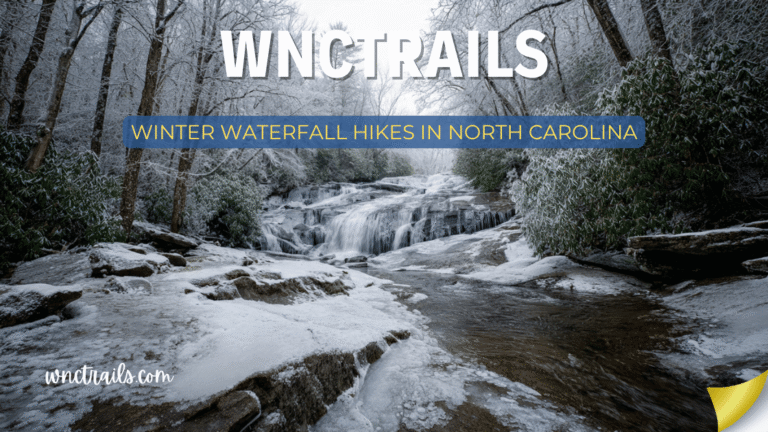
Winter (December–February): The finest season for solitude at Deep Creek. Tom Branch Falls with ice formations on the cliff face is extraordinary and sees almost no visitors. Indian Creek Falls runs clear and cold through the quiet winter forest. Mingo Falls in snow is genuinely spectacular. Lower-elevation sites like Deep Creek and Mingo remain accessible even during cold snaps.
Key Considerations
- Trail Difficulty: Waterfall hikes near Bryson City range from paved, stroller-friendly paths to steeper, rocky climbs. Know your group’s ability and choose accordingly.
- Parking and Access: Many trailheads have designated parking, but popular spots can fill quickly, especially during weekends and peak seasons. Arrive early to secure a spot.
- Trail Conditions: Trails can be muddy or slippery after rain. Wear sturdy, grippy footwear and check local trail reports for closures or hazards.
- Safety: Stay on marked paths and respect posted signs. Rocks near waterfalls are often slick, and water levels can rise rapidly after storms.
- Leave No Trace: Carry out all trash, avoid disturbing wildlife, and stick to established trails to help preserve these natural areas for future visitors.
- Seasonal Factors: Waterfall flow is strongest after spring rains, but summer and fall offer comfortable hiking weather and beautiful scenery. Winter can bring icy conditions—check ahead before visiting.
Common Use Cases
- Family-Friendly Outings: Deep Creek’s loop trail is ideal for families, with three waterfalls accessible on a relatively short, easy walk. Picnic areas and tubing spots make it a full-day destination.
- Photography Expeditions: Early morning or late afternoon light creates dramatic photo opportunities at Tom Branch Falls and Mingo Falls. Bring a tripod for long exposure shots of flowing water.
- Day Hikes: Combine multiple waterfalls in a single outing, such as the Deep Creek Loop (Juney Whank, Tom Branch, and Indian Creek Falls). For a longer adventure, Rufus Morgan Falls offers a moderate hike with a rewarding view.
- Nature Study: These trails are rich in plant and bird life. Spring and early summer bring wildflowers and active songbirds, making the area popular with naturalists and students.
- Relaxation and Solitude: Less-visited falls, like Rufus Morgan, can offer quiet escapes from busier spots. Weekdays or off-season visits increase your chances of solitude.
Final Thoughts
Bryson City doesn’t shout. It doesn’t have the marketing budget of Gatlinburg or the name recognition of Asheville. What it has is a quiet gateway position — between the least-visited corner of the Smokies, the wild Nantahala Gorge, and a national forest wilderness that most visitors drive through without stopping.
The waterfalls here are accessed by trails that are quieter than their quality warrants. The town is small enough to feel like a local discovery. The drive in — through the gorge, along the river, under the ridge — prepares you for what the mountains actually are rather than what the tourist corridor version of them looks like.
Come for the waterfalls. Stay for the quiet. Bryson City rewards both.
Frequently Asked Questions
- Which waterfall hike is best for beginners?
Tom Branch Falls, just a short walk from the Deep Creek trailhead, is one of the most accessible options. The path is mostly flat and suitable for all ages. - Are dogs allowed on these trails?
Dogs are permitted on many national forest trails, but restrictions apply within Great Smoky Mountains National Park. Always check regulations before bringing pets, and keep them leashed. - Is swimming allowed at the waterfalls?
Wading is possible in some areas, but swimming directly under waterfalls is not recommended due to currents and slippery rocks. Deep Creek is popular for tubing downstream from the falls. - What should I bring on a waterfall hike?
Essentials include water, snacks, sturdy shoes, a map or GPS, rain gear, and a camera. Insect repellent and sunscreen are also useful, especially in summer. - When is the best time to visit?
Spring offers the highest flows, while fall provides colorful scenery. Summer is popular for families and tubing, but trails are busiest. Winter hikes can be peaceful, but check for ice on trails. - How do I get to Deep Creek’s waterfalls from Bryson City?
The Deep Creek trailhead is about a five-minute drive from downtown Bryson City. Follow signs for Deep Creek Road and the national park entrance. - Do I need a permit or pay a fee?
Some parking areas near Bryson City now require a parking tag or day pass, especially within the Great Smoky Mountains National Park. Check current requirements before your visit.
Related Pages
Know a waterfall near Bryson City we should add? Share it in the comments below!
Explore more NC mountain destinations at WNCTrails.com →