Dupont Waterfall Hikes
DuPont State Recreational Forest contains more iconic waterfalls per acre than almost any public land in the eastern United States — and you can see all seven of them in a single day.
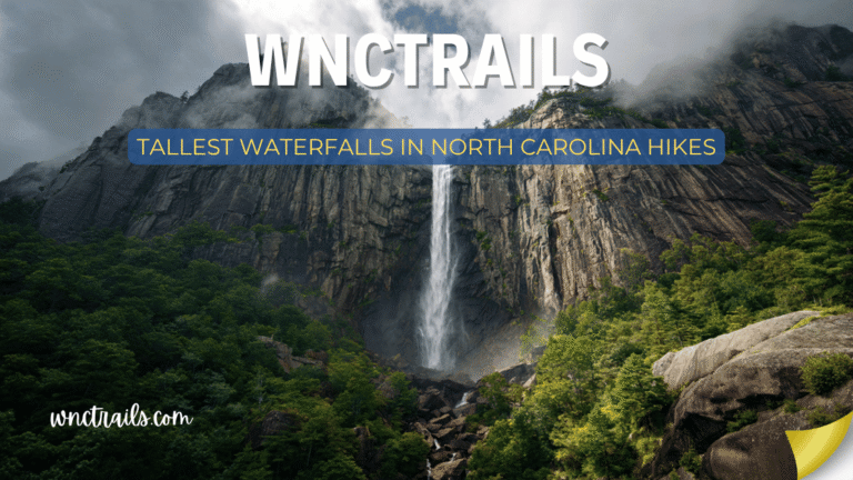
Most visitors know one name: Triple Falls. The 120-foot three-tiered cascade appeared in The Hunger Games (2012) as the waterfall district, and the resulting attention made DuPont one of the most-searched waterfall destinations in the Southeast. What most visitors don’t know is that Triple Falls is just one of seven distinct waterfalls within the forest — and that High Falls, at 150 feet, dwarfs it entirely.
DuPont covers 10,000 acres of the Blue Ridge foothills between Brevard and Hendersonville, with 90 miles of trail connecting a waterfall network built around the Little River and its tributaries. You can do a focused 3-mile waterfall loop hitting four falls in two hours, or spend a full day exploring all seven with time to spare.
This guide covers all seven DuPont waterfalls — their character, how to reach each one, the best routes to combine them, and everything you need to plan a great visit.
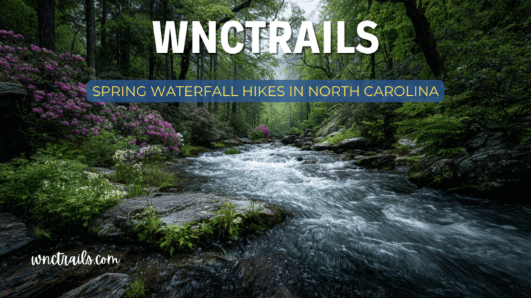
DuPont State Forest Waterfall Hikes: The Complete Guide to All 7 Waterfalls
Recommended Tools
Disclosure: This page may contain affiliate links.
- Water Shoes — Check current pricing
- Rain Jacket — Check current pricing
- Dry Bag — Check current pricing
Quick Reference: All 7 DuPont Waterfalls
| Waterfall | Height | Style | Swim? | Film Location | Nearest Trailhead | GPS |
|---|---|---|---|---|---|---|
| Hooker Falls | 12 ft | Wide curtain + pool | ✅ Best pool | No | Hooker Falls Access | 35.2034°N, 82.6287°W |
| Triple Falls | 120 ft | Three-tiered cascade | ✅ Middle tier | Hunger Games | Hooker Falls Access | 35.2089°N, 82.6231°W |
| High Falls | 150 ft | Free-fall plunge | ❌ Dangerous | No | High Falls Access | 35.2143°N, 82.6175°W |
| Bridal Veil Falls | 120 ft | Walk-behind curtain | ❌ No pool | No | High Falls Access | 35.2167°N, 82.6192°W |
| Grassy Creek Falls | 50 ft | Fan cascade | ✅ Small pool | No | Buck Forest Access | 35.2201°N, 82.6389°W |
| Wintergreen Falls | 60 ft | Tiered plunge | ✅ Upper pool | No | Lake Imaging Access | 35.2312°N, 82.6241°W |
| Corn Mill Shoals | 15 ft | Wide rocky shoals | ✅ Shallow | No | Buck Forest Access | 35.2189°N, 82.6421°W |
Swimming notes reflect current DSRF guidance. Conditions vary — always check water level before entering.
The DuPont Waterfall Experience: What Makes This Forest Unique
DuPont’s waterfalls share a geological origin that distinguishes them from other western North Carolina falls. The Little River cuts through a granite batholith — the same intrusive rock that forms Looking Glass Rock and John Rock in nearby Pisgah — and the resulting waterfalls tend to flow over wide, smooth, open rock faces rather than through narrow gorges. This means you can get closer to the action at DuPont than at most other waterfall areas, the views are more open, and the photographic compositions are broader.
The forest is also managed as a recreational forest rather than a wilderness — meaning the trail system is exceptionally well-maintained, well-signed, and widely accessible. Most trails are doubletrack width (converted forest roads and old DuPont company roads), making DuPont unusually friendly for trail running, mountain biking, and visitors who struggle with narrow single-track.
The tradeoff: DuPont’s accessibility and fame mean it can be genuinely crowded, particularly at Triple Falls on weekends from April through October. This guide includes strategies for crowd avoidance throughout.
The Waterfalls in Detail
1. Hooker Falls
The Best Swimming Hole in the Forest
Distance from Hooker Falls Access: 0.6 miles RT | Elevation Gain: Minimal | Difficulty: Easy | Time: 20–40 min
GPS: 35.2034°N, 82.6287°W | Trailhead: Hooker Falls Access Area, DuPont Rd
Hooker Falls is DuPont’s most approachable waterfall — a 12-foot wide curtain drop over a horizontal granite shelf into the deepest, most swimmable pool in the forest. The walk from the Hooker Falls parking area is flat, wide, and short, making this the right choice for families with young children, visitors with limited mobility, or anyone who wants a quick dip with minimal effort.
The falls themselves are modest in height, but the pool below is exceptional: broad, clear, and deep enough to jump from the falls lip (about 8 feet) when water levels are appropriate. The surrounding rock is flat granite, providing natural sunbathing platforms on both sides of the river. This is DuPont’s beach, as much as a mountain forest can have one.
The Little River above and below Hooker Falls is wide and relatively gentle, making wading upstream or downstream from the pool area pleasant on warm days.
Swimming note: The pool directly below the falls has a moderate downstream current. Strong swimmers only at high water (spring and after heavy rain). In summer low water, it’s gentle enough for children who can swim.
Photography: Hooker Falls is wide and low — ideal for a wide-angle composition with the rock shelf in the foreground and the forest framing the sides. Soft overcast light works best; direct sun creates harsh contrast on the white water and dark pool.
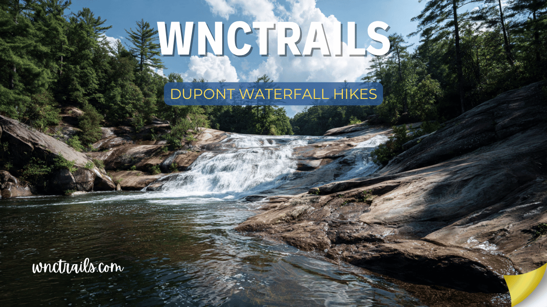
2. Triple Falls
The Movie Waterfall
Distance from Hooker Falls Access: 1.6 miles RT | Elevation Gain: 280 ft | Difficulty: Easy-Moderate | Time: 45–90 min
GPS: 35.2089°N, 82.6231°W | Trailhead: Hooker Falls Access Area, DuPont Rd
Triple Falls is DuPont’s most famous waterfall, and the reputation is earned. The Little River drops 120 feet in three distinct tiers — upper, middle, and lower — each separated by a pool or rock ledge. The full sequence is visible from a wooden viewing platform on the left bank and from a rock ledge that extends into the river at the middle tier.
The middle tier (the largest drop, approximately 60 feet) is where the swimming access is. A rock shelf provides entry to a pool below the middle drop — manageable for adults in moderate water, not recommended for children or non-swimmers given the current.
The Hunger Games filming used Triple Falls as the backdrop for Katniss navigating the waterfall district. If you’ve seen the film and can place the scene, you’ll recognize the view from the right bank immediately. This connection generates a specific category of visitor — people who come specifically for the film location — which adds to crowd pressure at peak season.
The Triple Falls trail in context: Most visitors start at the Hooker Falls Access Area and hike Triple Falls Trail (also called the Little River Trail or Hooker Falls Trail, depending on the map version) upstream. The trail climbs moderately on the left bank, with the river audible throughout, and arrives first at the lower viewing area, then continues up to the middle tier access.
Crowd reality check: Triple Falls is the single most crowded trail in DuPont on spring and fall weekends. The parking lot at Hooker Falls Access fills by 9 AM on Saturdays in October. If you arrive at 10 AM on a peak weekend, you will see dozens of people at the falls. If this bothers you, plan accordingly: weekday visits are dramatically less crowded, and early-morning Saturday arrivals (before 8:30 AM) typically find the falls to themselves.
3. High Falls
The Tallest in DuPont
Distance from High Falls Access: 0.7 miles RT | Elevation Gain: 150 ft | Difficulty: Easy | Time: 25–50 min
GPS: 35.2143°N, 82.6175°W | Trailhead: High Falls Access Area, DuPont Rd
High Falls drops 150 feet in a single plunge off a granite ledge — the tallest waterfall in DuPont and, at full flow, one of the most imposing sights in western North Carolina. The falls face roughly south, meaning they receive good light from mid-morning through early afternoon. The viewing area is a broad rock shelf at the base, with the plunge pool sitting directly below the drop.
Swimming is not permitted at High Falls (the current at the base of the plunge is genuinely dangerous), but the viewing area is excellent — you can walk to within 30 feet of the base on flat rock.
High Falls is best seen in high water (spring, after rain). In dry late summer, the flow can reduce significantly from what photos show. If you’re planning a trip around High Falls specifically, check recent AllTrails reviews or DSRF conditions reports first.
The best angle: From the viewing platform directly in front of the falls. A second trail on the right bank provides an elevated view looking down into the plunge pool — interesting, but the full-face view from below is more dramatic.
Combined with Bridal Veil: The High Falls Access Area is also the closest trailhead to Bridal Veil Falls (see below). Most visitors do both in a single short loop, spending 60–90 minutes total.
4. Bridal Veil Falls
Walk Behind the Water
Distance from High Falls Access: 1.2 miles RT | Elevation Gain: 180 ft | Difficulty: Easy | Time: 40–70 min
GPS: 35.2167°N, 82.6192°W | Trailhead: High Falls Access Area (same as High Falls)
Bridal Veil Falls drops 120 feet off an overhanging granite ledge — and the overhang is deep enough to walk behind the falls on a dry rock shelf. The experience is similar to Moore Cove Falls in Pisgah, but on a larger scale: the curtain is wider, the plunge is longer, and the dry alcove behind it is roomier.
To walk behind Bridal Veil, approach from the right side of the falls (facing the falls) and follow the rock shelf under the overhang. The rock is wet near the curtain edge but dry further back. You can walk the full width of the falls behind the water — the kind of experience that’s memorable long after the photos fade.
The High Falls + Bridal Veil Loop: From High Falls Access Area, hike High Falls Trail to the base of High Falls (0.35 miles), return to the junction, then continue on the connector trail to Bridal Veil Falls (additional 0.6 miles). Return to trailhead. Total: approximately 1.8 miles, 60–90 minutes. This is one of the best short hikes in western North Carolina — two dramatically different 120–150-foot waterfalls in under 2 miles.
5. Grassy Creek Falls
The Quiet West Side
Distance from Buck Forest Access: 1.4 miles RT | Elevation Gain: 200 ft | Difficulty: Easy-Moderate | Time: 50–75 min
GPS: 35.2201°N, 82.6389°W | Trailhead: Buck Forest Access Area, Buck Forest Rd
Grassy Creek Falls sits in the western section of DuPont, accessed from the Buck Forest trailhead rather than the main DuPont Road access points. The 50-foot fan cascade spreads across a wide granite face before collecting in a shallow pool — narrower than Hooker Falls but more scenic in terms of surrounding forest framing.
Because it’s accessed from a different trailhead than the main waterfall circuit, Grassy Creek sees a fraction of the traffic of Triple Falls and Hooker Falls. On a busy October Saturday when the main access lots are full, Grassy Creek might have four or five people at it.
The trail follows Grassy Creek upstream through a pleasant hardwood-rhododendron corridor. The grade is consistent and manageable — a good choice for families who want a longer walk than Hooker Falls provides but aren’t ready for the full High Falls loop.
6. Wintergreen Falls
The Secluded Northern End
Distance from Lake Imaging Access: 2.0 miles RT | Elevation Gain: 350 ft | Difficulty: Moderate | Time: 1–2 hours
GPS: 35.2312°N, 82.6241°W | Trailhead: Lake Imaging Access Area, Sky Valley Rd
Wintergreen Falls is DuPont’s most secluded waterfall — a 60-foot tiered plunge in the northern section of the forest that requires the longest approach of any falls in the guide. The upper pool is swimmable in summer and accessible from the right bank with a short scramble.
The trail passes through some of the forest’s best interior terrain — mixed hardwood stands, hemlock hollows, and open granite slabs that invite off-trail exploration between the main trail and the creek.
This is the waterfall for visitors who’ve already seen Triple Falls, High Falls, and Bridal Veil and want to go deeper into DuPont’s less-traveled sections. If it’s your first DuPont visit, focus on the main circuit first.
7. Corn Mill Shoals
The Wading Waterfall
Distance from Buck Forest Access: 1.0 miles RT | Elevation Gain: 80 ft | Difficulty: Easy | Time: 30–50 min
GPS: 35.2189°N, 82.6421°W | Trailhead: Buck Forest Access Area, Buck Forest Rd
Corn Mill Shoals isn’t a conventional waterfall — it’s a 15-foot drop over wide, flat granite ledges where the river fans into a series of shallow braided channels before collecting in a broad pool. The effect is more like a natural waterpark: multiple small drops, wide rock slabs for wading, and a pool at the bottom accessible from all sides.
This is DuPont’s most family-friendly water feature. The water is shallow across most of the shoals (ankle-to-knee deep in summer), the rock is flat and grippy, and children can spend an hour exploring the channels and pools without significant safety concern.
Combined with Grassy Creek Falls (both accessed from Buck Forest), Corn Mill Shoals makes the Buck Forest trailhead the best option for families with young children who want water play over dramatic scenery.
DuPont Trail Routes: How to See Multiple Waterfalls
Route 1: The Classic Four-Waterfall Loop
Hooker Falls + Triple Falls + High Falls + Bridal Veil
Total Distance: 4.8 miles loop | Elevation Gain: 600 ft | Difficulty: Moderate | Time: 2.5–4 hours
Start: Hooker Falls Access Area
This is the most popular multi-waterfall route in DuPont and for good reason — it covers four of the seven waterfalls, including all four of the most dramatic ones, in a single efficient loop.
Route sequence:
- From Hooker Falls parking, take Hooker Falls Trail downstream to Hooker Falls (0.3 mi)
- Backtrack to junction, take Triple Falls Trail upstream to Triple Falls (1.3 mi cumulative)
- Continue upstream on the trail system, connecting via Buck Forest Rd or conservation road to High Falls (2.8 mi cumulative)
- From High Falls, take connector trail to Bridal Veil Falls (3.6 mi cumulative)
- Return to Hooker Falls Access via High Falls Connector and Buck Forest connector (4.8 mi total)
Trail navigation note: DuPont’s trail system uses a combination of named hiking trails and numbered fire/forest roads. The route above connects several named trails with short road walks. Download the DSRF official trail map at ncparks.gov/dupont-state-recreational-forest before going — AllTrails’ DuPont coverage is reliable but can lag on trail name updates.
Route 2: The Easy Family Loop
Hooker Falls + Triple Falls
Total Distance: 1.6 miles RT (or 2.8-mile loop variation) | Elevation Gain: 280 ft | Difficulty: Easy-Moderate | Time: 1–2 hours
Start: Hooker Falls Access Area
The most popular short route in DuPont: park at Hooker Falls, walk to the pool, continue upstream on Triple Falls Trail to Triple Falls, return the same way. Total: under 2 miles, covers the two most famous waterfalls in the forest.
For a loop variation, return via the right-bank trail (Buck Forest Rd connector) rather than retracing the left-bank path — slightly longer but avoids backtracking and provides different views of the river.
Best for: First-time DuPont visitors, families with children over 4, anyone with 90 minutes and decent walking shoes.
Route 3: The High Falls Focus
High Falls + Bridal Veil Falls
Total Distance: 1.8 miles loop | Elevation Gain: 280 ft | Difficulty: Easy | Time: 1–1.5 hours
Start: High Falls Access Area
The most efficient route to DuPont’s two most dramatic waterfalls. Park at High Falls Access, hike to High Falls base (0.35 mi), return to junction, hike to Bridal Veil Falls (additional 0.6 mi), walk behind the falls, return to trailhead.
Two major waterfalls (150 ft and 120 ft), less than 2 miles, no significant difficulty. If you have only 90 minutes in DuPont, this is the route.
Route 4: The Complete DuPont Waterfall Tour
All Seven Waterfalls
Total Distance: 9–11 miles (depending on connector routing) | Elevation Gain: 1,200 ft | Difficulty: Moderate-Hard | Time: 5–8 hours
Start: Hooker Falls Access Area (primary), with car spot or shuttle at Buck Forest or High Falls Access
Seeing all seven DuPont waterfalls in a single day is a legitimate goal for fit hikers. The full tour connects all three access areas and requires either a car shuttle (leave a vehicle at Buck Forest and High Falls Access) or a willingness to walk connecting road segments between waterfall clusters.
Recommended sequence:
- Hooker Falls (Hooker Falls Access)
- Triple Falls (upstream from Hooker Falls)
- High Falls (via trail connector from Triple Falls area)
- Bridal Veil Falls (trail connector from High Falls)
- Wintergreen Falls (northern section, requires connector trail from main circuit)
- Grassy Creek Falls (Buck Forest section, best reached via Grassy Creek connector)
- Corn Mill Shoals (Buck Forest, lower section)
Logistics note: The connecting trails between clusters use a mix of named trails and fire roads. The DSRF official trail map (paper version available at the access area kiosks) shows the connections clearly. Rely on this rather than phone navigation in the field — cell service is unreliable in the interior of the forest.
Carry: 2+ liters of water, lunch, and a layer. The full tour takes most people 5–7 hours on the trail.
Route 5: The DuPont Mountain Bike + Waterfall Route
Triple Falls + High Falls via Ridgeline Trails
Total Distance: 8–12 miles | Difficulty: Moderate | Time: 2–3.5 hours
DuPont is one of the premier mountain bike destinations in western North Carolina — the wide doubletrack trails and well-maintained surfaces make it exceptional for riders. Most waterfall trails are also open to bikes (verify current access at the kiosks, as some waterfall access spurs are hike-only).
Recommended bike approach: Ride the main ridgeline trails and descend to the waterfall spurs, then climb back out. Triple Falls Trail is narrow and steep — most riders walk bikes on the final approach to the falls. High Falls is accessible by bike on the fire road approach; Bridal Veil requires a short hike-a-bike.
Bike rental: Available in Brevard at Sycamore Cycles (downtown Brevard, 10 minutes from DuPont). Ask for their DuPont map — staff ride the system regularly and know current conditions.
DuPont’s Seasons: When to Visit
Spring (March–May): Peak Waterfall Flow
The best time to see DuPont’s waterfalls at full force is March through May, when snowmelt from the upper elevations and spring rainfall drive the Little River to peak volume. High Falls in full spring flow is a genuinely different experience from High Falls in August low water — broader, louder, and more powerful.
Spring also brings wildflowers to DuPont’s forest floor: trillium, wild iris, fire pink, and Solomon’s seal are common along the creek corridors April through May.
Spring crowd note: Weekends in late April and May are increasingly popular as word has spread about spring DuPont. Arrive before 9 AM or target weekdays.
Summer (June–August): Swimming Season
DuPont’s best attribute in summer is the swimming. Hooker Falls pool, the Triple Falls middle tier, Corn Mill Shoals, and Grassy Creek all offer legitimate swimming in summer. The water temperature is consistently 60–65°F — cold enough to be refreshing, warm enough to stay in.
Summer heat strategy: DuPont sits at 2,200–2,600 feet elevation, which provides meaningful relief from Piedmont summer heat. Even on a 95°F day in Charlotte, DuPont is typically 80–85°F — and you’re in the water.
Peak crowding: Summer weekends, particularly July 4th weekend, are the most crowded days of the year in DuPont. The Hooker Falls Access parking lot can reach capacity by 8:30 AM. Arrive early or visit High Falls Access instead (typically less crowded even in peak season).
Fall (September–November): Color Season
Fall color at DuPont’s 2,200–2,600-foot elevation typically peaks in late October — usually the third and fourth weeks of October in most years. The combination of fall color and the granite-faced waterfalls makes this the most photographically compelling season.
The Hunger Games effect in fall: The film’s most famous waterfall scenes were shot in fall-adjacent conditions, which has created a specific October pilgrimage to Triple Falls. If you want Triple Falls with good light and acceptable crowds, target a weekday in mid-October. A weekend in late October is the most crowded day of the DuPont year.
Winter (December–February): Ice and Solitude
Winter DuPont is a genuinely different experience from the other seasons — and one that most visitors never discover. After sustained cold spells (temperatures below 25°F for several consecutive days), ice formations build on Bridal Veil Falls, High Falls, and Triple Falls that rival anything in the Southeast.
Bridal Veil in particular develops massive ice curtains — the spray from the falls freezes on the overhang and cliff face, creating formations 20–30 feet thick in cold winters. The walk-behind experience becomes a walk-behind-ice-curtain, which is extraordinary.
Winter DuPont is also nearly empty. On a December weekday, you may have all seven waterfalls to yourself.
Winter access note: DuPont’s access roads are maintained but unpaved — use caution after ice storms. The trails themselves are generally walkable in winter, though micro-spikes (Yaktrax or similar) are advisable after any precipitation below freezing.
DuPont for Photographers
DuPont offers more waterfall photography opportunities in a compact area than any other site in western North Carolina. A few notes specific to each falls:
Hooker Falls: Wide angle, horizontal composition. Soft overcast light or early morning. A polarizing filter removes glare from the pool surface and reveals the underwater rock color.
Triple Falls: The platform on the left bank gives the full three-tier view. The rock ledge at the middle tier gives a close-up of the largest drop. Shoot from the platform in morning light (the falls face east); use the ledge in afternoon. Long exposure (1–4 seconds) captures the silky water effect on the three tiers.
High Falls: Best light is mid-morning to noon (south-facing). The elevated right-bank trail gives a top-down view of the plunge pool for a compositionally unusual shot. Full-face view from the base gives the scale perspective.
Bridal Veil Falls: Shoot from inside the alcove looking out through the water curtain — one of the most distinctive compositions in DuPont. Late afternoon light through the falling water creates backlit spray that photographs spectacularly. Protect your lens from spray with a lens cloth ready.
Grassy Creek Falls: Fan composition, similar to Looking Glass but more intimate scale. Morning light (east-facing). The approach through rhododendron creates a natural tunnel frame on the approach.
Corn Mill Shoals: Best photographed from the rock ledge above the main drop looking downstream — wide angle captures the braided channels and the forest frame. Good for autumn color reflections in the shallow pools.
Golden hour tip: DuPont’s forest is dense enough that “golden hour” light reaches the creek bottoms only in spring and fall when the canopy is thinner. In summer, the best light on the waterfalls is soft overcast rather than direct sun.
Planning Your DuPont Visit
Getting to DuPont from Major Cities
From Brevard (10 minutes): DuPont is the closest major waterfall destination to Brevard. Take Hwy 64 E to Crab Creek Rd to DuPont Rd. The drive itself is through horse country and second-growth forest — scenic from the start.
From Asheville (40 minutes): Take I-26 E to Exit 33 (Hwy 280 / Brevard Rd), follow Hwy 280 to Brevard, then Hwy 64 E to DuPont Rd.
From Hendersonville (25 minutes): Hendersonville is the eastern gateway to DuPont. Take Hwy 64 W to Crab Creek Rd to DuPont Rd — a faster approach than the Brevard route.
From Charlotte (2 hours): I-85 N to I-26 W to Exit 49 (US-74 W), then US-74 W to US-64 W to Hendersonville, then DuPont Rd. Or I-85 N to I-26 W, same exit, same route.
From Greenville, SC (1.5 hours): I-385 N to I-26 W to US-74 W, then US-64 W toward Hendersonville.
The Three Access Areas
DuPont has three main access points — choosing the right one saves time:
Hooker Falls Access Area (DuPont Rd, off Staton Rd): Primary access for Hooker Falls and Triple Falls. Largest parking lot. Most crowded. Best choice if your primary goal is Triple Falls or the Classic Four-Waterfall Loop.
High Falls Access Area (DuPont Rd, further north from Hooker Falls): Best access for High Falls and Bridal Veil Falls. Smaller lot, typically less crowded than Hooker Falls even on busy weekends. Best choice if your primary goal is the two tallest waterfalls.
Buck Forest Access Area (Buck Forest Rd, off Cascade Lake Rd): Western access point for Grassy Creek Falls, Corn Mill Shoals, and the interior trail network. Least crowded of the three. Best choice for families wanting Corn Mill Shoals or hikers avoiding the main crowds.
Parking and Fees
Good news: DuPont State Recreational Forest currently charges no day-use fee. Parking is free at all three access areas. This may change — NC State Parks and Forests have been evaluating fee structures for high-use sites. Check ncparks.gov for current status before your trip.
Parking overflow plan: If the Hooker Falls lot is full (common by 9 AM on peak weekends), overflow parking is available along DuPont Rd. It’s not ideal but it happens. Alternatively, park at High Falls Access and hike the connector trails — slightly longer but the lot there fills later.
Trail Rules and Regulations
- Dogs: Allowed on leash. DuPont is very dog-friendly compared to most NC waterfalls. Many DuPont regulars bring dogs to Hooker Falls pool for swimming.
- Bikes: Allowed on most trails including many waterfall approach routes. Some spur trails to waterfall viewpoints are hike-only — posted at junctions.
- Horses: Allowed on designated trails. Be aware of horse traffic on the wider doubletrack.
- Drones: Prohibited without a permit.
- Fires: Prohibited except in designated campfire rings at primitive campsites.
- Camping: Primitive backcountry camping permitted at designated sites (permit required). Contact DSRF for current site availability.
Cell Service and Navigation
Cell service in DuPont is unreliable and often absent, particularly in the creek hollows near the waterfalls. Download the DSRF official trail map (available as a PDF at ncparks.gov) before your visit. AllTrails’ DuPont coverage is generally accurate. Gaia GPS works with downloaded offline maps.
The trail system is well-signed at major junctions — DuPont is one of the better-signed forests in western NC — but the junction signs use trail names that sometimes differ from app labels. Carry the official map.
America the Beautiful Pass: Does It Apply to DuPont?
No. DuPont State Recreational Forest is managed by the North Carolina Division of Parks and Recreation — a state agency. The America the Beautiful Annual Pass covers National Parks and National Forests (federal land) but does not cover NC State Parks or Recreation Areas.
DuPont currently has no admission fee, so this is moot for now. If fees are ever implemented, they would be paid as NC State park fees — separate from any federal pass.
For nearby sites where the America the Beautiful Pass DOES apply: Blue Ridge Parkway (Graveyard Fields, Crabtree Falls), Pisgah National Forest day-use areas (Looking Glass Falls, Sliding Rock). If you’re combining a DuPont trip with Pisgah or BRP stops, the pass is worth having.
Where to Stay Near DuPont
In Brevard (10 minutes from DuPont)
Brevard is the closest town to DuPont with full services — restaurants, grocery, gear shops, and a range of accommodations. Its position between DuPont and Pisgah National Forest makes it the best single base in the region for multi-day waterfall exploration.
- Search Brevard cabin rentals on Booking.com → — dozens of mountain cabins along the French Broad headwaters
- The Inn at Brevard (historic downtown B&B)
- Multiple vacation rental properties within 5 miles of DuPont trailheads
Brevard gear stop: Oskar Blues Brewing has a taproom in Brevard (they brew REEB Cycles beer and run a bike shop in the same complex) — a convenient pre-hike breakfast and post-hike beer stop with DuPont maps posted on the wall.
In Hendersonville (25 minutes)
Hendersonville offers a wider range of budget accommodations than Brevard and is slightly faster to DuPont via Hwy 64. Useful as a base if Brevard accommodations are booked (common in peak fall season).
Search Hendersonville hotels on Booking.com →
Camping Near DuPont
Inside DuPont: Primitive backcountry campsites are available by permit. Contact the forest office (828-877-6527) for current site availability and permit requirements.
Davidson River Campground (Pisgah National Forest, 20 minutes): The best full-service campground for DuPont visitors who also want Pisgah waterfall access. Reserve well ahead via Recreation.gov — fills completely on spring and fall weekends.
DuPont State Forest Equestrian Campground: For horse campers. Facilities for both horses and riders.
DuPont + Brevard: A Two-Day Waterfall Itinerary
DuPont and Brevard’s surrounding waterfalls combine naturally into a two-day itinerary that covers the best of the “Land of Waterfalls” region without excessive driving.
Day 1: DuPont State Forest
Morning (8:00–12:00):
- 8:00 AM — Hooker Falls (arrive early, claim the pool)
- 9:00 AM — Triple Falls (crowds build after 10, be there before them)
- 10:30 AM — Drive to High Falls Access Area
- 11:00 AM — High Falls + Bridal Veil Falls loop (1.8 mi, 90 min)
Afternoon (12:00–5:00):
- 12:30 PM — Lunch in Brevard (15 min drive)
- 2:00 PM — Buck Forest Access: Grassy Creek Falls + Corn Mill Shoals
- 4:00 PM — Explore Brevard: White Squirrel Brewery, downtown shops
Day 2: Pisgah National Forest
Morning (8:00–12:00):
- 8:30 AM — Looking Glass Falls (the icon, before crowds)
- 9:00 AM — Moore Cove Falls (walk behind the water)
- 10:30 AM — Sliding Rock (if warm enough)
Afternoon:
- Drive the Blue Ridge Parkway to Graveyard Fields (35 min from Sliding Rock trailhead)
- 2:00 PM — Graveyard Fields Second Falls + Upper Falls
- 5:00 PM — Return to Brevard or Asheville
Two-day total: 7 distinct waterfalls in DuPont, 4 more in Pisgah, the Blue Ridge Parkway drive — a comprehensive introduction to western NC’s best waterfall region.
Guided Tours in DuPont
DuPont Guided Hiking: Several Brevard-based guide services offer half-day waterfall tours in DuPont, typically covering Triple Falls, High Falls, and Bridal Veil with naturalist commentary.
Asheville-based tours: Several Asheville outfitters include DuPont in their day-tour rotation from the city. Browse DuPont tour options on Viator →
Mountain bike tours: Sycamore Cycles (Brevard) and several mountain bike guide services offer guided DuPont rides that incorporate waterfall stops.
Frequently Asked Questions
Is DuPont where they filmed The Hunger Games? Yes — specifically Triple Falls. The waterfall district scenes in The Hunger Games (2012) were filmed at Triple Falls. Filming also used other DuPont locations for background. The forest was also used in The Last of the Mohicans (1992) — though that film’s iconic waterfall scene was actually shot at Chimney Rock’s Hickory Nut Falls, not in DuPont.
Can you swim at DuPont’s waterfalls? Yes, at several: Hooker Falls pool (best), Triple Falls middle tier (moderate current — strong swimmers), Corn Mill Shoals (shallow, family-friendly), and Grassy Creek Falls (small pool). Swimming is not permitted at High Falls (dangerous current at plunge base) or Wintergreen Falls (restricted access).
How long does it take to see all the waterfalls at DuPont? The four main waterfalls (Hooker, Triple, High, Bridal Veil) take 3–5 hours depending on pace and swimming. All seven takes a full day (5–8 hours of hiking). A focused two-hour visit can cover Hooker Falls and Triple Falls comfortably.
Is DuPont good for kids? Very good. Hooker Falls and Corn Mill Shoals are ideal for young children. Triple Falls is accessible for children over 5 who hike regularly. High Falls and Bridal Veil require moderate climbing but no technical terrain. The wide, well-maintained trails reduce navigation stress. Dogs are welcome on leash.
What’s the difference between DuPont and Pisgah? DuPont State Recreational Forest is managed by NC State Parks and Recreation. Pisgah National Forest is managed by the US Forest Service. They’re adjacent and connected (you can drive between them in 15 minutes), but different land management systems, different trail characters, and different waterfall styles. DuPont has wider trails and more swimming-friendly granite-faced falls. Pisgah has more remote terrain and more dramatic gorge scenery.
When is DuPont least crowded? Weekday mornings year-round, and any winter day (December–February). Summer weekdays before 10 AM. If you must visit on a fall weekend, High Falls Access is consistently less crowded than Hooker Falls Access even on the busiest days.
Key Considerations
- Trail Selection: The most popular waterfall loop covers Triple Falls, High Falls, and Hooker Falls, typically totaling around 3 miles. For a longer trek, Bridal Veil Falls can be added, extending the hike to 7+ miles roundtrip.
- Parking: DuPont’s main access points, such as the Hooker Falls and High Falls parking areas, can fill up quickly, especially on weekends and holidays. Arriving early or visiting on weekdays can help avoid congestion.
- Trail Conditions: The trails are generally well-maintained but can become muddy or slippery after rain. Sturdy footwear and awareness of your footing are recommended, especially near waterfall overlooks and rocks.
- Accessibility: Some sections are suitable for strollers or those with limited mobility, particularly the path to Hooker Falls. However, reaching all the falls may require navigating moderate inclines or rocky sections.
- Safety: Swimming is allowed at Hooker Falls but not at other waterfalls due to strong currents and slippery rocks. Always stay on marked trails and observe posted safety guidelines.
- Pets: Leashed dogs are welcome throughout DuPont, but be prepared to pack out waste and keep pets under control near busy overlooks and picnic areas
Common Use Cases
- Family Outings: With relatively short distances between falls and gentle grades, DuPont waterfall hikes are ideal for families with children or mixed-ability groups.
- Photography: The combination of accessible overlooks, changing light, and dramatic cascades makes these trails popular among amateur and professional photographers alike. Early morning or late afternoon offers the best lighting and fewer crowds.
- Fitness and Training: The interconnected trail network allows runners and hikers to customize distances, making it a great option for training or building endurance.
- Nature Observation: In addition to waterfalls, the trails pass through diverse habitats, offering opportunities to spot wildflowers, birds, and occasional wildlife.
- Educational Trips: The area is frequently used for school field trips and guided hikes, thanks to its interpretive signs and accessible terrain.
Final Thoughts: Why DuPont Deserves More Than One Visit
Most visitors come to DuPont once, see Triple Falls, take the photos, and check the box. That’s understandable — Triple Falls is famous for a reason, and the hike there from Hooker Falls is genuinely excellent.
But DuPont’s deeper rewards take more than one visit to unpack. The ice formations at Bridal Veil Falls in January. The rhododendron tunnel on the Grassy Creek approach in late June. Corn Mill Shoals on a hot August afternoon with children wading the braided channels. High Falls at full spring flood when the plunge bass is audible from the parking area.
The forest has 90 miles of trails and seven waterfalls, and the waterfall circuit is only a fraction of what’s here. The trail system extends up to Ridgeline Trail, which offers the best ridge-to-valley views in the Brevard area. The mountain bike trails in the interior are among the best purpose-built singletrack in the Carolinas.
Come for the Hunger Games waterfall if you need a reason. Stay for everything else.
Frequently Asked Questions
- How long does it take to hike the main DuPont waterfall loop?
Most visitors complete the Triple Falls–High Falls–Hooker Falls loop in 2 to 3 hours, depending on pace and stops. Adding Bridal Veil Falls can extend the trip to 4 to 5 hours. - Are the trails crowded?
These are some of the most popular waterfall hikes in North Carolina, so weekends and holidays can be busy. Early morning and weekdays are generally quieter. - Is there an entrance fee?
DuPont State Recreational Forest is free to enter and hike. Donations are welcome to support trail maintenance and conservation efforts. - Can you swim at the waterfalls?
Swimming is permitted only at Hooker Falls in designated areas. The other waterfalls are unsafe for swimming due to strong currents and slippery rocks. - Are restrooms and water available?
Restrooms are available at major parking areas, but potable water is limited. Bring your own water, especially if planning a longer hike. - What should I bring?
Sturdy shoes, water, snacks, a map or GPS, sun protection, and a camera are recommended. Bug spray is useful in warmer months.
For those eager to experience North Carolina’s waterfalls up close, DuPont waterfall hikes offer a rewarding blend of accessibility, scenic beauty, and variety. With thoughtful planning and respect for trail etiquette, these hikes can be enjoyed by visitors of all ages and abilities.
Related Guides
- Waterfall Hikes Near Brevard, NC — DuPont is 10 minutes from Brevard; this guide covers the full surrounding region
- Waterfall Hikes With Swimming Holes in NC — Hooker Falls and Triple Falls both rank
- Easy Waterfall Hikes in North Carolina — Hooker Falls and the High Falls/Bridal Veil loop both qualify
- Scenic Waterfall Hikes in North Carolina — Photography guide includes DuPont
- Pisgah Waterfall Hikes — The adjacent national forest with its own waterfall circuit
- Waterfall Hikes Near Asheville, NC — DuPont is 40 minutes from Asheville
WNCTrails.com — Your guide to Western North Carolina trails, waterfalls, and outdoor adventure.
Trail conditions and forest regulations can change. Always check current conditions with DuPont State Recreational Forest before your visit.