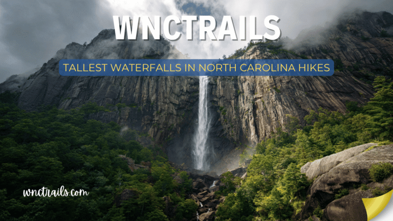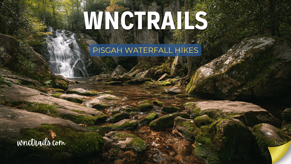
Pisgah Waterfall Hikes
Pisgah National Forest contains more spectacular waterfalls per square mile than almost anywhere else in the eastern United States — and most visitors only find two or three of them.
The forest covers over 500,000 acres across western North Carolina, stretching from the ridges above Asheville south to the Gorges, west into the Smokies foothills, and north along the Blue Ridge Parkway. Within that vast landscape, dozens of waterfalls pour off ancient Appalachian slopes — from roadside icons like Looking Glass Falls to remote plunge pools that require real route-finding to reach.
This guide covers the 14 best Pisgah waterfall hikes, organized by difficulty and grouped by access corridor. Whether you have two hours or two days, you’ll find exactly the right falls for your trip.
Pisgah Waterfall Hikes: The Ultimate Guide to Waterfalls in Pisgah National Forest
Recommended Tools
Disclosure: This page may contain affiliate links.
- Water Shoes — Check current pricing
- Rain Jacket — Check current pricing
- Dry Bag — Check current pricing
Quick Reference: Pisgah Waterfall Hikes
| Waterfall | Distance (RT) | Difficulty | Height | Drop Style | Parking Fee | GPS |
|---|---|---|---|---|---|---|
| Looking Glass Falls | 0.1 mi | Easy | 60 ft | Free-fall curtain | $5 | 35.3113°N, 82.7681°W |
| Sliding Rock | 0.2 mi | Easy | 60 ft | Natural slide | $5 | 35.3275°N, 82.7836°W |
| Moore Cove Falls | 1.4 mi | Easy | 50 ft | Behind-curtain | Free | 35.3097°N, 82.7545°W |
| Toms Spring Falls | 0.6 mi | Easy | 80 ft | Tiered cascade | Free | 35.3271°N, 82.7838°W |
| Log Hollow Falls | 2.0 mi | Moderate | 35 ft | Fan spray | Free | 35.3240°N, 82.7520°W |
| Courthouse Falls | 0.6 mi | Easy-Mod | 40 ft | Circular plunge | Free | 35.2437°N, 82.9319°W |
| Dill Falls | 1.6 mi | Moderate | 60 ft | Steep cascade | Free | 35.3168°N, 82.7472°W |
| Twin Falls | 3.2 mi | Moderate | 125 ft | Dual plunge | Free | 35.2301°N, 82.9541°W |
| Graveyard Fields Falls | 3.4 mi | Moderate | 60 ft / 50 ft | Double-tiered | $5 BRP | 35.3230°N, 82.8552°W |
| Catawba Falls | 3.4 mi | Moderate | 100 ft | Multi-tiered | Free | 35.6459°N, 82.2137°W |
| Upper Creek Falls | 4.0 mi | Mod-Hard | 150 ft | Multi-drop cascade | Free | 35.8847°N, 81.9102°W |
| Crabtree Falls | 2.7 mi | Moderate | 70 ft | Free-fall plunge | $20 BRP | 35.8210°N, 82.1441°W |
| Setrock Creek Falls | 1.2 mi | Easy | 80 ft | Multi-step fan | Free | 35.7125°N, 82.2489°W |
| John Rock Falls | 5.2 mi | Hard | 45 ft | Wilderness cascade | Free | 35.2919°N, 82.7658°W |
BRP = Blue Ridge Parkway entrance fee applies. All other trails accessed via USFS roads — no fee unless noted.
The Davidson River Corridor: Pisgah’s Waterfall Highway
The Davidson River corridor — stretching along US-276 from the Pisgah Ranger District entrance to the Blue Ridge Parkway — is the most waterfall-dense stretch of road in North Carolina. In a single 16-mile drive, you pass trailheads leading to at least eight significant waterfalls. This is where most visitors focus their time, and for good reason.
1. Looking Glass Falls
The Icon of Pisgah Forest
Distance: 0.1 miles round-trip | Elevation Gain: 30 ft | Difficulty: Easy | Time: 15–30 min
GPS: 35.3113°N, 82.7681°W | Parking: Roadside pullout on US-276, $5 fee
Looking Glass Falls is one of the most photographed waterfalls in the Southeast — and it earns every photo. The Davidson River drops 60 feet in a full-width curtain over a smooth granite face into a broad plunge pool, with a paved viewing platform 30 feet from the base and stone steps that descend directly to the pool’s edge.
What makes Looking Glass exceptional isn’t just its height or volume — it’s the geometry. The falls are nearly as wide as they are tall, creating a symmetrical wall of white water that frames perfectly in a camera lens. In winter, the spray builds elaborate ice formations on the surrounding rock faces. In spring flood, the roar can be heard from the parking area.
The trailhead is right on US-276, roughly 5 miles north of the Pisgah Ranger District entrance from Brevard. Steps lead down from the road to the lower viewing area — it’s less than 100 feet of walking. For those who want to get closer, the stone steps continue to the water’s edge, where a large pool sits behind a rock bar.
Photography note: Arrive early morning for side-angle light and minimal crowds. The falls face roughly northeast, so full direct sun arrives mid-morning. A polarizing filter dramatically reduces glare on the pool surface.
Do not: swim here. The current directly beneath the falls is deceptively powerful, and several people have been seriously injured. The pool looks calm from the viewing platform — it is not.
2. Sliding Rock
The Natural Water Slide
Distance: 0.2 miles round-trip | Elevation Gain: Minimal | Difficulty: Easy | Time: 30 min–2 hours
GPS: 35.3275°N, 82.7836°W | Parking: Dedicated USFS lot on US-276, $5 fee
Sliding Rock is technically a waterfall — the Looking Glass Creek drops 60 feet over a smooth, sloping granite face into an 8-foot-deep pool — but most people come here to ride it, not photograph it. The rock has been polished to near-glass smoothness by centuries of water flow, and on a warm summer weekend, hundreds of people queue up to make the 23-foot descent.
The experience is simple: walk up the left side of the rock face (staying on the designated path), sit at the lip, and push off. The water temperature is a constant 50–60°F year-round, which makes the whole event bracingly efficient.
Rangers are on duty Memorial Day through Labor Day to ensure visitors use the slide safely (feet-first only, no head-first sliding). Outside staffed season, Sliding Rock is technically closed for sliding but remains open for viewing.
Best visiting strategy: Arrive before 10 AM to beat the lines. By noon on summer weekends, wait times to slide can exceed 45 minutes.
Water temperature reality check: 50°F is cold. Children under 5 and adults with heart conditions should consider watching from the viewing platforms instead. The platforms offer an excellent view of the action without the shock.
3. Moore Cove Falls
Walk Behind the Water
Distance: 1.4 miles round-trip | Elevation Gain: 180 ft | Difficulty: Easy | Time: 45–75 min
GPS: 35.3097°N, 82.7545°W | Parking: Small gravel lot on US-276 (0.4 miles south of Looking Glass Falls)
Moore Cove Falls rewards a short hike with an experience most Pisgah visitors never have: standing behind an active waterfall. The 50-foot drop falls from a horizontal overhang, sending water outward from the rock face and creating a dry alcove behind the curtain large enough to stand in comfortably.
The trail follows Moore Creek upstream through second-growth hardwood forest on an easy grade, crossing the creek twice on footbridges before arriving at the base of the falls. The approach is gentle enough that it works for most children over 3, provided they’re comfortable on uneven forest ground.
The alcove behind the falls stays dry even during high water — the overhang geometry ensures the water arcs away from the rock face. You’ll feel the mist from inside, but won’t get soaked. It’s one of the most intimate waterfall experiences in western North Carolina.
Seasonal note: Visit in April–May when the surrounding slopes are covered in trillium, wild geranium, and Solomon’s seal. The combination of wildflowers and the falls makes this one of the best spring hikes in Pisgah.
4. Toms Spring Falls
The Overlooked Neighbor
Distance: 0.6 miles round-trip | Elevation Gain: 60 ft | Difficulty: Easy | Time: 20–40 min
GPS: 35.3271°N, 82.7838°W | Parking: Sliding Rock parking area (short road walk to trailhead)
Toms Spring Falls sits 200 yards from Sliding Rock but attracts maybe 5% of the traffic. The 80-foot tiered cascade flows over multiple shelves into a quiet pool — no crowds, no lines, no fee beyond the standard Sliding Rock parking.
The short trail begins near the upper end of the Sliding Rock lot and follows a tributary upstream to the base of the falls. The path is unmaintained compared to the main Sliding Rock facilities, but it’s straightforward and used enough to be followable.
The falls run with better flow earlier in the season (March–May) and after rain. In dry late summer, they can reduce to a trickle. If you’re visiting Sliding Rock anyway, Toms Spring adds only 30 minutes to your trip.
5. Log Hollow Falls
The Quiet Interior
Distance: 2.0 miles round-trip | Elevation Gain: 350 ft | Difficulty: Moderate | Time: 1.5–2.5 hours
GPS: 35.3240°N, 82.7520°W | Parking: Log Hollow Trailhead on FR-477 (dirt road, suitable for standard vehicles in dry conditions)
Log Hollow Falls sits in a hollow east of the main Davidson River corridor, accessible via Forest Road 477. The 35-foot fan waterfall spreads across a wide rock face in a distinctive spray pattern — less dramatic than Looking Glass but photographically distinctive, especially in late afternoon light when the spray catches gold.
The trail climbs moderately through mixed forest before dropping into the hollow where the falls sit. The creek crossing before the falls has no bridge — in spring or after heavy rain, waterproof footwear is advisable.
This waterfall rarely appears on casual visitor itineraries, which means you’re likely to have it entirely to yourself even on busy weekends. Bring a lunch and the silence is yours.
6. Dill Falls
The Forest Interior
Distance: 1.6 miles round-trip | Elevation Gain: 280 ft | Difficulty: Moderate | Time: 1–2 hours
GPS: 35.3168°N, 82.7472°W | Parking: Trailhead on FR-477C
Dill Falls is a 60-foot steep cascade that plunges through a narrow rocky channel before spreading at the base. The approach follows an old logging road converted to trail, which makes navigation easy even without a map.
The falls flow best February through May. By August they can be reduced significantly in dry years. The surrounding forest is recovering second-growth with a heavy understory of rhododendron — in late June, the trail corridor is spectacular.
The Courthouse / Twin Falls Corridor: Southern Pisgah
The southern section of Pisgah, accessed via NC-215 from Brevard toward Lake Logan, contains some of the forest’s most dramatic geology. The waterfalls here tend toward circular plunge pools and vertical drops — the rock is different here, more fractured and fault-influenced.
7. Courthouse Falls
The Perfect Circle
Distance: 0.6 miles round-trip | Elevation Gain: 80 ft | Difficulty: Easy-Moderate | Time: 30–60 min
GPS: 35.2437°N, 82.9319°W | Parking: Small gravel pullout on FR-140, north of Lake Logan
Courthouse Falls drops 40 feet into what appears to be a perfectly circular plunge pool — a geological oddity formed by the rotational grinding of boulders in the current over thousands of years. The circular pool and the vertical drop combine to create a visually striking scene that’s disproportionately dramatic relative to the short approach.
The trail descends steeply from FR-140 (a maintained gravel forest road) to the base of the falls. The path is short but requires careful footing on loose rock near the bottom. The plunge pool is swimmable in summer — and this one is actually safe to swim in, unlike Looking Glass.
Navigation note: FR-140 branches from NC-215 approximately 2.5 miles north of the Lake Logan entrance. The turnoff is unmarked on most consumer GPS maps. Use the GPS coordinates above and look for a gated forest road on the right side of NC-215 heading north.
8. Twin Falls
Double the Drama
Distance: 3.2 miles round-trip | Elevation Gain: 650 ft | Difficulty: Moderate | Time: 2–3.5 hours
GPS: 35.2301°N, 82.9541°W | Parking: Trailhead at the end of FR-225B near Lake Logan
Twin Falls delivers exactly what the name promises: two separate waterfalls dropping into the same pool from different angles, combining for a total drop of 125 feet. The East Fork and West Fork of the Tuckasegee converge at the base, which means both falls run with strong flow nearly year-round.
The hike follows the West Fork upstream on a generally well-maintained trail with two creek crossings — wet feet are likely in spring even with stepping stones. The terrain is moderate with no exposed scrambling, but the 650-foot gain on the return makes this legitimately tiring for young children.
The basin at the base of Twin Falls is one of the most beautiful in western North Carolina — a rock amphitheater with the dual falls as the centerpiece. Plan 30 minutes here minimum; 60 minutes if you’re photographing. The falls receive morning light on the left fork and afternoon light on the right — plan your visit based on which you want to capture.
Blue Ridge Parkway Access: Northern Pisgah
Several Pisgah waterfalls are accessed from the Blue Ridge Parkway rather than from US-276 or NC-215. These require paying the Parkway entrance fee (currently $20/vehicle) or holding an America the Beautiful Pass.
9. Graveyard Fields (Second Falls + Upper Falls)
The High-Elevation Double
Distance: 3.4 miles round-trip to both falls | Elevation Gain: 425 ft | Difficulty: Moderate | Time: 2–3 hours
GPS: 35.3230°N, 82.8552°W | Parking: Graveyard Fields Overlook, MP 418.8 on Blue Ridge Parkway
Graveyard Fields sits at 5,120 feet elevation — high enough that it’s surrounded by spruce-fir forest, feels noticeably cooler than the valley floor even in summer, and sees snow when the valleys are dry. The name comes from the meadow’s peculiar landscape of tree stumps that early settlers thought resembled grave markers.
The trail loops past two separate waterfalls: Second Falls (60 feet, directly below the parking area) and Upper Falls (50 feet, requiring the additional 0.8-mile upstream extension). Most visitors see only Second Falls and turn around — do not be most visitors. Upper Falls is the more dramatic of the two, a curtain drop into a clean plunge pool surrounded by high-elevation forest.
Second Falls is visible from an overlook just minutes from the parking area. The falls drop into a wide rocky basin where swimming is permitted and popular in summer, despite the cold water (consistently 55–65°F at this elevation).
Upper Falls requires crossing Yellowstone Prong on rocks (no bridge) and a short climb. In high water, this crossing can be ankle-to-knee deep. The falls themselves are accessible by scrambling down a rocky slope to the base.
Seasonal strategy:
- Spring (April–May): Peak waterfall flow, but the Parkway may have weather closures. Check road status at nps.gov/blri before driving up.
- Summer (June–August): Best for swimming. Arrive before 9 AM on weekends — the Graveyard Fields lot fills completely by mid-morning and cars park along the Parkway for half a mile.
- Fall (October): Peak color at 5,100 feet typically hits the third week of October — 2–3 weeks ahead of the valley floor.
- Winter (December–February): The falls are accessible when the Parkway is open, with ice formations forming around both drops during cold snaps. Check BRP closure status — this section closes frequently in winter.
10. Crabtree Falls
The Hidden Gem of the Northern Parkway
Distance: 2.7 miles loop | Elevation Gain: 560 ft | Difficulty: Moderate | Time: 2–3 hours
GPS: 35.8210°N, 82.1441°W | Parking: Crabtree Meadows Campground, MP 339.5 on Blue Ridge Parkway
Crabtree Falls is the most undervisited major waterfall on the Blue Ridge Parkway — partly because of its location in the northern section of Pisgah, far from the Brevard/Asheville concentration of visitors, and partly because finding the trailhead requires knowing to look for Crabtree Meadows Campground.
The falls drop 70 feet in a single free-fall plunge off a rock ledge into a sheltered basin rimmed with rhododendron. The loop trail descends steeply to the falls from the campground, crosses the creek below the falls, and returns on a different route — making this a proper loop rather than an out-and-back.
Peak rhododendron bloom here runs mid-June at Parkway elevation, creating one of the most photographically productive waterfall hikes in the entire forest.
Access note: Crabtree Meadows Campground is open seasonally (typically May–October). Outside that window, parking availability along the Parkway varies. The $20 Parkway fee or America the Beautiful Pass is required.
Eastern Pisgah: The Catawba Corridor
The eastern edge of Pisgah National Forest, accessible from Old Fort (I-40 Exit 73), contains waterfalls that most western NC visitors completely overlook. The Catawba River drainage here is lush, lower-elevation, and accessible without driving mountain roads.
11. Catawba Falls
The Eastern Pisgah Showpiece
Distance: 3.4 miles round-trip | Elevation Gain: 600 ft | Difficulty: Moderate | Time: 2–3.5 hours
GPS: 35.6459°N, 82.2137°W | Parking: Catawba Falls Trailhead on Old Fort Road, free
Catawba Falls has been a local secret for decades and is now getting well-deserved attention. The 100-foot multi-tiered waterfall sits at the end of a trail that follows the Catawba River through a narrow, forested gorge. The trail is excellent — well-maintained, clearly marked, and varied in terrain.
The falls themselves are dramatic: upper tiers cascade over fractured rock into a mid-level pool, which in turn drops a final 40 feet into the main plunge basin. You can access the base of the falls easily, and a short scramble (use hands, no technical climbing required) reaches a ledge with a close-up view of the upper tier.
The surrounding hardwood forest provides excellent fall color in October, making this one of the better fall waterfall hikes on the eastern side of Pisgah.
Getting there: From I-40, take Exit 73 (Old Fort), drive through town on US-70, then turn onto Old Fort Road (also called Catawba River Road). The trailhead is approximately 3 miles up this road. No USFS fee. The road is paved to the trailhead.
12. Setrock Creek Falls
The Accessible Eastern Alternative
Distance: 1.2 miles round-trip | Elevation Gain: 150 ft | Difficulty: Easy | Time: 45–75 min
GPS: 35.7125°N, 82.2489°W | Parking: Curtis Creek Campground area, free
Setrock Creek Falls is an 80-foot multi-step fan waterfall in the Curtis Creek watershed, one of the oldest parts of Pisgah National Forest (the first land purchased under the Weeks Act of 1911). The falls spread across a wide rock face in a distinctive fan shape that displays beautifully in soft overcast light.
The trail is short and relatively gentle, making this an excellent choice for families with young children who want a legitimate waterfall experience without committing to a longer hike.
Historical note: The Curtis Creek watershed contains some of the oldest USFS management history in the eastern US — interpretive signs along the trail explain the early conservation history of Pisgah, which adds an educational dimension unusual in waterfall hiking.
The John Rock Loop: Pisgah’s Premier Waterfall Hike
13. John Rock Falls + John Rock Summit
The Epic Day
Distance: 5.2 miles loop | Elevation Gain: 1,200 ft | Difficulty: Hard | Time: 3.5–5.5 hours
GPS (trailhead): 35.2919°N, 82.7658°W | Parking: Cedar Rock Trailhead on FR-475, free
The John Rock Loop combines a significant waterfall with one of the best views in Pisgah — the summit of John Rock, a 3,320-foot granite dome with a 270-degree panoramic view of the Davidson River valley and the surrounding ridgeline.
The loop begins at Cedar Rock Trailhead, descends to the Davidson River watershed, visits the falls in the John Rock hollow (a 45-foot cascade into a clear pool), then climbs steeply to the John Rock summit before returning via the ridgeline. The summit section requires some hand-over-foot scrambling on granite slabs — manageable for fit adults and older teenagers comfortable with heights.
This is the best full-day hike in the Davidson River corridor. The falls are a worthy destination, the summit is spectacular, and the loop format means you’re seeing genuinely different terrain throughout.
Fitness requirement: The 1,200-foot elevation gain is real. This is not a casual waterfall walk. Bring 2+ liters of water per person, solid footwear, and plan for a full half-day at minimum.
Upper Creek Falls: Northern Pisgah’s Remote Prize
14. Upper Creek Falls
For Those Who Want to Work for It
Distance: 4.0 miles round-trip | Elevation Gain: 800 ft | Difficulty: Moderate-Hard | Time: 2.5–4 hours
GPS: 35.8847°N, 81.9102°W | Parking: Upper Creek Trailhead off Collettsville Road, Burke County, free
Upper Creek Falls sits in the northernmost section of Pisgah, in the Grandfather Ranger District near Linville — far from the Brevard-area concentration but worth the drive for visitors based in Boone, Blowing Rock, or Morganton.
The falls drop 150 feet in a series of cascades through a narrow gorge — the longest single sequence of drops of any accessible waterfall in Pisgah National Forest. The trail climbs moderately along the ridgeline before descending to the creek and the falls, with the last section requiring careful footwork on steep terrain above the upper cascade.
The total drop is subdivided into a 90-foot upper cascade visible from an overlook and a 60-foot lower plunge reached by scrambling down the left side of the gorge. Both sections are worth visiting. Budget 45 minutes at the falls site.
Access: The trailhead is accessed via Collettsville Road (SR-1337) from Lenoir or from the NC-181 junction near Jonas Ridge. The road is paved to the trailhead. No fee.
Planning Your Pisgah Waterfall Trip
America the Beautiful Pass
The Blue Ridge Parkway charges a $20/vehicle entrance fee, which covers the Parkway itself — not the USFS land on either side. Most trailheads accessed via US-276 and other forest roads are free (some charge $5 at high-use sites like Looking Glass Falls and Sliding Rock).
An America the Beautiful Annual Pass ($80) covers both the Parkway fee and the USFS day-use fees. If you’re spending two or more days in the area, or plan to return to North Carolina’s public lands in the future, the pass pays for itself quickly.
Available at: Recreation.gov, any National Park entrance station, any USFS Ranger District office, or by phone at 888-275-8747.
Road Conditions and Seasonal Access
Many Pisgah trailheads are accessed via Forest Roads (FR numbers). These are generally maintained gravel roads passable by standard vehicles. Key notes:
- FR-140 (Courthouse Falls access): Gravel, suitable for passenger cars in dry conditions. After heavy rain or in winter, a vehicle with higher clearance is preferable.
- FR-477 (Log Hollow / Dill Falls access): Gravel, passable for standard vehicles. Avoid after heavy rain.
- Blue Ridge Parkway: Check nps.gov/blri for closures before traveling — the Parkway closes sections regularly for weather, ice, and rockslides, especially October–April.
Best Times to Visit Pisgah’s Waterfalls
March–May (Spring): Peak waterfall flow from snowmelt and spring rains. Wildflowers at lower elevations (Moore Cove, Davidson River corridor) peak late March through early May. Graveyard Fields and high-elevation falls accessible once BRP opens.
June–August (Summer): Best for swimming (Courthouse Falls, Graveyard Fields Second Falls, Sliding Rock). Rhododendron blooms June–July. Arrive early on weekends — US-276 and Looking Glass/Sliding Rock parking areas are genuinely overwhelmed by 10 AM on summer Saturdays.
September–October (Fall): Fall color begins at high elevation (Graveyard Fields: mid-October) and moves downslope (Davidson River valley: late October into early November). Waterfalls run lower than spring but the color compensation is real.
November–February (Winter): Ice formations at Looking Glass Falls, Graveyard Fields, and Toms Spring can be extraordinary after sustained cold spells. Most falls are accessible (the Parkway is the variable). Minimal crowds. Dress in layers — temperatures at Pisgah elevations run 5–15°F colder than Brevard or Asheville.
What to Bring
The essentials that separate a great Pisgah day from a miserable one:
Water: At minimum 1.5 liters per person for any hike over 2 miles. The Davidson River has water but should be filtered.
Footwear: For the Davidson River corridor trails, trail runners or light hiking shoes work fine. For John Rock Loop, Upper Creek Falls, or any trail with significant scrambling, ankle-supporting hiking boots are worth it.
Waterproof layers: Pisgah generates its own weather — afternoon clouds and rain are common even when Asheville is sunny. A packable rain jacket takes no space and matters.
Bug protection: Black flies and gnats are aggressive April–June, particularly near creek bottoms. DEET or permethrin-treated clothing makes a meaningful difference.
Traction devices: If visiting between November and March, micro-spikes (Yaktrax or similar) are worth carrying for Graveyard Fields and any higher-elevation trails. Ice patches with no warning are the most common cause of serious injuries in winter Pisgah.
Multi-Day Pisgah Waterfall Itineraries
One Perfect Day: The Davidson River Circuit
Total driving: 18 miles | Total hiking: 3.5–5 miles
- 8:00 AM — Sliding Rock (arrive before crowds, $5)
- 9:00 AM — Toms Spring Falls (add 30 min while still at Sliding Rock area)
- 10:00 AM — Moore Cove Falls (1.4 miles, behind-the-falls experience)
- 11:30 AM — Looking Glass Falls (photos, viewing platform)
- 12:00 PM — Lunch at Davidson River Campground picnic area
- 1:30 PM — Log Hollow Falls or Dill Falls (choose one based on energy)
- 3:30 PM — Drive up to Graveyard Fields on the BRP (add $20 Parkway fee)
- 5:30 PM — Return to Brevard for dinner
Two Days in Pisgah
Day 1: Davidson River Corridor — Sliding Rock, Moore Cove, Looking Glass, Courthouse Falls (drive to NC-215 for the afternoon)
Day 2: Choose your adventure based on energy and interest:
- Hikers: John Rock Loop or Twin Falls (commit to the miles)
- Scenic drivers: Blue Ridge Parkway to Graveyard Fields, then Crabtree Falls (northern Parkway)
- Families: Catawba Falls from Old Fort (different geography, easier terrain)
Three Days: The Complete Pisgah Waterfall Experience
Day 1: Davidson River corridor (Sliding Rock, Toms Spring, Moore Cove, Looking Glass) Day 2: Southern Pisgah (Courthouse Falls, Twin Falls) + Blue Ridge Parkway drive Day 3: Northern Pisgah (Graveyard Fields, Crabtree Falls) or Eastern Pisgah (Catawba Falls, Setrock Creek)
Where to Stay Near Pisgah
Inside the Forest
Davidson River Campground — The best-positioned campground for waterfall access in Pisgah. Sites 0.5 miles from Looking Glass Falls, 2 miles from Sliding Rock, and walking distance from Moore Cove trailhead. Reserve well in advance through Recreation.gov for spring and summer. 160 sites, electric and non-electric options.
Crabtree Meadows Campground (BRP) — For the northern Parkway corridor. Small, scenic, and well-positioned for Crabtree Falls. Open seasonally. Reserve via Recreation.gov.
Curtis Creek Campground — Primitive camping near Old Fort, first-come-first-served. Excellent base for Catawba Falls and Setrock Creek Falls.
In Brevard (Closest Town to the Davidson River Corridor)
Brevard is 4 miles from the Pisgah Ranger District entrance — the best base for most visitors.
- Search cabin rentals near Brevard on Booking.com — dozens of mountain cabins available year-round, most with fire pits and mountain views
- The Inn at Brevard (historic B&B, downtown)
- Multiple vacation rental properties on the Davidson River and its tributaries
In Asheville (Best Base for Northern Pisgah)
For Graveyard Fields, Crabtree Falls, and the northern Parkway, Asheville (25 miles northeast of Brevard) provides the widest range of accommodations:
- Search Asheville hotels on Booking.com — from downtown boutique hotels to Biltmore-area resorts
Guided Waterfall Tours in Pisgah
If you prefer not to navigate forest roads independently, several outfitters run guided waterfall tours in Pisgah:
- Pisgah Adventures — guided hiking tours in the Davidson River corridor, small groups, customizable difficulty
- Asheville Hiking Tours (via Viator) — day tours from Asheville with transportation included, covers Looking Glass, Moore Cove, and Graveyard Fields
- REI Asheville — guided day hikes several weekends per year through the Pisgah corridor; check their local events calendar
Browse Pisgah guided tours on Viator →
Pisgah Waterfall Etiquette and Leave No Trace
Pisgah National Forest receives approximately 3 million visitors per year. The concentrated pressure on popular waterfall sites — particularly Looking Glass Falls and Sliding Rock — is real and increasing. A few practices that matter:
Stay on trails: The bare rock “desire paths” cut by people shortcutting to creek access cause significant erosion. Use established trails and access points.
Pack out everything: The Davidson River corridor has inadequate trash infrastructure for its visitor volume. Carry a small bag and pack out what you carry in.
No soap in streams: Even biodegradable soap harms aquatic life when used directly in streams. Wash hands and dishes 200+ feet from any water source.
Respect swimming closures: Looking Glass Falls has a “no swimming” designation that exists because of current danger, not aesthetics. Courthouse Falls and Graveyard Fields Second Falls are the appropriate swimming destinations in this corridor.
Pets: Dogs are permitted on most Pisgah trails (on leash) but are NOT permitted at Sliding Rock during staffed season (Memorial Day through Labor Day). They are permitted at Looking Glass Falls viewing area.
Frequently Asked Questions
Do I need a permit for Pisgah waterfalls? No permit is required for day hiking to any waterfall in this guide. Some parking areas charge a $5 day-use fee (Looking Glass Falls, Sliding Rock). The Blue Ridge Parkway charges a $20/vehicle entrance fee for Graveyard Fields and Crabtree Falls access. An America the Beautiful Pass covers all federal fees.
Are Pisgah trails dog-friendly? Most are. Exceptions: Sliding Rock (during staffed season, May–Labor Day). All other trails in this guide permit leashed dogs. Keep dogs out of swimming areas at Looking Glass Falls regardless of rules — the current is dangerous for humans and dogs alike.
What’s the best waterfall in Pisgah for first-time visitors? Looking Glass Falls for iconic impact with zero effort. Moore Cove Falls if you want to hike and have the “walk behind the waterfall” experience. Courthouse Falls if you want to swim. Graveyard Fields if you’re driving up the Parkway anyway.
When do the Pisgah waterfalls run best? March through May, after significant rainfall. Snowmelt from higher elevations feeds the Davidson River and its tributaries through early spring. Fall and winter waterfalls are still worth visiting but typically run lower volume.
Is Pisgah National Forest part of the Smokies? No. Pisgah National Forest and Great Smoky Mountains National Park are adjacent but separate public lands under different management (USFS vs. NPS). Pisgah is a National Forest — camping is more dispersed, fees are lower, and motorized recreation (ATVs, dirt bikes on designated roads) is permitted in some areas.
Key Considerations
- Trail Difficulty: Waterfall hikes in Pisgah range from easy, paved paths suitable for families and beginners to moderate or strenuous trails with elevation changes and stream crossings. Always check the trail description and assess your group’s abilities before setting out.
- Safety: Rocks near waterfalls are often slippery, and stream crossings can be hazardous after heavy rain. Stay on marked trails, avoid climbing on or around waterfalls, and supervise children closely. Cell service is limited in many areas, so plan accordingly.
- Seasonal Conditions: Water levels and trail conditions change throughout the year. Springtime may bring muddy trails and powerful flows, while late summer can mean lower water but more swimming opportunities. Winter hikes require extra caution due to ice on rocks and trails.
- Leave No Trace: Pisgah’s popularity means responsible recreation is essential. Pack out all trash, stay on established paths, and avoid picking plants or disturbing wildlife. Parking lots can fill up quickly on weekends—arrive early or consider less-visited falls.
- Parking and Fees: While many trailheads are free, some popular spots (like Looking Glass Falls) may have limited parking. Double-check for any posted regulations or fees before your visit.
Common Use Cases
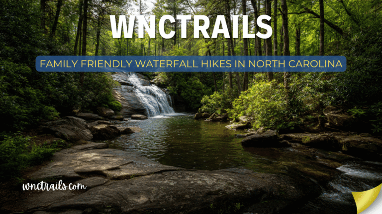
- Family Outings: Short, accessible hikes like Moore Cove Falls or Looking Glass Falls are perfect for families with young children or those seeking a gentle introduction to Pisgah’s waterfalls. These trails often include picnic areas and scenic viewpoints close to parking.
- Photography: The dramatic backdrops, changing light, and lush greenery make Pisgah waterfall hikes a favorite for both amateur and professional photographers. Early mornings or late afternoons offer the best lighting and fewer crowds.
- Swimming and Wading: Some waterfalls, such as Sliding Rock, are popular for swimming or sliding during warmer months. Always check for posted safety warnings and be aware of rapidly changing currents after rain.
- Trail Running and Fitness: The varied terrain and moderate elevation gains of many waterfall trails make them excellent for trail runners or those seeking a scenic workout.
- Nature Observation: The diverse ecosystems along Pisgah waterfall hikes offer opportunities for birdwatching, wildflower spotting, and learning about native Appalachian flora and fauna.
Final Thoughts: Why Pisgah’s Waterfalls Are Irreplaceable
Pisgah National Forest contains some of the oldest mountains on Earth — the southern Appalachians predate the Alps, the Rockies, and even the Atlantic Ocean in their current form. The waterfalls here are falling over rock that has been in place for 300 million years.
That geological age creates something you can feel but not easily explain: a sense of deep, anchored permanence. Looking Glass Falls was here before this continent had the shape it does now. The hollow behind Moore Cove Falls has been carved into the same granite face for longer than any human civilization has existed.
Pisgah is also intensely, deliberately preserved. The first parcels were purchased in 1916 under the Weeks Act specifically to protect the watersheds of the French Broad and Catawba Rivers — the waterfalls are partly the byproduct of that protection decision made more than a century ago.
When you’re standing at the base of any of these falls — getting the spray on your face, watching the white water break into foam and pool into calm — you’re participating in that long continuity. That’s worth showing up for.
Frequently Asked Questions
- Which Pisgah waterfall hike is best for beginners?
Looking Glass Falls requires almost no hiking and is fully accessible, while Moore Cove Falls offers an easy 1.5-mile round-trip trail suitable for most ages. - Are dogs allowed on Pisgah waterfall hikes?
Yes, leashed dogs are welcome on most trails. Be sure to pack out waste and bring plenty of water for your pet. - Is swimming allowed at Pisgah waterfalls?
Swimming is permitted at some locations, such as Sliding Rock. However, not all waterfalls are safe for swimming due to strong currents or rock hazards—always heed posted signs and use caution. - When is the best time to visit Pisgah waterfalls?
Spring offers the most dramatic water flow, while fall provides colorful foliage. Early mornings and weekdays are best for avoiding crowds. - Do I need a permit or pay a fee?
Most Pisgah waterfall hikes are free and do not require a permit, but some recreation areas may charge a small parking or use fee. Check current information before your visit.
Exploring Pisgah waterfall hikes is one of the best ways to experience the beauty of North Carolina’s mountains. Whether you’re seeking a peaceful family walk or a challenging backcountry adventure, these trails offer something for everyone—just remember to plan ahead, hike responsibly, and savor the sights and sounds of Western North Carolina’s remarkable waterfalls.
Related Guides
WNCTrails.com — Your guide to Western North Carolina trails, waterfalls, and outdoor adventure.
Trail distances and conditions change seasonally. Always check current conditions with the Pisgah Ranger District before visiting. Blue Ridge Parkway road status: nps.gov/blri.
- Waterfall Hikes Near Brevard, NC — Brevard is the nearest base for Pisgah waterfall access
- Easy Waterfall Hikes in North Carolina — For families and beginners in the Pisgah corridor
- Best Waterfall Hikes in North Carolina — The statewide overview
- Waterfall Hikes With Swimming Holes in NC — Courthouse Falls and Graveyard Fields Second Falls are top picks
- Spring Waterfall Hikes in North Carolina — Moore Cove wildflowers + peak spring flow