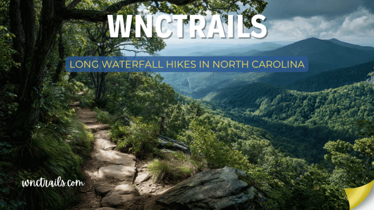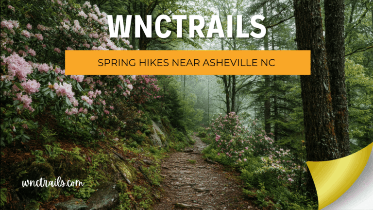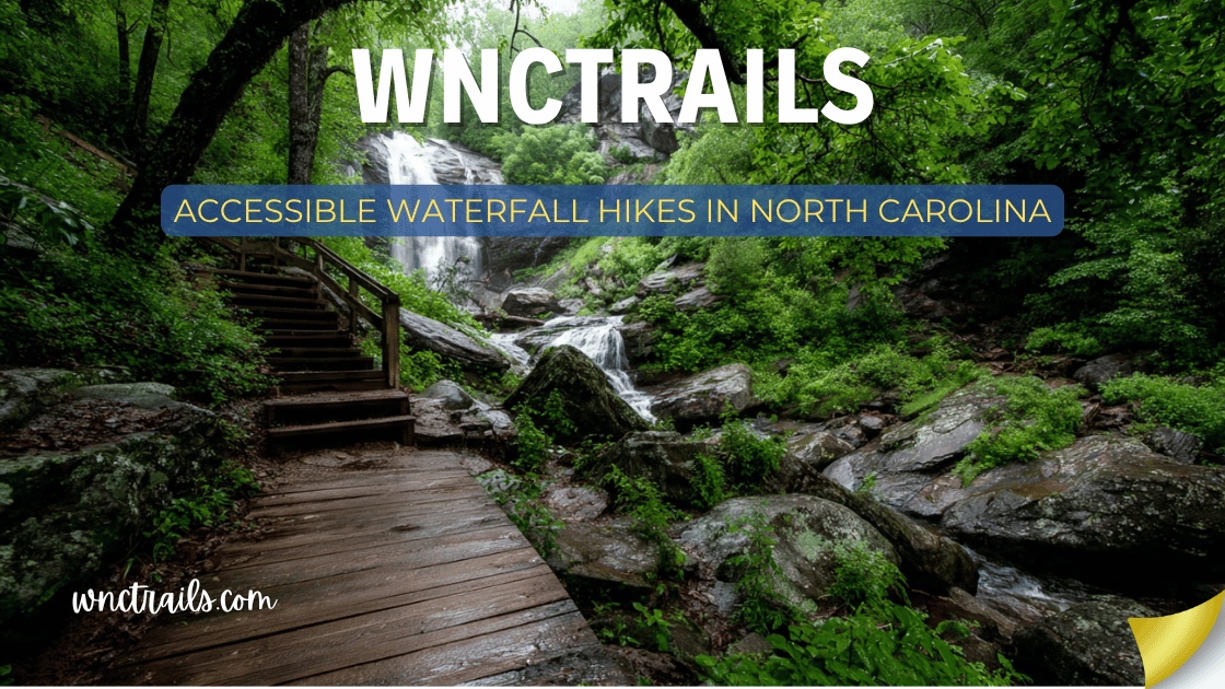
Accessible Waterfall Hikes In North Carolina
Everyone deserves to stand in front of a waterfall. North Carolina is home to more than 250 named cascades — and while many require strenuous backcountry hikes, a meaningful number of the state’s most spectacular falls are reachable by visitors using wheelchairs, walkers, canes, or other mobility aids, as well as those with limited stamina, chronic pain conditions, or other physical considerations that make standard trail hiking difficult.
This guide is dedicated to accessible waterfall hikes in North Carolina — with honest, specific information about trail surfaces, grades, restroom availability, accessible parking, and exactly how far a mobility device or limited-mobility visitor can travel before the trail changes character. We do not use “accessible” loosely here. Every site is evaluated against real accessibility criteria so you can plan with confidence.
How this guide rates accessibility: Sites are rated on a four-tier system based on trail surface, grade, obstacle presence, restroom availability, and whether the waterfall viewpoint itself is reachable by wheelchair or mobility aid. Ratings assume dry conditions — wet weather degrades all surfaces.
Accessible Waterfall Hikes in North Carolina (2026 Guide)
Recommended Tools
Disclosure: This page may contain affiliate links.
- Water Shoes — Check current pricing
- Rain Jacket — Check current pricing
- Dry Bag — Check current pricing
Accessibility Rating System
| Rating | What It Means |
|---|---|
| ⭐⭐⭐⭐⭐ Fully Accessible | Paved or boardwalk surface, grade ≤5%, waterfall viewpoint reachable by wheelchair without assistance, accessible restrooms on-site |
| ⭐⭐⭐⭐ Highly Accessible | Paved or firm gravel surface, grade ≤8%, waterfall viewpoint reachable by wheelchair with minimal assistance or by most mobility aid users independently |
| ⭐⭐⭐ Moderately Accessible | Firm gravel or compacted dirt, grade ≤10%, may require assistance for wheelchair users; easily managed by visitors using canes, walkers, or with limited stamina |
| ⭐⭐ Partially Accessible | Waterfall viewpoint partially reachable; good accessible parking and facilities; some portion of the trail suits mobility-limited visitors even if the full route does not |
Quick Reference: Accessible Waterfall Sites
| Waterfall | Location | Access Rating | Surface to Falls | Restrooms | Accessible Parking |
|---|---|---|---|---|---|
| Dry Falls | US-64, Nantahala NF | ⭐⭐⭐⭐⭐ | Fully paved | Yes | Yes (designated) |
| Whitewater Falls | NC-281, Nantahala NF | ⭐⭐⭐⭐⭐ | Fully paved | Yes | Yes (designated) |
| Bridal Veil Falls | US-64, Highlands | ⭐⭐⭐⭐⭐ | Flat pavement | No | Pull-off |
| Looking Glass Falls | US-276, Pisgah NF | ⭐⭐⭐⭐ | Paved stairs | No | Pull-off |
| Hooker Falls | DuPont State Forest | ⭐⭐⭐⭐ | Firm gravel | No | Gravel lot |
| Linville Falls Visitor Ctr | Blue Ridge Pkwy MP 316.4 | ⭐⭐⭐⭐ | Paved/gravel | Yes | Yes (designated) |
| Graveyard Fields (Lower) | Blue Ridge Pkwy MP 418.8 | ⭐⭐⭐ | Paved then dirt | Yes (parking area) | Yes (designated) |
| Pearson’s Falls | Near Tryon | ⭐⭐⭐ | Gravel path | Yes | Gravel lot |
| Mingo Falls | Cherokee, NC | ⭐⭐⭐ | Paved steps | No | Paved lot |
| Sliding Rock | US-276, Pisgah NF | ⭐⭐⭐ | Paved | Yes | Yes (designated) |
| Moore Cove Falls | US-276, Pisgah NF | ⭐⭐ | Dirt path | No | Pull-off |
| Soco Falls | US-19, Maggie Valley | ⭐⭐ | Dirt/informal | No | Roadside pull-off |
Fully Accessible (⭐⭐⭐⭐⭐)
Dry Falls — Nantahala National Forest
Access Rating: ⭐⭐⭐⭐⭐ Fully Accessible Distance to Falls: 0.1 miles | Surface: Fully paved | Grade: ≤5%
The gold standard for waterfall accessibility in Western North Carolina. The path from the parking area to the rocky alcove beneath Dry Falls is paved, non-slip, gently graded, and wide enough for a standard wheelchair throughout. There are no steps, no gravel sections, no grade changes. The alcove beneath the 75-foot falls is reachable by wheelchair with minimal or no assistance — one of the only true wheelchair-accessible walk-behind waterfall experiences in the eastern United States.
Accessibility details:
- Designated accessible parking spaces directly adjacent to the trail entrance
- Paved path width: approximately 6 feet — adequate for wheelchairs and passing pedestrians
- Maximum grade: approximately 4–5% on the descent; assistive handles recommended for steeper wheel users on return
- The alcove beneath the falls has a flat paved floor — waterfall viewpoint is fully reachable
- Accessible restroom facilities in the parking area
Important notes for wheelchair users: The rock floor directly inside the alcove transitions from paved to natural stone at the very base — the final 10–15 feet nearest the water is unpaved and slightly uneven. The best viewing and misting experience is reachable on paved surface; only the absolute closest approach requires natural rock navigation.
Facilities: Restrooms, fee collection station, designated parking. $5/vehicle; America the Beautiful Access Pass (free for permanent disability) accepted and covers the fee entirely.
Coordinates: 35.0574° N, 83.2219° W
Whitewater Falls — Nantahala National Forest
Access Rating: ⭐⭐⭐⭐⭐ Fully Accessible Distance to Overlook: 0.2 miles | Surface: Fully paved | Grade: ≤5%
The tallest cascading waterfall east of the Rocky Mountains — on a fully accessible paved path. At 411 feet, Whitewater Falls is one of the great natural spectacles of the eastern United States, and the upper overlook requires nothing more than a short, gently graded paved walk from accessible parking. The overlook itself is a paved platform with sturdy barriers, providing a full-height view of the cascade for all visitors.
This is arguably the most accessible “world-class waterfall” viewpoint in the eastern United States — the combination of trail quality, designated parking, restroom facilities, and the sheer scale of what you’re viewing makes it exceptional by any measure.
Accessibility details:
- Designated accessible parking spaces at the trailhead parking lot
- Fully paved path from parking to overlook with consistent non-slip surface
- Grade is gentle throughout — manageable for most manual wheelchair users independently
- Overlook platform is paved and flat with solid barriers on all open sides
- Accessible restrooms in the parking area
Important notes for wheelchair users: The overlook platform has a slight cross-slope near the barrier edge on one side — standard wheelchair positioning provides excellent views without this being an issue. The viewing experience from the accessible portion is the same as for all visitors.
Facilities: Restrooms, fee station, designated parking, interpretive signage at the overlook. $5/vehicle; America the Beautiful Access Pass accepted.
Coordinates: 35.0338° N, 83.0004° W
Bridal Veil Falls — Near Highlands, NC
Access Rating: ⭐⭐⭐⭐⭐ Fully Accessible Distance to Falls: Seconds | Surface: Flat pavement | Grade: Zero
The most accessible waterfall experience in North Carolina — flat pavement from parking to waterfall with zero elevation change. Bridal Veil Falls spills over the former US-64 roadbed, and the original drive-through lane beneath it is flat, paved, and requires nothing more than stepping out of a vehicle and walking forward. There are no steps, no grade, no gravel, no distance to speak of.
For visitors with the most significant mobility limitations, this is the most achievable profound waterfall experience in the state. A visitor who cannot walk at all can experience the waterfall from a vehicle driving the former roadbed — genuinely the only drive-through waterfall in NC.
Accessibility details:
- The old roadbed lane is flat, continuous pavement — zero obstacles
- Wide enough for two wheelchairs side by side
- No designated accessible parking per se — the adjacent pull-off is flat and unpaved gravel, and the roadbed itself serves as the accessible route
- No restrooms on-site — nearest facilities are at Dry Falls (2 miles west)
- Free; no fee, no infrastructure required
Important notes for wheelchair users: The pavement beneath the falls is perpetually wet and can develop a slight film — non-slip tires or footwear helps. The flat grade means no pushing difficulty; the wet surface is the only variable to manage.
Facilities: None on-site. Restrooms at Dry Falls (2 miles). Free and always open.
Coordinates: 35.0639° N, 83.2389° W
Highly Accessible (⭐⭐⭐⭐)
Looking Glass Falls — Pisgah National Forest
Access Rating: ⭐⭐⭐⭐ Highly Accessible Distance to Falls: 0.2 miles | Surface: Paved stairs with dual railings | Grade: Moderate descent
The most iconic waterfall in Western NC is reachable via a paved staircase with continuous dual-side handrailing. Looking Glass Falls drops 60 feet in a wide, powerful curtain just off US-276, and the staircase from the parking area leads to a mist-soaked viewing platform at the base. For visitors who can navigate stairs with support, this provides a full-frontal waterfall experience that is among the most impressive in the state.
Looking Glass Falls does not rate as fully accessible because the staircase — while excellent quality — requires stair-climbing ability. It is not navigable by wheelchair without significant assistance and is not appropriate for mobility scooters. However, for visitors using canes, walkers, or who simply need the support of a railing, the dual handrails and consistent stair depth make this very manageable.
Accessibility details:
- Paved staircase with dual continuous handrailing on both sides
- Stair depth is consistent — no irregular risers
- Viewing platform at the base is flat and stable
- The falls are also partially visible from the road and parking area — visitors who cannot manage the stairs can see the upper portion of the falls without descending
- No designated accessible parking or restrooms at this site
Important notes for cane/walker users: The descent is manageable with the railing; take it slow and test each step. The return ascent requires more effort — pace yourself. The mist at the base can make the bottom platform damp underfoot.
Important notes for wheelchair users: The staircase is not navigable by standard wheelchair. An off-road or beach wheelchair with assistance could potentially manage it, but this is not a standard accessible route. The falls are visible (partially) from the parking level without descending.
Facilities: No on-site restrooms or designated accessible parking — small roadside pull-off. Free to visit.
Coordinates: 35.3025° N, 82.7648° W
Hooker Falls — DuPont State Recreational Forest
Access Rating: ⭐⭐⭐⭐ Highly Accessible Distance to Falls: 0.8 miles | Surface: Wide compacted gravel | Grade: Nearly flat
The most accessible multi-mile waterfall trail in Western NC. The path to Hooker Falls is a wide, compacted gravel surface maintained by the state forest — essentially flat the entire 0.8 miles, with no steps, no creek crossings without bridges, and no significant obstacles. The trail is used regularly by visitors with mobility scooters, and many wheelchair users complete it independently in dry conditions.
The gravel surface is what prevents a full ⭐⭐⭐⭐⭐ rating — loose top gravel can make pushing more effortful than a paved surface, and the surface degrades slightly after heavy rain. In dry conditions, it is among the most accessible natural waterfall trails in the state.
Accessibility details:
- Wide gravel surface (approximately 8 feet) — enough for two wheelchairs side by side
- Grade is essentially flat — measured elevation change from trailhead to falls is minimal
- No creek crossings — the trail stays on the river bank with no bridge transitions
- The pool at the base of the falls is accessible and can be viewed directly from the trail terminus
- Gravel parking areas — not paved, but large and flat
Important notes for wheelchair users: Manual wheelchair users may find the loose top gravel layer requires more pushing effort than expected on a flat trail — a companion to assist on the outbound section is helpful. Power wheelchairs and mobility scooters handle this surface well in dry conditions. Avoid after heavy rain when top gravel can become churned and more difficult.
Facilities: No restrooms at the Hooker Falls trailhead — nearest facilities at other DuPont parking areas. Free to enter DuPont.
Coordinates: 35.1906° N, 82.6380° W
Linville Falls — Visitor Center Area — Blue Ridge Parkway
Access Rating: ⭐⭐⭐⭐ Highly Accessible Distance to Viewpoint: 0.8 miles round-trip | Surface: Paved and firm gravel | Grade: ≤8%
The best-facilitated accessible waterfall site on the Blue Ridge Parkway, with an NPS visitor center, designated accessible parking, clean restrooms, and a paved trail leading to an upper viewpoint of the 90-foot falls and the Linville Gorge. The upper overlook trail (0.8 mi round-trip) has the best accessibility of the four available trail options, with a paved beginning and firm gravel continuation.
The upper falls viewpoint is reachable by most mobility aid users and, with assistance, by wheelchair users. The gorge overlook is one of the most dramatic viewpoints in the entire Parkway system.
Accessibility details:
- Designated accessible parking in the main lot adjacent to the visitor center
- Paved path from parking to the trail entrance; trail transitions to firm compacted gravel
- Upper overlook trail: 8% grade maximum on the gravel section — manageable with assistance for wheelchairs
- Visitor center itself is fully accessible — exhibits, restrooms, ranger staff
- The upper falls viewpoint has a flat observation area suitable for wheelchair positioning
Important notes for wheelchair users: The gravel section of the trail (approximately 0.3 miles) is the main challenge. In dry conditions with a companion, most wheelchairs can be pushed to the upper viewpoint. After rain, the gravel surface becomes more challenging. Power chairs handle this route well in dry conditions.
Facilities: NPS visitor center with accessible restrooms, exhibits, and ranger information. Designated accessible parking. Free entry at this trailhead.
Coordinates: 35.9544° N, 81.9279° W
Moderately Accessible (⭐⭐⭐)
Graveyard Fields — Lower Falls — Blue Ridge Parkway
Access Rating: ⭐⭐⭐ Moderately Accessible Distance to Falls: 1.0 mile | Surface: Paved then packed dirt | Grade: Gentle
The trail from the Parkway parking area begins paved and transitions to packed dirt after the first section. The descent to the lower falls involves a moderate grade on the dirt section — manageable for most cane and walker users, but more challenging for wheelchair users without assistance. The accessible parking at the Parkway pullout is designated and flat.
For mobility-limited visitors: The paved opening section of the trail (approximately 0.3 miles) provides access to the open Graveyard Fields meadow basin and mountain views without requiring the full descent to the falls. This portion alone is worth the stop.
For wheelchair users: The full trail to Lower Falls requires assistance and is not independent-navigation terrain. The paved section is fully accessible; the dirt descent is moderate-assistance territory.
Facilities: Accessible restrooms in the parking area. Designated accessible parking. Free on the Blue Ridge Parkway. Note: no dogs allowed on Graveyard Fields trails.
Coordinates: 35.3272° N, 82.8600° W
Pearson’s Falls — Near Tryon, NC
Access Rating: ⭐⭐⭐ Moderately Accessible Distance to Falls: 1.0 mile round-trip | Surface: Gravel path | Grade: Gentle with one steeper section
A well-maintained gravel path through the Garden Club preserve leads to the 90-foot falls with mostly gentle grade. One moderate section approximately halfway exists where the grade increases — manageable for cane and walker users; requires assistance for wheelchairs. The falls viewing area itself is flat and open.
For mobility-limited visitors: One of the most rewarding accessible waterfall experiences in the NC foothills, with exceptional botanical richness along the approach that makes even a partial walk deeply enjoyable.
Facilities: Restrooms at the trailhead. Gravel parking lot. $5/adult admission; children free. No dogs.
Coordinates: 35.2126° N, 82.1549° W
Mingo Falls — Cherokee, NC
Access Rating: ⭐⭐⭐ Moderately Accessible Distance to Falls: 0.4 miles | Surface: Paved steps | Grade: Stairs throughout
The entire trail to Mingo Falls is a staircase — 200 steps with continuous handrailing. Not wheelchair accessible, but one of the most manageable stair-based waterfall experiences in NC for visitors using canes or walkers who can manage steps with support. The payoff — a 120-foot cascade at the top — is among the most impressive in the region for the effort required.
For mobility-limited visitors: If you can manage 200 steps with a railing — equivalent to roughly 10 floors — Mingo Falls is an extraordinary reward. The steps are uniform in depth and rise, which makes them more predictable than irregular trail terrain.
Facilities: Paved parking lot. Free to visit. No restrooms at trailhead. Road paved all the way to the parking area.
Coordinates: 35.5665° N, 83.2662° W
Sliding Rock — Pisgah National Forest
Access Rating: ⭐⭐⭐ Moderately Accessible Distance to Viewing Area: 0.1 miles | Surface: Paved | Grade: Minimal
The paved path from the parking area to the viewing area above the slide is accessible to most mobility aid users. The viewing platform provides a clear view of the waterfall and the slide activity below. Getting into the water and using the slide is not feasible for most mobility-limited visitors — the bank and water entry require physical agility.
For mobility-limited visitors: The viewing experience from the accessible platform is genuinely enjoyable — watching the activity below is entertainment in itself even without swimming.
Facilities: Restrooms, changing rooms, designated accessible parking. $5/vehicle; America the Beautiful Access Pass accepted.
Coordinates: 35.3372° N, 82.7572° W
Partially Accessible (⭐⭐) — Worth Knowing About
Moore Cove Falls — US-276, Pisgah NF
Access Rating: ⭐⭐ Partially Accessible
The 0.75-mile dirt path has good maintenance and gentle grade but no paved surface — not appropriate for wheelchairs or scooters. Cane and walker users can manage it in dry conditions. The walk-behind waterfall experience at the end is uniquely rewarding for those who can complete the trail. Partial accessibility: the first 0.3 miles on the flat creek-side section is manageable for limited-mobility visitors even if the full trail is not.
Coordinates: 35.2569° N, 82.8064° W
Soco Falls — US-19, Near Maggie Valley
Access Rating: ⭐⭐ Partially Accessible
An informal dirt path descends steeply to the falls viewing area — not appropriate for wheelchairs or walkers. However, the falls are partially visible through the trees from the roadside pull-off for visitors who cannot navigate the path. Partial accessibility: the roadside view provides some exposure to the twin falls even for those who cannot descend.
Coordinates: 35.5011° N, 83.1658° W
Planning an Accessible Waterfall Trip in NC
The America the Beautiful Access Pass
This is the single most important resource for visitors with permanent disabilities visiting North Carolina waterfalls. The America the Beautiful Access Pass is a free lifetime pass available to U.S. citizens or permanent residents with permanent disabilities. It covers:
- Day-use fees at all National Forest sites (Dry Falls, Whitewater Falls, Sliding Rock)
- Entrance fees at all National Parks (Blue Ridge Parkway, Great Smoky Mountains)
- 50% discount on camping, swimming, and other amenity fees
How to obtain it: Apply in person at any federal recreation fee site or federal agency office — bring documentation of permanent disability (letter from VA, SSA award letter, or similar documentation). The pass is free of charge and valid for the lifetime of the passholder.
Without this pass, a single day visiting Dry Falls + Whitewater Falls + Sliding Rock costs $15 in fees. With the pass, it’s free.
Accessible Parking: What to Expect
Parking at NC waterfall sites ranges from designated ADA spaces with paved surfaces to informal roadside pull-offs with no facilities. Here’s the breakdown for the most-visited sites:
Sites with designated ADA parking and paved lots: Dry Falls, Whitewater Falls, Linville Falls (NPS), Sliding Rock, Graveyard Fields (Parkway pullout)
Sites with gravel lots (flat, but not paved): Hooker Falls (DuPont), Pearson’s Falls, Mingo Falls
Sites with informal roadside pull-offs: Looking Glass Falls, Bridal Veil Falls, Soco Falls, Moore Cove Falls
For visitors requiring a smooth, level surface to transfer from vehicles, prioritize the paved-lot sites. For visitors who can transfer from gravel, the DuPont and foothills sites offer more options.
Accessible Waterfall Day Trips from Asheville
The Highlands Accessible Loop (2–3 hours from Asheville): Drive US-64 from Brevard toward Highlands. Stop at Dry Falls (fully accessible, restrooms), then Bridal Veil Falls (flat pavement, no fee), then continue to Whitewater Falls (fully accessible, restrooms) on NC-281. Three fully accessible waterfalls, two with restroom facilities, all within a 30-mile stretch.
The Pisgah Easy Morning (45 min from Asheville): Drive US-276 south from Brevard to Looking Glass Falls (paved stairs, accessible for most cane/walker users). Combine with a flat drive along Davidson River Road for additional scenic water views without leaving the car. Back by noon.
The Blue Ridge Parkway Vista (varies from Asheville): Drive the Parkway to Linville Falls (MP 316.4) for the NPS visitor center, accessible parking, accessible restrooms, and the gravel upper overlook trail. Combine with a Parkway scenic drive and the Graveyard Fields accessible parking area stop (MP 418.8) for a full Parkway day.
Adaptive Equipment and Resources
Off-road and beach wheelchairs significantly expand accessible waterfall options in NC. Several sites on this guide that are listed as ⭐⭐⭐ become more achievable with wider tires and higher ground clearance. Some NC state parks offer adaptive equipment loans:
- South Mountains State Park has an adaptive trail program — contact the park office for current equipment availability
- Chimney Rock State Park offers a full elevator to upper park areas that provide views adjacent to Hickory Nut Falls gorge — call ahead for current accessible options
- Gorges State Park has limited adaptive resources but staff are knowledgeable about accessible routes — call the park office before visiting
For trip planning assistance:
- NC State Parks Accessibility page: ncparks.gov (search “accessibility”)
- Pisgah National Forest accessibility information: fs.usda.gov/nfsnc
- Blue Ridge Parkway accessibility: nps.gov/blri/planyourvisit/accessibility.htm
Tips for Visiting Waterfalls with Limited Mobility
Call ahead when possible. Trail conditions change — gravel surfaces can be washed out, paved areas can crack, accessible restrooms can be temporarily closed. A quick call to the managing agency before a long drive saves significant frustration.
Wet conditions change everything. Every accessible site on this list is easier in dry weather. Wet compacted gravel becomes significantly more difficult to push through. Wet paved surfaces can be slippery. If visiting after recent rain, add extra caution and companion assistance planning for any gravel-surface site.
Visit early. The most accessible parking spaces fill first. At popular sites like Dry Falls, Whitewater Falls, and Linville Falls, accessible parking can be occupied by 9–10 AM on summer weekends. Early morning visits also mean shorter distances from parking to trail when overflow lots are not yet needed.
The view from the road has value. Several waterfalls in NC — particularly along the Blue Ridge Parkway and US-64/US-276 corridors — are partially or fully visible from a vehicle. For visitors where no amount of trail modification makes hiking possible, a slow drive through Cullasaja Gorge, past Looking Glass Falls, or along the Parkway is a genuinely beautiful waterfall experience without leaving the car.
Companion planning matters. For ⭐⭐⭐ sites and some ⭐⭐⭐⭐ gravel sections, a companion who can assist with pushing or stabilizing over uneven sections makes the difference between a manageable and an exhausting experience. Plan companion roles before arriving — not at the trailhead.
Key Considerations
- Trail Surface: Look for trails with paved or compacted surfaces. Boardwalks or wide dirt paths with few obstacles are also suitable, but conditions can vary after rain or storms.
- Grade and Elevation: Accessible trails typically have a gentle grade (less than 5% slope) and avoid steep climbs. Check trail descriptions for details on elevation change.
- Facilities: Accessible parking spaces, restrooms, and picnic areas are important for a comfortable visit. Some trailheads may be better equipped than others.
- Trail Length: Many accessible waterfall hikes are short (often under a mile) but may offer optional longer routes for those who want to explore more.
- Weather and Maintenance: Trail conditions can change quickly due to weather. Call ahead or check park websites for updates on closures or accessibility issues.
Common Use Cases
- Family Outings: Accessible waterfall hikes are ideal for families with young children, strollers, or grandparents. The short distances and easy terrain make them enjoyable for all ages.
- Wheelchair Users: Many North Carolina waterfalls, such as Looking Glass Falls (Brevard) and Pearson’s Falls (Saluda), provide paved viewing platforms and accessible routes right from the parking area.
- Visitors with Limited Mobility: Trails like the Hooker Falls Trail in DuPont State Recreational Forest offer gentle slopes and wide paths, making them suitable for those who prefer to avoid steps or rough ground.
- Nature Photography: Accessible trails often lead to excellent vantage points for waterfall photography without the need for strenuous hiking or carrying heavy equipment long distances.
- Educational Groups: School groups or organizations focused on inclusive recreation can benefit from accessible trails, which allow more participants to enjoy field trips and outdoor learning.
Final Thoughts
Western North Carolina’s waterfall landscape is more accessible than most visitors realize — and access continues to improve as federal and state agencies invest in accessible infrastructure at natural sites. The three fully accessible ⭐⭐⭐⭐⭐ sites on this list — Dry Falls, Whitewater Falls, and Bridal Veil Falls — alone represent some of the most spectacular accessible waterfall experiences in the entire eastern United States.
A mobility limitation changes how you get to a waterfall. It does not change what the waterfall does to you when you get there.
Plan carefully, go early, and bring the America the Beautiful Access Pass. The mountains are waiting.
Frequently Asked Questions
- What are some of the most accessible waterfall hikes in North Carolina?
Looking Glass Falls (Brevard), Hooker Falls (DuPont State Forest), Pearson’s Falls (Saluda), and Linville Falls (Erwins View Trail) are among the most accessible. Each offers a short, well-maintained path with minimal elevation change and accessible facilities. - Are there accessible restrooms at these waterfall sites?
Most popular accessible waterfall locations provide accessible restrooms at or near the trailhead. However, facilities can vary by season or maintenance schedule, so check ahead if this is essential for your visit. - Can I use a wheelchair or mobility scooter on these trails?
Yes, many of the highlighted trails are suitable for wheelchairs and mobility scooters, especially those with paved or hard-packed surfaces. Always review the specific trail details before your trip. - Is there an entrance fee for these waterfall hikes?
Some sites, like Pearson’s Falls, have an admission fee. Others, such as Looking Glass Falls and Hooker Falls, are free to the public. Check current pricing and park policies before you go. - Are pets allowed on accessible waterfall trails?
Policies vary by location. Many state and national parks allow leashed pets, but some preserves, such as Pearson’s Falls, restrict pets to protect sensitive habitats. Always confirm the rules for your chosen destination. - When is the best time to visit accessible waterfalls?
Spring and early summer offer the strongest water flow, while fall brings colorful foliage. Weekdays and early mornings tend to be less crowded, making for a more peaceful experience.
How can I find more information about accessibility features?
Visit the official websites for North Carolina State Parks, the US Forest Service, or the specific waterfall site. Many include detailed accessibility information, maps, and contact numbers for further questions.
Related Pages
Know of an accessible waterfall site in NC that belongs on this guide? Share it in the comments — accurate accessibility information helps everyone plan better.
Find more accessible trails and outdoor destinations at WNCTrails.com →