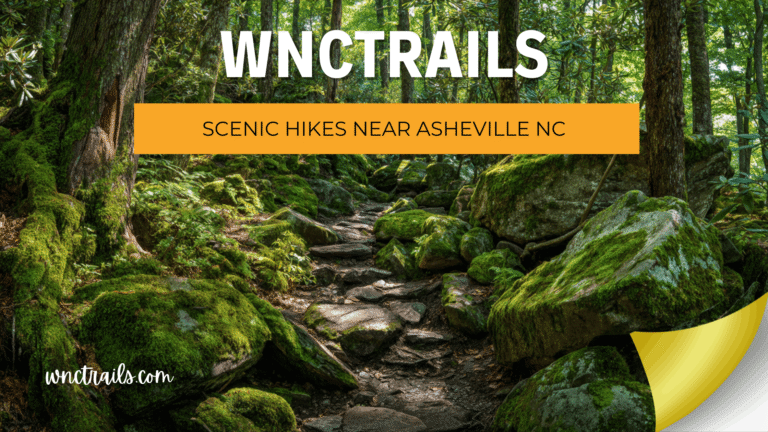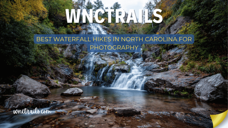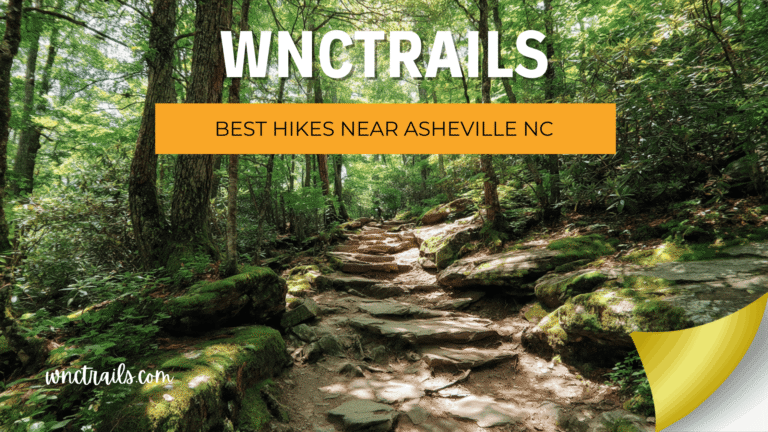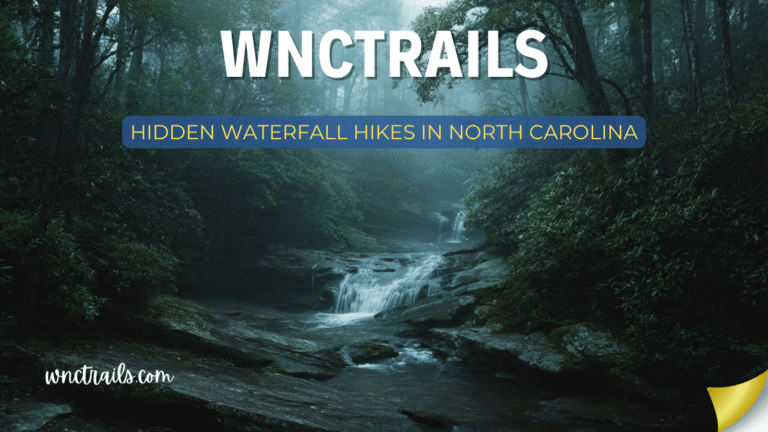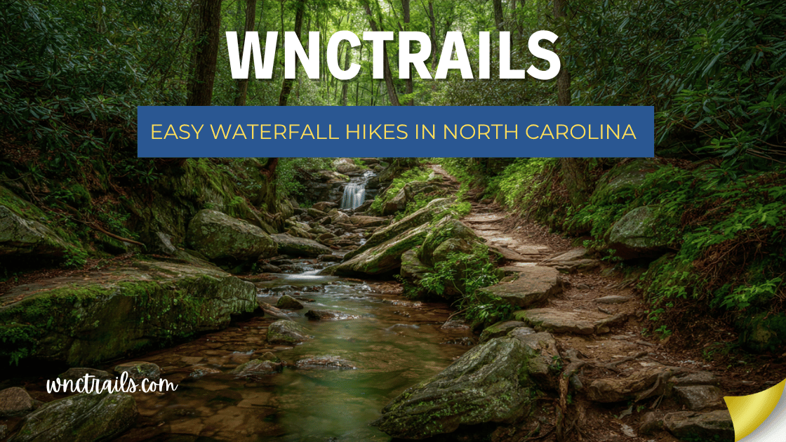
Easy Waterfall Hikes In North Carolina
You do not need to be a hiker to experience the best waterfalls in Western North Carolina. Some of the most spectacular cascades in the state — 60-foot plunges, walk-behind curtains, natural waterslides — are reachable via paved paths, flat gravel trails, and gentle forest walks that require no fitness preparation, no hiking boots, and no previous trail experience.
This guide covers the best easy waterfall hikes in North Carolina: trails rated Easy based on terrain quality, surface conditions, elevation grade, and obstacle level — not just distance. A trail earns “easy” status here only when it genuinely is: wide, well-maintained, with minimal steep sections, and accessible to visitors who don’t consider themselves hikers.
Easy vs. Short: This guide is distinct from our Short Waterfall Hikes guide. Short focuses on distance under 2 miles. Easy focuses on terrain difficulty — some hikes here are 2–4 miles but remain genuinely easy due to flat grades and good trail surfaces. Distance is noted for each entry so you can plan accordingly.
Easy Waterfall Hikes in North Carolina (2026 Guide)
Recommended Tools
Disclosure: This page may contain affiliate links.
- Water Shoes — Check current pricing
- Rain Jacket — Check current pricing
- Dry Bag — Check current pricing
What Makes a Waterfall Hike Truly Easy?
Not all trails labeled “easy” on maps actually are. Here’s the standard used for every hike on this list:
- Grade: No sustained grades steeper than 8–10%
- Surface: Paved, gravel, compacted dirt, or well-maintained root-free path
- Obstacles: No significant rock scrambling, creek crossings without bridges, or route-finding required
- Footing: Consistent, predictable terrain without loose rock or technical steps
- Accessibility: Suitable for visitors in regular athletic shoes (not just hiking boots)
If a trail has one steep section or one tricky creek crossing, it’s noted — so you know exactly what to expect.
Quick Reference: Easy Waterfall Hikes
| Waterfall | Location | Distance | Elev. Gain | Surface | Accessibility |
|---|---|---|---|---|---|
| Bridal Veil Falls | US-64, Highlands | 0.1 mi | Flat | Paved | Excellent |
| Dry Falls | US-64, Nantahala NF | 0.1 mi | Minimal | Paved | Excellent (wheelchair) |
| Sliding Rock | US-276, Pisgah NF | 0.1 mi | Flat | Paved | Excellent |
| Looking Glass Falls | US-276, Pisgah NF | 0.2 mi | 60 ft | Paved stairs | Very Good |
| Whitewater Falls | NC-281, Nantahala NF | 0.2 mi | Minimal | Paved | Very Good |
| Mingo Falls | Big Cove Rd, Cherokee | 0.4 mi | ~200 steps | Paved steps | Good |
| Silver Run Falls | NC-107, Cashiers | 0.5 mi | Minimal | Dirt path | Good |
| Hooker Falls | DuPont State Forest | 0.8 mi | Flat | Gravel | Excellent |
| Moore Cove Falls | US-276, Pisgah NF | 1.5 mi | ~100 ft | Dirt path | Very Good |
| Soco Falls | US-19, Maggie Valley | 0.3 mi | Minimal | Dirt path | Good |
| Graveyard Fields Lower | Blue Ridge Pkwy | 1.0 mi | ~150 ft | Paved/dirt | Very Good |
| Linville Falls Upper | Blue Ridge Pkwy | 0.8 mi | ~100 ft | Paved/gravel | Very Good |
| Pearson’s Falls | Near Tryon | 1.0 mi | ~100 ft | Gravel path | Very Good |
| Roaring Fork Falls | Near Hot Springs | 0.4 mi | Minimal | Dirt path | Good |
| Davidson River Trail | Pisgah NF, Brevard | 3.0 mi | Flat | Gravel | Excellent |
1. Dry Falls — Nantahala National Forest
Distance: 0.1 miles | Elevation Gain: Minimal | Surface: Fully paved | Accessibility: Wheelchair accessible
The most accessible waterfall experience in North Carolina — a paved, handicap-accessible path leading directly behind a 75-foot waterfall on the Cullasaja River. The path from the parking area to the rocky alcove beneath the falls is smooth, gently graded, and takes about two minutes to walk. You end up standing behind a curtain of white water with the gorge framing the view on the other side.
The “Dry” in Dry Falls refers to the fact that you stay largely dry in the center of the alcove — a small miracle of geology that makes this the most unique easy waterfall experience in the state.
Why it’s genuinely easy: The paved path has a continuous non-slip surface with gentle grade throughout. There are no steps, no gravel, no uneven ground. The NPS has invested in making this site fully accessible — it is one of the few waterfall experiences in WNC that visitors with limited mobility or wheelchair users can truly enjoy.
Visitor tips:
- The rock floor directly beneath the falls is damp and can be slippery despite the paving — move deliberately
- $5/vehicle fee; restrooms at the parking area — a practical convenience
- Combine with Bridal Veil Falls (2 miles east on US-64) for two unique walk-behind waterfall experiences in one stop
- Year-round access; the gorge is spectacular in winter with ice formations
Coordinates: 35.0574° N, 83.2219° W
2. Bridal Veil Falls — Near Highlands, NC
Distance: 0.1 miles | Elevation Gain: Flat | Surface: Paved | Accessibility: Excellent
A 45-foot waterfall you can walk — or drive — directly beneath, on flat, dry pavement. Bridal Veil Falls spills over the former US-64 roadbed, and the original drive-through lane beneath it remains open to foot traffic. From the adjacent parking area, it’s a 30-second walk to standing underneath a waterfall. There are no steps, no inclines, no trail to follow.
It is the easiest waterfall experience in the state by any meaningful measure — and the walk-through format makes it one of the most memorable.
Why it’s genuinely easy: Literally flat pavement from car to waterfall. No surface irregularities, no elevation change, no distance to speak of. Visitors in dress shoes, pushing strollers, or using mobility aids can all reach this waterfall without modification.
Visitor tips:
- The pavement beneath the falls is perpetually wet and slick — move slowly regardless of footwear
- Free, open year-round, zero infrastructure required
- The old drive-through lane can accommodate most standard passenger vehicles driven very slowly — but walking is safer and more enjoyable
- The falls are most dramatic in spring after heavy rain; the delicate summer flow earns the “bridal veil” name
Coordinates: 35.0639° N, 83.2389° W
3. Looking Glass Falls — Pisgah National Forest
Distance: 0.2 miles | Elevation Gain: ~60 ft descent | Surface: Paved stairs with railing | Accessibility: Very Good
The most iconic easy waterfall hike in Western NC — a wide, 60-foot curtain of water visible directly from US-276, reached by a short staircase with handrails from the adjacent parking area. The descent takes about two minutes. The platform at the base puts you directly in the mist zone of one of the most powerful waterfalls in Pisgah National Forest.
The staircase is the entire “hike.” It is well-maintained, has continuous handrailing on both sides, and descends at a gentle angle. The return ascent takes slightly more effort but remains well within easy range for most visitors.
Why it’s genuinely easy: Paved staircase with dual handrails, non-slip surface, and consistent width throughout. Steeper than a flat path but the railing and short length keep it comfortably in the easy category for visitors of most fitness levels.
Visitor tips:
- Parking is the main challenge — the small lot fills by 9 AM on summer weekends; arrive early
- The mist at the base soaks phones and cameras within minutes — bring a dry bag or waterproof case
- Free to visit; no permits or fees required
- The falls are photographed millions of times per year — for a unique shot, visit on a foggy morning or lightly snowy winter day
Coordinates: 35.3025° N, 82.7648° W
4. Whitewater Falls — Nantahala National Forest
Distance: 0.2 miles | Elevation Gain: Minimal | Surface: Paved | Accessibility: Very Good
The tallest cascading waterfall east of the Rocky Mountains — on a 0.2-mile paved path. At 411 feet, Whitewater Falls is one of the great natural spectacles of the eastern United States, and the upper overlook requires nothing more than a short, gently graded paved walk from the parking area. The overlook delivers a full-length view of all 411 feet in a single frame.
The scale reliably stuns first-time visitors. Most people stand in silence for a moment before saying anything. For such a short, easy walk, the payoff is extraordinary.
Why it’s genuinely easy: Paved path with minimal grade, consistent surface, and clear wayfinding throughout. The overlook has sturdy barriers making it safe for all visitors including young children. Similar accessibility quality to Dry Falls — among the best in WNC.
Visitor tips:
- $5/vehicle fee; America the Beautiful Pass accepted; restrooms at the trailhead
- Do not climb beyond the overlook barriers — multiple fatalities have occurred at this site
- Lower falls trail (1.0 mi, strenuous descent into SC) available for those wanting more after the easy overlook
- Best visited in spring or after significant rainfall for maximum volume
Coordinates: 35.0338° N, 83.0004° W
5. Sliding Rock — Pisgah National Forest
Distance: 0.1 miles | Elevation Gain: Flat | Surface: Paved | Accessibility: Excellent
The most interactive easy waterfall in NC — a natural waterslide where the Davidson River flows over a 60-foot granite slab into a 6-foot pool. The walk from the parking area to the slide is flat, paved, and takes under two minutes. What happens after that is entirely up to you.
The supervised season (Memorial Day through Labor Day) with lifeguards on duty makes this one of the most structured easy outdoor water experiences in WNC — ideal for families who want a safe, managed environment.
Why it’s genuinely easy: Flat paved path with zero elevation change from parking to the slide entry. The challenge is the cold water, not the terrain. Even the return from the pool base to the slide entry involves minimal walking on well-maintained surfaces.
Visitor tips:
- $5/vehicle or $3/person; changing rooms and restrooms on-site — well-equipped for a managed experience
- Water temperature is ~55°F year-round; bring towels and warm layers for after
- No dogs allowed during operating season
- Arrive before 10 AM on summer weekends — the facility reaches capacity
Coordinates: 35.3372° N, 82.7572° W
6. Mingo Falls — Cherokee, NC
Distance: 0.4 miles round-trip | Elevation Gain: ~200 steps | Surface: Paved steps with railing | Accessibility: Good
The most rewarding easy hike on this list in terms of waterfall scale versus effort. Mingo Falls drops 120 feet — one of the tallest cascades in the Southern Appalachians — at the end of a 200-step staircase from the roadside parking area. The steps are well-maintained with a continuous railing and take about three minutes to climb. The viewing platform at the top delivers a full-height view of the falls in stunning detail.
Rated “good” rather than “excellent” accessibility due to the steps — it requires more physical effort than the paved walks above, but remains well within easy range for most visitors in reasonable health.
Why it’s genuinely easy: The entire hike is a staircase — predictable, well-maintained, railed throughout. No loose rock, no creek crossings, no navigation. The steepness makes it more of a workout than the flatter entries, but the short distance and consistent surface keep it solidly in the easy category.
Visitor tips:
- Take the steps slowly — the descent is harder on knees than the ascent for many visitors
- Free to visit; paved road access all the way to the trailhead
- Located in the Eastern Band Cherokee territory — combine with the Museum of the Cherokee Indian for a cultural half-day
- Fall foliage frames the upper falls beautifully in October
Coordinates: 35.5665° N, 83.2662° W
7. Silver Run Falls — Near Cashiers, NC
Distance: 0.5 miles round-trip | Elevation Gain: Minimal | Surface: Dirt path | Accessibility: Good
An undervisited gem with a beautiful swimming hole, Silver Run Falls drops 40 feet into a wide, clear pool on Silver Run Creek just south of Cashiers. The short trail from the roadside parking area follows the creek on a flat, shaded path with minimal elevation change. The pale granite streambed gives the water an almost luminescent clarity — unusual even by WNC standards.
The combination of easy access, excellent swimming, and low visitation makes Silver Run one of the best easy waterfall hikes in the Cashiers area.
Why it’s genuinely easy: Nearly flat trail on a well-worn dirt path with no significant obstacles. The only technical moment is the final approach to the pool, which involves a short rocky section — manageable in regular athletic shoes with care.
Visitor tips:
- Small roadside parking area (6–8 vehicles) on NC-107 south of Cashiers — weekday visits recommended
- Free; no permits or fees required
- Pool is 6–8 feet deep and excellent for swimming in summer
- Combine with Whitewater Falls (8 miles south) for two exceptional easy waterfall stops in one outing
Coordinates: 35.0712° N, 83.0991° W
8. Hooker Falls — DuPont State Recreational Forest
Distance: 0.8 miles round-trip | Elevation Gain: Flat | Surface: Wide gravel path | Accessibility: Excellent
The flattest and most accessible trail to a significant waterfall in WNC. The path to Hooker Falls is essentially level the entire way — a wide, well-graded gravel trail that is as close to stroller-accessible as any waterfall trail in the region. The 12-foot cascade at the end spills into a wide, swimmable pool on the Little River, surrounded by smooth river rocks ideal for picnicking and sunbathing.
This is the go-to easy waterfall for visitors who want a genuine outdoor experience without any trail challenge whatsoever.
Why it’s genuinely easy: Wide, well-compacted gravel surface with near-zero grade throughout. No roots, no loose rock, no elevation changes. The trail is maintained to a higher standard than most in the region specifically because of its high visitor volume. One of the most reliably easy waterfall trails in the state.
Visitor tips:
- Dogs allowed on leash — one of the most dog-friendly waterfall trails in WNC
- Parking lots fill by 9:30 AM on summer weekends; multiple lots available along the approach road
- Free to enter DuPont State Recreational Forest
- Extend the hike 1.5 miles to Triple Falls and High Falls for more waterfalls on the same trail system — both accessible from the same direction though terrain becomes more varied
Coordinates: 35.1906° N, 82.6380° W
9. Moore Cove Falls — US-276, Pisgah National Forest
Distance: 1.5 miles round-trip | Elevation Gain: ~100 ft | Surface: Dirt path | Accessibility: Very Good
A walk-behind waterfall reached by one of the most pleasant easy forest trails in Pisgah. Moore Cove Falls drops 50 feet off a mossy overhang into a shallow pool, and the trail follows Moore Creek through an old-growth hemlock and rhododendron corridor the entire way. The grade is gentle throughout, the creek crossings use wooden bridges, and the trail surface is consistent and well-maintained.
At 1.5 miles round-trip, it’s longer than most entries on this list — but the flat terrain, excellent surface, and beautiful forest make it one of the most enjoyable easy hikes in Pisgah regardless of the destination.
Why it’s genuinely easy: Gentle grade throughout with no steep sections. Wooden footbridges over all creek crossings — no wet-foot moments. The trail surface is maintained by the Forest Service and stays consistent even after rain.
Visitor tips:
- The walk-behind experience at Moore Cove is free and more intimate than the paved version at Dry Falls — a more natural version of the same concept
- Wear waterproof shoes — the rock behind the falls is damp and the mist reaches your feet
- Trailhead on US-276 approximately 1 mile north of the US-276/US-64 junction — look for the small pullout on the right
- Combine with Looking Glass Falls (8 miles north on US-276) for two excellent easy waterfalls in one morning
Coordinates: 35.2569° N, 82.8064° W
10. Soco Falls — US-19, Near Maggie Valley
Distance: 0.3 miles round-trip | Elevation Gain: Minimal | Surface: Dirt path | Accessibility: Good
Twin waterfalls side by side on an unmarked trail off a busy highway — one of the most rewarding easy waterfall discoveries in WNC. Soco Falls drops two parallel cascades 50 feet through a rhododendron-framed gorge on Soco Creek, and the short, informal path from the roadside pull-off takes about five minutes each way.
The terrain is simple: a gentle downhill through forest to a creek-side viewing area. No technical challenges, no navigation required. The twin-falls geometry — two separate streams dropping simultaneously — is genuinely unusual and worth the five-minute detour.
Why it’s genuinely easy: Short, gently graded dirt path with no obstacles. The final approach to the viewing area is slightly steep and can be slippery when wet — the one moment that requires care on what is otherwise an effortless walk.
Visitor tips:
- The pull-off is unmarked on US-19 — load the coordinates into your GPS before departing
- Use extreme caution pulling off and re-entering US-19 traffic, which moves fast in this stretch
- Free; no facilities at the trailhead
- Best in late May–June when rhododendron blooms frame the falls in color
Coordinates: 35.5011° N, 83.1658° W
11. Graveyard Fields — Lower Falls — Blue Ridge Parkway
Distance: 1.0 mile round-trip | Elevation Gain: ~150 ft | Surface: Paved then dirt | Accessibility: Very Good
A high-elevation alpine meadow, a mountain stream, and a beautiful wading waterfall — all on a well-maintained Parkway trail. The path from the Parkway parking area descends gently through the open Graveyard Fields basin to the Lower Falls, where the Yellowstone Prong fans out into a wide, shallow cascade and pool. At nearly 5,000 feet, the scenery is expansive and the air is cool even in midsummer.
The trail is paved for the first section and transitions to a well-maintained dirt path — consistent and easy throughout.
Why it’s genuinely easy: Gentle, consistent grade with no technical sections. The paved beginning and well-compacted dirt continuation make this accessible in regular athletic shoes. The open meadow setting makes it feel spacious rather than constrained.
Visitor tips:
- No dogs allowed on Graveyard Fields trails — plan accordingly
- One of the most crowded Parkway stops in summer; arrive before 8 AM or after 4 PM
- Carry a jacket — at 5,000 ft, temperatures can drop 10–15°F below the valley unexpectedly
- The Upper Falls (0.6 mi further, steeper terrain) is optional for those wanting more after the easy lower section
Coordinates: 35.3272° N, 82.8600° W
12. Linville Falls — Upper Overlook Trail — Blue Ridge Parkway
Distance: 0.8 miles round-trip | Elevation Gain: ~100 ft | Surface: Paved and gravel | Accessibility: Very Good
The easiest way to experience one of North Carolina’s most famous waterfalls, the upper overlook trail at Linville Falls leads through mature forest to a viewpoint above the 90-foot falls and the edge of the deepest gorge in the eastern United States. The trail surface is paved at the beginning and transitions to a well-maintained gravel path — excellent footing throughout.
The NPS visitor center at the trailhead provides restrooms, trail maps, and exhibits — all the infrastructure of a well-managed visitor experience.
Why it’s genuinely easy: Good trail surface throughout, gentle grade, clear wayfinding, and NPS maintenance standards keep this solidly in the easy category. The short distance means the modest elevation gain is spread over enough trail to never feel steep.
Visitor tips:
- Four trail options exist at Linville Falls ranging from 0.8 to 3.4 miles — stick to the upper overlook trail for the easy experience
- Extremely crowded on summer and fall weekends; visit on weekdays for the best experience
- America the Beautiful Pass not required at this trailhead — free
- Dogs allowed on leash on most trails; confirm current NPS regulations before visiting
Coordinates: 35.9544° N, 81.9279° W
13. Pearson’s Falls — Near Tryon, NC
Distance: 1.0 mile round-trip | Elevation Gain: ~100 ft | Surface: Gravel path | Accessibility: Very Good
The most botanically extraordinary easy waterfall hike in North Carolina. Pearson’s Falls drops 90 feet in a privately maintained gorge owned by the Tryon Garden Club since 1931, and the gravel path to the falls passes through a living sanctuary of over 200 species of rare ferns, wildflowers, mosses, and native plants. The combination of a well-maintained trail and exceptional ecological richness makes this unlike any other easy waterfall hike in the state.
Why it’s genuinely easy: Gravel path maintained to a high standard by the Garden Club, with consistent grade and clear wayfinding throughout. The trail surface stays well-drained even after rain — one of the most reliable easy surfaces in WNC.
Visitor tips:
- $5/adult admission; children free — the fee funds ongoing preserve maintenance
- No dogs allowed
- Peak wildflower bloom is April–May; the trail is at its most spectacular in this window
- Located in the foothills near Tryon — accessible year-round due to lower elevation than mountain waterfall trails
Coordinates: 35.2126° N, 82.1549° W
14. Roaring Fork Falls — Near Hot Springs, NC
Distance: 0.4 miles round-trip | Elevation Gain: Minimal | Surface: Dirt path | Accessibility: Good
An 80-foot powerhouse waterfall reached by a short, flat walk in remote Madison County. Roaring Fork Falls is one of the most powerful waterfalls accessible on an easy trail in Pisgah National Forest — the volume and sound are exceptional, and the forest setting in Madison County feels genuinely wild despite the short approach.
Because Hot Springs is outside the main tourist corridor, this waterfall sees a fraction of the visitors that comparable falls near Brevard attract — a rare combination of easy access and genuine solitude.
Why it’s genuinely easy: Short, relatively flat dirt path with no significant obstacles. The access road is unpaved, which is the main challenge for visitors — the trail itself is straightforward once you arrive.
Visitor tips:
- Forest service road approach is unpaved — manageable in most standard vehicles but slow
- Download offline navigation before leaving Hot Springs; cell service is limited in Madison County
- Dogs allowed on leash; free on National Forest land
- Combine with the Hot Springs Resort & Spa mineral pools for a complete Madison County experience
Coordinates: 35.8819° N, 82.7394° W
15. Davidson River Trail — Pisgah National Forest, Brevard
Distance: 3.0 miles one-way (or any segment) | Elevation Gain: Flat | Surface: Gravel | Accessibility: Excellent
The most underrated easy trail in Pisgah National Forest — a flat, wide gravel path that follows the Davidson River upstream through old-growth forest, passing multiple cascades, rapids, and small waterfalls along the way. Unlike single-destination waterfall hikes, the Davidson River Trail is a continuous series of water features — a living river walk where every hundred yards reveals something new.
It doesn’t have one signature falls, but the cumulative waterfall and cascade experience over 3 miles rivals any destination hike on this list.
Why it’s genuinely easy: Flat gravel surface maintained by the Forest Service, zero elevation gain, wide enough for side-by-side walking. Among the most reliably easy trail surfaces in WNC regardless of recent weather conditions. Accessible in regular walking shoes.
Visitor tips:
- Can be hiked as an out-and-back for any distance — 1 mile, 2 miles, or the full 3 each way
- The Davidson River runs alongside the trail the entire way — swimming, wading, and fishing access throughout
- Dogs allowed on leash
- Connects to multiple other Pisgah trails for those wanting to extend the hike
- Trailhead near the Davidson River Campground off US-276 south of Brevard
Coordinates (Trailhead): 35.2742° N, 82.8022° W
Easy Waterfall Hikes by Region
Asheville & Surroundings (under 45 min)
- Looking Glass Falls — US-276 Pisgah, 30 min from Asheville
- Moore Cove Falls — US-276 Pisgah, 35 min
- Hooker Falls — DuPont State Forest, 40 min
- Davidson River Trail — Brevard, 40 min
Highlands & Cashiers Area
- Dry Falls — US-64, the standard for accessibility
- Bridal Veil Falls — US-64, the easiest waterfall experience in the state
- Whitewater Falls — NC-281, tallest in the East on a paved path
- Silver Run Falls — NC-107, best easy swimming hole
Blue Ridge Parkway
- Graveyard Fields Lower Falls — MP 418.8
- Linville Falls Upper Overlook — MP 316.4
Cherokee & The Smokies
- Mingo Falls — Big Cove Road, 3 min from downtown Cherokee
Foothills & Eastern NC
- Pearson’s Falls — Near Tryon, best botanical easy hike in NC
- Stone Mountain Falls — longer hike but flat sections reward with a 200-ft cascade
Tips for Easy Waterfall Hiking in Western NC
The Best Footwear for Easy Waterfall Trails
“Easy” trail does not mean “dry trail.” Waterfall hikes involve mist, damp rock, and occasionally muddy paths — even on the easiest routes. Here’s what works:
- Trail runners or athletic shoes with rubber soles — appropriate for most easy trails on this list in dry conditions
- Waterproof hiking shoes — the right choice for any visit that includes wading, walk-behind falls, or wet-season hiking
- Avoid flip-flops — even on easy trails, damp rock surfaces cause falls in open footwear
The Best Time to Visit Easy Waterfalls
For maximum water flow: March–May, when snowmelt and spring rain fill streams to their seasonal peak.
For comfortable temperatures: June and September — full flow but without the peak summer crowds.
For fall color: October at higher elevations (Blue Ridge Parkway sites); early-to-mid November at lower elevations (Pearson’s Falls, Tryon area).
For solitude: Any weekday. The difference between a Saturday morning and a Tuesday morning at most easy waterfall trailheads is dramatic — the same beautiful waterfall with a fraction of the crowd.
Easy Waterfall Hikes for Specific Groups
Seniors and limited mobility visitors: Dry Falls (fully accessible), Whitewater Falls (paved overlook), Bridal Veil Falls (flat pavement)
Toddlers and very young children: Hooker Falls (flat gravel, wading pool), Bridal Veil Falls (flat, interactive), Looking Glass Falls (short stairs, big impression)
First-time hikers: Davidson River Trail (flat, long, no pressure to reach a specific destination), Hooker Falls (simple and rewarding), Moore Cove Falls (beautiful forest walk)
Visitors with dogs: Hooker Falls, Moore Cove Falls, Roaring Fork Falls, Davidson River Trail — all dog-friendly on leash
Key Considerations
- Trail Accessibility: Not all easy hikes are fully accessible for strollers or wheelchairs. Some, like the paved path to Looking Glass Falls, are suitable for most mobility levels, while others may have occasional roots, rocks, or steps.
- Distance and Elevation: Most easy waterfall hikes in North Carolina are under three miles round trip with minimal elevation gain. Always check trail details before heading out, as even short trails can have steep sections or slippery rocks near the falls.
- Seasonal Conditions: Water flow can vary dramatically by season. Spring and early summer often feature the most impressive cascades, but autumn adds vibrant leaf color. Winter hikes can be icy, so use caution.
- Safety: Rocks near waterfalls are often wet and slippery. Stay on marked paths and observe posted warnings. Swimming is not always permitted or safe, especially after heavy rain.
- Facilities: Some trailheads offer restrooms, picnic areas, and visitor centers, while others are more remote. Plan accordingly, especially with young children or groups.
- Parking: Popular waterfall trails can fill up quickly, especially on weekends and holidays. Arriving early or visiting on weekdays can improve your experience.
Common Use Cases
- Family Outings: Easy waterfall hikes are a favorite for families with children. Trails like Hooker Falls in DuPont Forest or Tom’s Creek Falls near Marion offer short distances with big rewards and safe viewing areas.
- Beginner Hikers: For those new to hiking, trails such as Moore Cove Falls (less than 1.5 miles round trip) or Soco Falls (a short walk from the parking area) provide a gentle introduction to WNC’s landscape.
- Accessible Adventures: Visitors with limited mobility can enjoy waterfalls like Looking Glass Falls, which is visible from the roadside, or Pearson’s Falls, which features a well-maintained path and benches.
- Photography and Nature Observation: Easy-access falls are ideal for photographers or birdwatchers who want to spend more time enjoying the scenery and less time on the trail.
- Short Escapes: Locals and travelers alike use these hikes for quick outings—perfect for a lunch break, sunset walk, or when time is limited but the call of the falls is strong.
Final Thoughts
The best waterfall experiences in North Carolina are not hidden behind difficult trails or reserved for experienced hikers. Many of the state’s most spectacular cascades are reachable by anyone willing to step out of the car and walk a few minutes down a well-maintained path.
Easy doesn’t mean less. It means more people get to feel it.
Pick a trail, drive the road, park the car, and go find the water.
Frequently Asked Questions
- What are some of the best easy waterfall hikes in North Carolina?
Popular options include Looking Glass Falls (Pisgah National Forest), Hooker Falls and Triple Falls (DuPont State Recreational Forest), Tom’s Creek Falls (Pisgah National Forest), and Pearson’s Falls (Saluda area). Each offers a short, mostly level trail with rewarding views. - Are these hikes suitable for young children?
Yes, many easy waterfall hikes are ideal for families with children. Always supervise kids near water and slippery rocks, and choose trails with railings or wide paths when possible. - Can I bring my dog on these trails?
Most public waterfall trails allow leashed dogs. Always check specific regulations for each park or forest before visiting, and bring waste bags to clean up after your pet. - Do I need any special gear for easy waterfall hikes?
Basic walking shoes with good traction are usually sufficient. Bring water, snacks, sun protection, and a camera. Rain can make trails slippery, so consider trekking poles or a change of socks in wet weather. - Is swimming allowed at North Carolina waterfalls?
Swimming is not permitted at all falls and can be dangerous due to strong currents and slippery rocks. Always obey posted signs and use caution if swimming is allowed. - When is the best time to visit North Carolina waterfalls?
Spring and early summer provide the most robust flows, while fall offers beautiful foliage. Weekdays and early mornings are less crowded, especially during peak tourist seasons.
Exploring easy waterfall hikes in North Carolina is a rewarding way to experience the region’s natural beauty without a strenuous journey. With a bit of planning and awareness, these trails offer safe, accessible adventures for all ages and abilities.
Related Pages
Know an easy waterfall hike in NC we should add? Share it in the comments!
Discover more easy trails across Western NC at WNCTrails.com →