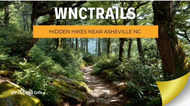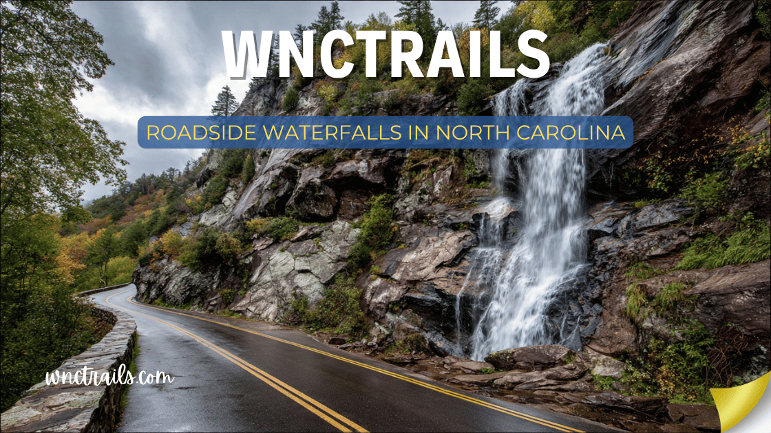
Roadside Waterfalls In North Carolina
Not every great waterfall requires a hike. Some of the most spectacular cascades in Western North Carolina are visible from the road, steps from a parking area, or reachable in less than five minutes on foot. Whether you’re on a road trip with limited time, traveling with passengers who can’t hike, or simply want to pack as many waterfalls as possible into a single day, North Carolina’s roadside waterfalls deliver extraordinary scenery with almost no physical effort required.
This guide covers the best roadside waterfalls in North Carolina — falls you can see from your car window, step out and view from a paved pullout, or reach via a walk under 0.4 miles. Every waterfall on this list is accessible without a trail map, hiking boots, or advance preparation.
What counts as “roadside”: All waterfalls on this list are either visible from a paved road, located in a designated roadside pullout or parking area, or reached by a walk of 0.4 miles or less on a paved or well-maintained path. No trail navigation required.
Roadside Waterfalls in North Carolina (2026 Guide)
Recommended Tools
Disclosure: This page may contain affiliate links.
Dry Bag — Check current pricing
Water Shoes — Check current pricing
Rain Jacket — Check current pricing
Quick Reference: Roadside Waterfalls at a Glance
| Waterfall | Road / Route | Walk from Car | Fee | Drive-Through? |
|---|---|---|---|---|
| Bridal Veil Falls | US-64, near Highlands | Seconds | Free | Yes (old road lane) |
| Looking Glass Falls | US-276, Pisgah NF | 2 min (stairs) | Free | No |
| Dry Falls | US-64, near Highlands | 2 min (paved) | $5/vehicle | No |
| Soco Falls | US-19, near Maggie Valley | 5 min | Free | No |
| Mingo Falls | Big Cove Rd, Cherokee | 3 min (steps) | Free | No |
| Whitewater Falls | NC-281, Nantahala NF | 5 min (paved) | $5/vehicle | No |
| Graveyard Fields (Lower) | Blue Ridge Pkwy MP 418.8 | 10–15 min | Free | No |
| Linville Falls (Upper) | Blue Ridge Pkwy MP 316.4 | 15 min | Free | No |
| Cullasaja Gorge Falls | US-64, near Highlands | From car window | Free | Yes (from road) |
| Moore Cove Falls | US-276, Pisgah NF | 15 min | Free | No |
| Roaring Fork Falls | FR 1206, near Hot Springs | 3–5 min | Free | No |
| Sliding Rock | US-276, Pisgah NF | 3 min | $5/vehicle | No |
1. Bridal Veil Falls — US-64, Near Highlands
Walk from car: Seconds | Fee: Free | Drive-through: Yes
The only true drive-through waterfall in North Carolina — and one of the most memorable roadside stops in the state. Bridal Veil Falls drops 45 feet directly over the original US-64 roadway, and the old lane beneath it is still open to foot traffic (and carefully driven vehicles). You can literally park, walk under a waterfall, and be back in your car in under three minutes.
The falls are gentle enough that you don’t get completely soaked — a fine mist and the sound of the water overhead is the experience — but it’s entirely possible to stand directly in the curtain for a full shower effect.
What makes it special for road trippers: Zero effort, zero cost, and a completely unique “I drove under a waterfall” story. It’s practically mandatory on any US-64 drive between Franklin and Highlands.
Road trip tips:
- The drive-through lane can accommodate most standard passenger vehicles; skip it if you’re in an RV or wide truck
- Pavement under the falls is perpetually slick — drive extremely slowly (under 5 mph) if driving through
- Walking is safer and more rewarding than driving through; park in the adjacent lot
- Combine with Dry Falls just 2 miles west for a second spectacular roadside waterfall on the same stretch of US-64
Best time: Year-round; the falls flow even in dry seasons due to the consistent watershed above.
Coordinates: 35.0639° N, 83.2389° W
2. Looking Glass Falls — US-276, Pisgah National Forest
Walk from car: 2 minutes (staircase) | Fee: Free | Drive-through: No
The most iconic roadside waterfall in Western North Carolina, and arguably in the entire state. Looking Glass Falls is visible directly from US-276 as you drive the Pisgah National Forest corridor — a wide, 60-foot curtain of white water that appears without warning around a bend in the road and demands that you stop.
The short staircase with handrails descends to a mist-soaked viewing platform at the base in under two minutes. From there, the full 60-foot plunge fills your field of vision and the spray reaches your face. It is one of those places that photographs consistently fail to capture — the scale and sound must be experienced in person.
What makes it special for road trippers: Maximum impact, minimal walking. Families with strollers, travelers in dress clothes, and grandparents who haven’t hiked in years can all stand at the base of a 60-foot waterfall with almost no effort.
Road trip tips:
- The parking area is small (approximately 15 vehicles) and fills within minutes on summer weekends — arrive before 9 AM or plan to wait in line
- Part of the US-276 waterfall cluster: Sliding Rock is 4 miles north, Courthouse Falls is 7 miles south — do all three in one morning
- The staircase railing makes this accessible for most mobility levels
- Waterproof your phone before approaching the base — the mist is real
Best time: Spring for maximum flow; early morning in any season for empty parking and golden light on the falls.
Coordinates: 35.3025° N, 82.7648° W
3. Dry Falls — US-64, Near Highlands
Walk from car: 2 minutes (paved path) | Fee: $5/vehicle | Drive-through: No
A 75-foot waterfall you can walk completely behind — and the paved, handicap-accessible path from the parking area takes about two minutes to reach the rocky alcove beneath it. Dry Falls is arguably the most immersive roadside waterfall experience in the state: you stand in a natural chamber while the Cullasaja River pours over your head and the outside world turns into a white curtain.
The name comes from the fact that you stay mostly dry in the center of the alcove — though the mist definitely reaches you on high-flow days.
What makes it special for road trippers: The “walk-behind” experience is unlike anything else on a road trip itinerary. Kids go absolutely quiet for a moment when they step into the alcove and realize what’s happening above them.
Road trip tips:
- Parking area has restrooms — a genuine convenience on a long road trip
- The paved path is fully accessible for wheelchairs and mobility devices
- The rock floor beneath the falls is perpetually wet — shoes with good grip matter
- Located on US-64 between Franklin and Highlands: pair with Bridal Veil Falls (2 miles east) and Cullasaja Gorge (15 miles west toward Franklin) for a full roadside waterfall day
Best time: After heavy rainfall for the most dramatic experience; year-round for the walk-behind alcove.
Coordinates: 35.0574° N, 83.2219° W
4. Cullasaja Gorge Falls — US-64, Near Franklin
Walk from car: Zero — visible from the road | Fee: Free | Drive-through: Yes (gorge drive)
The most dramatic roadside waterfall sequence in North Carolina — a series of cascades visible from the windows of your vehicle as US-64 threads through the Cullasaja River Gorge between Highlands and Franklin. The gorge narrows dramatically as the road descends, and the river drops hundreds of feet over a series of named and unnamed falls within a few miles.
The most notable stops are Lower Cullasaja Falls (approximately 250 feet, visible from a turnout) and several unnamed cascades that appear through the guardrail as you drive. The gorge walls rise nearly vertically above the road — one of the most dramatic drives in the state.
What makes it special for road trippers: You don’t even need to leave the car. The entire gorge drive is a waterfall experience, with cascades appearing around every bend. It’s essentially a moving waterfall tour.
Road trip tips:
- Drive westbound (Highlands toward Franklin) for the most dramatic descent and best views through the driver’s side window
- Pullouts are limited and narrow — use them carefully and only where legally designated
- Lower Cullasaja Falls has a small pullout approximately 8 miles east of Franklin on US-64 — look for the guardrail gap on the river side
- Gorge walls can shed rockfall onto the road — drive attentively, especially after heavy rain or freezing weather
- The gorge drive takes 20–30 minutes at a comfortable sightseeing pace
Best time: Spring after rain for the most powerful falls; fall for foliage against the gorge walls.
Coordinates (Lower Cullasaja Falls pullout): 35.1083° N, 83.2005° W
5. Soco Falls — US-19, Near Maggie Valley
Walk from car: 5 minutes | Fee: Free | Drive-through: No
Twin waterfalls dropping side-by-side through a rhododendron-lined gorge, just 300 feet from an unmarked pull-off on US-19. Soco Falls is one of WNC’s best-kept roadside secrets — two parallel cascades dropping 50 feet on Soco Creek, accessible via a short steep path through dense vegetation.
Most drivers on US-19 pass within 100 feet of this waterfall every day without knowing it exists. That invisibility is exactly what makes it a perfect road trip discovery.
What makes it special for road trippers: The five-minute walk feels like finding something secret rather than visiting a tourist site. The twin-falls geometry is genuinely unusual — two separate streams dropping simultaneously into a shared pool.
Road trip tips:
- The pull-off is unmarked; look for a gravel area on the river side of US-19 approximately 5 miles west of Maggie Valley (near the Eastern Band of Cherokee boundary)
- The path to the falls is steep and can be slippery — take it slowly
- Traffic on US-19 moves fast; use caution when pulling off and returning to the road
- Free and unmanaged — pack out any trash and leave no trace
Best time: Late May–June when rhododendron frames the falls in bloom; spring for peak water flow.
Coordinates: 35.5011° N, 83.1658° W
6. Mingo Falls — Big Cove Road, Cherokee
Walk from car: 3 minutes (200 steps) | Fee: Free | Drive-through: No
At 120 feet, Mingo Falls is one of the tallest waterfalls in the Southern Appalachians — and it’s reached by a 200-step staircase from a roadside parking area. The road is paved all the way to the trailhead, and the staircase (well-maintained, with railings) takes about three minutes to climb. The payoff at the top is a viewing platform directly in front of a thundering, 120-foot cascade.
For sheer waterfall-per-minute-of-effort ratio, almost nothing in NC competes with Mingo Falls.
What makes it special for road trippers: It genuinely surprises people. A quick stop for “some waterfall in Cherokee” turns into standing in front of a 120-foot cascade — a moment that recalibrates expectations for the rest of the trip.
Road trip tips:
- Located on Big Cove Road, approximately 3 miles from downtown Cherokee — easy to add to any Smokies road trip
- The 200 steps are the entire hike — no trail navigation required
- Steep descent on the return; take it slowly, especially with young children
- Combine with the Museum of the Cherokee Indian in downtown Cherokee for a culturally rich half-day
Best time: Spring and fall; the surrounding forest frames the falls beautifully in leaf color.
Coordinates: 35.5665° N, 83.2662° W
7. Whitewater Falls — NC-281, Nantahala National Forest
Walk from car: 5 minutes (paved) | Fee: $5/vehicle | Drive-through: No
The tallest cascading waterfall east of the Rocky Mountains — 411 feet — is a five-minute paved walk from the parking area. The path is well-maintained, gently graded, and leads directly to an overlook with a full-length view of the cascade in all its scale. For families, seniors, or anyone with mobility considerations, this is the most accessible “world-class waterfall” in the eastern United States.
The America the Beautiful Pass covers the $5 fee — and at 411 feet, the Whitewater Falls overlook is one of the best returns on any road trip stop in WNC.
What makes it special for road trippers: The scale shocks people. Most visitors expect a nice waterfall and encounter something closer to a geological event. The 411-foot drop makes Niagara Falls (167 feet) look modest by comparison.
Road trip tips:
- Parking area has restrooms — helpful on a long road trip day
- The paved overlook path is accessible for most mobility levels
- America the Beautiful Pass accepted; worth having if visiting multiple NPS/NF sites
- Lower falls trail (1.0 mi into South Carolina) available for those who want more — strenuous descent
Best time: Spring for maximum volume; morning light from the east illuminates the falls best.
Coordinates: 35.0338° N, 83.0004° W
8. Moore Cove Falls — US-276, Pisgah National Forest
Walk from car: 15 minutes (0.75 mi) | Fee: Free | Drive-through: No
The best walk-behind waterfall in Pisgah National Forest, Moore Cove Falls drops 50 feet off a mossy overhang into a shallow pool, and you can walk directly behind the curtain of water on dry ground. The approach trail from the US-276 pullout is easy, shaded, and beautiful — a gentle walk through old-growth forest along Moore Creek.
At 0.75 miles one-way, it’s slightly longer than a true roadside stop, but the trail is so easy and the payoff so good (especially for the walk-behind experience) that it earns its place on this list.
What makes it special for road trippers: The walk-behind experience at Moore Cove is arguably better than Dry Falls — more intimate, less structured, and completely free. You step behind the falls on natural rock rather than a paved path.
Road trip tips:
- Trailhead is on US-276 approximately 1 mile north of the US-276/US-64 junction near Brevard — look for the small pullout on the right (westbound)
- The trail is essentially flat the entire way — suitable for most fitness levels
- Wear waterproof shoes; the rock behind the falls can be damp
- Combine with Looking Glass Falls (8 miles north on US-276) for two outstanding roadside waterfalls in one morning
Best time: Spring and early summer for best water flow behind the falls.
Coordinates: 35.2569° N, 82.8064° W
9. Graveyard Fields Lower Falls — Blue Ridge Parkway, MP 418.8
Walk from car: 10–15 minutes (0.5 mi) | Fee: Free | Drive-through: No
At Milepost 418.8 on the Blue Ridge Parkway, a large parking area opens to a broad alpine meadow basin at nearly 5,000 feet elevation. A wide, well-maintained trail descends 0.5 miles to Lower Graveyard Fields Falls — a wide cascade where the Yellowstone Prong fans out over smooth rock into a swimmable pool. The trail is gentle enough that most visitors treat it as a roadside stop with a short walk attached.
The Parkway itself is a scenic road, and the Graveyard Fields basin is one of its most dramatic pullouts — the combination of open sky, high-elevation meadow, and mountain views makes this an exceptional roadside experience even before you reach the falls.
What makes it special for road trippers: The Blue Ridge Parkway is the road trip. Graveyard Fields combines a Parkway pullout with a waterfall destination, a mountain meadow, and one of the best high-elevation swimming holes in WNC — all within 15 minutes of the car.
Road trip tips:
- One of the most congested Parkway stops in summer — arrive before 8 AM or after 4 PM
- No dogs allowed on the trails in this area
- At 5,000 feet, carry a jacket — temperatures can be 10–15°F cooler than the valley
- Upper Falls (0.6 mi further) requires a steeper descent; optional for those wanting more
Best time: Late July–August for swimming; October for peak fall foliage at high elevation.
Coordinates: 35.3272° N, 82.8600° W
10. Linville Falls Upper Overlook — Blue Ridge Parkway, MP 316.4
Walk from car: 15 minutes (0.8 mi) | Fee: Free | Drive-through: No
The Linville Falls Visitor Center at Blue Ridge Parkway Milepost 316.4 anchors one of the best roadside waterfall stops on the entire 469-mile Parkway. The upper overlook trail — just 0.8 miles round-trip — leads through a beautiful forest to a viewpoint above the 90-foot falls and the edge of the Linville Gorge, the deepest gorge in the eastern United States east of the Grand Canyon.
The NPS visitor center at the trailhead has restrooms, exhibits, and trail maps — all the infrastructure of a classic road trip stop.
What makes it special for road trippers: The Parkway drive to Linville Falls is one of the finest stretches of the entire 469-mile route. Combining the drive with the short upper overlook trail creates a perfect 30-minute stop that delivers views most visitors never forget.
Road trip tips:
- The visitor center has clean restrooms — a valued resource on a Parkway road trip
- Four different trail lengths are available (0.8 mi to 3.4 mi); the upper overlook is the best roadside option
- Very crowded on summer and fall weekends; weekday visits recommended
- America the Beautiful Pass not required at this trailhead — free parking
Best time: Fall for extraordinary foliage in the gorge; spring for full water volume.
Coordinates: 35.9544° N, 81.9279° W
11. Roaring Fork Falls — FR 1206, Near Hot Springs
Walk from car: 3–5 minutes | Fee: Free | Drive-through: No
An 80-foot waterfall with one of the largest volumes of any roadside fall in WNC — and located in Madison County, well outside the usual tourist circuit. The forest service road leads directly to a small parking area, and the short walk to the falls base takes under five minutes. The sound hits you before the falls come into view — Roaring Fork earns its name.
Because Hot Springs is better known for its natural thermal pools and the Appalachian Trail crossing than for waterfall tourism, Roaring Fork Falls sees a fraction of the visitors that a comparable fall near Brevard would attract.
What makes it special for road trippers: The solitude is rare for a waterfall this impressive. On most weekdays you’ll have the falls entirely to yourself — something that simply doesn’t happen at Looking Glass or Linville on the same day.
Road trip tips:
- The forest service road (FR 1206) is unpaved — manageable in most standard vehicles but slow
- Cell service is very limited in Madison County; download offline maps before leaving Hot Springs
- Combine with a soak at the Hot Springs Resort & Spa for a full Madison County day
- Dogs allowed on leash; free on National Forest land
Best time: Spring for peak volume; the falls are powerful year-round due to the large watershed.
Coordinates: 35.8819° N, 82.7394° W
12. Sliding Rock — US-276, Pisgah National Forest
Walk from car: 3 minutes | Fee: $5/vehicle | Drive-through: No
Technically a natural waterslide rather than a waterfall — but no roadside waterfall guide in WNC is complete without it. Sliding Rock is a 60-foot granite slab over which the Davidson River slides into a natural pool, located directly off US-276 with a three-minute walk from the parking area. Lifeguards are on duty Memorial Day through Labor Day.
On a hot summer day, the sight of dozens of people sliding down a real waterfall into a mountain pool is one of the most joyful scenes in Western North Carolina.
What makes it special for road trippers: It’s interactive. You don’t just look at the water — you slide down it. Kids remember Sliding Rock for decades, and adults rediscover something important about having fun.
Road trip tips:
- Arrive before 10 AM in summer — the facility reaches capacity and the road can back up significantly
- Changing rooms and restrooms available on-site
- Water temperature stays around 55°F year-round — bring a towel and prepare for cold
- No dogs allowed in the recreation area during the operating season
- Off-season sliding is at your own risk with no lifeguard coverage
Best time: June–August for staffed, full-experience visits; May and September for smaller crowds.
Coordinates: 35.3372° N, 82.7572° W
The Best Roadside Waterfall Road Trips in NC
Route 1 — The US-64 Highlands Waterfall Corridor (Half Day)
One of the most waterfall-dense stretches of highway in the eastern United States, US-64 between Franklin and Brevard passes or accesses six major waterfalls within 30 miles. Drive it west to east for the most dramatic descent through Cullasaja Gorge:
Franklin → Highlands → Brevard: Cullasaja Gorge Falls (visible from road) → Dry Falls (2 min walk) → Bridal Veil Falls (walk through) → Highlands lunch break → Whitewater Falls (5 min walk, $5 fee) → return via US-64 east
Total waterfalls: 4–6 depending on stops | Total driving: ~60 miles | Total time: 4–5 hours
Route 2 — The US-276 Pisgah Waterfall Loop (Half Day)
The most efficient waterfall road trip from Asheville or Brevard, US-276 through Pisgah National Forest passes multiple roadside and near-roadside waterfalls in sequence:
Brevard → Pisgah → back to Brevard: Moore Cove Falls (15 min walk) → Looking Glass Falls (2 min walk) → Sliding Rock (3 min walk, optional swim) → continue north and return via US-276
Total waterfalls: 3 major stops | Total driving: ~25 miles | Total time: 3–4 hours with swim time
Route 3 — The Blue Ridge Parkway Waterfall Drive (Full Day)
Drive the Parkway south to north between Cherokee and the Linville area, stopping at the best roadside waterfall pullouts along the way:
Cherokee/Smoky Mtns → Asheville area → Linville: Mingo Falls (5 min detour off Parkway, 3 min walk) → Graveyard Fields (10–15 min walk) → Crabtree Falls (2.5 mi hike, optional) → Linville Falls (15 min walk)
Total distance: ~100 miles of Parkway | Total time: Full day with stops
Tips for Roadside Waterfall Road Trips
Timing Is Everything
The single biggest variable in a roadside waterfall road trip isn’t which falls you visit — it’s when you arrive at the parking area. The popular roadside waterfalls (Looking Glass, Graveyard Fields, Linville) fill their parking lots by 9–10 AM on summer weekends. Two strategies work consistently:
The early start: Arrive at your first stop before 8:30 AM. You’ll have the falls to yourself, the light is beautiful, and you’ll be done and on to the next stop before most visitors arrive.
The late afternoon push: Arrive at popular stops after 4 PM when day visitors start heading home. The evening light is often better for photography, and parking opens up significantly.
What to Keep in the Car for a Waterfall Road Trip
- Water shoes or flip-flops — for roadside wading and walk-behind falls
- Dry bag — for phone and valuables near the water
- Layers — Blue Ridge Parkway elevations can be 15°F cooler than the valley
- America the Beautiful Annual Pass ($80) — covers the $5 fees at Whitewater Falls, Dry Falls, and Sliding Rock in a single trip; pays for itself quickly if visiting multiple federal sites
- Offline map — AllTrails or Google Maps downloaded for the area; cell service is unreliable in Pisgah and Nantahala
Accessibility Notes
Several roadside waterfalls on this list are among the most accessible outdoor experiences in Western NC:
- Dry Falls: Fully paved, handicap-accessible path to the walk-behind area
- Whitewater Falls: Paved overlook path; accessible for wheelchairs and mobility devices
- Bridal Veil Falls: Flat pavement; fully accessible
- Mingo Falls: Steps only — not wheelchair accessible, but manageable for most visitors
- Looking Glass Falls: Staircase with railings — accessible for most visitors, not for wheelchairs
Key Considerations
- Accessibility: Not all roadside waterfalls are equally accessible. Some have paved paths and viewing platforms, while others may require navigating uneven ground or a few steps. Always check accessibility details before visiting, especially if mobility is a concern.
- Parking: Many roadside waterfalls feature small pull-offs or parking lots. These can fill up quickly during peak seasons, particularly on weekends or holidays. Arrive early or plan for off-peak times if possible.
- Safety: Roadside locations often mean traffic nearby. Be cautious when entering or exiting your vehicle, especially with children or pets. Some pull-offs are narrow, and visibility can be limited on winding mountain roads.
- Leave No Trace: Even though these spots are easy to access, it’s important to respect the environment. Pack out all trash, stay on designated paths, and avoid climbing on rocks near the falls, which can be slippery and dangerous.
- Seasonal Flow: Waterfall volume can vary greatly with rainfall. Spring and after heavy rains typically offer the most dramatic flows, while late summer or drought periods may result in reduced water levels.
Common Use Cases
- Scenic Drives: Many visitors plan routes specifically to include several roadside waterfalls. US 64 between Brevard and Highlands, for example, is renowned for its high density of accessible falls.
- Family Outings: Short walks and easy viewing make these waterfalls ideal for families with kids, strollers, or elderly relatives who may not be able to tackle longer hikes.
- Photography: These locations are popular with photographers who want to capture waterfalls without hauling gear deep into the woods. Early morning or late afternoon light often produces the best images.
- Quick Stops: If you’re on a tight schedule or passing through the area, roadside waterfalls let you experience North Carolina’s natural beauty without a major time commitment.
- Accessible Nature Experiences: For those with limited mobility or who use wheelchairs, some roadside waterfalls offer accessible viewing platforms and paved paths, such as Looking Glass Falls and Dry Falls.
Final Thoughts
A road trip through Western North Carolina without stopping at the roadside waterfalls is like driving through wine country without tasting anything — technically possible, but a missed opportunity on a fundamental level.
The beauty of this region is that the waterfalls come to you. They appear around bends in the road, through guardrails above gorges, at the ends of forest service lanes that are barely on the map. You don’t need a permit, a trail map, or hiking boots for most of them.
Roll down the windows, keep your eyes on the road — and pull over when you hear the water.
Frequently Asked Questions
- What are the most popular roadside waterfalls in North Carolina?
Some of the most visited include Looking Glass Falls (near Brevard), Dry Falls (near Highlands), Bridal Veil Falls (also near Highlands), and Soco Falls (near Maggie Valley). Each offers a unique viewing experience with minimal walking required. - Are roadside waterfalls open year-round?
Most are accessible throughout the year, though winter weather can occasionally cause road closures or icy conditions. Always check local road reports before heading out in colder months. - Is there an entrance fee for roadside waterfalls?
The majority of roadside waterfalls in North Carolina are free to visit. Some may require a small parking fee, especially in national forest areas, but most are open to the public without charge. - Can you swim at roadside waterfalls?
Swimming is not recommended at most roadside waterfalls due to strong currents, slippery rocks, and safety concerns. Some locations, like Sliding Rock, are designated swimming areas, but always observe posted signs and exercise caution. - Are pets allowed at roadside waterfalls?
Pets are generally welcome but should be kept on a leash and under control at all times. Clean up after your pet to help keep these natural areas pristine. - How can I find more roadside waterfalls?
Trail guides, local visitor centers, and resources like WNC Trails offer detailed maps and descriptions. Planning ahead ensures you make the most of your trip and don’t miss lesser-known gems along your route.
Exploring roadside waterfalls in North Carolina is one of the simplest ways to enjoy the region’s spectacular scenery. With a little planning and respect for the environment, these accessible wonders can be highlights of any mountain adventure.
Related Pages
Spotted a great roadside waterfall in NC that belongs on this list? Share it in the comments below!
Plan your WNC road trip at WNCTrails.com →