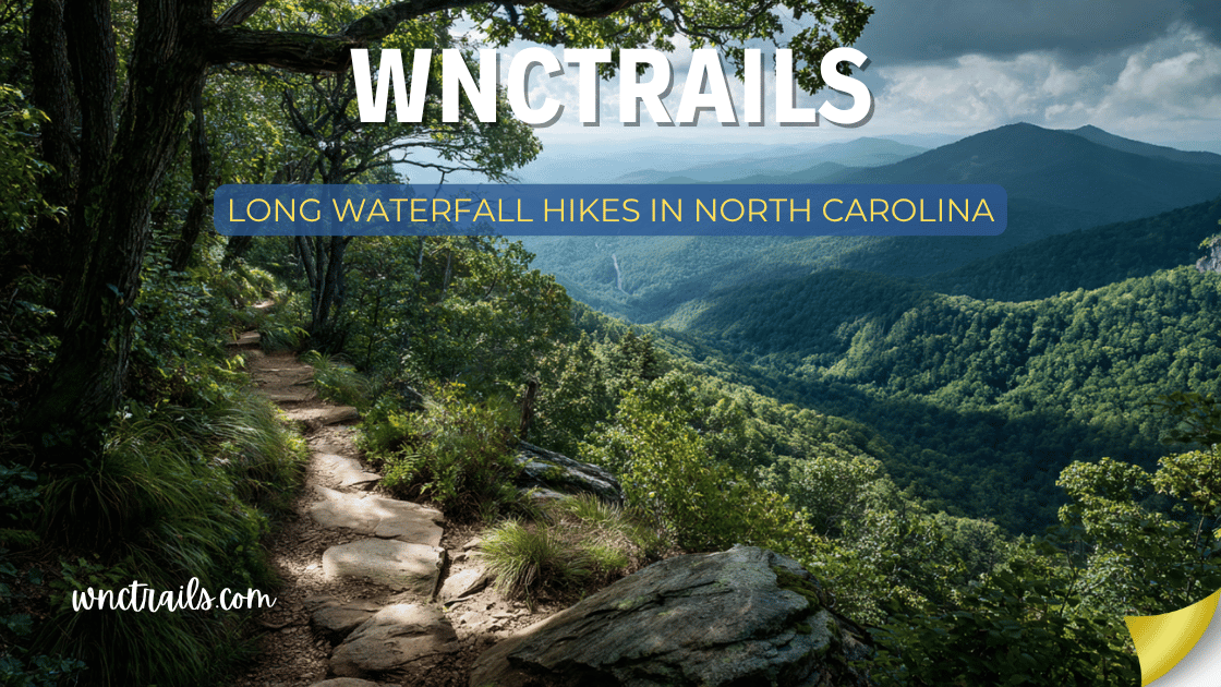
Long Waterfall Hikes In North Carolina
Some waterfalls in North Carolina are worth a full day — and a few are worth planning an entire trip around. The long waterfall hikes on this list aren’t just longer versions of the standard tourist stops. They go deeper: into wilderness areas, national park backcountry, remote gorges, and ridge-to-valley descents that reward experienced hikers with cascades that most visitors never see.
This guide covers the best long waterfall hikes in North Carolina — all trails are 3 miles or more round-trip, with several exceeding 10 miles. Each one delivers something you simply can’t find on a short trail: solitude, multiple waterfalls in sequence, true backcountry immersion, or the earned satisfaction of a hard-won destination.
What counts as a long waterfall hike: All hikes on this list are 3+ miles round-trip with significant elevation change. Several are backcountry routes in designated wilderness areas. Difficulty ratings reflect both distance and terrain — not just one or the other.
Long Waterfall Hikes in North Carolina (2026 Guide)
Recommended Tools
Disclosure: This page may contain affiliate links.
- Water Shoes — Check current pricing
- Rain Jacket — Check current pricing
- Dry Bag — Check current pricing
North Carolina is renowned for its abundant waterfalls, and some of the state’s most memorable hikes combine scenic beauty with the challenge of a longer trek. If you’re searching for long waterfall hikes in North Carolina, you’ll find a diverse selection ranging from moderate half-day outings to strenuous full-day adventures. This guide highlights what makes these hikes unique, how to prepare, and which trails are most rewarding for those seeking both distance and spectacular cascades.
Quick Reference: Long Waterfall Hikes at a Glance
| Waterfall / Trail | Location | Distance | Elevation Change | Difficulty |
|---|---|---|---|---|
| Rainbow Falls + Turtleback | Gorges State Park | 6.4 mi | ~1,000 ft | Strenuous |
| Panthertown Valley Loop | Nantahala NF | 7.5 mi | ~800 ft | Moderate–Strenuous |
| Big Creek Trail | Great Smoky Mtns NP | 10.0 mi | ~1,400 ft | Strenuous |
| Upper Creek Falls Trail | Pisgah NF / Burke Co. | 4.5 mi | ~700 ft | Moderate |
| Stone Mountain Falls Loop | Stone Mountain SP | 4.9 mi | ~1,000 ft | Moderate–Strenuous |
| Slickrock Creek Trail | Nantahala NF | 13.0 mi | ~2,000 ft | Very Strenuous |
| Linville Gorge Wilderness | Blue Ridge Pkwy Area | 8.0+ mi | ~1,600 ft | Strenuous |
| South Mountains: High Shoals | South Mountains SP | 3.5 mi | ~600 ft | Moderate |
| DuPont Full Waterfall Circuit | DuPont State Forest | 7.0 mi | ~700 ft | Moderate |
| Art Loeb Trail Waterfall Section | Pisgah NF / Shining Rock | 8.0 mi | ~2,400 ft | Very Strenuous |
1. Rainbow Falls + Turtleback Falls — Gorges State Park
Distance: 6.4 miles round-trip | Elevation Change: ~1,000 ft | Difficulty: Strenuous
The definitive long waterfall hike in Western NC, and one of the best in the entire eastern United States. The trail descends nearly 1,000 feet into the Horsepasture River gorge — a federally designated Wild and Scenic River corridor — through a landscape so lush and biodiverse it borders on otherworldly. Mossy boulders, ancient hemlocks, dense rhododendron tunnels, and over 80 inches of annual rainfall create an environment that feels closer to a Pacific Northwest rainforest than the southern Appalachians.
Rainbow Falls (150 ft) launches off a granite shelf in a single powerful plunge and generates rainbows almost daily in the afternoon mist. Just 0.5 miles further downstream, Turtleback Falls slides over a smooth granite dome into a deep swimming pool — a completely different character than Rainbow, and one of the most beloved natural swimming areas in the state.
Doing both falls in one hike is the standard approach for experienced hikers, and the combination creates a deeply satisfying full-day outing.
Trail highlights:
- Two major waterfalls (150 ft + 20 ft slide) in a single route
- The Horsepasture River is designated Wild & Scenic by U.S. Congress — one of the most protected rivers in the South
- Gorge floor biodiversity rivals the Great Smoky Mountains
- Afternoon rainbows at Rainbow Falls are nearly a guarantee in summer
- Dogs allowed on leash throughout Gorges State Park
Logistics:
- Start early — 7–8 AM recommended; the gorge heats up by midday
- Allow 4–5 hours round-trip at a comfortable pace
- Bring 2+ liters of water per person; the descent is deceptive on the way out
- Traction devices useful in wet conditions; the gorge rocks are perpetually damp
- No fee to enter Gorges State Park
Know before you go: The return climb from the gorge floor is sustained and relentless. Many hikers underestimate the ascent after swimming at Turtleback. Pace yourself on the way down so you have reserves for the climb out.
Coordinates (Trailhead): 35.1063° N, 82.9615° W
2. Panthertown Valley Waterfall Loop — Nantahala National Forest
Distance: 7.5-mile loop | Elevation Change: ~800 ft | Difficulty: Moderate–Strenuous
The most waterfall-dense long hike in North Carolina. Panthertown Valley — sometimes called the “Yosemite of the East” for its open granite domes and valley floor — contains at least eight named waterfalls within a compact backcountry area in Nantahala National Forest near Cashiers. A well-planned 7.5-mile loop can hit five or six of them in a single day.
The trail system passes Schoolhouse Falls (the most swimmable), Wilderness Falls (the most dramatic plunge), Salt Rock Falls, Mac’s Falls, and several smaller unnamed cascades — each one different in character from the last. The granite dome landscape between falls, unique in the Southern Appalachians, adds a visual dimension unlike any other long waterfall hike in the state.
Trail highlights:
- 5–6 major named waterfalls accessible in a single day loop
- Open granite dome landscape — unique geological setting in the Southeast
- Schoolhouse Falls has one of the finest natural swimming pools in WNC
- Backcountry feel with a well-marked trail network
- Free dispersed camping available for overnight trips
Logistics:
- Access via Cold Mountain Road trailhead (above Cashiers) — the road is unpaved but drivable in most vehicles
- Download a Panthertown trail map before going — cell service is unreliable inside the valley
- Multiple trail combinations are possible; the loop via Panthertown Creek and the rim trail is the most efficient for waterfall access
- Allow 5–6 hours for the full loop at a comfortable pace
Know before you go: The valley trail system has multiple junctions and the signage can be inconsistent. Offline navigation is strongly recommended — use Gaia GPS or AllTrails with downloaded maps. Getting turned around in the valley adds mileage quickly.
Coordinates (Cold Mountain Trailhead): 35.1063° N, 83.0547° W
3. Big Creek Trail — Great Smoky Mountains National Park (NC Side)
Distance: 10.0 miles round-trip | Elevation Change: ~1,400 ft | Difficulty: Strenuous
The best long waterfall hike in the Great Smoky Mountains on the North Carolina side, Big Creek Trail follows one of the park’s most beautiful streams for 5 miles into the backcountry, passing through old-growth forest with multiple cascades and swimming holes along the way.
Mouse Creek Falls (4.0 miles in) is the primary destination for day hikers — a 35-foot waterfall that drops into Big Creek from a side tributary. Continuing to Midnight Hole (2.0 miles in) adds one of the most extraordinary swimming holes in the park: a deep, perfectly clear pool carved into bedrock by the creek. Full-length hikers continuing to Walnut Bottom (5.0 miles) enter genuine old-growth forest with towering tulip poplars and hemlocks that predate European settlement.
Trail highlights:
- Multiple waterfalls and swimming holes accessible in a single trail
- Midnight Hole: one of the best natural swimming holes in the Smokies
- Mouse Creek Falls: dramatic 35-foot side-tributary cascade
- Old-growth forest in the upper section — some of the largest trees in the East
- Far less crowded than the Tennessee side of the park
Logistics:
- Trailhead at the Big Creek Campground and Picnic Area, just off I-40 near the NC/TN border (exit 451)
- Free entry (NPS entry pass not required for this trailhead parking area)
- Big Creek Campground is primitive but beautiful — excellent base for multi-day trips
- Dogs are not allowed on trails in Great Smoky Mountains National Park
Know before you go: The trail gains elevation gradually but consistently — the return trip from Mouse Creek Falls involves 4 miles of downhill on rocky terrain that can be taxing on knees. Trekking poles strongly recommended for the descent.
Coordinates (Big Creek Trailhead): 35.7563° N, 83.1017° W
4. Upper Creek Falls Trail — Pisgah National Forest / Burke County
Distance: 4.5 miles round-trip | Elevation Change: ~700 ft | Difficulty: Moderate
One of the most rewarding moderate-length waterfall hikes in the Pisgah, Upper Creek Falls is a tiered series of cascades dropping over 100 feet in a dramatic staircase formation on Upper Creek in Burke County. The trail passes through a beautiful hardwood and rhododendron forest before reaching the upper and lower tiers of the falls, each offering a different perspective of the cascade.
Because it sits in the eastern edge of Pisgah near Morganton rather than the heavily visited Brevard/Asheville corridor, Upper Creek Falls sees a fraction of the crowds that comparable trails attract — a true gem for those willing to explore beyond the obvious.
Trail highlights:
- Multi-tiered cascade dropping 100+ feet in a scenic staircase series
- Quiet, uncrowded trail — one of the least-visited major waterfalls in Pisgah NF
- Beautiful old-growth pockets along the creek corridor
- Good swimming opportunities below the lower tier
- Dogs allowed on leash; free to visit
Logistics:
- Access via NC-181 south of Newland; the trailhead is reached via a forest service road
- Download an offline map — the access road can be confusing without navigation
- The trail can be muddy after rain; waterproof boots recommended
- Allow 3–4 hours round-trip
Know before you go: The trailhead is not well-marked from the main road. Search AllTrails for “Upper Creek Falls” in Burke County to get precise GPS navigation to the trailhead — do not rely solely on Google Maps for the final approach.
Coordinates (Upper Creek Trailhead): 35.9302° N, 81.8837° W
5. Stone Mountain Falls Loop — Stone Mountain State Park
Distance: 4.9-mile loop | Elevation Change: ~1,000 ft | Difficulty: Moderate–Strenuous
The best long waterfall hike in the NC foothills, and one of the most geologically dramatic trails in the state. Stone Mountain State Park protects a massive granite dome — one of the largest exposed granite monoliths in the eastern U.S. — and the main trail loop circumnavigates it while descending to Stone Mountain Falls, a 200-foot cascade that slides down the open granite face of the dome.
The sight of a waterfall running down a bare granite mountain is unlike anything else in North Carolina. The falls are seasonal — most impressive in spring and after significant rainfall — but the granite dome itself is spectacular year-round.
Trail highlights:
- 200-foot cascade on the open granite face of the dome — visually unique
- Full loop trail with varied terrain: forest, creek, open rock, ridge
- Stone Mountain itself is a National Natural Landmark
- Trout fishing in the park’s creeks (permit required)
- Rock climbing on the granite dome (permitted with registration)
- Dogs allowed on leash
Logistics:
- Located near Roaring Gap in Wilkes County — about 2 hours from Asheville, 1.5 hours from Charlotte
- $8/adult day-use fee
- Busy on fall weekends — arrive early for parking
- Combine with a sunset walk on the dome for a full-day experience
Know before you go: The falls are best from January through May. By late summer in dry years, the slide may be minimal. Check recent visitor reports on AllTrails before visiting specifically for the waterfall.
Coordinates: 36.3931° N, 81.0460° W
6. Slickrock Creek Trail — Nantahala National Forest / Citico Creek Wilderness
Distance: 13.0 miles round-trip | Elevation Change: ~2,000 ft | Difficulty: Very Strenuous
The most demanding and most rewarding long waterfall hike on this list. The Slickrock Creek Trail penetrates the Citico Creek Wilderness — one of the most remote and biodiverse wilderness areas in the eastern U.S. — along a creek corridor that features dozens of small cascades, waterfalls, and swimming holes over 6.5 miles of trail.
This is not a destination-waterfall hike. It is a waterfall-immersion hike: the entire trail is a cascade, with the creek rarely far from view and the sound of water constant for the full length of the route. The culminating destination, the confluence with Yellowhammer Creek and the upper gorge, rewards those who push through with a wild, utterly remote wilderness experience.
Trail highlights:
- Dozens of cascades and waterfalls throughout the full length of the trail
- One of the most remote wilderness corridors in the southern Appalachians
- Outstanding trout fishing (permit required in wilderness areas)
- Bears, wild turkeys, and rare woodland salamanders are frequently seen
- Backcountry camping available — this trail rewards an overnight stay
Logistics:
- Trailhead near Robbinsville, NC — about 90 minutes from Asheville
- Crossing the creek multiple times is unavoidable; waterproof boots or water shoes essential
- This trail should only be attempted by experienced hikers comfortable with creek navigation and route-finding
- Water sources are abundant; filter all drinking water
- No fee to enter; wilderness regulations apply
Know before you go: This trail is remote — the nearest cell service is miles away. File a trip plan with a contact before going. Bring a paper map and compass as backup. Flash flooding risk is real in this canyon during or after heavy rain.
Coordinates (Trailhead): 35.3517° N, 84.0115° W
7. Linville Gorge Wilderness — Babel Tower + Linville Falls Loop
Distance: 8.0+ miles | Elevation Change: ~1,600 ft | Difficulty: Strenuous
The deepest gorge in the eastern United States — and a full-day backcountry experience that puts Linville Falls in a completely different context than the standard Parkway overlook visits. The Linville Gorge Wilderness descends from the rim to the river through 2,000 feet of near-vertical forested gorge wall, and the trails along the canyon floor follow the Linville River past multiple cascades, rapids, and the dramatic plunge pools below the main falls.
The Babel Tower Trail descends to the gorge floor from the west rim, connecting to the Linville River Trail for a rugged out-and-back or shuttle route that passes directly beneath Linville Falls — a perspective that the overlook trails above can never replicate.
Trail highlights:
- View Linville Falls from below in the gorge — an entirely different (and more powerful) perspective than the overlook
- Multiple cascades and river rapids along the gorge floor
- True wilderness designation — no mechanized equipment, no maintained facilities
- Outstanding scenery in all seasons; ice formations in winter are spectacular
- Rock climbing on the gorge walls is a popular secondary activity
Logistics:
- Wilderness permits are required on weekends May–October — obtain in advance from the Grandfather Ranger District
- Multiple trailheads on both rims; Babel Tower Trail on the west rim is the most direct to the gorge floor
- The gorge floor trail can be overgrown — long sleeves and pants recommended
- Allow a full day; the terrain is slow and demanding
Know before you go: The Linville Gorge Wilderness has a reputation as one of the more demanding wilderness areas in the eastern U.S. Trails are unmaintained and routes require navigation skill. This is not a beginner wilderness experience.
Coordinates (Babel Tower Trailhead): 35.9513° N, 81.9378° W
8. High Shoals Falls Loop — South Mountains State Park
Distance: 3.5-mile loop | Elevation Change: ~600 ft | Difficulty: Moderate
The best long waterfall hike in the NC foothills east of Asheville, the High Shoals Falls Loop in South Mountains State Park combines a beautiful forest walk with an 80-foot waterfall and a series of rapids and smaller cascades along the Jacob Fork River. The loop descends to the river corridor, passes the main falls, and returns along a ridge with views across the park.
South Mountains State Park is a hidden gem — a large, mountainous park with surprisingly rugged terrain that most visitors driving through the Piedmont don’t realize exists. The Jacob Fork corridor is one of its finest features.
Trail highlights:
- 80-foot High Shoals Falls as the anchor destination
- Multiple smaller cascades and rapids along the Jacob Fork
- Well-maintained loop trail with clear signage
- Excellent year-round hiking — lower elevation means accessible when Parkway trails are icy
- Dogs allowed on leash; $6/vehicle fee
Logistics:
- Located near Connelly Springs in Burke County — about 1.5 hours from Charlotte, 1.5 hours from Asheville
- The main trailhead parking area is well-marked off Old NC 18
- Can be combined with additional park trails for a longer 6–8 mile day
- Waterfalls are best January–May; summer can be lower flow but swimming is good
Know before you go: The trail down to the Jacob Fork corridor involves rocky, root-covered terrain that requires attention. Not a stroller-accessible trail despite being listed as “moderate.”
Coordinates: 35.6021° N, 81.6285° W
9. DuPont Full Waterfall Circuit — DuPont State Recreational Forest
Distance: 7.0-mile loop | Elevation Change: ~700 ft | Difficulty: Moderate
The best way to see all five major waterfalls in DuPont State Recreational Forest in a single hike, the full circuit connects Hooker Falls, Triple Falls, High Falls, Bridal Veil Falls (DuPont’s version), and Wintergreen Falls on a 7-mile loop through the heart of the forest. Each waterfall is dramatically different from the last — from the broad swimming hole at Hooker to the tiered drama of Triple Falls to the massive face of High Falls — and the connecting trails wind through a beautiful mix of pine forest, granite outcrops, and river corridor.
For visitors who want to truly experience DuPont rather than just hit the most popular stops, this full circuit is the definitive route.
Trail highlights:
- Five major named waterfalls connected in a single 7-mile loop
- Most diverse waterfall experience in any single trail system in WNC
- The famous Hunger Games filming location (Triple Falls section)
- Excellent mountain biking trails in the forest can be combined with hiking for multi-sport days
- Free to enter; dogs allowed on leash throughout
Logistics:
- Start at the Hooker Falls trailhead for the most logical loop progression
- The full circuit takes 4–5 hours at a comfortable pace with time at each waterfall
- Multiple side trails add mileage if desired — the forest trail network exceeds 80 miles
- Busy on summer weekends; arrive before 8:30 AM for parking
Know before you go: The trail surfaces range from wide gravel paths (near Hooker Falls) to rocky, rooted singletrack (near Bridal Veil and High Falls). Footwear with ankle support is recommended for the full loop.
Coordinates (Hooker Falls Trailhead): 35.1906° N, 82.6380° W
10. Art Loeb Trail — Davidson River Headwaters Section, Pisgah NF
Distance: 8.0 miles one-way (shuttle required) | Elevation Change: ~2,400 ft | Difficulty: Very Strenuous
The most challenging long waterfall hike in Pisgah National Forest, this section of the Art Loeb Trail — one of North Carolina’s premier long-distance trails — traverses the high ridge of the Shining Rock Wilderness before descending through the Davidson River headwaters, passing multiple cascades and waterfalls in a dramatic ridge-to-valley route.
The upper section crosses the open balds of Black Balsam Knob and Tennent Mountain (both above 6,000 feet), offering panoramic views before the trail plunges into the rhododendron-choked gorge below, where the young Davidson River tumbles over a series of waterfalls and slides on its descent to the valley.
This is a point-to-point route requiring a vehicle shuttle or a second car at the lower trailhead.
Trail highlights:
- Open 6,000-foot balds with 360-degree mountain views in the upper section
- Multiple waterfalls and cascades in the Davidson River headwaters gorge
- Passes through the Shining Rock Wilderness — one of two official wilderness areas in Pisgah NF
- One of the most dramatically varied long hikes in WNC: open high ridgeline to dense gorge
- Backcountry camping available; overnight trips along this section are outstanding
Logistics:
- Shuttle required: upper trailhead at Black Balsam Knob parking (Blue Ridge Pkwy MP 420.2); lower trailhead at the Davidson River Campground area
- This route should only be attempted by experienced hikers with navigation skills
- Weather changes rapidly above 5,500 feet — carry rain gear even on clear days
- Allow a full 7–9 hours for the one-way traverse at a strong pace
Know before you go: The high-elevation section is exposed and fully above treeline — lightning risk is serious. Check the forecast and be off the balds by early afternoon if there is any chance of afternoon thunderstorms, which are common June–August.
Coordinates (Upper Trailhead at Black Balsam): 35.3237° N, 82.8977° W
Training for a Long Waterfall Hike
If you’re planning one of the strenuous or very strenuous hikes on this list — particularly Rainbow Falls, Slickrock Creek, Linville Gorge, or the Art Loeb section — a few weeks of preparation makes a significant difference.
Build Up Gradually
Start with the moderate hikes on this list (Upper Creek Falls, High Shoals, DuPont Full Circuit) before committing to the strenuous options. The difference between 4.5 and 13 miles with 2,000 feet of elevation gain is not just distance — it’s a completely different kind of physical demand.
Train on Similar Terrain
Flat road or treadmill miles don’t prepare you for rocky, rooted mountain trails. Hike local trails with elevation change — even smaller hills — in the weeks before a big hike. Your ankles, knees, and feet need time to adapt to uneven surfaces.
Dial In Your Gear Before the Big Day
Don’t wear brand-new boots on a 10-mile backcountry hike. Break in footwear thoroughly before a demanding trail. The same applies to your pack, rain gear, and trekking poles — test everything on a shorter hike first.
Nutrition and Hydration on Long Hikes
A general rule for mountain hiking: drink 0.5 liters of water per hour of activity, more in heat or at high exertion. For food, plan for 200–300 calories per hour of hiking — a mix of fast-burning carbohydrates (fruit, crackers) and slower fats and proteins (nuts, nut butter). Don’t wait until you’re hungry or thirsty to eat and drink.
What to Pack for a Full-Day Waterfall Hike
The longer the hike, the more critical your gear decisions become. For any hike on this list over 5 miles:
- Navigation: Downloaded offline map (Gaia GPS or AllTrails) + paper backup for wilderness areas
- Water: 2–3 liters minimum + water filter or purification tablets for backcountry hikes
- Food: More than you think you need; 500–600 extra calories as emergency reserve
- First aid: Blister kit, wound care, pain reliever, emergency whistle
- Layers: Lightweight insulating layer + rain shell, even on warm days at elevation
- Trekking poles: Strongly recommended for gorge descents and creek crossings
- Headlamp: Even for day hikes — mountain afternoon storms or an injury can delay your return
- Emergency contact: Tell someone your plan and expected return time before wilderness hikes
Key Considerations
- Trail Length and Difficulty: Long waterfall hikes can range from moderate to strenuous. Elevation changes, rocky sections, and stream crossings add to the challenge. Always assess the total mileage and cumulative elevation gain before heading out.
- Seasonal Factors: Waterfall flows are typically strongest in spring and after heavy rain, but trails can be muddy or slippery. Summer offers lush greenery and cooler temperatures near waterfalls, while fall brings colorful foliage. Winter hikes may present icy conditions—microspikes can be essential.
- Navigation: While many trails are well-signed, some longer routes require map-reading skills or GPS navigation. Download maps ahead of time, as cell service is limited in remote areas.
- Safety: Remote waterfall hikes mean help is often far away. Let someone know your plans, pack extra food and water, and carry a basic first aid kit. Stay on marked trails and avoid slippery rocks near cascades.
- Leave No Trace: Protect fragile ecosystems by sticking to established paths, packing out all trash, and respecting posted guidelines at each site.
Common Use Cases
- Full-Day Hiking Adventures: Many hikers seek out long waterfall hikes in North Carolina for a full day of exploration, enjoying both the journey and the scenic destinations. Trails like the Linville Gorge Loop or Upper Whitewater Falls Trail provide extended mileage and dramatic views.
- Photography Expeditions: The combination of multiple waterfalls and changing light throughout the day makes these hikes a favorite for nature photographers. Early mornings or late afternoons often yield the best conditions.
- Training and Fitness: Outdoor enthusiasts use longer waterfall hikes to build endurance in a scenic setting. The varied terrain and natural beauty create an engaging environment for physical training.
- Group and Family Outings: Some longer waterfall trails, such as those in DuPont State Recreational Forest, offer moderate grades and wide paths suitable for families or small groups looking for a shared adventure.
- Solitude and Backcountry Experience: For those seeking quieter trails, routes in less-visited areas like Panthertown Valley or sections of the Appalachian Trail provide a sense of wilderness and solitude, often with hidden waterfalls as a reward.
Final Thoughts
The long waterfall hikes of North Carolina take you somewhere the roadside stops can’t reach — into gorges that haven’t changed in centuries, past waterfalls that most people never see, and through wilderness that reminds you why the southern Appalachians are one of the most ecologically extraordinary places in the world.
Earn the miles. The waterfalls at the end are worth every step.
Frequently Asked Questions
- What are some of the best long waterfall hikes in North Carolina?
Notable options include the Linville Gorge Loop (around 11 miles with multiple falls), the Rainbow Falls and Turtleback Falls Trail (about 5 miles round-trip), and the Big Creek Trail to Mouse Creek Falls in the Smokies (roughly 8 miles round-trip). Each offers a mix of scenery and challenge. - How should I prepare for a long waterfall hike?
Wear sturdy hiking boots, bring weather-appropriate clothing, and pack essentials like water, snacks, a map, and a first aid kit. Trekking poles can help on steep or slippery sections. Always check trail conditions before your trip. - Are dogs allowed on long waterfall hikes?
Many trails permit leashed dogs, but some state parks and protected areas have restrictions. Always verify regulations for your chosen trail and pack out pet waste to keep the area clean. - Is swimming allowed at these waterfalls?
Swimming is permitted at some locations but can be hazardous due to strong currents, slippery rocks, or hidden hazards. Always observe posted signs and exercise caution near the water. - When is the best time to hike to waterfalls in North Carolina?
Spring and early summer typically offer the most impressive waterfall flows, while autumn brings vibrant foliage. Each season has unique advantages, but always check for trail closures or weather advisories before heading out.
Long waterfall hikes in North Carolina offer a blend of physical challenge, natural beauty, and memorable experiences. With thoughtful preparation and respect for the environment, these trails can provide some of the most rewarding outdoor adventures in the region.
Related Pages
Have a long waterfall hike that belongs on this list? Share it in the comments below!
Plan your next adventure at WNCTrails.com →