|

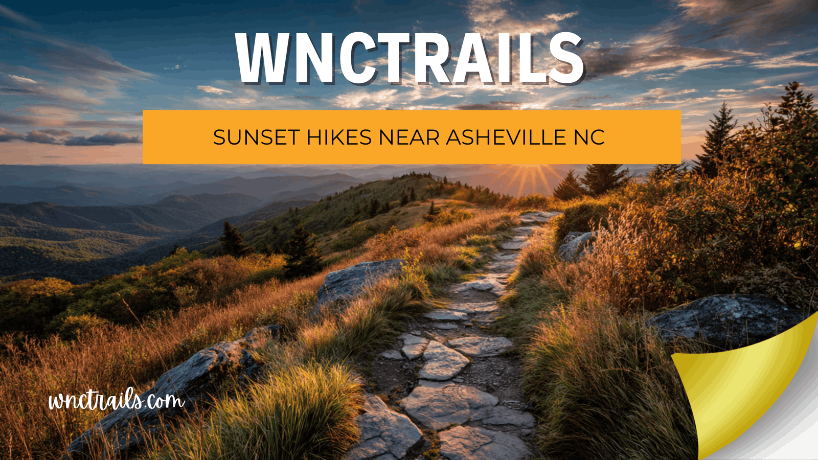
Sunset Hikes Near Asheville NC: How to Get Down Safely After Dark

Showing up at a “sunset hike” to find you’re facing east is the most avoidable disappointment in WNC hiking. The second is arriving at Max Patch at 7 PM on an October Saturday and parking a mile from the trailhead. The third is starting the descent after golden hour without a headlamp because nobody mentioned the trail back is forty-five minutes of unlit root-and-rock. WNC Trails documents viewpoint orientation, trailhead arrival windows, parking strategy, summer thunderstorm cutoff times, and post-sunset descent conditions for every trail in our sunset category. Here are 8 verified sunset hikes near Asheville — with the logistics that make the difference between a memorable evening and a frustrating one.

Asheville NC Sunset Hikes How to Get Down Safely After Dark

Recommended Tools

Disclosure: This page may contain affiliate links.

What WNC Trails Verifies for Every Sunset Hike

Sunset hiking requires different planning than any other trail visit. You’re racing a clock, managing a descent in diminishing light, and — in WNC summers — watching a weather window that opens and closes unpredictably. WNC Trails uses a 5-point sunset verification framework before any trail earns a sunset designation.

The WNC Trails Sunset Verification Framework

  1. Viewpoint Orientation: We document the compass direction the primary viewpoint faces. Only west-facing and omnidirectional viewpoints produce a direct sunset experience — the sun setting into or over the ridgeline you’re looking at. East-facing trails are beautiful at sunset for the alpenglow on distant peaks, but the sun sets behind you. We note the difference explicitly.
  2. Trailhead Arrival Window: We calculate the time you need to be parked and hiking to reach the viewpoint 40 minutes before sunset — the opening of golden hour. This accounts for drive time from Asheville, hike time to the viewpoint, and the realistic parking situation on peak-season evenings. Arriving at the trailhead at sunset is not the same as watching it from the summit.
  3. Summer Thunderstorm Cutoff: Western NC’s afternoon thunderstorm pattern is the primary hazard for sunset hikers on exposed ridges June–August. We document the latest safe departure time from the summit to avoid being above treeline during the peak storm window (typically 2–5 PM), and note which trails are exposed to risk versus sheltered. This cutoff is often incompatible with a full golden-hour summit stay in summer.
  4. Post-Sunset Descent Conditions: We document whether the return trail is navigable in low-light conditions with a headlamp, requires technical footing in the dark, or has junction/navigation points that are easy to miss after dusk. Some summit descents are straightforward in the dark; others involve scrambling and route-finding that demands more care once light fails.
  5. Peak Season Parking Status: Popular sunset destinations on the Blue Ridge Parkway and at high-elevation balds fill in the mid-afternoon on fall weekends — sometimes by 3 PM for a 6:45 PM sunset. We document realistic arrival times for parking security on peak dates versus off-season weekday visits.

8 Sunset Hikes Near Asheville NC — Arrival Windows, View Direction, and Descent Plan

These trails are organized from most west-facing and visually dramatic at sunset to more accessible options where golden hour light rewards even a modest viewpoint.

1. Waterrock Knob — WNC’s Sunset Benchmark

Distance to Viewpoint: 0.6 miles to summit  |  Elevation Gain: 340 ft  |  Viewpoint Orientation: West-facing — direct sunset into Smoky Mountain ridges  |  Summer Storm Risk: High (exposed, 6,292 ft)  |  Crowd Index: High (evenings)

Waterrock Knob at Blue Ridge Parkway milepost 451.2 is the go-to WNC sunset hike — a west-facing summit at 6,292 ft with an unobstructed view directly into the layered ridgelines of the Smokies and Balsam Mountains. As the sun drops toward the Tennessee horizon, the ridges stack in graduated blue silhouettes up to 60+ miles deep. On high-humidity October evenings, the atmospheric haze amplifies color — deep orange and red burning through the layers of ridge. On ultra-clear post-frontal evenings, the ridges are sharp and the color more subtle but the depth of visible terrain is extraordinary.

What the sunset actually looks like: The sun sets slightly left (south) of the main Smoky Mountain ridge from this position in October. The final 15 minutes before the sun hits the horizon are the most saturated in color. After the sun drops, the alpenglow — the pink/purple light that spreads across the sky above the set point — typically builds for another 10–20 minutes. Blue hour (deep blue sky with silhouetted ridges) follows and lasts until full dark ~40 minutes after sunset.

October trailhead arrival: Arrive by 4:30 PM. Hike 20 min to summit; arrive ~40 min before 6:45 PM sunset. Peak October weekends: parking lot fills by 4 PM. Arriving at 5 PM means parking on the road shoulder and adding 10-minute walk to your timeline.

June trailhead arrival: Arrive by 6:45 PM for 8:30 PM sunset. Summer thunderstorm caveat: if afternoon storms are in the forecast, delay arrival until the storm window closes — typically 5:30–6:00 PM — and accept a compressed golden hour window.

Post-sunset descent: The trail back is short (0.6 miles) with no technical sections — headlamp navigation is straightforward. The paved BRP overlook area has lighting. Low post-dark descent risk. Bring a headlamp regardless; the trail from summit to parking in full dark takes 30 minutes without rushing.

2. Max Patch — Omnidirectional Sunset with Tennessee Valley Alpenglow

Distance to Viewpoint: 0.7 miles to summit  |  Elevation Gain: 392 ft  |  Viewpoint Orientation: Omnidirectional — west-facing view into Tennessee valleys  |  Summer Storm Risk: High (exposed bald, 4,629 ft)  |  Crowd Index: High

Max Patch is equally spectacular at sunset as at sunrise — the open 360° bald lets you face west for the actual sunset and then turn east to watch alpenglow light the Black Mountains behind you as the sky darkens. The Tennessee mountain valleys to the west fill with gold and shadow as the sun drops. If a partial cloud layer sits on the western horizon, the final minutes before sunset can produce extraordinary color as the sun backlights the clouds from below. No other easily accessible location near Asheville offers the same full-sky sunset canvas.

What the sunset actually looks like: In October, the sun sets over the Bald Mountain ridge to the northwest, casting long shadow fingers across the meadow. Turn 180° after the sun drops — the east-facing Black Mountains catch alpenglow (pink-orange) as the western sky transitions to deep blue. The last 20 minutes of light on Max Patch, watching both directions simultaneously, is the most complete sunset experience in WNC.

October trailhead arrival: Arrive by 4:30 PM. The USFS timed parking reservation system may apply on peak fall weekends — verify and book in advance. Without a reservation, arrive by 3:30 PM to secure a spot before the afternoon crowd arrives. Trail is open meadow — no navigation difficulty in fading light, but carry a headlamp for the descent.

June trailhead arrival: Arrive by 7:00 PM for 8:30 PM sunset. Summer storm rule applies — the June–August storm window (typically 2–5 PM) usually closes before 6:30 PM, which is typically safe for an 8:30 PM golden hour. Monitor the forecast.

Post-sunset descent: The descent crosses open meadow with no technical terrain — headlamp navigation is easy. The unmarked approach to the parking area in full dark is the only navigation challenge; know the correct direction before light fails or mark the trailhead on your phone map before hiking up.

3. Black Balsam Knob — High-Country Sunset Above the Wilderness

Distance to Viewpoint: 1.6 miles to summit  |  Elevation Gain: 780 ft  |  Viewpoint Orientation: Omnidirectional; best sunset view faces west-northwest  |  Summer Storm Risk: Very High (6,214 ft, fully exposed)  |  Crowd Index: Moderate

Black Balsam Knob sunset views sweep west across the Shining Rock Wilderness and south toward the Nantahala high country — a wilder, more remote-feeling sunset than Max Patch or Waterrock Knob. The surrounding terrain is open high-country bald with the Pisgah ridge in every direction. Post-sunset, the Shining Rock Wilderness — an undeveloped roadless area — darkens into one of the darker skies available within 90 minutes of Asheville, making this a good option for sunset-into-stargazing if conditions allow.

October trailhead arrival: Arrive by 4:15 PM. Drive ~60 min from Asheville to BRP milepost 420 area; hike ~50 min to summit. BRP lot is smaller than Max Patch — typically less crowded but fills on peak October weekends by 4:30 PM.

June trailhead arrival: Arrive by 6:30 PM. Summer thunderstorm risk at 6,214 ft is the highest on this list — be off the summit by 2 PM if afternoon storms are in the forecast and plan only late-evening (post-storm) sunset visits June–August.

Post-sunset descent: The 1.6-mile descent via the Art Loeb Trail in full dark requires a headlamp and familiarity with the route — there are junction points and rock sections that need attention. This is a moderate post-dark descent; not technical but not trivial. Know the route before attempting after sunset.

4. Sam Knob — Less-Crowded West-Facing Bald

Distance to Viewpoint: 1.8 miles to summit  |  Elevation Gain: 540 ft  |  Viewpoint Orientation: West-facing — direct sunset view, Pisgah ridgelines  |  Summer Storm Risk: High (exposed, 6,045 ft)  |  Crowd Index: Low–Moderate

Sam Knob sits one ridge east of Black Balsam Knob and is accessed from the same trailhead area near BRP milepost 420 — but receives a fraction of the visitor traffic. The west-facing summit provides direct sunset views over the Pisgah National Forest ridge system with the Nantahala wilderness to the southwest. The lower Crowd Index makes Sam Knob the preferred choice for sunset hikers who want the open bald experience without competing for summit real estate on fall weekends. The summit has several rock perches spread across a wide area — no jostling for position.

October trailhead arrival: Arrive by 4:15 PM. Shared trailhead with Black Balsam; hike time to Sam Knob is slightly longer at ~55 min.

Post-sunset descent: Route back crosses open terrain and re-enters forest — headlamp required after full dark. Junction at the Sam Knob loop is the main navigation point to get right in low light. Mark it on your map before the summit push.

5. Fryingpan Mountain Lookout Tower — Fire Tower Sunset Platform

Distance to Viewpoint: 0.6 miles to tower  |  Elevation Gain: 220 ft  |  Viewpoint Orientation: Omnidirectional (tower platform) — west-facing primary value  |  Summer Storm Risk: High (tower is a lightning target)  |  Crowd Index: Low

Fryingpan Mountain Lookout Tower (5,340 ft) near BRP milepost 409 is one of the few remaining accessible fire lookout towers in WNC — a metal cab elevated above the treeline that puts you above the summit ridge for a 360° unobstructed platform view. The west-facing view from the tower cab platform at sunset is exceptional: the Pisgah ridges drop away in every direction and the sky is fully open above. The short approach and low crowd frequency make this an underused sunset option. The tower structure itself — steel grating, open railing, elevated cab — is part of the experience.

Lookout tower access: The tower cab is accessible to the public (open structure). The metal grating platform can be icy in cold conditions — use caution. Tower is a lightning rod: clear the platform if thunderstorm activity develops. Do not visit during active storms or if storm cells are visible on the horizon.

October trailhead arrival: Arrive by 5:00 PM. Drive ~65 min from Asheville to the BRP pull-off; hike ~20 min to tower.

Post-sunset descent: Short return (0.6 miles) with no technical terrain. Headlamp for the forest section back to the road. Low post-dark descent risk.

6. Bearwallow Mountain — Pastoral Golden Hour

Distance to Viewpoint: 1.9 miles to summit meadow  |  Elevation Gain: 1,000 ft  |  Viewpoint Orientation: West-facing primary — Cane Creek valley and ridgelines  |  Summer Storm Risk: Moderate (partially exposed meadow, lower elevation)  |  Crowd Index: Low–Moderate

Bearwallow Mountain’s west-facing summit meadow catches the last 45 minutes of daylight over the layered ridges to the west and the Cane Creek agricultural valley below. The golden hour light on the pastoral valley floor — farmland, pasture, low fog beginning in the hollows — produces a warmer, more intimate sunset than the wilderness panoramas of the high balds. This is the recommended sunset option for hikers who want a meaningful evening view without a 60+ minute drive to the BRP and without competition for summit space.

October trailhead arrival: Arrive by 4:30 PM. Drive ~35 min from Asheville; hike ~55 min to summit meadow. Trail is forested for most of the ascent — no significant storm exposure below the summit.

Post-sunset descent: The descent through forested trail requires a headlamp — 55 minutes back in the dark on a root-and-dirt path. No technical scrambling, but the private land approach section should be navigated carefully after dark. Know the junction points before sunset.

7. Gregory Bald — Remote West-Facing Summit (Best for June Azalea Sunset)

Distance to Viewpoint: 11.0 miles RT  |  Elevation Gain: 3,000 ft  |  Viewpoint Orientation: West-facing — Smokies sunset  |  Summer Storm Risk: High (exposed bald)  |  Crowd Index: Low (due to distance)

Gregory Bald in the Great Smoky Mountains National Park is a commitment — 11 miles round-trip with 3,000 ft of gain from the Twentymile trailhead — but the west-facing open bald sunset over the deepest Smoky Mountain wilderness is the most remote and spectacular sunset view accessible as a day hike from Asheville. The specific draw is late June, when the wild azalea bloom on Gregory Bald peaks — a sunset with the bald covered in flame azalea and the Smokies ridgelines fading to blue is a specific once-a-year WNC hiking experience. Check bloom status on WNC Trails before planning this hike; the azalea window is roughly 2 weeks and shifts year to year.

October trailhead arrival: This is a full-day hike timed to arrive at the summit for sunset. Depart trailhead by 12:30 PM for a 6:45 PM October sunset. Drive ~2 hours from Asheville to Twentymile trailhead (GSMNP). Dogs are not permitted in the backcountry of GSMNP.

Post-sunset descent: 5.5 miles back in the dark is the reality of a Gregory Bald sunset hike — a headlamp, familiarity with the route, and an early enough departure to be off the exposed summit before full dark are all required. This is the highest-commitment hike on this list; plan it like a backcountry outing even though it’s a day hike.

8. Lover’s Leap Ridge (Hot Springs) — River Valley Sunset

Distance to Viewpoint: 1.0 miles to primary overlook  |  Elevation Gain: 520 ft  |  Viewpoint Orientation: West/southwest — French Broad River valley sunset  |  Summer Storm Risk: Moderate (partially sheltered ridge)  |  Crowd Index: Low (evenings)

The Lover’s Leap ridge at Hot Springs faces west along the French Broad River gorge — at sunset, the light drops behind the ridge walls to the west and paints the river corridor in orange and gold before shadow climbs the gorge walls from below. This is a gorge-sunset experience rather than an open-sky one — the visual drama comes from the way light falls into and then leaves the valley rather than from a horizon-to-horizon color display. The town of Hot Springs along the river below catches light in a way that adds a human element to the view. Evenings here are quiet, the trailhead parking in town is uncrowded, and the post-sunset return is straightforward via the Appalachian Trail loop.

October trailhead arrival: Arrive by 5:30 PM. Drive ~45 min from Asheville to Hot Springs; hike 35 min to the ridge overlook. Ample parking in Hot Springs town center.

Post-sunset descent: The AT descent from the ridge back to town follows a known route with no technical scrambling — headlamp required for the lower forested section but low navigation difficulty. The town provides ambient lighting as you return.

Sunset Hike Quick Reference

TrailView DirectionOct Trailhead ArrivalStorm RiskPost-Dark DescentCrowd Index
Waterrock KnobWest — SmokiesBy 4:30 PMHighEasy (0.6 mi)High
Max PatchOmni — west primaryBy 4:30 PMHighEasy (open meadow)High
Black Balsam KnobOmni — west-northwestBy 4:15 PMVery HighModerate (1.6 mi, junctions)Moderate
Sam KnobWest — Pisgah ridgesBy 4:15 PMHighModerate (loop junction)Low–Moderate
Fryingpan TowerOmni — tower platformBy 5:00 PMHigh (tower = lightning)Easy (0.6 mi)Low
Bearwallow MountainWest — Cane Creek valleyBy 4:30 PMModerateModerate (55 min forested)Low–Moderate
Gregory BaldWest — SmokiesBy 12:30 PM (full day)HighDemanding (5.5 mi in dark)Low
Lover’s LeapWest — river gorgeBy 5:30 PMModerateEasy (AT return to town)Low

Arrival Time and Parking Strategy for WNC Sunset Hikes

Sunset hiking reverses the parking problem of sunrise hiking — instead of arriving before dawn to an empty lot, you’re arriving mid-afternoon to a lot that’s been filling since noon. On peak fall weekends at Waterrock Knob, Max Patch, and the BRP overlooks, parking is often the binding constraint, not the hike itself.

Asheville-Area Approximate Sunset Times by Month

MonthApprox. Sunset (Asheville)Golden Hour BeginsNotes
January5:25–5:45 PM~4:45 PMShortest days; early trailhead arrival required
February5:55–6:20 PM~5:15 PMDays lengthening; cold clear air maximizes color
March6:20–7:35 PM~5:40–6:55 PMDST transition shifts sunset ~1 hour later mid-month
April7:45–8:00 PM~7:05 PMLong evenings return; post-DST pleasant conditions
May8:05–8:20 PM~7:25 PMLong days; rhododendron bloom starts; storm risk building
June8:25–8:35 PM~7:45 PMLatest sunsets; afternoon thunderstorms peak; Gregory Bald azalea window
July8:20–8:35 PM~7:40 PMLong days but high humidity haze often mutes color
August7:55–8:20 PM~7:15 PMDays shortening; late August sees first clarity improvement
September7:20–7:55 PM~6:40 PMStorm frequency drops; clarity improves; excellent sunset month
October6:40–7:20 PM~6:00 PMPeak foliage + best color conditions; highest demand for parking
November5:25–6:35 PM~4:45–5:55 PMDST ends early month; sunset moves ~1 hour earlier; open canopy views
December5:10–5:25 PM~4:30 PMEarliest sunsets; icy high-elevation conditions; exceptional clarity

Trailhead Arrival Time Formula

To calculate when to arrive at the trailhead: Sunset time − hike time to viewpoint − 40-minute golden hour buffer = latest trailhead arrival. Then subtract 15–30 minutes for parking (peak season) to get your target departure from Asheville.

Peak Season Parking Rules

Waterrock Knob (October weekends): Lot fills by 4:00–4:30 PM. Arrive by 3:30 PM or accept a 10-minute shoulder walk in the dark on the way back. No overflow lot — roadside shoulder parking only.

Max Patch (October weekends): USFS timed reservation system applies on peak weekends. Book in advance at recreation.gov. Without a reservation, arrive by 3:00 PM or risk a 0.5–1.0 mile overflow walk each way — extending your sunset timeline significantly.

Black Balsam / Sam Knob (October weekends): The shared parking area fills by 3:30–4:00 PM on peak fall weekends. Arrive by 3:00 PM for secure parking. Overflow along the BRP shoulder is possible but extends the approach.

Weekday October advantage: Trailhead lots at all BRP sunset destinations are typically well below capacity on weekday evenings through October. Tuesday–Thursday visits eliminate parking as a constraint entirely.


Summer Thunderstorm Risk: The Sunset Window That Closes Before It Opens

WNC’s summer afternoon thunderstorm pattern is the most important safety variable for sunset hikers on exposed ridges June through August — and the one most commonly ignored in trail recommendations.

The WNC Summer Storm Pattern

Daytime heating over the Southern Appalachians builds convective thunderstorms almost daily from mid-June through mid-August. The typical storm cycle: clear morning → cloud buildup by noon → storm development 1:00–3:00 PM → storm peak 2:00–5:00 PM → clearing 5:00–7:00 PM → clear evening. On the right day, this clearing produces the most dramatic sunset skies of the year — towering anvil clouds backlit by the setting sun, layered post-storm color. On many days, the storm lingers or a second wave develops in the early evening, eliminating the sunset window entirely.

High-Elevation Lightning Risk

Above 5,000 ft on an open bald, you are the tallest object for hundreds of yards in any direction. Lightning fatalities in the Southern Appalachians occur disproportionately on exposed balds. The rule is simple: if you can hear thunder, you are in range. If you can see storm cells in the direction the weather is coming from (typically southwest), begin descending immediately. Do not wait for rain to start. On high balds — Max Patch, Black Balsam, Waterrock Knob, Sam Knob — the storm-to-summit time can be 10–15 minutes from first visible cloud to lightning overhead.

Summer Sunset Hike Strategy

For June–August sunset hikes on exposed ridges: monitor the forecast the night before and again that afternoon. If afternoon storm activity is forecast, plan to arrive at the summit after the storm window closes — typically 5:30–6:00 PM. This compresses your golden hour but keeps you off the exposed summit during peak storm risk. Alternatively, choose a lower-elevation or forested sunset option (Lover’s Leap, Bearwallow forested approach) where lightning exposure is lower. A sunset from a west-facing ridgeline viewpoint in trees is safer than an open bald in the same weather window.


After the Sun Goes Down: Blue Hour, Safe Descent, and Getting Back to the Car

Most hikers leave a sunset viewpoint the moment the sun drops below the horizon. The ones who stay for the 20 minutes after are the ones who see the best light of the evening.

Blue Hour: The Window Most Hikers Miss

After the sun sets, the sky above the set point transitions from gold to orange to deep pink to violet to blue. The blue hour — the period when the sky is a saturated deep blue and the ridgelines are pure black silhouettes — typically peaks 20–35 minutes after astronomical sunset. The western horizon still holds residual color; the zenith is blue-black; the ridge silhouettes are absolute. This is the photographic window that produces the most dramatic sky-to-ridge contrast, and it requires staying on the summit approximately 30 minutes longer than the average group does.

The tradeoff: 30 more minutes on the summit means 30 more minutes of the descent in darkness. Budget for it explicitly — add 30 minutes to your post-sunset descent time if you plan to stay for blue hour.

Post-Sunset Descent Checklist

Trailhead navigation: Know which trailhead you’re returning to, especially on trails with multiple access points. On Black Balsam, the BRP approach is not the same as the Art Loeb Trail trailhead — in the dark, the visual landmarks that distinguished them in daylight disappear.

Headlamp charged and accessible before the summit: Don’t dig through a pack for your headlamp in the dark on a rocky trail. Take it out and put it in a hip belt pocket or jacket pocket before you reach the viewpoint. You will need it on the way down.

Know the first junction before light fails: The most common post-sunset navigation error is missing a trail junction in the dark. Identify the first junction below the summit — and mark it on your map — before you lose daylight. On Max Patch, this is the point where the open meadow trail splits toward the parking area; in the dark, the correct direction is not obvious.

Move slower in the dark: Roots, rocks, and water bars that were easy to step over in daylight become trip hazards in headlamp light, which flattens depth perception. Budget 30–40% more time for the descent after full dark versus daylight pace.

Temperature drop: Summit temperature drops rapidly after sunset as radiative cooling begins. What was comfortable at golden hour can be cold enough for a jacket layer 30 minutes after dark. Pack a light insulating layer specifically for the post-sunset window, even in summer.

Key Considerations

  • Trail Selection: Not all trails are equally suited for sunset viewing. Look for hikes with west-facing overlooks, open balds, or fire towers. Some favorites include Craggy Pinnacle, Black Balsam Knob, and Max Patch.
  • Timing: Plan to reach your chosen viewpoint 20“30 minutes before sunset. This allows time to settle in and enjoy the changing light. Remember that hiking back will likely be in low light or darkness.
  • Gear: Bring a reliable headlamp or flashlight with fresh batteries for the return hike. Extra layers are essential, as mountain temperatures can drop quickly after sunset.
  • Safety: Trails can become more challenging after dark. Stick to well-marked routes, let someone know your plans, and consider hiking with a group.
  • Weather: Clouds can enhance sunset colors, but fog or storms may obscure views. Check the forecast and be prepared to adjust your plans if conditions change.
  • Leave No Trace: Pack out all trash, stay on marked trails, and respect wildlife. Sunset hours are active times for many animals”observe quietly from a distance.

Common Use Cases

  • Photography: Sunset hikes are a favorite for landscape photographers. The soft, golden light and dramatic skies create ideal conditions for capturing memorable images. Consider trails with unobstructed western views for the best results.
  • Family Outings: Shorter trails like Craggy Gardens or the Mount Pisgah Trail offer manageable distances and rewarding vistas, making them suitable for families or less experienced hikers.
  • Romantic Evenings: Many couples seek out sunset hikes near Asheville NC for a quiet, scenic date night. Pack a blanket and snacks for a relaxed evening at the summit.
  • Solo Reflection: The peacefulness of a mountain sunset makes these hikes ideal for solo hikers seeking solitude or a mindful end to the day.
  • Fitness Goals: Challenging hikes like Looking Glass Rock or Bearwallow Mountain offer a satisfying workout with the bonus of a sunset payoff at the summit.

Find Your Sunset Hike Near Asheville

WNC Trails filters by viewpoint orientation, storm risk level, and post-sunset descent difficulty so you can find the right sunset hike for your group’s experience level and timeline. Check current conditions — including BRP access status and any timed parking reservation requirements — before you leave Asheville.

Frequently Asked Questions

  • What are the best sunset hikes near Asheville NC?
    Top choices include Craggy Pinnacle, Black Balsam Knob, Max Patch, Bearwallow Mountain, and the Mount Pisgah summit trail. Each offers a unique perspective and varying difficulty levels.
  • How do I stay safe during a sunset hike?
    Start your hike early enough to reach the viewpoint before sunset, bring a headlamp for the return trip, and stick to familiar or well-marked trails. Let someone know your plans and carry extra layers.
  • Are pets allowed on these trails?
    Most trails in Pisgah National Forest and along the Blue Ridge Parkway allow leashed dogs, but always check specific regulations before heading out.
  • Do I need a permit or reservation?
    Most sunset hikes near Asheville NC do not require permits for day use. However, special areas or overnight camping may have separate regulations.
  • What should I bring?
    Essentials include a light source, water, snacks, weather-appropriate clothing, and a map or GPS. For photography, a tripod can help capture low-light scenes.
  • Is parking available at trailheads?
    Most popular sunset trails have parking lots, though they can fill quickly on weekends or during peak fall color. Arrive early to secure a spot, and always follow posted parking rules.

Continue Exploring These Trails

Browse Sunset-Verified Trails Near Asheville →

Check Today’s Trail Conditions →

Discover More Western North Carolina Trails