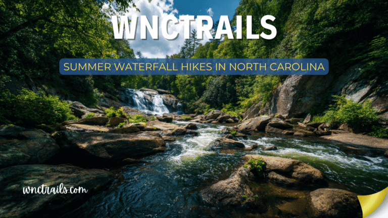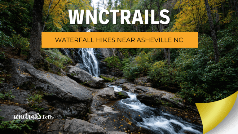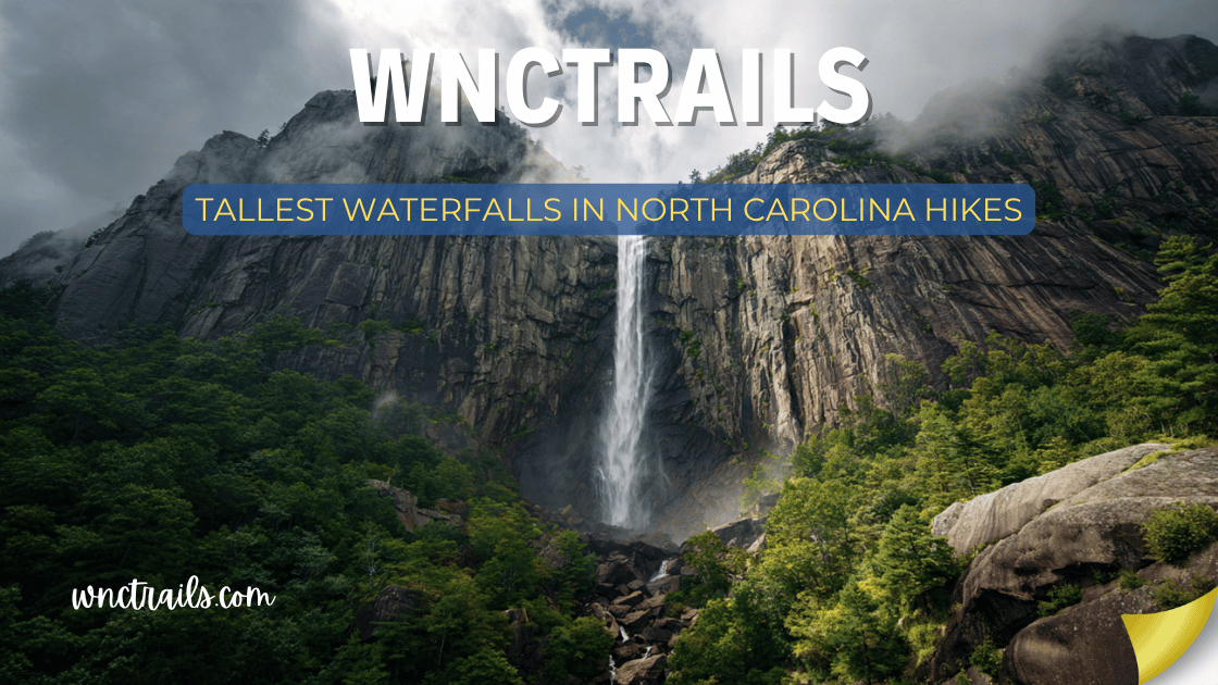
Tallest Waterfalls In North Carolina Hikes
North Carolina is home to some of the tallest waterfalls in the entire eastern United States — and most of them are reachable by trail. The combination of ancient granite geology, high-elevation ridgelines, and over 60 inches of annual rainfall in some gorges creates the conditions for truly monumental cascades that dwarf anything in the mid-Atlantic or New England.
This guide ranks the tallest waterfalls in North Carolina by verified drop height, with full trail details for each one. Whether you’re chasing records or just want the most dramatic scenery possible, these are the falls that stop you in your tracks.
How height is measured: Waterfall heights can vary by source depending on whether the total cascade, the longest single plunge, or the combined multi-tier drop is measured. Heights listed here reflect the most widely documented figures from the U.S. Geological Survey, North Carolina state parks, and the National Park Service.
Tallest Waterfalls in North Carolina — Ranked by Height (2026 Guide)
Recommended Tools
Disclosure: This page may contain affiliate links.
- Water Shoes — Check current pricing
- Rain Jacket — Check current pricing
- Dry Bag — Check current pricing
North Carolina is renowned for its dramatic mountain landscapes and abundant waterfalls, many of which rank among the tallest in the eastern United States. For hikers, these cascades offer not just stunning views but also rewarding trails that wind through lush forests and rugged terrain. Whether you seek a challenging trek to a remote overlook or a gentle path to a family-friendly vantage point, the tallest waterfalls in North Carolina hikes provide memorable experiences for all skill levels.Ranked: Tallest Waterfalls in North Carolina
| Rank | Waterfall | Height | Location | Trail Difficulty |
|---|---|---|---|---|
| #1 | Whitewater Falls | 411 ft | Nantahala NF | Easy |
| #2 | Hickory Nut Falls | 404 ft | Chimney Rock SP | Moderate |
| #3 | Rainbow Falls | 150 ft | Gorges State Park | Strenuous |
| #4 | High Falls | ~150 ft | DuPont State Forest | Easy–Moderate |
| #5 | Mingo Falls | 120 ft | Cherokee | Easy |
| #6 | Catawba Falls | 100 ft | Pisgah NF / Old Fort | Moderate |
| #7 | Linville Falls | 90 ft | Blue Ridge Parkway | Moderate |
| #8 | Pearson’s Falls | 90 ft | Near Tryon | Easy |
| #9 | Dry Falls | 75 ft | Nantahala NF | Easy |
| #10 | Crabtree Falls | 70 ft | Blue Ridge Parkway | Moderate |
| #11 | Elk Falls | 65 ft | Elk Park | Easy–Moderate |
| #12 | Looking Glass Falls | 60 ft | Pisgah NF | Easy |
#1 — Whitewater Falls: 411 Feet
Difficulty: Easy to upper overlook | Distance: 0.2 miles (overlook) / 2.0 miles (lower falls) | Location: Nantahala National Forest, near Cashiers
The tallest cascading waterfall east of the Rocky Mountains. Whitewater Falls drops 411 feet in a series of powerful cascades through a granite gorge on the Whitewater River — a figure that puts it in a league with waterfalls found in the American West, not the Appalachians.
The upper overlook is a short, paved 0.2-mile walk from the parking lot and delivers the full-length view of the cascade in all its scale. What’s striking isn’t just the height — it’s how the falls seem to keep going. Just when you think it’s done, there’s more.
For a more immersive experience, the lower trail descends 1.0 mile into South Carolina (the base of the falls crosses the state line) to a viewpoint near the plunge pool. The climb back up is strenuous.
The record: At 411 feet, Whitewater Falls is taller than Niagara Falls (167 ft) by more than double. Let that sink in.
Trail highlights:
- Upper overlook: 0.2 miles, paved, suitable for all ages
- Lower falls trail: 2.0 miles round-trip, steep descent, enters South Carolina
- $5/vehicle day-use fee; America the Beautiful Pass accepted
- Restrooms at trailhead; well-maintained facilities
- Dogs welcome on leash at the overlook
Photography tip: Visit in the morning when eastern light illuminates the face of the falls. A polarizing filter dramatically reduces glare on the white water.
Safety note: The overlook barriers exist for a reason — multiple fatalities have occurred at this site. Never climb beyond them regardless of conditions or the apparent accessibility of rocks below.
Coordinates: 35.0338° N, 83.0004° W
#2 — Hickory Nut Falls: 404 Feet
Difficulty: Moderate | Distance: 2.0 miles round-trip | Location: Chimney Rock State Park, near Chimney Rock
The second-tallest waterfall in the eastern United States, and the one with the most dramatic setting: a sheer granite cliff face rising nearly 500 feet in the middle of Chimney Rock State Park. Hickory Nut Falls gained national recognition when it was featured in the 1992 film The Last of the Mohicans — the waterfall chase scene was filmed here.
The trail climbs steadily through the gorge with Rocky Broad River tumbling alongside, and the falls come into view gradually as you round the final bend — a reveal that earns the word “spectacular.” A viewing platform at the base gives you the full 404-foot height in a single upward gaze.
Trail highlights:
- 2.0-mile round-trip with ~500 ft of elevation gain
- State park admission required: $17/adult, $10/child (ages 5–15)
- The park also offers elevator access to Chimney Rock summit for non-hikers
- Seasonal hours apply — check the state park website before visiting
- Shuttle service available within the park on busy days
Know before you go: The park can sell out of parking on peak summer and fall weekends. Reservations are now required for busy periods — book in advance on the NC State Parks website. Worth every bit of the planning.
Fun fact: The gorge around Hickory Nut Falls is also one of the best places in NC to see peregrine falcons, which nest on the upper cliff faces each spring.
Coordinates: 35.4334° N, 82.2451° W
#3 — Rainbow Falls: 150 Feet
Difficulty: Strenuous | Distance: 5.4 miles round-trip | Location: Gorges State Park, near Sapphire
The hardest hike on this list — and one of the most rewarding. Rainbow Falls drops 150 feet off a granite shelf on the Horsepasture River, which is designated a National Wild and Scenic River through the gorge. The name comes from the afternoon rainbows that form almost daily in the mist at the base — a result of the gorge’s extraordinary rainfall (80+ inches per year in some years).
The descent into the gorge drops nearly 1,000 feet in elevation, passing through some of the most biologically diverse forest in the eastern United States. The vegetation feels almost tropical at the gorge floor — massive hemlocks, dense rhododendron, and a constant soundtrack of rushing water.
Trail highlights:
- 5.4 miles round-trip with ~1,000 ft of elevation change
- One of the most scenic gorge environments in the eastern U.S.
- The Horsepasture River is designated Wild & Scenic by the U.S. Congress
- Afternoon rainbows at the base are common and reliably photogenic
- Can be combined with Turtleback Falls (0.5 miles further) for a bonus waterfall
Know before you go: The return climb is relentless. Pace yourself and your hiking party carefully — the ascent takes significantly longer than the descent. Bring at minimum 2 liters of water per person and expect 4–5 hours round-trip.
Photography tip: Visit in the early afternoon (1–3 PM) in summer when the angle of light through the gorge creates the rainbow effect at the base of the falls.
Coordinates (Trailhead): 35.1063° N, 82.9615° W
#4 — High Falls: ~150 Feet
Difficulty: Easy–Moderate | Distance: 3.5-mile loop (with Triple Falls) | Location: DuPont State Recreational Forest, near Brevard
The most accessible tall waterfall in Western NC, High Falls is the broadest and most powerful of DuPont State Forest’s five major cascades. The Little River spreads across a wide granite face and drops approximately 150 feet in a stunning, broad cascade that feels more like a natural dam break than a conventional waterfall.
Unlike Rainbow Falls (also ~150 ft), High Falls is reachable via an easy-to-moderate loop trail that also passes Triple Falls and Hooker Falls — three major waterfalls in a single 3.5-mile circuit. It’s one of the best waterfall-per-mile ratios in the state.
Trail highlights:
- ~150-foot broad cascade on the Little River
- Part of the classic DuPont waterfall loop with Triple Falls and Hooker Falls
- Filming location for The Hunger Games (Triple Falls section)
- Free to enter; multiple trailhead parking areas
- Dogs welcome on leash throughout DuPont
Know before you go: The overlook above High Falls is unfenced in places — stay on designated areas and keep children and dogs close to the edge. The current above the falls is extremely powerful.
Photography tip: Shoot from the rocks downstream on a cloudy day — overcast light eliminates harsh shadows and makes the white water pop against the dark granite.
Coordinates (Hooker Falls Trailhead, nearest lot): 35.1906° N, 82.6380° W
#5 — Mingo Falls: 120 Feet
Difficulty: Easy | Distance: 0.4 miles round-trip | Location: Cherokee, NC (Qualla Boundary)
The most dramatic short hike on this entire list. Mingo Falls drops 120 feet through a narrow, lush gorge in the heart of Cherokee, and requires nothing more than a well-maintained staircase to reach the viewing platform at its base. For 0.4 miles of walking — almost entirely steps — the visual payoff is extraordinary.
What makes Mingo Falls uniquely powerful is how it appears: the gorge is narrow and densely forested, so you don’t see the full height of the falls until you’re standing right in front of it. The reveal is immediate and stunning.
The falls hold cultural significance to the Eastern Band of Cherokee Indians and are one of the most visited natural landmarks in their tribal territory.
Trail highlights:
- 120-foot single-plunge cascade visible in full from the viewing platform
- Approximately 200 steps from trailhead to base — a genuine short workout
- Free to visit; paved road access directly to the trailhead
- Culturally significant landmark within the Qualla Boundary
Know before you go: The steps descend after the falls viewing platform to a small area near the creek — this lower section is rockier and less maintained. Most visitors stop at the main platform, which offers the best view.
Coordinates: 35.5665° N, 83.2662° W
#6 — Catawba Falls: 100 Feet
Difficulty: Moderate | Distance: 2.8 miles round-trip | Location: Pisgah National Forest, Old Fort
The tallest single-drop waterfall in Pisgah National Forest, Catawba Falls plunges 100 feet through a rocky gorge carved by the Catawba River just outside the small town of Old Fort. The hike follows the river upstream with multiple creek crossings before the falls appear around a final bend — the kind of arrival that makes the 2.8-mile round trip feel worthwhile.
At 100 feet, the falls produce significant mist and sound — you hear them before you see them. The spray creates a microclimate that supports dense moss and fern growth on the surrounding rocks, giving the falls an almost prehistoric feel.
Trail highlights:
- 100-foot single plunge — tallest single drop in Pisgah NF
- Multiple creek crossings add adventure and water access throughout
- Just 5 miles off I-40 exit 73 — excellent access from the interstate
- Dogs welcome on leash
- Popular with locals; less known to tourists
Know before you go: The creek crossings can be knee-deep or higher after significant rainfall. Check recent trail conditions on AllTrails or the Pisgah NF website before going. Water shoes are essential — this is not a dry-foot hike.
Coordinates: 35.6281° N, 82.1668° W
#7 — Linville Falls: 90 Feet
Difficulty: Moderate | Distance: 1.6–3.4 miles depending on trail | Location: Blue Ridge Parkway, Milepost 316.4
One of the most photographed waterfalls in the entire National Park System, Linville Falls drops 90 feet into the Linville Gorge — the deepest gorge in the eastern United States east of the Grand Canyon. The upper falls make a 12-foot plunge over a broad granite ledge before the river narrows and drops the full 90 feet into the dark, ancient rock below.
What makes Linville visually extraordinary is the gorge itself: sheer, forested walls dropping 2,000 feet to the river below, with the white water visible far beneath. Multiple overlook trails offer different perspectives of the falls and gorge, each one striking.
Trail highlights:
- Four trail options ranging from 0.8 miles to 3.4 miles round-trip
- Multiple overlooks with dramatically different perspectives of the falls and gorge
- NPS visitor center and restrooms at the trailhead
- Located on the Blue Ridge Parkway — combined with a Parkway drive makes for a full day
- Dogs allowed on leash on most trails
Know before you go: This is one of the most-visited NPS sites in North Carolina — summer weekends are extremely crowded. Weekday visits, especially early morning, offer a far better experience. The upper falls overlook (0.8-mile round-trip) is the most accessible option.
Photography tip: The Chimney View overlook (on the Erwins View Trail) offers the most dramatic perspective — gorge walls framing the plunge from above.
Coordinates: 35.9544° N, 81.9279° W
#8 — Pearson’s Falls: 90 Feet
Difficulty: Easy | Distance: 1.0 mile round-trip | Location: Near Tryon, NC (Polk County)
Tied in height with Linville Falls but entirely different in character, Pearson’s Falls drops 90 feet through a privately owned botanical gorge that has been preserved and maintained by the Tryon Garden Club since 1931. The trail passes through a living sanctuary of over 200 species of rare ferns, wildflowers, mosses, and native plants — making this one of the most botanically significant short hikes in the Carolinas.
At 90 feet, the falls create a fine mist that keeps the gorge perpetually cool and damp, which is precisely why such an unusual concentration of rare plant species thrives here.
Trail highlights:
- 90-foot falls in a privately maintained botanical preserve
- 200+ species of rare native plants along the trail corridor
- One of the finest wildflower hikes in NC (peak: April–May)
- $5/adult admission; well-maintained facilities
- Located in the foothills near Tryon — lower elevation, accessible year-round
Know before you go: No dogs allowed. Trail hours are seasonal — check the Pearson’s Falls website before visiting. The lower-elevation foothills location means it can be hot in summer compared to higher-altitude waterfalls on this list.
Coordinates: 35.2126° N, 82.1549° W
#9 — Dry Falls: 75 Feet
Difficulty: Easy | Distance: 0.1 miles | Location: Nantahala National Forest, near Highlands
The most accessible tall waterfall on this list, Dry Falls drops 75 feet over a granite overhang on the Cullasaja River — and the paved path beneath it lets you walk directly behind the curtain of water without getting soaked. At 75 feet, the waterfall creates an impressive wall of sound and mist even from inside the alcove.
It’s a short stop, but an immersive one: the feeling of standing behind a 75-foot waterfall is something most people never experience.
Trail highlights:
- 75-foot waterfall you can walk completely behind
- Paved, accessible path — excellent for limited mobility visitors
- $5/vehicle fee; restrooms available
- Pairs naturally with Bridal Veil Falls and Whitewater Falls in a single afternoon
Know before you go: The path behind the falls is perpetually damp and slippery — take slow, deliberate steps. The sound level behind the falls can be intense for young children or hearing-sensitive visitors.
Coordinates: 35.0574° N, 83.2219° W
#10 — Crabtree Falls: 70 Feet
Difficulty: Moderate | Distance: 2.5-mile loop | Location: Blue Ridge Parkway, Milepost 339.5
The most underrated tall waterfall on the Blue Ridge Parkway, Crabtree Falls drops 70 feet in a single elegant curtain into a hemlock-lined gorge that feels genuinely remote. The 2.5-mile loop descends through old-growth forest with mountain stream access throughout before delivering you to the base of the falls.
At 70 feet, the drop is substantial enough to generate real mist and sound — unlike smaller roadside falls, Crabtree fills the gorge with presence.
Trail highlights:
- 70-foot single-plunge cascade in a secluded hemlock gorge
- 2.5-mile loop — no backtracking
- Far less crowded than nearby Linville Falls
- Crabtree Meadows Campground adjacent — great overnight option
- Dogs allowed on leash
Know before you go: The loop can be done in either direction, but counterclockwise (left fork first) gives a steeper descent with a more gradual return — better for most hikers. Spring wildflowers along the trail are exceptional.
Coordinates: 35.8076° N, 82.1418° W
#11 — Elk Falls: 65 Feet
Difficulty: Easy–Moderate | Distance: 1.0 mile round-trip | Location: Elk Park, Avery County
One of the most undervisited tall waterfalls in the NC High Country, Elk Falls drops 65 feet on the Elk River near the small town of Elk Park in Avery County. The short trail follows the river downstream through a mixed hardwood forest to a large plunge pool at the base.
Because it sits well outside the Asheville and Boone tourist corridors, Elk Falls rarely sees the crowds that comparable waterfalls attract — making it a premium experience for those willing to seek it out.
Trail highlights:
- 65-foot plunge into a large, swimmable pool
- Short, accessible trail with well-maintained path
- One of the quietest major waterfalls in the High Country
- Dogs allowed on leash
- Free to visit with good trailhead parking
Know before you go: Local climbers and swimmers use this area heavily on summer weekends. The pool is a popular cliff-jumping spot — exercise caution and assess water depth carefully before any jumping from height.
Coordinates: 36.1731° N, 81.9846° W
#12 — Looking Glass Falls: 60 Feet
Difficulty: Easy | Distance: 0.2 miles | Location: Pisgah National Forest, US-276
The most visited waterfall in Western NC, and a fitting cap to this list. Looking Glass Falls drops 60 feet in one of the widest, most powerful displays of any waterfall in the region. Its position right off a major road, with a staircase leading to the base, makes it the most-seen tall waterfall in the state.
At 60 feet it is the smallest on this ranked list, but its width and volume make it feel as commanding as many taller falls. The spray at the base reaches 20–30 feet out into the viewing area — especially impressive in spring.
Trail highlights:
- 60-foot wide cascade with exceptional width and volume
- Free and easily accessible year-round
- Part of the US-276 waterfall cluster — easiest to combine with other stops
- Staircase with railings; suitable for most visitors
Know before you go: Parking fills extremely fast on summer weekends. This is one of the first stops most WNC visitors make — the crowds reflect that. Early mornings are the only reliable strategy for a relaxed visit.
Coordinates: 35.3025° N, 82.7648° W
Planning a “Tallest Waterfalls” Road Trip in NC
If you want to check off the tallest falls in the state, here’s how to build an efficient multi-day itinerary:
Day 1 — The Highlands/Cashiers Zone (Falls #1, #3, #6*)
Start at Whitewater Falls (411 ft) in the morning — the light is best early. Drive to the Gorges State Park trailhead for Rainbow Falls (150 ft) — allow 4–5 hours round-trip. End the day in Cashiers or Highlands and note that Catawba Falls (#6) is a 90-minute drive east, best saved for another day.
Day 2 — Brevard / DuPont Zone (Falls #4)
High Falls (150 ft) via the DuPont waterfall loop hits three major falls in one circuit. Brevard is a charming base town with excellent food and lodging — spend the night.
Day 3 — Blue Ridge Parkway Corridor (Falls #7, #10)
Drive the Parkway south to north: Linville Falls (90 ft) at Milepost 316.4, then continue to Crabtree Falls (70 ft) at Milepost 339.5. Pair with a sunset drive on the Parkway between stops.
Day 4 — Cherokee + Pisgah (Falls #5, #6, #12)
Morning at Mingo Falls (120 ft) in Cherokee — short and stunning. Afternoon drive to Old Fort for Catawba Falls (100 ft). Finish the day at Looking Glass Falls (60 ft) in Pisgah as a scenic close to the trip.
Key Considerations
- Trail Difficulty: The hikes to the tallest waterfalls range from easy, paved paths to steep, rocky climbs. Research the distance, elevation gain, and trail conditions before heading out, and match your hike to your fitness and experience level.
- Safety: Waterfall areas can be slippery, especially after rain. Stay on marked trails and observe posted warnings—venturing too close to the edge is dangerous and can be fatal. Supervise children and pets closely.
- Weather: Mountain weather changes quickly. Bring rain gear, layers, and plenty of water. Trails may close temporarily due to flooding or ice; check current conditions before your trip.
- Leave No Trace: Protect these natural wonders by packing out trash, staying on trails, and respecting wildlife. Many waterfall areas are sensitive habitats for rare plants and animals.
- Parking and Access: Some popular trailheads fill up quickly, especially on weekends and holidays. Arrive early or consider visiting on weekdays for a quieter experience.
Common Use Cases
- Day Hiking: Most visitors seek out the tallest waterfalls in North Carolina for day hikes, enjoying a few hours on the trail with scenic rewards at the end. Whitewater Falls and Linville Falls are classic choices for this type of outing.
- Photography: Waterfalls offer spectacular photo opportunities, especially in the morning or late afternoon when lighting is softer. Bring a tripod for long exposure shots and plan for misty conditions near the falls.
- Family Adventures: Several waterfall trails, such as those to Dry Falls or Looking Glass Falls, are short and accessible, making them suitable for families with young children or visitors with limited mobility.
- Backpacking: Ambitious hikers can incorporate multiple waterfalls into longer backpacking routes, especially in areas like the Pisgah National Forest or along the Mountains-to-Sea Trail.
- Nature Study: Waterfall environments support unique plant and animal communities. Birdwatchers and wildflower enthusiasts will find plenty to observe along these trails, particularly in spring and early summer.
Final Thoughts
North Carolina’s tallest waterfalls are not footnotes in a guidebook — they are genuine natural wonders that rival anything the eastern United States has to offer. From the record-setting drop of Whitewater Falls to the quiet grandeur of Elk Falls, each cascade on this list earns its place.
Chase the height. Earn the views. The mountains are waiting.
Frequently Asked Questions
- What is the tallest waterfall in North Carolina?
Whitewater Falls, located near the border with South Carolina, is the tallest, dropping a total of 411 feet over two tiers. The main overlook is accessible by a short paved path, with additional viewpoints reached by stairs. - Are the tallest waterfall hikes suitable for beginners?
Some, like Whitewater Falls and Dry Falls, have accessible paths suitable for most visitors. Others, such as Rainbow Falls or Crabtree Falls, require more strenuous hikes with uneven terrain and elevation gain. Always check trail details before setting out. - Can you swim at the base of these waterfalls?
Swimming is not recommended at most of the tallest waterfalls due to strong currents, slippery rocks, and hazardous conditions. Some smaller falls or downstream pools may be safer, but always heed posted signs and use caution. - When is the best time to see the waterfalls?
Late spring and early summer usually provide the highest water flow, but autumn adds vibrant foliage for a different visual experience. Winter visits may reveal stunning ice formations, though access can be limited by weather. - Do I need a permit or pay a fee to hike to these waterfalls?
Most waterfall trails in national forests are free, though some areas (like Gorges State Park or certain parking lots) may require a small fee. Check with the managing agency or park for current information.
For those seeking the tallest waterfalls in North Carolina hikes, planning ahead ensures a safe and memorable adventure. Explore responsibly, respect the landscape, and enjoy the natural splendor that makes Western North Carolina a premier destination for waterfall enthusiasts.
Related Pages
Know a tall waterfall in NC we should add to this ranking? Drop the details in the comments below!
Explore every trail and waterfall in Western NC at WNCTrails.com →