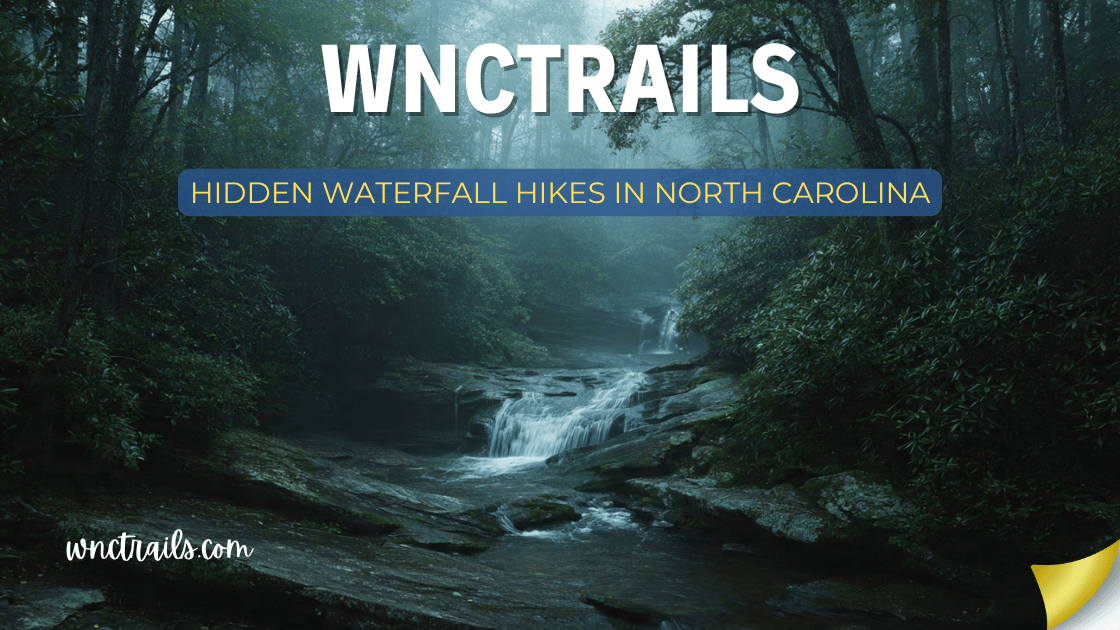
Hidden Waterfall Hikes In North Carolina
North Carolina has over 250 named waterfalls — and most visitors see the same ten. Looking Glass Falls, Linville Falls, Graveyard Fields: they’re magnificent, and they’re packed on summer weekends. But for every famous cascade on a major road, there are a dozen more tucked into remote hollows, forest service corridors, and backcountry canyons that most people drive right past without ever knowing they exist.
This guide is for the hikers who want something different. These are the hidden waterfall hikes in North Carolina — off the tourist radar, rarely photographed, and completely worth seeking out. No crowds. No parking wars. Just you, the forest, and a waterfall that feels like your own private discovery.
What makes a waterfall “hidden”: Every waterfall on this list appears on few or no mainstream travel guides, has minimal signage from main roads, requires research or local knowledge to find, and consistently sees a fraction of the visitors that comparable falls attract.
Hidden Waterfall Hikes in North Carolina (2026 Guide)
Recommended Tools
Disclosure: This page may contain affiliate links.
- Water Shoes — Check current pricing
- Rain Jacket — Check current pricing
- Dry Bag — Check current pricing
Quick Reference: Hidden Waterfall Hikes
| Waterfall | Location | Distance | Difficulty | Crowd Level |
|---|---|---|---|---|
| Silver Run Falls | Near Cashiers | 0.5 mi | Easy | Very Low |
| Soco Falls | Near Maggie Valley | 0.3 mi | Easy | Very Low |
| Tom’s Creek Falls | Near Marion | 1.0 mi | Easy | Very Low |
| Setrock Creek Falls | Near Black Mountain | 1.5 mi | Easy–Moderate | Very Low |
| Glen Burney Falls | Blowing Rock | 2.4 mi | Moderate | Low |
| Roaring Fork Falls | Near Hot Springs | 0.4 mi | Easy | Very Low |
| Caney Fork Falls | Jackson County | 3.0 mi | Moderate | Very Low |
| Fishhawk Falls | Near Todd / Boone | 1.0 mi | Easy | Very Low |
| Paradise Falls | Near Hendersonville | 2.0 mi | Moderate | Low |
| Bust Your Butt Falls | Near Highlands | 0.6 mi | Easy | Very Low |
| Lost Cove Creek Falls | Near Linville | 4.0 mi | Strenuous | Very Low |
| Schoolhouse Falls | Panthertown Valley | 4.0 mi | Moderate | Low |
1. Silver Run Falls — Near Cashiers, NC
Distance: 0.5 miles round-trip | Difficulty: Easy | Crowd Level: Very Low
One of the most beautiful swimming hole waterfalls in Western NC — and almost no one knows it exists. Silver Run Falls drops about 40 feet into a wide, clear pool on Silver Run Creek just off NC-107 south of Cashiers. The water runs over pale granite with an almost silver shimmer in sunlight — which explains the name and the remarkable clarity of the pool below.
For a half-mile walk from the parking area, this is as good as waterfall swimming gets in the region. The pool is deep, the current is gentle at the edges, and the granite slabs surrounding it are perfect for sunbathing after a swim.
Why it stays hidden: It sits just a few miles from the heavily-visited Whitewater Falls, and most visitors drive straight to the famous site without stopping. The turnoff for Silver Run is easy to miss, and there’s no significant signage drawing attention to it.
Trail highlights:
- Beautiful 40-foot cascade into one of the finest natural swimming holes in WNC
- Pale granite streambed gives the water an unusual silver-blue clarity
- Short and flat — accessible for almost everyone
- Free to visit; small roadside parking area
Know before you go: The parking area holds only 6–8 vehicles. Visit on weekdays or early morning; locals do know this one and it can get busy on summer weekends despite its low profile. No facilities at the trailhead.
Best time to visit: Late June through August for swimming; spring for maximum waterfall flow.
Coordinates: 35.0712° N, 83.0991° W
2. Soco Falls — Near Maggie Valley, NC
Distance: 0.3 miles round-trip | Difficulty: Easy | Crowd Level: Very Low
Twin waterfalls dropping side-by-side through a narrow gorge, just a stone’s throw from one of the busiest tourist corridors in Western NC — yet almost entirely overlooked. Soco Falls splits into two parallel streams on Soco Creek near Maggie Valley before dropping 50 feet in a double cascade framed by thick rhododendron and hemlocks.
The combination of the twin falls geometry, the framing vegetation, and the near-total absence of other visitors makes this one of the most photogenic hidden gems in the region. It sits right off US-19, visible through the trees from the road if you know where to look.
Why it stays hidden: The pull-off is unmarked and easy to miss on a fast road. Most drivers on US-19 are headed to Cherokee or the Parkway and have no reason to stop. The falls don’t appear on most waterfall guides.
Trail highlights:
- Twin side-by-side cascades — an unusual and photogenic formation
- 0.3-mile walk to the viewing area; minimal effort for a spectacular result
- Rhododendron canopy creates beautiful tunnel effect on the approach trail
- Free and accessible year-round; no fees or permits
Know before you go: The parking area is an informal pull-off on US-19. Traffic moves fast here — use caution when pulling in and out. The trail to the viewing area is steep but short, with some loose footing near the base.
Best time to visit: Spring when rhododendron is in bloom (late May–June) and water flow is at its peak — this combination is extraordinary.
Coordinates: 35.5011° N, 83.1658° W
3. Tom’s Creek Falls — Near Marion, NC
Distance: 1.0 mile round-trip | Difficulty: Easy | Crowd Level: Very Low
A 60-foot waterfall in McDowell County that almost no one outside the local hiking community knows about. Tom’s Creek Falls drops in a dramatic single plunge through a rocky gorge on the eastern edge of Pisgah National Forest, accessed via a quiet forest service road that sees a fraction of the traffic of the Brevard or Asheville-area trails.
The falls are among the tallest accessible single-drop cascades in the region, and the forest surrounding them — a mix of old-growth hemlock and mature hardwoods — adds to the sense of discovering something genuinely wild.
Why it stays hidden: Located in McDowell County rather than the more-visited Transylvania or Buncombe County corridors, Tom’s Creek Falls sits outside the geographic zone that most WNC waterfall guides cover. The forest service road access further reduces casual visitation.
Trail highlights:
- 60-foot single-plunge waterfall in a pristine gorge setting
- Old-growth hemlock forest along the creek corridor
- Very short and accessible — excellent for visitors who want a significant waterfall without a long hike
- Dogs allowed on leash; free to visit
Know before you go: The forest service road to the trailhead is unpaved and can be rough after rain — clearance helps but most vehicles manage. Download the Pisgah NF map for McDowell County before going; cell service is unreliable in this area.
Best time to visit: Spring (March–May) for maximum flow and wildflowers; fall for foliage.
Coordinates: 35.7356° N, 82.0114° W
4. Setrock Creek Falls — Near Black Mountain, NC
Distance: 1.5 miles round-trip | Difficulty: Easy–Moderate | Crowd Level: Very Low
One of the most undervisited waterfalls near Asheville, Setrock Creek Falls drops in two tiers through a beautiful rocky gorge in the Black Mountain Campground area of Pisgah National Forest. Despite being just 30 minutes from downtown Asheville, the falls see very little traffic — most visitors to the area go directly to the more famous sites in the Brevard or Blue Ridge Parkway corridors.
The lower falls are the more dramatic of the two, dropping about 40 feet into a clear pool accessible from the trail. The upper falls require a short scramble but reward the effort with a more powerful cascade.
Why it stays hidden: The Black Mountain Campground is primarily used by campers accessing the Craggy Gardens and Mount Mitchell areas. Day hikers rarely seek out the waterfall specifically, and it appears on few published trail guides.
Trail highlights:
- Two-tiered waterfall system — lower plunge pool and upper cascade
- Located near the Black Mountain Campground, making it an ideal addition to a camping trip
- Beautiful mixed hardwood and hemlock forest throughout the short approach
- Free day-use access; nominal camping fee if staying overnight
Know before you go: The trail to the upper falls involves some off-trail scrambling on loose rock — use good judgment and appropriate footwear. The lower falls viewpoint is straightforward and accessible to most hikers.
Best time to visit: Spring and early summer for best flow; the campground setting makes fall foliage visits especially pleasant.
Coordinates: 35.7262° N, 82.2677° W
5. Glen Burney Falls — Blowing Rock, NC
Distance: 2.4 miles round-trip | Difficulty: Moderate | Crowd Level: Low
The best-kept waterfall secret in the NC High Country. Glen Burney Falls drops 60 feet through a narrow gorge in the Annie Cannon Gardens — a private nature preserve in Blowing Rock — in a series of three cascades on Glen Mary Creek. The trail descends steeply through a hemlock forest with a quality and quietness that feels completely out of place given how close it is to the shops and restaurants of downtown Blowing Rock.
The three-tiered cascade system — Glen Mary Falls (upper), Glen Burney Falls (middle, the most dramatic), and a lower cascade near the creek floor — creates a waterfall-hopping experience on a short trail with genuine intimacy.
Why it stays hidden: The trailhead is tucked behind a residential neighborhood in Blowing Rock rather than on a major road. Most High Country visitors head directly to the Parkway, Grandfather Mountain, or Rough Ridge — and completely miss this preserve a few blocks from Main Street.
Trail highlights:
- Three named cascades in a single 2.4-mile out-and-back
- Privately maintained nature preserve with unusually pristine trail conditions
- Glen Burney is the most dramatic cascade at 60 feet — a significant plunge in a tight gorge
- Free to visit during daylight hours; no fees
Know before you go: The descent to Glen Burney is steep and requires care on wet days. The return climb is the harder portion — don’t let the short distance mislead you. Trekking poles recommended. Trail closes at sunset.
Best time to visit: Fall for spectacular foliage in the gorge; spring for wildflowers and peak water flow.
Coordinates: 36.1337° N, 81.6739° W
6. Roaring Fork Falls — Near Hot Springs, NC
Distance: 0.4 miles round-trip | Difficulty: Easy | Crowd Level: Very Low
One of the most powerful short-approach waterfalls in the entire state, Roaring Fork Falls drops 80 feet on Roaring Fork Creek in a remote corner of Pisgah National Forest near the small town of Hot Springs. The falls are accessed via a short, easy trail that leads directly to the base of the cascade — where the sound and mist hit you like a wall.
The Madison County location puts it far outside the typical Asheville-Brevard waterfall circuit, and the result is a genuinely crowd-free experience at a waterfall that would attract hundreds of visitors per day if it were 20 miles south.
Why it stays hidden: Hot Springs and Madison County are off the beaten path for most WNC tourists. The town is better known for its natural hot springs and the Appalachian Trail than for waterfall hiking — and Roaring Fork Falls benefits from that anonymity.
Trail highlights:
- 80-foot cascade with exceptional volume and power — impressive even in dry seasons
- Very short trail makes it accessible for most visitors
- Remote location means genuine solitude even on summer weekends
- Dogs allowed on leash; free to visit via the Pisgah National Forest
Know before you go: The road to the trailhead is narrow and winding — not suitable for large RVs or trailers. GPS directions in this area can be unreliable; download the Pisgah NF Hot Springs Ranger District map before going.
Best time to visit: Spring for maximum volume; the falls are powerful year-round due to the large watershed above.
Coordinates: 35.8819° N, 82.7394° W
7. Caney Fork Falls — Jackson County, NC
Distance: 3.0 miles round-trip | Difficulty: Moderate | Crowd Level: Very Low
A true backcountry discovery in one of WNC’s most overlooked wild areas. Caney Fork Falls drops in a spectacular 75-foot plunge on Caney Fork Creek in the Nantahala National Forest south of Sylva — in a gorge that sees almost no recreational traffic despite being one of the finest natural settings in Jackson County.
The trail descends through a forest recovering from chestnut blight damage, with large-diameter oaks and tulip poplars filling the void, before arriving at the base of the falls where the creek has carved a beautiful pool in the bedrock below.
Why it stays hidden: The Caney Fork watershed is primarily known for fishing, not hiking. The trailhead has no signage on the main road, and the area doesn’t appear in any major WNC hiking guides. Finding it requires detailed USGS topo maps or insider knowledge.
Trail highlights:
- 75-foot plunge in a remote, entirely undeveloped gorge
- Outstanding examples of large second-growth forest in a recovering Appalachian landscape
- Good fishing in Caney Fork Creek throughout the hike
- Zero facilities — true backcountry experience
- Dogs allowed; free on National Forest land
Know before you go: Navigation is the primary challenge here — bring a detailed topo map and GPS coordinates loaded offline. The trail is unmaintained in places; route-finding experience is helpful. Wear long pants for overgrown sections.
Best time to visit: Spring through early summer for best flow and manageable trail conditions.
Coordinates: 35.2874° N, 83.2138° W
8. Fishhawk Falls — Near Todd, NC (Ashe County)
Distance: 1.0 mile round-trip | Difficulty: Easy | Crowd Level: Very Low
The best-hidden waterfall in the NC High Country, Fishhawk Falls drops over 50 feet on Beaver Creek in Ashe County — just outside the small community of Todd. The New River flows through this area, and the entire Ashe/Watauga corridor is more known for tubing and Christmas tree farms than waterfalls. That obscurity works in Fishhawk’s favor.
The trail follows Beaver Creek upstream through an open pastoral valley before entering a hemlock grove where the falls appear with almost no warning — a dramatic reveal that rewards the easy walk in.
Why it stays hidden: Ashe County is not on the map for most WNC waterfall seekers. The combination of rural location, lack of state park or national forest designation, and minimal online presence keeps this waterfall remarkably quiet.
Trail highlights:
- 50+ foot cascade in a beautiful hemlock-framed setting
- Short, easy trail through a mix of pastoral and forested terrain
- The High Country setting offers a cooler, less humid microclimate than lower WNC gorges
- Pair with a float on the New River for a full day in Ashe County
- Dogs allowed; free to visit
Know before you go: The access road to the trailhead passes through private land — stay on the designated path and respect property. The falls area itself is on public land. Park only in the designated pull-off area.
Best time to visit: Spring and early summer; the falls are most impressive before the summer dry season sets in.
Coordinates: 36.3195° N, 81.6283° W
9. Paradise Falls — Near Hendersonville, NC
Distance: 2.0 miles round-trip | Difficulty: Moderate | Crowd Level: Low
A 60-foot double waterfall hiding in plain sight between Hendersonville and Brevard, Paradise Falls drops in two graceful tiers on North Mills River Creek in Pisgah National Forest. The falls are located just off the North Mills River Recreation Area — a popular fishing and camping destination — but most visitors never venture the short distance to the falls themselves.
The name fits: the setting is as lush and serene as any waterfall in the region, and the North Mills River valley is genuinely beautiful throughout the approach hike.
Why it stays hidden: The North Mills River area is primarily marketed for trout fishing and family camping, not waterfall hiking. Visitors who know the area for camping rarely connect it with a notable waterfall destination.
Trail highlights:
- Two-tiered cascade with a beautiful combined drop of ~60 feet
- Located in the North Mills River Recreation Area — combine with camping for an overnight trip
- Well-maintained trail with good footing throughout
- Dogs allowed on leash; small day-use fee for the recreation area
Know before you go: The North Mills River Recreation Area charges a day-use fee. The trail to the falls is not the main feature of the recreation area and is not heavily signed — ask at the entrance station for directions or check AllTrails beforehand.
Best time to visit: Spring for full water flow; the recreation area is beautiful in fall foliage.
Coordinates: 35.4244° N, 82.6489° W
10. Bust Your Butt Falls — Near Highlands, NC
Distance: 0.6 miles round-trip | Difficulty: Easy | Crowd Level: Very Low
With a name this good, it deserves its own section. Bust Your Butt Falls — yes, that’s its real, USGS-recognized name — drops about 20 feet on the West Fork of the Chattooga River near Highlands in a tight, moss-covered gorge that feels perpetually damp and green. The name reportedly comes from the slippery rocks on the approach, which have launched more than a few hikers unexpectedly onto their backsides.
The falls themselves are modest in height but exceptional in setting — the dark, wet rock, the dense rhododendron overhang, and the unusual name combine to make this one of the most memorable short waterfall stops in the Highlands area.
Why it stays hidden: The Chattooga headwaters area near Highlands has several waterfalls, but most visitors head for the more famous Bridal Veil and Dry Falls. Bust Your Butt’s unusual name doesn’t appear in polished travel content, and the trailhead is informal.
Trail highlights:
- Uniquely named USGS-recognized waterfall — a conversation piece guaranteed
- Lush, perpetually green gorge setting on the Chattooga headwaters
- Short enough for virtually any visitor
- Free; no permits required on National Forest land
Know before you go: The name is a warning — the rocks here are genuinely slippery even in dry conditions. Water shoes or boots with good grip are not optional. Move slowly near the falls and enjoy the view from stable ground.
Best time to visit: Year-round; the gorge vegetation is beautiful in all seasons.
Coordinates: 35.0503° N, 83.2448° W
11. Lost Cove Creek Falls — Near Linville, NC
Distance: 4.0 miles round-trip | Difficulty: Strenuous | Crowd Level: Very Low
The best-hidden backcountry waterfall in the Linville area, Lost Cove Creek Falls is located in a remote corner of the Pisgah National Forest between Linville Falls and the Blue Ridge Parkway — in a zone that most visitors pass directly over on the way to the famous Parkway overlooks without ever knowing what lies in the gorge below.
The trail descends steeply from the ridge into the Lost Cove Creek watershed, where a series of cascades culminate in the main falls — a dramatic plunge in a narrow gorge surrounded by old-growth timber that the logging era somehow missed.
Why it stays hidden: The descent into Lost Cove requires significant effort with no paved road access or developed facilities. The area is not part of the Linville Gorge Wilderness trail system that most guidebooks cover, and it requires detailed USGS topo navigation to find the falls themselves.
Trail highlights:
- Backcountry cascade in a genuine old-growth forest pocket — rare in the region
- Completely undeveloped — no facilities, no signage, no crowds
- The Lost Cove Creek corridor contains some of the most pristine wilderness in the Linville area
- Outstanding for experienced hikers seeking solitude and off-trail exploration
Know before you go: This hike requires offline navigation and route-finding experience. The descent is steep and the trail is unmaintained in the lower section. Appropriate only for experienced hikers comfortable with backcountry travel. Tell someone your plan before going.
Best time to visit: Late spring (May–June) for maximum flow before summer dry-down.
Coordinates: 36.0014° N, 81.9487° W
12. Schoolhouse Falls — Panthertown Valley, Nantahala NF
Distance: 4.0 miles round-trip | Difficulty: Moderate | Crowd Level: Low
The most swimmable hidden waterfall in North Carolina, and the crown jewel of the Panthertown Valley trail system. Schoolhouse Falls drops 15 feet into a perfectly circular, deep pool on Panthertown Creek — a pool so geometrically ideal that it looks digitally designed. The crystal-clear water, the granite walls of the pool, and the waterfall framing create a swimming experience that feels genuinely world-class.
The 4-mile round trip via the Cold Mountain trailhead takes you through the open granite dome landscape of Panthertown Valley — one of the most distinctive landscapes in WNC — before descending to the falls.
Why it stays hidden: Panthertown Valley is known within the local hiking community but largely absent from mainstream travel guides. The unpaved road access and multi-mile approach keep casual visitors away. It appears almost nowhere in WNC tourist content.
Trail highlights:
- Perfectly circular natural swimming pool — one of the finest in the entire Southeast
- The Panthertown Valley setting adds granite dome scenery unlike anywhere else in WNC
- Part of a larger trail network with 5–6 additional named waterfalls nearby
- Backcountry camping available in the valley — overnight trips are exceptional
- Dogs allowed on leash; free on National Forest land
Know before you go: The Cold Mountain Road approach is unpaved — manageable in most vehicles in dry conditions but muddy after rain. Download the Panthertown Valley trail map from the Nantahala NF website before going; the trail network has many junctions.
Best time to visit: July and August for swimming; the water is cold but the pool is irresistible.
Coordinates (Cold Mountain Trailhead): 35.1063° N, 83.0547° W
How to Find Hidden Waterfalls on Your Own
The best hidden waterfalls in North Carolina aren’t on this list — they’re the ones no one has published yet. Here’s how locals and experienced hikers find them:
Use USGS Topo Maps
The U.S. Geological Survey topographic maps show every named waterfall and creek in the country. The USGS National Map viewer (nationalmap.gov) lets you search for waterfalls by name in any county. This is how you find falls that have been named and surveyed but never written about.
Follow the Contour Lines
On a topo map, closely-spaced contour lines indicate steep terrain. When a creek crosses closely-spaced contours, there’s almost certainly a waterfall there. Experienced hikers read topo maps the way musicians read sheet music — the falls are written right there in the elevation data.
Cross-Reference with Satellite Imagery
Google Earth and the satellite view on Google Maps can show the white water of a cascade if the resolution is good enough and the water flow is sufficient. Zoom into creek corridors in areas with dense contour lines and look for the tell-tale white streak.
Talk to Forest Service Staff
Rangers at the Pisgah, Nantahala, and Uwharrie district offices know the waterfalls in their districts that never make the guidebooks. A five-minute conversation at the ranger station often produces a handwritten note with directions to something extraordinary.
Check Fishing Forums
Trout fishermen know every pool and cascade on every creek in WNC. Fly fishing forums and local tackle shop bulletin boards contain waterfall knowledge that never makes it into outdoor publications — because fishermen generally prefer to keep their spots quiet.
The Hidden Waterfall Code
When you find a hidden waterfall — whether from this guide or through your own exploration — there’s an informal ethic worth following:
Don’t geopin it everywhere. Posting precise GPS coordinates and photos on Instagram and AllTrails is how hidden places stop being hidden. Share the experience with friends you trust; be thoughtful about broadcasting it to the internet at large.
Pack out everything you pack in. The reason these places are still pristine is partly because so few people visit. Keep the footprint minimal.
Stay on the trail or on rock. Streamside vegetation and soil are fragile. Beating new paths to waterfalls causes erosion that can permanently damage the site.
Respect private land. Several hidden waterfalls in WNC are accessible only by crossing or parking on private property. When that access is respected and honored, it tends to remain open. When it’s abused, gates go up.
Key Considerations
Before setting out on a hidden waterfall hike, it’s important to plan carefully. Many of these trails are less maintained than popular routes, so navigation and preparation are essential. Here are several factors to keep in mind:
- Trail Difficulty: Hidden waterfall hikes often involve uneven terrain, creek crossings, or steep sections. Review trail descriptions and maps before heading out, and choose a hike that matches your experience level.
- Navigation: Some trails are not well-marked. Carry a reliable map, GPS, or a downloaded offline trail guide. Cell service can be limited in remote areas.
- Safety: Wet rocks and roots near waterfalls can be slippery. Wear sturdy footwear and use caution around water. Always let someone know your hiking plans.
- Leave No Trace: Help preserve these special places by packing out all trash, staying on established trails, and respecting wildlife and plant life.
- Seasonal Conditions: Waterfall flow is often strongest in spring after rain, but some trails can become muddy or impassable. Check local trail reports for current conditions.
- Parking and Access: Trailheads for hidden waterfalls may have limited parking or require driving on gravel roads. Arrive early and have a backup plan if lots are full.
Preparation ensures a safe and enjoyable outing, especially when exploring less-visited areas.
Common Use Cases
Hidden waterfall hikes in North Carolina appeal to a variety of outdoor enthusiasts and situations:
- Photography: The secluded nature of these trails allows for undisturbed landscape and wildlife photography, especially in early morning or late afternoon light.
- Family Outings: Easy-to-moderate hidden waterfall trails provide a sense of adventure for families seeking kid-friendly hikes without large crowds.
- Solitude Seekers: Those looking to escape busy trailheads and enjoy quiet time in nature often prefer lesser-known waterfall hikes.
- Picnics and Relaxation: Many hidden waterfalls have flat rocks or shaded areas perfect for a peaceful lunch or meditation session.
- Swimming and Wading: Some hidden waterfalls feature swimming holes or shallow pools, but always check safety and water conditions before entering.
- Fitness and Training: More challenging hikes offer a good workout, with the added motivation of a beautiful waterfall destination.
Choosing the right trail depends on your interests, ability level, and desired experience. Many of these hikes can be tailored to fit a range of needs, from quick excursions to full-day adventures.
Final Thoughts
North Carolina’s hidden waterfalls aren’t hidden because they’re less beautiful — they’re hidden because the roads to them are unmarked, the trails are unmaintained, and the travel guides haven’t caught up yet. That is precisely their value.
The best waterfall you’ll ever see is the one nobody else is standing in front of.
Go find yours.
Frequently Asked Questions
- How do I find hidden waterfall hikes in North Carolina?
Research local trail guides, trusted hiking websites, and regional hiking books. Look for trails marked as “less crowded” or “off the beaten path.” Local ranger stations and outdoor outfitters can also provide recommendations. - Are hidden waterfall hikes suitable for beginners?
Some are, especially those with shorter distances and well-maintained paths. Always review trail difficulty and prepare accordingly. Setrock Creek Falls and Grogan Creek Falls are good options for less experienced hikers. - Is there an ideal season for hidden waterfall hikes?
Spring offers strong water flow and wildflowers, while fall provides colorful foliage. Summer brings lush greenery, but some trails may be busier or have higher water levels. Winter hikes can be peaceful but may require extra caution due to ice. - Can I bring my dog on these trails?
Many hidden waterfall hikes in North Carolina are dog-friendly, but always check specific trail regulations. Keep pets leashed, and pack out pet waste. - What should I pack for a hidden waterfall hike?
Essentials include sturdy shoes, water, snacks, a map or GPS, rain gear, a first aid kit, and a camera. Bug spray and trekking poles can be helpful, especially in summer or on uneven terrain. - Are there guided tours for hidden waterfall hikes?
Some local outfitters and hiking clubs offer guided hikes to lesser-known waterfalls. This can be a great way to explore safely and learn about the area’s natural history.
Hidden waterfall hikes in North Carolina invite exploration, reflection, and a deeper connection to the region’s natural beauty. With the right preparation, these trails offer some of the most memorable and rewarding outdoor experiences in the state.
Related Pages
Know a hidden waterfall in NC that deserves to be on this list? Share the details carefully in the comments below.
Explore more off-the-beaten-path trails at WNCTrails.com →