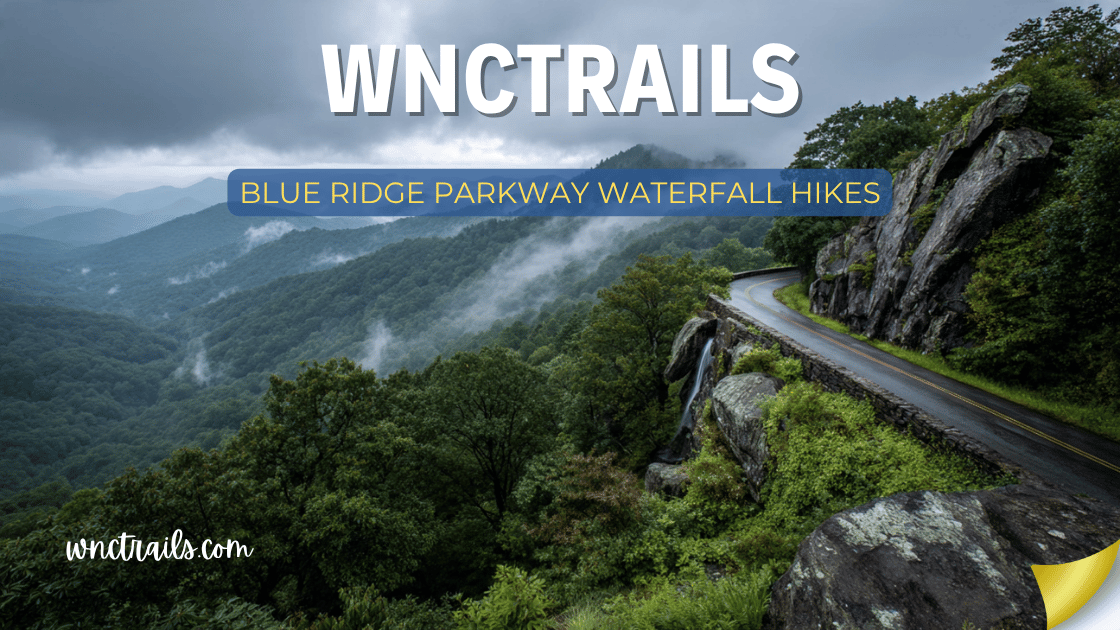
Blue Ridge Parkway Waterfall Hikes
The Blue Ridge Parkway runs 469 miles from Shenandoah to the Smokies — and along its North Carolina stretch alone, more than a dozen waterfalls are reachable within a mile of the road.
That’s the thing about the Parkway that casual visitors miss. Most people know it as a scenic drive. What they don’t fully appreciate is that the Parkway functions as a waterfall access highway — a 252-mile NC stretch that crosses the headwaters of the French Broad, the Linville River, the New River, and dozens of smaller streams, each one dropping off the Blue Ridge escarpment in cascades that range from roadside trickles to 404-foot plunges.
Linville Falls alone draws more than a million visitors per year. Graveyard Fields’ Second Falls fills its parking lot by 9 AM on fall weekends. Crabtree Falls is one of the most underrated waterfalls in the Southeast. Skinny Dip Falls is the kind of local secret that becomes less secret every season.
This guide covers every significant waterfall on the Blue Ridge Parkway in North Carolina — organized north to south by milepost — with everything you need to plan your trip: trail details, best seasons, photography windows, crowd strategy, and how to link multiple stops into a single Parkway drive.
Blue Ridge Parkway Waterfall Hikes: Complete Guide to Every Waterfall on the Parkway in NC
Recommended Tools
Disclosure: This page may contain affiliate links.
- Water Shoes — Check current pricing
- Rain Jacket — Check current pricing
- Dry Bag — Check current pricing
Quick Reference: Blue Ridge Parkway Waterfalls (North Carolina, North to South)
| Waterfall | Milepost | Distance (RT) | Difficulty | Height | Parkway Fee | GPS |
|---|---|---|---|---|---|---|
| Basin Cove / Doughton Falls | ~238 | 3.0 mi | Moderate | 30 ft | $20 | 36.4102°N, 81.1754°W |
| Cascade Falls (E.B. Jeffress) | 272 | 1.4 mi | Easy | 30 ft | $20 | 36.2201°N, 81.4698°W |
| Linville Falls (Erwin’s View) | 316.4 | 1.6 mi | Easy-Mod | 90 ft | $20 | 35.9575°N, 81.9282°W |
| Linville Falls (Plunge Basin) | 316.4 | 1.4 mi | Moderate | 90 ft | $20 | 35.9561°N, 81.9301°W |
| Upper Creek Falls | ~316 | 4.0 mi | Mod-Hard | 150 ft | No fee (USFS) | 35.8847°N, 81.9102°W |
| Roaring Fork Falls | 347.7 | 0.4 mi | Easy | 60 ft | $20 | 35.8034°N, 82.0878°W |
| Setrock Creek Falls | ~351 | 1.2 mi | Easy | 80 ft | No fee (USFS) | 35.7125°N, 82.2489°W |
| Crabtree Falls | 339.5 | 2.7 mi loop | Moderate | 70 ft | $20 | 35.8210°N, 82.1441°W |
| Glassmine Falls (overlook) | 361.2 | Roadside | Drive-by | 800 ft | $20 | 35.5992°N, 82.4681°W |
| Skinny Dip Falls | 417 | 0.4 mi | Easy | 15 ft | $20 | 35.3271°N, 82.8341°W |
| Graveyard Fields – Second Falls | 418.8 | 1.0 mi | Easy | 60 ft | $20 | 35.3230°N, 82.8552°W |
| Graveyard Fields – Upper Falls | 418.8 | 3.4 mi | Moderate | 50 ft | $20 | 35.3240°N, 82.8482°W |
| Looking Glass Falls* | ~411 | 0.1 mi | Easy | 60 ft | $5 USFS | 35.3113°N, 82.7681°W |
*Looking Glass Falls accessed via US-276 descent from the Parkway, not directly from the BRP. Included for Parkway drive planning.
All BRP waterfalls covered by America the Beautiful Annual Pass ($80). USFS sites (Upper Creek, Setrock Creek) also covered.
How to Use This Guide
The Blue Ridge Parkway in North Carolina runs from the Virginia state line near Cumberland Knob (MP 217.5) to the Tennessee border at Soco Gap (MP 469.1). The waterfalls in this guide follow that south-to-north travel direction, but most visitors approach from specific gateways:
- Northern NC Parkway (Boone / Blowing Rock access): Cascade Falls, Linville Falls, Crabtree Falls
- Central NC Parkway (Asheville access): Glassmine Falls, Roaring Fork Falls, Crabtree Falls
- Southern NC Parkway (Brevard / Asheville access): Skinny Dip Falls, Graveyard Fields, Looking Glass Falls
The most efficient approach is to plan a one-direction Parkway drive with waterfall stops built in — rather than driving to individual trailheads separately. A single day driving the Parkway south from Linville can cover four significant waterfalls.
The Waterfalls: North to South
1. Cascade Falls at E.B. Jeffress Park
The Gentle Northern Start
Milepost: 272.0 | Distance: 1.4 miles RT | Elevation Gain: 175 ft | Difficulty: Easy | Time: 45–75 min
GPS: 36.2201°N, 81.4698°W | Access: E.B. Jeffress Park parking area, MP 272
The Cascade Trail at E.B. Jeffress Park provides one of the most pleasant short hikes on the Parkway — a loop through old-growth hemlock forest along Cove Creek, ending at a 30-foot cascade that drops through a narrow rocky channel into a quiet pool.
The falls are modest compared to Linville or Graveyard Fields, but the surrounding forest is exceptional. The hemlocks here are old-growth specimens that survived the logging era because the terrain was too steep to harvest. Walking beneath them feels genuinely ancient.
The sad reality about hemlock forests: Woolly adelgid, an invasive insect, has killed most eastern hemlock forests in the southern Appalachians since the 1990s. The E.B. Jeffress hemlocks are among the survivors, maintained through treatment programs by the NPS. If they look unusually healthy for a hemlock grove, that’s because significant effort keeps them that way.
Best season: Spring and early summer, when Cove Creek runs with full flow and the understory wildflowers (trillium, wild ginger, bloodroot) are at peak bloom.
Parkway context: E.B. Jeffress is a short detour from the main Parkway — the access road is well-signed from the overlook. Park in the main lot, not on the road shoulder.
2. Basin Cove Falls — Doughton Park
The Remote Northern Option
Milepost: ~238 | Distance: 3.0 miles RT | Elevation Gain: 600 ft | Difficulty: Moderate | Time: 2–3 hours
GPS: 36.4102°N, 81.1754°W | Access: Brinegar Cabin / Basin Cove Overlook, MP 238.5
Doughton Park is one of the least-visited sections of the Parkway in North Carolina — a broad, open landscape of grassy balds and wooded hollows that feels more Appalachian plateau than mountain ridgeline. The Basin Cove waterfall sits at the bottom of a long descent into the basin, accessible via the Basin Creek Trail.
The waterfall is a modest 30-foot cascade, but the hike through Basin Cove is the point — a long, narrow hollow with dense rhododendron thickets, old homestead ruins, and exceptional bird life. This is a place for people who want the experience of the Parkway’s interior rather than just its iconic viewpoints.
Best for: Hikers who want solitude and genuine backcountry feel close to the Parkway. Not worth a dedicated long drive for a 30-foot waterfall alone — plan it as part of a broader Doughton Park exploration.
3. Linville Falls — Multiple Trails
The Parkway’s Most Famous Waterfall
Milepost: 316.4 | Multiple trails: 0.8–4.0 miles | Difficulty: Easy to Moderate | Time: 1–4 hours
GPS (visitor center): 35.9575°N, 81.9282°W | Access: Linville Falls Recreation Area, MP 316.4
Linville Falls is the crown jewel of Blue Ridge Parkway waterfalls in North Carolina — a 90-foot two-stage plunge where the Linville River drops off the Blue Ridge escarpment into the Linville Gorge, one of the most rugged wilderness areas in the eastern United States.
The falls are dramatic from any angle. The gorge they’ve carved — 2,000 feet deep in places — is more dramatic still. The combination makes Linville Falls unique among Parkway waterfalls: it’s both a waterfall worth seeing and a geological showpiece worth spending time with.
The Trail Options:
Erwin’s View Trail (1.6 miles RT, Easy-Moderate) The most popular approach — a gentle climb through mixed forest to a series of four viewpoints overlooking the falls and gorge. The first viewpoint (Chimney View) shows the upper cascade from above. The second (Erwin’s View) shows the full two-stage drop into the plunge pool from the rim of the gorge. Both viewpoints require no scrambling.
This trail is appropriate for most visitors. The surface is maintained crushed gravel on the lower section, transitioning to natural surface. Suitable for children who hike regularly.
Plunge Basin Overlook Trail (1.4 miles RT, Moderate) The south-side trail descends steeply to a viewpoint above the plunge basin — the pool at the base of the lower falls. The perspective here is looking up at the falls from below the rim, which is different and equally dramatic from Erwin’s View. Steep switchbacks require careful footing.
Linville Gorge Trail Extension (Add 1.5–2.5 miles, Hard) For those wanting more, the Linville Gorge Trail continues from the falls overlooks into the gorge proper. The gorge descent is steep and unmaintained in sections — appropriate for fit, experienced hikers with proper footwear. The view from the gorge floor looking up at the lower falls is extraordinary but requires significant effort to reach.
What makes Linville Falls different from other Parkway waterfalls: Most Parkway waterfalls sit in the landscape in isolation — a single falls on a single creek. Linville Falls is embedded in a geological narrative: the escarpment edge, the gorge, the wilderness below, the distinct difference in vegetation between the upper plateau (oaks and rhododendron) and the gorge walls (hemlocks and mosses). The falls are the focal point, but the story around them is what gives them weight.
Crowds: Linville Falls receives over a million visitors per year and is the single most crowded waterfall on the North Carolina Parkway. Weekend visits require early arrival (before 9 AM) or accepting a full parking lot and a busy trail. Weekday visits are dramatically more peaceful. Fall weekends in October are the absolute peak.
Facilities: Linville Falls Recreation Area has a visitor center (seasonal hours), restrooms, picnic tables, and a small campground (first-come-first-served). The visitor center has trail maps and current conditions information.
Photography:
- Erwin’s View is a classic wide-angle composition — bring a tripod and use the longest exposure possible (1–4 seconds) to show the falls motion against the gorge rock.
- The upper cascade is best captured in the morning when the gorge opening allows direct light.
- The plunge basin viewpoint gives a compression effect — 400mm+ equivalent focal length shows the scale of the falls against the gorge walls.
- Overcast days are genuinely better for falls photography here — direct sun creates extreme contrast between the white water and dark gorge shadow.
4. Upper Creek Falls
The Off-Parkway Reward
Nearest Milepost: ~316 | Distance: 4.0 miles RT | Elevation Gain: 800 ft | Difficulty: Moderate-Hard | Time: 2.5–4 hours
GPS: 35.8847°N, 81.9102°W | Access: Upper Creek Trailhead, Collettsville Rd (Burke County), no BRP fee
Upper Creek Falls sits in Pisgah National Forest near the Parkway’s MP 316 corridor, accessed from Collettsville Road below the escarpment rather than from the Parkway itself. The 150-foot cascade — the longest drop sequence in Pisgah — is the most dramatic waterfall in the northern Parkway corridor and sees a fraction of Linville’s crowds.
The trade-off: the hike is longer and harder than any of the Parkway’s direct-access trails. But for visitors based in the Boone / Linville area, combining a Linville Falls Parkway stop with the Upper Creek Falls hike below the escarpment makes an excellent full day.
5. Crabtree Falls
The Best Kept Secret on the Parkway
Milepost: 339.5 | Distance: 2.7 miles loop | Elevation Gain: 560 ft | Difficulty: Moderate | Time: 1.5–2.5 hours
GPS: 35.8210°N, 82.1441°W | Access: Crabtree Meadows Campground, MP 339.5
Crabtree Falls is the most undervisited major waterfall on the Blue Ridge Parkway — a 70-foot free-fall plunge into a rhododendron-ringed pool in the northern Pisgah corridor, reached via a genuine loop hike that is one of the more rewarding short trails on the entire Parkway.
Why it’s undervisited: Crabtree requires actually getting out of the car and hiking 2.7 miles — a moderate commitment that filters out casual visitors. Combined with its location in the less-trafficked northern Pisgah section (far from the Brevard/Asheville visitor concentration), Crabtree regularly sees 20–50 visitors on days when Linville Falls and Graveyard Fields have hundreds.
The hike: The loop descends steeply from Crabtree Meadows Campground through mixed hardwood and hemlock forest, crosses the creek below the falls, and returns on a different route. The falls appear at the bottom of the descent — a vertical plunge over a clean granite ledge into a pool surrounded by thick rhododendron and hemlock branches.
Best season: Mid-June, when the Catawba rhododendron flanking the pool is in full bloom — a combination of the 70-foot plunge and masses of pink-purple flowers that is one of the best single waterfall scenes on the Parkway. Peak bloom varies by year (check with the Parkway for current season), but generally runs June 10–25 at this elevation.
Fall color: Crabtree sits at approximately 3,600 feet — fall color here peaks in mid-October, 1–2 weeks before the lower valleys. The loop trail through hardwood forest is beautiful in fall color; the waterfall with orange and yellow canopy is excellent for photography.
Access note: Crabtree Meadows Campground (the trailhead access) is open seasonally, typically May–October. Outside this window, roadside parking on the Parkway provides access. The campground itself is first-come-first-served, a rarity among Parkway campgrounds, making it popular in peak season.
6. Roaring Fork Falls
Short, Impressive, Overlooked
Milepost: 347.7 | Distance: 0.4 miles RT | Elevation Gain: 80 ft | Difficulty: Easy | Time: 20–35 min
GPS: 35.8034°N, 82.0878°W | Access: Roaring Fork Falls Overlook, MP 347.7
Roaring Fork Falls is one of the Parkway’s best-kept waterfall secrets: a 60-foot plunge accessible via a 10-minute walk from a small Parkway pullout that most people drive past without stopping.
The trail descends briefly through a rhododendron thicket to the base of the falls, which drops off a granite ledge into a clear pool. The surrounding forest is old hemlock and hardwood — quieter and more intimate than the wide-open meadow scenery of Graveyard Fields or the gorge drama of Linville.
The honest assessment: Roaring Fork Falls won’t appear on many “top 10 Parkway waterfalls” lists, but it punches well above its traffic weight. If you’re driving the Parkway between Asheville and the Crabtree area, this is a 30-minute stop that rewards almost anyone who makes it.
Photography: The falls face roughly north, making them shaded most of the day — ideal for waterfall photography (soft, even light) but not for dramatic backlit shots. Overcast days or early morning work best.
7. Setrock Creek Falls
History in the Forest
Nearest Milepost: ~351 | Distance: 1.2 miles RT | Elevation Gain: 150 ft | Difficulty: Easy | Time: 45 min
GPS: 35.7125°N, 82.2489°W | Access: Curtis Creek Campground, accessed via USFS roads from MP 351 area, no BRP fee
Setrock Creek Falls in Curtis Creek watershed sits just below the Parkway in the oldest National Forest land in the eastern United States — purchased by the federal government in 1911 under the Weeks Act. The 80-foot fan waterfall spreads across wide granite in a distinctive broad pattern, reached by a short easy trail.
Curtis Creek is exceptional for its history and ecological recovery story. The watershed was heavily logged in the early 1900s and has been recovering under Forest Service management for over a century — the second-growth forest visible today represents 100-plus years of natural regeneration. Interpretive signs along the trail explain this history.
A stop here pairs naturally with the Parkway drive — the access road from the BRP to Curtis Creek Campground provides a route to the trailhead without significant detour.
8. Glassmine Falls Overlook
The Drive-By Giant
Milepost: 361.2 | Distance: Roadside viewpoint | Difficulty: None | Time: 5–10 min
GPS: 35.5992°N, 82.4681°W | Access: Glassmine Falls Overlook, MP 361.2
Glassmine Falls is the largest waterfall visible from the Blue Ridge Parkway — a 800-foot seasonal cascade that spills down the face of Grassy Ridge above the Bear Creek Valley. The falls are visible from a dedicated overlook at MP 361.2.
The catch: Glassmine is highly seasonal. After significant rain or during snowmelt, the falls are dramatic — a long, thin white thread on the mountain face visible for miles. In dry conditions, they may be entirely absent. There is no hiking trail to the base or any closer view than the overlook.
Planning reality: Glassmine is worth a 5-minute stop if you’re driving past — pull over, scan the mountain face (the falls appear on the right side of the ridge from the overlook perspective), take in the scale, continue. It’s not a destination you’d drive specifically to visit, but it provides dramatic context for the scale of the Blue Ridge escarpment.
When to see it: Best after 24–48 hours of rain. Spring snowmelt from upper elevations produces the most reliable flow. Check recent visitor reports on AllTrails or the Parkway’s social media before going if you want to see the falls active.
9. Skinny Dip Falls
The Young Person’s Parkway Secret
Milepost: ~417 | Distance: 0.4 miles RT | Elevation Gain: Minimal | Difficulty: Easy | Time: 20–40 min
GPS: 35.3271°N, 82.8341°W | Access: Looking Glass Rock Overlook / Parkway pullout near MP 417, walk to trailhead
Skinny Dip Falls is an 15-foot cascade on the North Fork of the Mills River — low, wide, and spread across a broad granite shelf with several natural water slide routes and a decent swimming pool. The name is self-explanatory; the falls have long been known as a local swimming and sunbathing spot, particularly for younger visitors.
The falls are accessed via a short, unmarked trail from a Parkway pullout near MP 417 (the Looking Glass Rock Overlook is nearby — don’t confuse the parking areas). The path is informal but well-worn.
The swimming experience: Multiple granite ledges create natural entry points at different depths. The water is consistently cold (60°F) and the flow in summer is reliable enough for comfortable wading and swimming. It’s a casual, low-pressure swimming hole rather than a dramatic destination.
Crowds: Skinny Dip is known among Brevard locals and Brevard College students but hasn’t yet reached the mainstream visitor radar. On peak summer weekends, you might find 10–20 people; on weekdays, often 2–5. Access while it remains relatively peaceful.
Navigation note: The exact pullout is not marked on most consumer GPS maps. Use the GPS coordinates above and look for the well-worn informal path descending from the pullout toward the sounds of the creek.
10. Graveyard Fields — Second Falls and Upper Falls
The Parkway’s Most Popular Waterfall Destination
Milepost: 418.8 | Second Falls: 1.0 mi RT (Easy) | Both Falls: 3.4 mi RT (Moderate) | Time: 45 min–3 hours
GPS: 35.3230°N, 82.8552°W | Access: Graveyard Fields Overlook, MP 418.8
Graveyard Fields is the peak of the Blue Ridge Parkway waterfall experience in every sense — the most visited, the most photographed, the most often shared on social media, and the most dramatically different from the valley landscapes below.
At 5,120 feet, the Graveyard Fields plateau is the highest elevation waterfall destination in this guide. The surrounding landscape is spruce-fir forest and open bog meadow — genuinely alpine character that feels nothing like the rest of western North Carolina. On a hot August afternoon in Asheville, Graveyard Fields is 15–20°F cooler.
Second Falls (the main falls, 60 feet): A partially paved trail descends from the overlook parking area through the meadow to the base of Second Falls in about 0.5 miles. The falls drop over a wide granite ledge into a rocky basin where swimming is permitted. This trail is accessible for most visitors, including families with older children and fit older adults.
Upper Falls (the better falls, 50 feet): An additional 1.2 miles upstream from Second Falls requires crossing Yellowstone Prong on rocks (no bridge — wet feet likely in spring), climbing a moderate slope, and scrambling to the viewpoint. Upper Falls is a curtain drop over a horizontal ledge into a clean plunge pool surrounded by high-elevation spruce. Most visitors who don’t hike turn around at Second Falls, meaning Upper Falls typically has far fewer people even when the main trail is crowded.
The Graveyard Fields name: The meadow’s peculiar open landscape — treeless bogs and grass, unusual at this elevation — reminded early settlers of a graveyard. Some accounts attribute the name to the tree stumps left after a 19th-century blowdown; others to the shapes of the sphagnum hummocks in the bog. Either way, the name has stuck for more than a century.
The crowd problem and its solution: Graveyard Fields is genuinely, significantly overcrowded on fall and summer weekends. The parking lot (approximately 80 cars) fills by 9 AM on peak October weekends. Cars line the Parkway for half a mile in both directions when the lot is full. This is not a minor inconvenience — it’s a fundamental visitor experience issue the NPS has been studying.
The solution is simple but requires commitment: arrive before 8:30 AM or visit on a weekday. The trail itself is the same experience at 7:30 AM that it is at 11 AM, minus 200 people. A weekday in late October — with full peak color and fewer than 20 people on the trail — is one of the best experiences on the entire Parkway.
Photography:
- Second Falls: A classic wide-angle composition with the meadow upstream in the background. Morning light from the northeast is ideal. The paved viewing platform is positioned for this shot.
- Upper Falls: Long exposure showing the curtain drop. Overcast preferred. The pool reflection in calm weather can be exceptional.
- The meadow itself: In early October, the bog grasses turn deep red and amber — pair this with the falls and the spruce background for a uniquely high-elevation autumn scene.
Waterfall Connections: Descending from the Parkway
The Parkway’s elevation (typically 4,000–5,500 feet in the NC mountains) means it crosses the headwaters of rivers that cascade dramatically off the escarpment before becoming the valley rivers below. Several significant waterfalls are accessed by descending from the Parkway to lower trailheads — technically off the Parkway, but naturally connected to a Parkway day.
US-276 Corridor (Near MP 411)
Descending US-276 from the Parkway toward Brevard connects you to:
- Looking Glass Falls (0.1 mi, 60 ft) — 5 miles down US-276
- Moore Cove Falls (1.4 mi, 50 ft) — walk behind the curtain
- Sliding Rock (0.2 mi) — natural water slide
This descent is one of the most scenic drives in the region regardless of waterfall goals — the Davidson River valley below is beautiful from the road.
NC-181 / Linville Area (Near MP 316)
Descending from the Parkway near Linville connects to:
- Linville Falls (from above via BRP, or from below via Linville Gorge access)
- Upper Creek Falls (USFS road from Collettsville, 150 ft cascade)
Planning a Blue Ridge Parkway Waterfall Drive
The Southern NC Parkway Day (Asheville Base)
Drive north to south, Asheville to the Graveyard Fields area and back
Total Parkway driving: ~40 miles | Total hiking: 2–5 miles depending on options
- 8:00 AM — Depart Asheville, reach Parkway at Hwy 191 junction (MP 393)
- 8:45 AM — Stop at Skinny Dip Falls (MP ~417, 30 min)
- 9:30 AM — Graveyard Fields parking — arrive before it fills (MP 418.8)
- 9:45 AM — Second Falls (30 min)
- 10:30 AM — Upper Falls extension (add 90 min if energy and interest)
- 12:00 PM — Descend US-276 to Looking Glass Falls (15 min drive)
- 12:15 PM — Looking Glass Falls (30 min)
- 12:45 PM — Moore Cove Falls hike (1.4 mi, 60 min)
- 2:15 PM — Lunch at Davidson River Campground picnic area or return to Brevard
- 4:00 PM — Return to Asheville via US-276 north to I-26, or via Parkway northbound
The Northern NC Parkway Day (Boone / Blowing Rock Base)
Drive south, Boone corridor toward Linville and Crabtree
Total Parkway driving: ~70 miles | Total hiking: 3–6 miles
- 8:00 AM — Depart Boone, reach Parkway at Milepost ~290
- 9:00 AM — E.B. Jeffress Park — Cascade Falls trail (MP 272, 1.4 mi, 60 min)
- 10:30 AM — Continue south to Linville Falls Recreation Area (MP 316.4)
- 11:00 AM — Erwin’s View Trail (1.6 mi, 90 min including viewpoint time)
- 12:45 PM — Linville Falls picnic area lunch
- 2:00 PM — Continue south to Crabtree Meadows (MP 339.5)
- 2:30 PM — Crabtree Falls loop (2.7 mi, 1.5 hours)
- 4:30 PM — Return north on Parkway or descend to US-221 for faster return to Boone
The Full NC Waterfall Parkway (Two Days)
For visitors doing the full NC stretch or a road trip along the Parkway
Day 1 (Northern):
- Basin Cove Falls, Doughton Park (MP 238)
- Cascade Falls, E.B. Jeffress Park (MP 272)
- Linville Falls (MP 316.4) — spend 2–3 hours
- Upper Creek Falls (descend from MP 316)
- Stay: Linville Falls Campground or accommodations in Newland/Spruce Pine
Day 2 (Southern):
- Roaring Fork Falls (MP 347.7)
- Crabtree Falls (MP 339.5)
- Glassmine Falls Overlook (MP 361.2)
- Skinny Dip Falls (MP ~417)
- Graveyard Fields (MP 418.8)
- Descend US-276 to Looking Glass Falls and Moore Cove Falls
- Overnight in Brevard or return to Asheville
Practical Information for the Blue Ridge Parkway
Fees and Passes
The Blue Ridge Parkway charges an entrance fee of $20 per vehicle (valid for 7 consecutive days). An America the Beautiful Annual Pass ($80) covers this fee for a full year and is the obvious choice for anyone visiting more than four times or combining BRP visits with other federal lands.
America the Beautiful Pass purchase options:
- Recreation.gov (online, mailed to you)
- Any National Park entrance station
- Linville Falls Visitor Center (seasonal)
- Crabtree Meadows entrance station (seasonal)
The pass does NOT cover: NC State Parks (Chimney Rock, Gorges), state-managed recreational forests (DuPont), or private attractions.
Parkway Road Closures
The Blue Ridge Parkway is subject to frequent closures, especially from November through April. Ice, rockslides, fallen trees, and maintenance work can close sections of the road for days or weeks.
Check current status before every trip: nps.gov/blri/planyourvisit/road-closures.htm
The NPS Parkway app (free, iOS and Android) provides real-time closure notifications and offline maps.
Key closure-prone sections:
- Graveyard Fields area (MP 418): Closes regularly in winter, sometimes for weeks
- Linn Cove Viaduct (MP 304): Closed for maintenance periodically
- Rough Ridge / Linville area: Ice closures common November–March
Cell Service on the Parkway
Cell service on the Blue Ridge Parkway is intermittent and unreliable. Expect no service in most sections between MP 290 and MP 430. Download offline maps before departure — Google Maps offline works, Gaia GPS is better.
The NPS Parkway app provides offline maps and offline trail descriptions.
Speed Limits and Travel Times
The Parkway speed limit is 45 mph but is frequently lower (35 mph) at overlooks, campgrounds, and recreation areas. Actual travel speed averages 35–40 mph accounting for curves, overlook stops, and occasional wildlife.
Rule of thumb: Budget 90 minutes for every 50 miles of Parkway driving, not including stops. The 130-mile stretch from Linville Falls to Graveyard Fields takes at least 3 hours of pure driving time with no stops.
Parking Strategy at Peak-Demand Sites
| Site | Peak Arrival Time | Lot Capacity | Overflow Options |
|---|---|---|---|
| Graveyard Fields (MP 418.8) | 9:00 AM on fall weekends | ~80 cars | Parkway shoulder (0.5 mi each way) |
| Linville Falls (MP 316.4) | 10:00 AM on summer/fall weekends | ~150 cars | Overflow lot (signed, 0.2 mi walk) |
| Crabtree Meadows (MP 339.5) | 11:00 AM (rarely fills) | ~60 cars | Road shoulder |
| E.B. Jeffress (MP 272) | Rarely fills | ~40 cars | Not typically needed |
Universal solution: Arrive 45–60 minutes before peak time, especially at Graveyard Fields in October.
Seasonal Highlights on the Blue Ridge Parkway
Spring Wildflower Windows
The Parkway is one of the best wildflower corridors in the eastern United States. The elevation gradient creates a rolling bloom window that moves upslope from March through June:
- MP 200–280 (lower elevations, 2,500–3,000 ft): Trillium, bloodroot, spring beauty — late March through mid-April
- MP 300–380 (mid elevations, 3,000–4,500 ft): Flame azalea, mountain laurel — late April through May
- MP 400–450 (high elevations, 4,500–6,000 ft): Catawba rhododendron, sand myrtle — late May through June
Crabtree Falls’ surrounding rhododendron peaks mid-June. Graveyard Fields’ bog wildflowers (swamp rose, sundew, bog rosemary) peak in late June.
Fall Color Timeline
The Parkway’s fall color window depends entirely on elevation:
| Elevation | Typical Peak Color | BRP Mileposts |
|---|---|---|
| 5,000+ ft | Late September – Early October | 418 (Graveyard Fields), 430+ |
| 4,000–5,000 ft | First–Second week October | 316, 339, 347 |
| 3,000–4,000 ft | Second–Third week October | 238, 272, 295 |
The color wave moves downslope over 3–4 weeks. Driving the Parkway south in mid-October means the northern sections are past peak while the southern sections are just beginning — a rolling color experience that makes a multi-day Parkway drive particularly rewarding in fall.
Peak visitor demand follows the color: the Parkway sees its highest annual traffic during the third and fourth weeks of October. If you’re planning a fall color Parkway trip, mid-week visits are dramatically less crowded than weekends.
Winter on the Parkway
Winter is the Parkway’s most underrated season for waterfall visitors. After sustained cold spells, several waterfalls develop significant ice formations:
- Linville Falls: Ice builds on the plunge basin walls and overhang sections of the upper falls — one of the best winter ice scenes in NC
- Graveyard Fields Upper Falls: The curtain drop ices over at the edges and builds formations down the surrounding cliff face
- Crabtree Falls: The plunge pool edges and surrounding rocks ice elaborately in cold winters
Ice waterfalls require temperatures consistently below 28°F for at least 3–4 days. Late January and early February are the most reliable windows in most years.
The Parkway in winter: Many sections close due to ice and snow. Check road status at nps.gov/blri before every winter trip. The Graveyard Fields section closes most frequently (high elevation, exposed, limited sun exposure). Linville Falls is more consistently accessible in mild winters.
Wildlife on the Blue Ridge Parkway
The Parkway corridor is exceptional wildlife habitat — protected land that connects the Smokies to Shenandoah, allowing animal populations to move across a 469-mile corridor.
Species commonly seen near waterfall areas:
Black bears: Common throughout the Parkway. Most common sightings are at forest edge and in berry-producing areas (late summer, fall). Bears near trails are not unusual. Keep food secured, don’t approach, move away calmly if you encounter one at close range.
White-tailed deer: Abundant, particularly in the meadow sections near Graveyard Fields and Doughton Park. Most active at dawn and dusk.
Peregrine falcons: Nesting pairs have returned to Linville Gorge — one of the most significant peregrine recovery stories in the East. Watch the gorge walls from the Erwin’s View overlook; the birds are often visible from the Linville Falls viewpoints April through July.
Brook trout: In cold streams below the falls — especially Yellowstone Prong at Graveyard Fields and the upper Davidson River tributaries. Fishing is permitted with NC license; catch-and-release in some sections.
Wild turkeys: Year-round in the oak forest sections, particularly Doughton Park and E.B. Jeffress.
Accessibility on the Blue Ridge Parkway
The Parkway itself is fully accessible by vehicle — the road is paved, well-maintained, and provides access to all overlooks including most waterfall viewpoints. For mobility-limited visitors:
Linville Falls: The first 0.4 miles of Erwin’s View Trail is paved and graded for accessibility. The Chimney View overlook (the first viewpoint) is accessible to visitors who can walk a quarter mile on a firm surface. The full trail to Erwin’s View involves more uneven terrain.
Graveyard Fields: The first section of trail (to the Yellowstone Prong footbridge) is partially paved and accessible. The viewpoint near the bridge provides partial views of the falls without completing the full trail. The path to the swimming basin at Second Falls includes uneven rock terrain near the base.
Crabtree Falls: No accessibility-focused trail routing — the loop is steep in both directions. Not recommended for visitors with significant mobility limitations.
Glassmine Falls: Fully accessible — roadside overlook, no walking required.
Roaring Fork Falls: The trail descends 0.2 miles on natural surface. Manageable for many mobility-limited visitors depending on ability.
Where to Stay Along the NC Parkway
Parkway Campgrounds (NC Section)
All Parkway campgrounds require the $20 Parkway fee. Reservations at Recreation.gov recommended for peak season (April–October). First-come-first-served in shoulder season.
- Linville Falls Campground (MP 316.4): Best base for northern NC waterfalls. Walking distance to Linville Falls trailhead.
- Crabtree Meadows Campground (MP 339.5): Directly at Crabtree Falls trailhead. First-come-first-served (no reservation system).
- Mount Pisgah Campground (MP 408.6): Best base for Graveyard Fields and the southern Parkway. 10 miles from Graveyard Fields parking.
- Price Park Campground (MP 297): Near Blowing Rock, good base for Cascade Falls and the northern NC corridor.
Gateway Towns
Linville / Banner Elk (Northern): Closest full-service towns to Linville Falls. Search Linville-area lodging on Booking.com →
Asheville (Central/Southern): Best overall base for the southern NC Parkway including Graveyard Fields, Skinny Dip Falls, and the US-276 waterfall corridor. 30–45 minutes to most southern Parkway waterfalls.
Brevard (Southern): 10 minutes from the US-276 / Parkway junction. Closest lodging to Graveyard Fields and the Looking Glass Falls corridor.
Search Brevard cabin rentals on Booking.com →
Frequently Asked Questions
Do I need a National Parks pass for the Blue Ridge Parkway? The BRP charges $20/vehicle. An America the Beautiful Annual Pass ($80) covers this fee. The pass also covers Pisgah National Forest day-use fees (Looking Glass Falls, Sliding Rock). It does NOT cover DuPont State Forest, Chimney Rock State Park, or other NC State Parks.
Which Blue Ridge Parkway waterfall is best for families? Graveyard Fields Second Falls (partially paved trail, broad access, swimming permitted) and Roaring Fork Falls (very short trail) are the most family-accessible. Linville Falls Erwin’s View Trail is manageable for families with children who hike regularly.
When does the Blue Ridge Parkway close? The Parkway closes sections frequently in winter (ice, snow, rockslides) and occasionally in other seasons for maintenance. Always check nps.gov/blri before departing. The Graveyard Fields section (MP 418.8) closes most frequently due to its high elevation and exposure.
What’s the best waterfall on the Blue Ridge Parkway? Linville Falls is the most dramatic in terms of geological context and overall scale — the gorge setting makes it more than just a waterfall. Graveyard Fields is the most unique high-elevation experience. Crabtree Falls is the most rewarding for the investment. Roaring Fork Falls is the best value for time spent.
Is the Blue Ridge Parkway free? No — $20/vehicle entrance fee (7-day pass). America the Beautiful Annual Pass covers this fee.
Key Considerations
- Trail Difficulty: Waterfall hikes range from easy, paved paths suitable for families to steep, rocky trails requiring sturdy footwear and good balance. Always check trail descriptions and maps before heading out.
- Seasonal Conditions: Water levels and trail accessibility can change with the seasons. Spring and early summer often bring the highest flows, while fall offers colorful foliage. Winter may create icy conditions, making some trails slippery or inaccessible.
- Parking and Access: Many trailheads have limited parking, especially during peak weekends and leaf season. Arriving early or visiting on weekdays can help avoid crowds. Some sites may require a small fee or permit.
- Leave No Trace: Protecting these natural wonders is essential. Stay on marked trails, pack out all trash, and avoid disturbing plants or wildlife.
- Safety: Rocks near waterfalls are often slick. Swimming is not permitted at all locations, and strong currents or hidden hazards may be present. Always supervise children and use caution near water’s edge.
Common Use Cases
- Family Outings: Short, well-maintained trails like those to Linville Falls or Looking Glass Falls are ideal for families with children or anyone seeking an easy adventure.
- Photography: The interplay of light, mist, and foliage around waterfalls creates excellent photo opportunities. Early morning or late afternoon often provides the best lighting and fewer crowds.
- Wildlife and Botany: Waterfall areas support diverse plant and animal life. Spring visits reward hikers with wildflowers, while shaded hollows remain lush even in midsummer.
- Picnicking and Relaxation: Many waterfall sites have picnic areas or quiet spots to rest and enjoy the sound of rushing water. Always check for designated picnic areas before setting up.
- Fitness and Exploration: Longer hikes, such as the loop to Crabtree Falls or the descent to Douglas Falls, offer a physical challenge and a deeper sense of immersion in the landscape.
Final Thoughts: The Parkway as a Waterfall Itinerary
The Blue Ridge Parkway was engineered as a scenic road — one of the most deliberately designed landscapes in American history. Its curves, grades, overlooks, and vegetation plantings were all chosen to maximize the experience of moving through the southern Appalachian landscape at a human pace.
What the Parkway’s designers understood is still true: the best way to see this part of the world is slowly, with frequent stops, in a direction that reveals the landscape sequentially rather than as a series of isolated destinations.
The waterfalls are part of that sequential revelation. Driving south from Linville Falls to Graveyard Fields, you’re traveling the length of the Blue Ridge escarpment — watching the landscape change from northern hardwood forest to high-elevation spruce-fir, the elevation rising and the views widening, the waterfalls marking each river system’s passage off the ridge. By the time you’re standing at Graveyard Fields at 5,120 feet, watching Yellowstone Prong pour through its alpine meadow, the journey from Linville has given you the full context for why this landscape exists and why it’s remarkable.
That’s what the Parkway, and its waterfalls, are really for.
Related Guides
- Pisgah Waterfall Hikes — Descend US-276 from the Parkway into the full Pisgah waterfall network
- Waterfall Hikes Near Asheville, NC — Southern Parkway connections from Asheville
- Best Waterfall Hikes in North Carolina — Statewide overview including BRP highlights
- Fall Waterfall Hikes in North Carolina — Peak fall color timing for each Parkway waterfall
- Accessible Waterfall Hikes in North Carolina — Accessibility notes for Linville Falls and Graveyard Fields
- Tallest Waterfalls in North Carolina — Linville Falls and Glassmine Falls in context
WNCTrails.com — Your guide to Western North Carolina trails, waterfalls, and outdoor adventure.
Blue Ridge Parkway road status: nps.gov/blri. Parkway conditions change frequently — always check before travel.