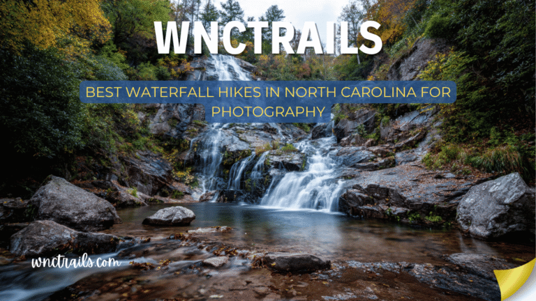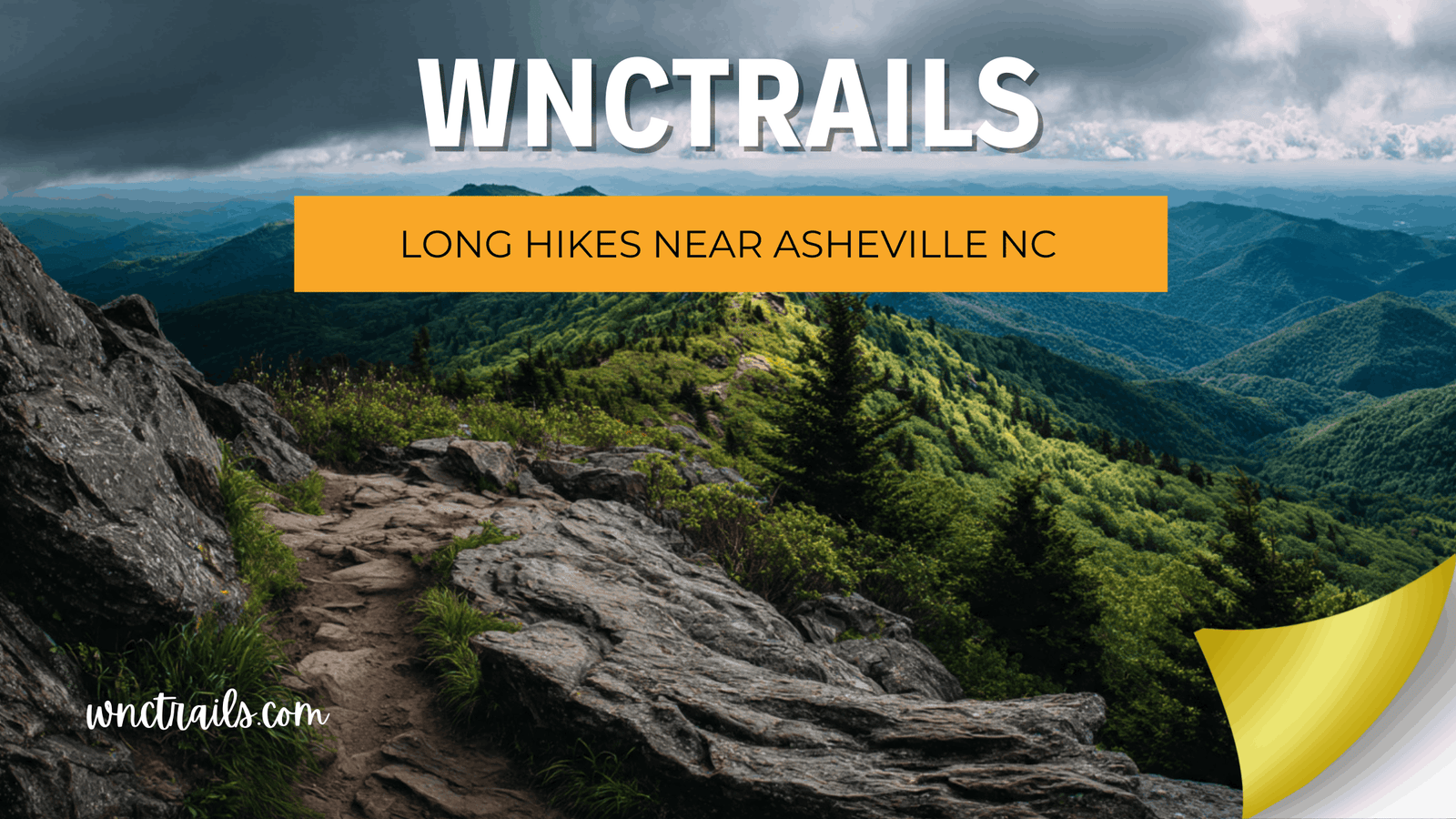
Long Hikes Near Asheville NC: Full-Day Routes Worth Every Mile
Recommended Tools
Disclosure: This page may contain affiliate links.
- Hiking Shoes ” Check current pricing
- Daypack ” Check current pricing
- Trekking Poles ” Check current pricing
You’ve cleared the calendar, packed the layers, and you’re ready for a full day in the mountains. The problem with planning long hikes near Asheville NC isn’t finding options — it’s finding accurate ones. Long routes demand a different level of information: Where are the water sources? What’s the real elevation profile — not just total gain? Are there bail-out points if conditions change? Does the access road require a high-clearance vehicle? At WNC Trails, every long route is verified end-to-end by local hikers who document the full picture — logistics, hazards, water, and conditions — so your full-day commitment pays off exactly the way you planned it.
What Makes a Long Hike Different — And Why the Planning Bar Is Higher
A mislabeled short hike costs you an hour. A mislabeled long hike — wrong distance, incorrect water source info, closed access road, or understated technical difficulty — can cost you an entire day and put you in a genuinely unsafe situation. Long routes in Western North Carolina compound every variable that shorter hikes handle easily: weather windows narrow, afternoon lightning becomes a real threat, water becomes critical, and bail-out options shrink the farther in you go.
The WNC Trails Long-Hike Verification Standard
Every route in our long-hike category is verified to document all of the following — not just distance and elevation:
- 📏 True end-to-end distance — trailhead to trailhead, with loop vs. out-and-back clearly labeled; car shuttle requirements noted
- 📈 Elevation profile breakdown — gain and loss per section, not just totals; where the hard climbs actually hit in the route
- 💧 Water source locations — springs, streams, and reliability by season; which sections are dry and how long
- 🚪 Bail-out points — documented exits at specific mileages for when weather, fitness, or conditions require turning back
- ⏱️ Realistic time ranges — timed at both a moderate pace and a trail-runner pace, with rest stops factored in
- 🚗 Full access logistics — road type, clearance requirements, shuttle points, and parking at both ends for one-way routes
7 Best Long Hikes Near Asheville NC (Locally Verified)
Seven full-day routes — all over 6 miles — verified on the ground by WNC Trails local scouts. Each listing includes the logistics that make a long hike plannable, not just possible.
1. Black Mountain Crest Trail — Burnsville Area (12.0 mi One-Way | 8–10 hrs | High Route)
The crown jewel of long hiking in Western North Carolina — a one-way ridge traverse of the Black Mountain Crest visiting six of the ten highest peaks east of the Mississippi, including Mount Mitchell (6,684 ft), along an exposed alpine ridgeline above 6,000 ft for nearly the entire route. Logistics: Car shuttle required between the Black Mountain Campground trailhead and the Commissary Trail upper terminus — WNC Trails documents GPS coordinates and parking details for both ends. Water: Reliable springs documented at miles 3.2 and 7.8; dry ridge sections in between. Bail-out: Mount Mitchell summit parking area at mile 6.5 provides the only realistic mid-route exit.
2. Art Loeb Trail — Deep Gap to Shining Rock (13.5 mi One-Way | 7–9 hrs | Wilderness Traverse)
The most iconic long-distance trail section in the Pisgah District — a sustained high-country traverse linking Deep Gap (US-276) to the Shining Rock Wilderness, crossing Black Balsam Knob, Tennent Mountain, and the brilliant white quartzite summit of Shining Rock (5,940 ft). WNC Trails note: No blazes inside the Shining Rock Wilderness boundary — download our offline map before losing cell service at the FR-816 trailhead. Water: Ivestor Gap spring (mile 5.1) is the most reliable source; dry above 5,800 ft between miles 6 and 11. Logistics: One-way route; shuttle required from Shining Creek trailhead back to Deep Gap.
3. Mountains-to-Sea Trail — Craggy Gardens to Black Mountain (18.0 mi One-Way | Full Day | Ridge Walk)
The most ambitious single-day long hike accessible from Asheville — a Blue Ridge Parkway ridge traverse on the Mountains-to-Sea Trail from Craggy Gardens (MP 364) to the town of Black Mountain, descending through Montreat Wilderness and the Upper Flat Creek watershed. Offers an extraordinary range of ecosystems in a single day: alpine heath bald, northern hardwood forest, and piedmont cove. WNC Trails logistics: Point-to-point route with complex shuttle — our listing documents three staged parking options depending on how much of the route you want to tackle. Best season: May–October; Blue Ridge Parkway road status updated in real time on WNC Trails.
4. Cold Mountain via Art Loeb Trail — Daniel Boone Scout Camp (10.0 mi RT | 6–8 hrs | Iconic Peak)
The classic Cold Mountain route from the Deep Gap trailhead — nearly 3,000 ft of cumulative elevation gain across a relentless series of ridge climbs to the 5,928-ft grassy summit bald. One of the most rewarding long out-and-back hikes in WNC, entirely within the Pisgah National Forest. Timing critical: Summit ridge is exposed — WNC Trails recommends a 6:30 a.m. start from June through August to clear the open bald before afternoon storm window. Water: Reliable stream crossing at mile 1.8 (last reliable source before the summit ridge); carry 2+ liters from that point. Bail-out: Flower Gap saddle at mile 3.5 offers a turnaround option with partial views.
5. Linville Gorge Loop — Table Rock to Linville River (11.0 mi Loop | 7–9 hrs | Gorge Wilderness)
The most technically demanding long loop in the Asheville region — a descent to the Linville River via the Table Rock spur trail, a river-level gorge traverse, and a brutal climb back out via the Babel Tower ridge. Exposed scrambling on both the descent and the return ascent; river crossing required (thigh-deep in normal flow, impassable in spring runoff). Permit required: Free Linville Gorge Wilderness permit on weekends May–October — WNC Trails links directly to the current permit portal and flags when permits are unavailable. Emergency access: Limited; carry a satellite communicator. WNC Trails note: This loop is rated hard, not moderate — long distance combined with technical terrain places it firmly in the strenuous + long category.
6. Shut-In Trail — French Broad River to Mount Pisgah (17.0 mi One-Way | Full Day | Historic Route)
One of the most historically significant long trails in WNC — built by Vanderbilt’s estate crew in the 1890s as a private hunting trail from the Biltmore Estate to the Mount Pisgah hunting lodge. The full Shut-In Trail follows the Blue Ridge from the French Broad River valley to the Mount Pisgah summit area, gaining over 3,600 ft across rolling ridge terrain. Character: Never extremely steep but relentlessly rolling — energy management over miles is the primary challenge. Logistics: One-way route with multiple trailhead access points documented by WNC Trails, allowing hikers to tackle 5-, 10-, or full 17-mile segments. Least-crowded long trail near Asheville — largely absent from major apps.
7. Richland Balsam Loop — Blue Ridge Parkway MP 431 (6.2 mi Loop | 4–5 hrs | Highest BRP Point)
The shortest entry on this list but the highest — a loop through the highest point on the entire Blue Ridge Parkway (6,053 ft) through dense Fraser fir and red spruce forest to an open summit bald with sweeping western views. A genuine long hike experience compressed into 6 miles thanks to the sustained elevation and often-challenging weather above 5,500 ft. WNC Trails distinction: This loop is rarely documented correctly — several platforms list only the Haywood Gap section or omit the summit bald entirely. Our local scout verified the full loop including the unmarked connector in fall 2025. Seasonal alert: BRP access closes seasonally — road status updated in real time.
Planning a Long Hike in WNC: The Logistics That Make or Break Your Day
More than any other category of hiking, long routes live or die by their pre-trip logistics. Getting the trail right is only half the work — getting yourself to the trailhead, through the route safely, and back to your car before dark is the other half.
The 5 Long-Hike Planning Questions WNC Trails Answers for Every Route
- 🚗 Do I need a car shuttle? One-way routes (Black Mountain Crest, Art Loeb, Shut-In, MST) require a second vehicle or a arranged pickup. WNC Trails documents both trailhead GPS points, parking situations at each end, and flags where shuttle logistics are complex.
- 💧 Where is the water? Long routes in WNC’s high country can have dry stretches of 4–6 miles above 5,500 ft. WNC Trails maps water sources by mile marker with seasonal reliability ratings — updated after drought conditions or unusually dry seasons.
- ⏰ What time do I need to start? Routes with exposed summit ridges above 5,000 ft require early starts in summer to avoid the afternoon lightning window (typically 1–4 p.m.). WNC Trails provides season-specific recommended departure times for every long route.
- 🚪 What are the bail-out options? Every long route listing on WNC Trails documents bail-out points at specific mileages — where you can safely turn around or exit the trail if conditions, fitness, or weather demand it.
- 📋 Do I need a permit? Linville Gorge Wilderness weekend permits, Shining Rock Wilderness day-use rules, and any seasonal permit requirements are flagged clearly in every relevant listing — with direct links to booking portals.
Long Hikes Near Asheville by Season: Timing Your Full-Day Adventure
| Season | Conditions | Top Hazard on Long Routes | Best Long Hike Pick |
|---|---|---|---|
| Spring (Mar–May) | Wet and muddy; snow above 5,000 ft through April; stream crossings at seasonal high; long days building | High water crossings, lingering ice on shaded ridge sections | Shut-In Trail (lower elevations dry first), Richland Balsam (avoid before May) |
| Summer (Jun–Aug) | Ideal trail surfaces; afternoon thunderstorms on exposed routes — early start essential; longest daylight hours | Lightning on open ridgelines and balds above 5,000 ft | Cold Mountain (6:30 a.m. start), Art Loeb traverse (camp at Ivestor Gap) |
| Fall (Sep–Nov) | Best overall conditions; stable weather through mid-October; parkway access closes late Oct–Nov; peak crowds on weekends | Crowded trailheads and full parking lots; BRP road closures by Nov | Black Mountain Crest, Linville Gorge Loop |
| Winter (Dec–Feb) | Strenuous conditions; ice above 4,000 ft; short daylight limits long-route options; solitude guaranteed | Ice, short days limiting turnaround time, limited rescue access | Shut-In Trail (lower section stays clear), MST (lower Montreat section) |
Gear for Long Hikes in Western North Carolina: What Experienced Hikers Don’t Skip
Long-route hikers in WNC know the gear list gets longer as the miles do. Beyond standard day-hike essentials, full-day routes in the Southern Appalachians introduce specific demands that shorter hikes don’t expose.
The WNC Long-Hike Gear Add-Ons
- 🗺️ WNC Trails offline map downloaded — cell coverage disappears in Shining Rock Wilderness, Linville Gorge, and upper Black Mountain Crest sections
- 💧 Water filter or purification tablets — essential for routes with natural water sources and dry ridge sections over 4 miles
- 🥢 Trekking poles — non-negotiable on long descents (Linville Gorge, Cold Mountain return); saves knees on multi-hour routes
- 🥪 More food than you think — 6–10 hour routes burn 2,500–4,000 calories; under-fueling is the most common long-hike mistake
- 🧥 Full rain shell + insulating layer — weather above 5,500 ft can shift 20°F and turn to rain within an hour; always in the pack
- 🆘 Satellite communicator or PLB — strongly recommended for wilderness routes (Linville Gorge, Shining Rock, Black Mountain Crest) with limited rescue access
- 🔦 Headlamp with fresh batteries — long hikes can run long; never assume you’ll be out before dark
Key Considerations
- Trail Difficulty: Long hikes in this region often involve significant elevation gain, rocky footing, and occasional stream crossings. Assess your fitness level and experience before committing to a route.
- Navigation: Not all trails are clearly marked, especially on remote ridgelines or in wilderness areas. Carry a map, compass, or GPS device, and review your route in advance.
- Weather: Mountain weather can change rapidly. Be prepared for cooler temperatures, sudden storms, and variable trail conditions, particularly at higher elevations.
- Water & Resupply: Plan water stops carefully. Some trails have reliable springs or streams, but others may require you to carry all the water youll need. Always filter or treat natural water sources.
- Permits & Regulations: While most long hikes near Asheville do not require permits for day use, some overnight trips (like those in the Shining Rock or Linville Gorge Wilderness) have specific regulations. Check current rules before heading out.
- Leave No Trace: Extended hikes magnify your impact. Pack out all trash, stay on designated trails, and minimize campfire use to protect these sensitive environments.
Common Use Cases
- Full-Day Adventures: Many hikers seek long routes for the challenge and reward of a single, immersive day outdoors. The Art Loeb Trail (30 miles total, but excellent for long day sections) and the Black Mountain Crest Trail (12+ miles) are popular choices.
- Backpacking Trips: Trails like the Mountains-to-Sea Trail and sections of the Appalachian Trail near Hot Springs offer opportunities for overnight or multi-day trips, with established campsites and scenic stopovers.
- Trail Running: Experienced trail runners often tackle long hikes as endurance challenges. Routes with less technical terrain, such as the Bent Creek area, are suitable for this purpose.
- Wildflower and Fall Foliage Hikes: Longer routes allow you to experience seasonal highlights away from crowded viewpoints. Spring and fall are especially rewarding for color and solitude.
- Training for Longer Treks: Many use these trails to prepare for even bigger adventures, such as thru-hiking the Appalachian Trail or other national scenic routes.
Western North Carolina’s Long Trails Reward Every Mile — With the Right Information
A full day in the mountains of Western North Carolina — from a dawn start at a Forest Service trailhead to a golden-hour summit and a long walk back to the car — is one of the best experiences this region offers. But it only works when the information behind it is accurate, complete, and locally verified. WNC Trails documents long routes the way they deserve to be documented: every water source, every bail-out point, every shuttle logistic, every seasonal hazard — so your full-day commitment delivers exactly what you came for.
The miles are long. The views are worth it. And now you have everything you need to plan them right.
Frequently Asked Questions
- What are the best long hikes near Asheville NC for beginners?
Look for trails with moderate elevation gain and clear markings, such as the Graveyard Fields Loop (can be extended to 8+ miles) or the Shut-In Trail for an out-and-back experience. Always start with a hike that matches your comfort level and build up to longer distances. - How do I prepare for a long hike in this region?
Check the weather, pack extra layers, bring sufficient water and food, and let someone know your route. Consider trekking poles for steep or uneven sections, and always carry a map or GPS. - Are dogs allowed on long hikes near Asheville?
Most trails in Pisgah National Forest and surrounding public lands are dog-friendly, but leashes are required. Be mindful of wildlife and other hikers, and pack out all pet waste. - What is the best season for long hikes near Asheville?
Spring and fall offer cooler temperatures and exceptional scenery. Summer brings lush greenery but can be humid, while winter hikes are possible with proper gear and preparation. - Where can I find detailed trail maps and updates?
Visit local ranger stations, reputable hiking websites, or use navigation apps with offline maps. Trail conditions can change due to weather or maintenance, so check for recent updates before your trip. - Is camping allowed along these long trails?
Backcountry camping is permitted in most national forest areas with some restrictions. Follow local guidelines, camp at least 200 feet from water sources, and use established sites when possible.
Long hikes near Asheville NC offer a true escape into the wild heart of the Southern Appalachians. With thoughtful preparation and respect for the land, these trails can provide rewarding experiences for hikers of all skill levels. For more route suggestions and seasonal tips, explore our trail guides and connect with the WNC Trails community.
Continue Exploring These Trails
- Family Friendly Hikes Near Asheville Nc
- Dog Friendly Hikes Near Asheville Nc
- Blue Ridge Parkway Hikes
- Pisgah National Forest Hikes
🏔️ Plan your full-day hike near Asheville — browse every verified long route with elevation profiles, water sources, and shuttle logistics.
👉 Browse All Long Hikes on WNC Trails → | 👉 Check Today’s Trail Conditions →