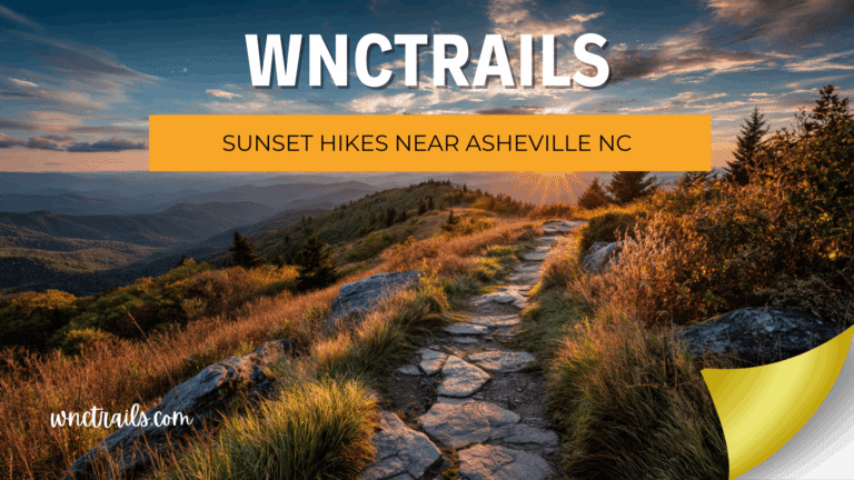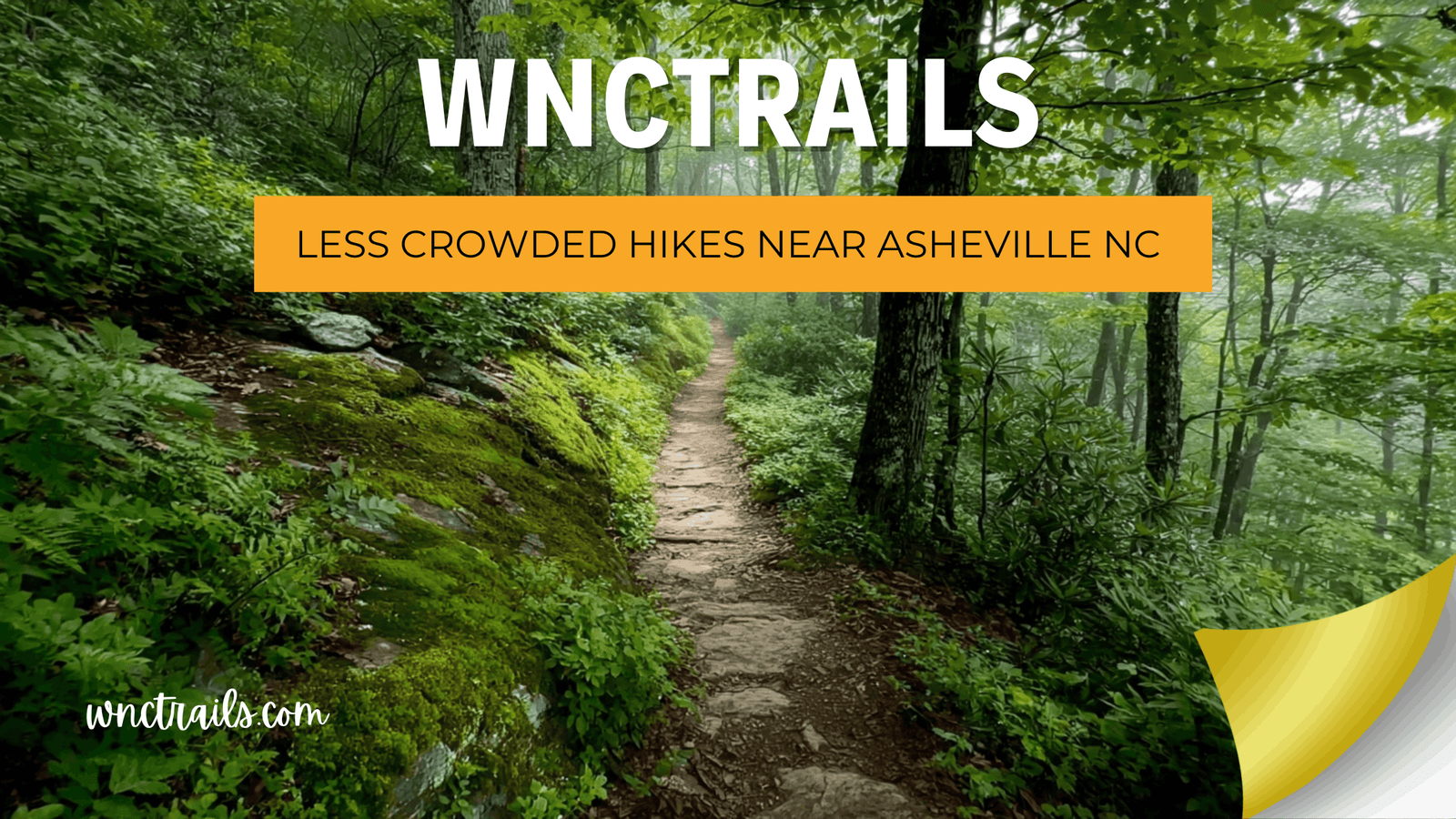
Less Crowded Hikes Near Asheville NC: Quiet Trails Worth the Extra Research
Recommended Tools
Disclosure: This page may contain affiliate links.
- Hiking Shoes ” Check current pricing
- Daypack ” Check current pricing
- Trekking Poles ” Check current pricing
You drove four hours to stand in a parking lot queue at Max Patch — and spent your summit time waiting for strangers to clear the frame for a photo. Western North Carolina has over 1,500 miles of trail. The problem isn’t a shortage of options. It’s that the same ten routes appear on every major app, every travel blog, and every “must-do” listicle, funneling thousands of visitors onto a handful of trailheads. At WNC Trails, our local scouts spend their time on the trails that don’t make those lists — documenting the quiet waterfalls, empty ridgelines, and uncrowded forest walks that give you the real Western North Carolina experience without the crowd that comes with it.
Why the Same 10 Trails Get All the Traffic — And What You’re Missing
Trail crowding near Asheville is a direct product of algorithmic recommendation. National platforms surface the trails with the most reviews, which draws more visitors, which generates more reviews, which pushes those same trails even higher. It’s a feedback loop that has nothing to do with trail quality — and everything to do with visibility.
The result: Graveyard Fields, Max Patch, Black Balsam, and Looking Glass Falls see thousands of visitors weekly during peak season, while trails with equal or greater scenery — located 10 or 20 minutes further down the same Forest Service road — sit almost entirely empty. WNC Trails was built to break that cycle.
How WNC Trails Identifies and Verifies Less-Crowded Routes
- 🔍 Local scout verification — every quiet trail on this list was walked by a WNC-based hiker, not sourced from existing databases
- 📊 Crowd-level ratings — each WNC Trails listing includes a crowd index (Low / Moderate / High) with peak-day and off-peak notes
- 🗓️ Seasonal crowd patterns — we document which formerly quiet trails are being discovered and update crowd ratings accordingly
- 📍 Alternative trailhead options — for popular destinations, we document lesser-used access points that dramatically reduce crowd exposure
8 Less Crowded Hikes Near Asheville NC (Locally Verified, Low Crowd Index)
Eight routes verified by WNC Trails local scouts with consistently low crowd levels — most absent from major trail platforms entirely, all offering scenery that rivals the region’s most famous trails without the parking lot chaos.
1. Mouse Creek Falls — Big Creek Area, GSMNP (4.0 mi RT | Easy-Moderate | Quiet Waterfall)
A creekside trail through cathedral old-growth hemlock and hardwood forest to a 45-ft mossy cascade — and one of the least-visited waterfall trails in the greater Asheville region. No fee station at the Big Creek trailhead, ample roadside parking, and a trail surface that sees a fraction of the foot traffic of comparable waterfall hikes in Pisgah. WNC Trails crowd rating: Low — even on summer weekends. Why it stays quiet: The Big Creek area is on the Tennessee side of GSMNP, rarely surfaced in NC-specific trail searches. Our local scout verified access and conditions in spring 2025.
2. Fryingpan Mountain Tower — Pisgah National Forest (3.4 mi RT | Moderate | Fire Tower)
A steady climb through dense hardwood forest to a restored 1940s fire lookout tower at 5,340 ft — with 360-degree panoramic views from the open cab 70 ft above the tree line. Virtually unknown outside local hiking circles and absent from most major trail directories. WNC Trails crowd rating: Low — our scouts have never encountered more than three other parties on this trail. Access note: FR-476 is unpaved and narrow for the final 2 miles; passable for most vehicles in dry conditions. WNC Trails flags road conditions after rain events.
3. Pinnacle of Bearwallow — Harmon Den Area (6.5 mi RT | Strenuous | Isolated Summit)
A relentless 2,200-ft climb to a remote ridge summit with sweeping views of the Great Balsam and Pisgah ranges — on a trail that appears on almost no major platform and sees almost no recreational traffic. WNC Trails crowd rating: Very Low — one of the quietest strenuous routes verified in WNC. The difficulty naturally filters the crowd; the obscurity does the rest. Navigation note: Zero signage after mile 1 — download the WNC Trails offline map before losing cell coverage at the Harmon Den trailhead.
4. Richland Balsam Loop — Blue Ridge Parkway MP 431 (6.2 mi Loop | Moderate-Strenuous | Highest BRP Point)
The highest point on the entire Blue Ridge Parkway (6,053 ft) — a loop through ancient Fraser fir and red spruce forest to an open summit bald with sweeping western views — and one of the most consistently uncrowded rewarding hikes in the region. Why it stays quiet: The trailhead has no obvious signage from the Parkway, and the full loop is rarely documented correctly on major apps. Most visitors who find it only do the short out-and-back section, missing the summit entirely. WNC Trails advantage: Our local scout verified the complete loop including the unsigned connector trail in fall 2025.
5. Shut-In Trail — Lower Section, French Broad to Mills River (8.0 mi One-Way | Moderate | Historic Ridge Walk)
The lower section of the historic Vanderbilt hunting trail — a rolling ridge walk through mature hardwood forest above the French Broad River valley with multiple quiet overlooks and a genuine sense of wilderness solitude just 20 minutes from downtown Asheville. WNC Trails crowd rating: Low on weekdays, Low-Moderate on fall weekends. Why it stays quiet: The Shut-In Trail is largely absent from major apps and receives no marketing from any trail organization — the trail’s length and point-to-point format deter casual visitors. Logistics: Shuttle required for the full section — WNC Trails documents both trailheads with GPS and parking details.
6. Lovers Leap to Rich Mountain — Hot Springs Full Loop (12.0 mi | Strenuous | Ridgeline Solitude)
While the short Lover’s Leap overlook spur trail sees moderate traffic from Hot Springs visitors, the full ridge loop extension toward Rich Mountain drops to near-zero crowd levels past the first overlook. A full day of ridgeline hiking above the French Broad River valley with rhododendron tunnels, hardwood forest, and multiple unmarked viewpoints — all to yourself. WNC Trails crowd rating: Very Low beyond mile 1.5 — the loop extension is not documented on any major platform. Navigation note: Two trail junctions where blazes fade; WNC Trails offline map marks both with waypoints.
7. Hickory Branch Trail — Nantahala National Forest (3.8 mi RT | Easy-Moderate | Creek Cove)
A secluded creek-side trail through a pristine southern Appalachian cove forest in the Nantahala — old-growth tulip poplar, moss-covered boulders, and a series of small cascades along Hickory Branch that feel genuinely remote despite being under an hour from Asheville. WNC Trails crowd rating: Very Low — this trail has no presence on AllTrails, Hiking Project, or any major directory. First documented by WNC Trails in 2024. Surface: Narrow single-track with some rooted sections; suitable for hikers comfortable with light route-finding.
8. Bearwallow Mountain — Cane Creek Valley (5.4 mi RT | Easy-Moderate | Open Meadow Summit)
The most visitor-accessible trail on this list — Bearwallow Mountain still maintains a Low crowd rating on weekdays and a Moderate rating only on peak fall weekends, making it reliably quieter than comparable hikes accessed from the Blue Ridge Parkway. A wide, well-graded trail through horse pastures and hardwood forest to a sweeping open summit meadow with grazing horses and 360-degree views. Best timing for solitude: Weekday mornings in spring or summer — WNC Trails crowd data shows consistent Low traffic before 10 a.m. on non-holiday weekdays.
When to Hike Popular Trails to Beat the Crowds
Sometimes you want the iconic trail — Max Patch at sunrise, Graveyard Fields in fall color, Black Balsam in rhododendron season — without the crowd that comes with peak timing. The good news: crowd levels on even the most popular WNC trails are highly predictable, and a simple timing adjustment can transform a chaotic experience into a quiet one.
WNC Trails’ Crowd-Timing Guide for Popular Trailheads
| Trail | Peak Crowd Window | Low-Crowd Window | WNC Trails Tip |
|---|---|---|---|
| Max Patch | Sat–Sun 9 a.m.–4 p.m., May–Oct | Weekdays any time; weekends before 7:30 a.m. or after 5 p.m. | Sunrise visits require reservation — book 2 weeks ahead for fall weekends |
| Graveyard Fields | Sat–Sun 9 a.m.–3 p.m., Jun–Nov | Weekday mornings; any day before 8 a.m. in summer | Upper Falls loop sees 60% less traffic than Lower Falls at any time |
| Black Balsam / Sam Knob | Sat–Sun 10 a.m.–2 p.m., Jul–Oct | Weekdays; weekends before 8 a.m. | Sam Knob summit sees far less traffic than Black Balsam despite sharing a trailhead |
| Craggy Pinnacle | Sat–Sun 10 a.m.–3 p.m., Jun (bloom) & Oct (color) | Early morning any day; shoulder-season weekdays | Craggy Gardens picnic area trailhead (alternate access) sees 40% less traffic than the main lot |
| Looking Glass Falls | Daily 10 a.m.–4 p.m., May–Oct | Before 9 a.m. or after 5 p.m. any day | 10-minute visit — plan as a before-breakfast stop, not a mid-day detour |
The WNC Trails Crowd Index: How We Rate and Track Trail Busyness
“Crowded” and “quiet” are subjective — unless you put a system behind them. WNC Trails assigns a crowd index to every trail in our database, based on data collected by local scouts across multiple days, times, and seasons. It’s one of the features that most clearly separates our database from national platforms, which have no mechanism for tracking crowd levels at all.
What the WNC Trails Crowd Index Measures
- 🟢 Low: Rarely more than 5–10 other parties on trail at peak times; ample parking available without early arrival
- 🟡 Moderate: 10–30 parties during peak windows; early arrival (before 9 a.m.) recommended on weekends
- 🔴 High: 30+ parties during peak windows; parking fills before 9 a.m.; reservation or very early arrival required on weekends
Each listing also notes seasonal crowd pattern shifts — trails that have moved from Low to Moderate as they’ve gained social media attention, and formerly popular trails that have quieted down as new routes have absorbed visitors. Crowd data is updated at minimum annually by our local team, and flagged when a formerly quiet trail goes viral.
Less Crowded by Season: When Timing Beats Location
Trail crowding in Western North Carolina is not just about which trail you choose — it’s about when you show up. The same trail that’s a parking-lot disaster in October can be a serene, empty walk in February. Understanding WNC’s seasonal crowd patterns is one of the most effective tools for finding solitude — even on well-known routes.
| Season | Crowd Level (Popular Trails) | Best for Solitude | Trade-off |
|---|---|---|---|
| Spring (Mar–May) | Moderate — building toward peak; early spring (Mar–Apr) still quiet | March–early April on any trail above 4,000 ft | Muddy conditions; some high trails still have snow in March |
| Summer (Jun–Aug) | High on weekends at popular trailheads; lower on weekdays and at lesser-known routes | Weekdays at off-platform trails (Fryingpan Tower, Mouse Creek Falls, Hickory Branch) | Heat at lower elevations; afternoon storms above 5,000 ft |
| Fall (Sep–Nov) | Peak crowds Oct 1–20 at color-viewing trails; very high on BRP weekends | Early September (pre-color) or late November (post-color) on any trail | Color peaks Oct 10–20 at mid-elevation — worth a crowd strategy, not avoidance |
| Winter (Dec–Feb) | Very Low on virtually every trail in WNC | Any trail, any day — the entire region goes quiet | Ice above 4,000 ft; some BRP access roads closed; short daylight |
Key Considerations
- Trail Access and Navigation: Less crowded hikes may not have the same signage or trail maintenance as popular routes. Carry a reliable map or GPS, and research trailheads in advance. Some trailheads are unpaved or have limited parking.
- Seasonal Factors: Solitude is easier to find on weekdays, early mornings, or during off-peak seasons (late fall, winter, and early spring). Summer weekends tend to be busiest almost everywhere.
- Trail Etiquette: Quieter trails mean fewer people to help in an emergency. Share your plans with someone, and practice Leave No Trace to preserve the experience for others.
- Wildlife and Safety: Less traffic means a higher chance of wildlife encounters. Stay alert, especially in remote areas, and know basic safety protocols for black bears and snakes.
- Cell Service: Many secluded trails are outside reliable cell coverage. Download maps offline and prepare accordingly.
- Local Regulations: Some areas have restrictions on pets, camping, or group sizes. Check local forest service or park guidelines before heading out.
Common Use Cases
- Seeking Solitude: Individuals or small groups looking for a peaceful escape from city life often prioritize less crowded hikes for a more immersive nature experience.
- Photography and Birdwatching: Quieter trails reduce distractions and disturbances, making them ideal for capturing wildlife or serene landscapes.
- Family Outings: Families may prefer less trafficked routes for safety, especially with young children or pets.
- Training and Trail Running: Trail runners and fitness hikers often seek out less crowded paths for uninterrupted workouts.
- Social Distancing: During times of public health concern or personal preference, avoiding crowded trails helps maintain space and comfort.
The Best Hike Near Asheville Is the One You Have to Yourself
Western North Carolina has more than enough trail miles to give every visitor a quiet, uncrowded experience — the challenge is knowing where to look. WNC Trails was built by local hikers who know the difference between the trails that show up on every app and the trails that reward the extra five minutes of research. Our crowd index, seasonal timing data, and locally verified quiet routes exist for exactly one reason: to make sure you spend your time on the trail, not in a parking lot queue.
The mountains here are wide, deep, and largely unexplored by the average visitor. WNC Trails knows where to find the quiet ones — and now, so do you.
Frequently Asked Questions
- What are some examples of less crowded hikes near Asheville NC?
Examples include the Big Butt Trail (Blue Ridge Parkway), Trombatore Trail (Fairview), Bearwallow Mountain via the longer loop, and Little Snowball Mountain. These trails typically see fewer visitors than popular destinations like Mount Pisgah or Graveyard Fields. - How can I ensure a quiet hiking experience?
Visit early in the morning, on weekdays, or during the shoulder seasons. Avoid well-publicized trails or those with large parking lots. Exploring lesser-known trail networks, such as those in the Big Ivy area or remote sections of Bent Creek, also helps. - Are less crowded trails suitable for beginners?
Many quiet trails are beginner-friendly, but some may be more rugged or less maintained. Always check trail difficulty and distance before heading out, and consider starting with shorter options if youre new to hiking. - Is parking an issue at less crowded trailheads?
Parking is often limited at these sites. Arrive early and have a backup plan in case lots are full. Avoid blocking access roads or driveways, and respect posted regulations. - Can I bring my dog on these hikes?
Most national forest trails near Asheville allow dogs on leashes, but always verify rules for the specific trail or preserve you plan to visit. - Do these trails have amenities like restrooms or water?
Less trafficked hikes rarely have restrooms, water fountains, or trash cans. Plan to pack out all waste and bring sufficient water for your group. - How do I find trail updates or closures?
Check official forest service websites, local hiking forums, or trail-specific pages for the latest conditions, closures, or weather advisories before your trip.
Choosing less crowded hikes near Asheville NC opens the door to a more peaceful and personal connection with the regions mountains. With a bit of preparation and the right trail choice, you can enjoy the best of Western North Carolinas outdoors”minus the crowds.
Continue Exploring These Trails
🌿 Find your quiet trail — browse every low-crowd verified route near Asheville, filterable by crowd index, difficulty, and season.
- Free Hikes Near Asheville Nc
- Weekend Hikes Near Asheville Nc
- Blue Ridge Parkway Hikes
- Pisgah National Forest Hikes
👉 Browse Low-Crowd Trails on WNC Trails → | 👉 Check Today’s Trail Conditions →