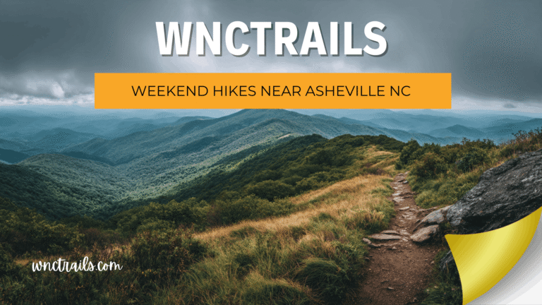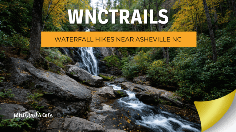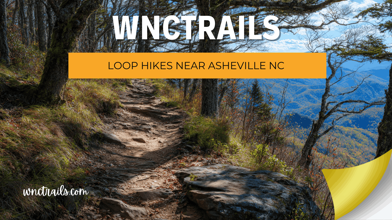
Loop Hikes Near Asheville NC: Maximum Variety, Zero Backtracking
A great loop trail does something an out-and-back can’t — it keeps moving forward, delivers fresh scenery around every bend, and brings you back to the trailhead with the quiet satisfaction of having covered genuinely new ground the whole way. The problem with finding loop hikes near Asheville NC on most platforms? Loops are the most commonly mislabeled trail type in the region — distances that include only half the circuit, junction descriptions that skip the connecting segment, or “loops” that are actually lollipops with an out-and-back approach. At WNC Trails, every loop is verified as a complete circuit with accurate full-distance documentation, every junction confirmed, and the terrain variety that makes a loop worth walking.
Recommended Tools
Disclosure: This page may contain affiliate links.
- Hiking Shoes ” Check current pricing
- Daypack ” Check current pricing
- Trekking Poles ” Check current pricing
What Makes a Great Loop Trail — And Why WNC Trails Documents Them Differently
Not all loops are created equal. A loop that crosses the same terrain twice from different directions isn’t much better than an out-and-back. A lollipop with a short connecting trail isn’t a true loop. And a loop where the connecting segment is unmarked, unmaintained, or difficult to navigate without prior local knowledge isn’t a loop you want to discover that detail about halfway through.
Western North Carolina has exceptional loop potential — its ridge-and-valley topography naturally creates circular routes with varied ecosystems, multiple viewpoints, and distinct outbound and return character. But realizing that potential requires documentation that goes beyond a single distance figure and a vague “loop” label.
The WNC Trails Loop Verification Standard
- 🔄 True circuit confirmed: Every junction in the loop verified on foot — no unmapped connectors, no assumed links between trail segments
- 📏 Full circuit distance documented: Complete round-trip measurement from trailhead back to trailhead; approach segments counted separately when relevant
- 🗺️ Junction-by-junction navigation notes: Every decision point in the loop documented with turn directions and trail name or blaze color — the detail that prevents getting half-lost on a loop connector
- 🌄 Terrain variety rating: WNC Trails notes whether the loop delivers genuinely different scenery on the return leg or simply reverses the same landscape
- ↩️ Bailout points identified: Where in the loop you can cut back to the trailhead early if conditions or energy levels change mid-circuit
8 Best Loop Hikes Near Asheville NC (Locally Verified)
Eight complete, verified loop circuits — covering every difficulty level, multiple geographic zones, and a range of distances from a quick 2-mile circuit to a full-day ridge traverse. Each one delivers something genuinely different on every leg of the loop.
1. Graveyard Fields Full Loop — Blue Ridge Parkway MP 418.8 (3.2 mi Loop | Easy-Moderate | Waterfall Circuit)
The best introductory loop near Asheville — a complete circuit through the glacially carved Graveyard Fields basin combining the Lower Falls (60-ft cascade), the open meadow traverse, and the Upper Falls (secondary cascade) on a well-signed, well-maintained trail. Each leg of the loop delivers entirely different terrain: open meadow, dense forest, and creek-side walking. WNC Trails loop note: Many visitors only do the Lower Falls out-and-back — the full loop adds only 1.7 miles and delivers significantly more variety and a second waterfall. Our listing documents the exact junction where most hikers turn around and how to continue the full circuit. Parking: Fills before 8:30 a.m. on summer/fall weekends — arrive early. Fee: Free.
2. Bearwallow Mountain Loop — Cane Creek Valley (5.4 mi Loop | Easy-Moderate | Meadow Summit)
A well-graded loop through horse pastures, mature hardwood forest, and open summit meadow — with the outbound leg climbing through shaded forest and the return leg descending through open grazing fields with long valley views. The two legs feel genuinely different, making this one of the most satisfying loop hikes near Asheville for the effort involved. WNC Trails loop note: The loop junction at the summit meadow is unmarked — WNC Trails documents the exact bearing and landmark for the return leg descent, which several competing platforms describe incorrectly. Crowd level: Low on weekdays; Moderate on fall color weekends. Fee: Free.
3. Lover’s Leap Ridge Loop — Hot Springs (3.2 mi Loop | Moderate | River Valley Circuit)
A forested ridgeline loop above the French Broad River — outbound on the high ridge with open French Broad River valley views, return along the lower creek corridor through dense rhododendron. Two completely different trail characters in a single loop accessible by foot from Hot Springs town center. WNC Trails loop note: The lower creek return segment involves one stream crossing on stepping stones; WNC Trails flags crossing depth after precipitation events. Best season: Fall for ridge color; spring for creek wildflowers and high river views. Fee: Free.
4. Bent Creek Lake Loop — South Asheville (3.0 mi Loop | Easy | Forest & Lake Circuit)
The most accessible full loop near Asheville city limits — a flat circuit through old-growth hardwood forest combining the Bent Creek Greenway with the Lake Powhatan shoreline trail and an optional return along the upper ridge connector. Creek sounds, forest birdsong, and a lake reflection at the midpoint make this the region’s best easy full-loop experience. WNC Trails loop note: Multiple trail intersections in the Bent Creek network can confuse first-time loop hikers — our listing provides a turn-by-turn junction guide for the complete circuit. Dog-friendly: Yes, on leash. Stroller: Lower Greenway section only. Fee: Free.
5. Sam Knob Loop — Pisgah National Forest (5.0 mi Loop | Moderate | High-Country Circuit)
One of the most rewarding moderate loops in the Pisgah high country — a complete circuit combining the Sam Knob summit trail, the Flat Laurel Creek wetland traverse, and the return leg through the upper Black Balsam meadows. Three entirely distinct ecosystems in a single loop: open bald summit, high-elevation bog, and wind-swept meadow ridge. WNC Trails loop distinction: Most platforms list Sam Knob as an out-and-back only — WNC Trails is one of the few sources documenting the full loop option with the Flat Laurel Creek connector, which adds genuine ecological variety to the circuit. Road note: FR-816 unpaved access — road conditions flagged after rain. Fee: Free.
6. Chimney Rock Summit Loop — Chimney Rock State Park (3.8 mi Loop | Moderate | Gorge Circuit)
The most scenically diverse loop in the Asheville day-trip range — a complete circuit through the Hickory Nut Gorge combining the Exclamation Point summit trail, the Opera Box viewpoint, Hickory Nut Falls (404 ft — one of the tallest in the eastern US), and the gorge-floor return along the Rocky Broad River. Every leg delivers completely different character: granite summit, forest traverse, waterfall, river. WNC Trails loop note: The loop can be walked in either direction — our listing documents both options with elevation profile implications (counterclockwise is preferred for saving the waterfall descent for the return). Fee: State park entrance fee applies.
7. Rich Mountain Full Loop — Hot Springs (12.0 mi Loop | Strenuous | Ridgeline Circuit)
The most rewarding full-day loop near Asheville for hikers ready to commit — a complete ridge circuit from Hot Springs town combining the Lover’s Leap ridge ascent, the high Rich Mountain ridgeline traverse, and the descent back through French Broad River valley forest. Over 3,200 ft of cumulative elevation gain across terrain that shifts from open ridgeline to dense rhododendron tunnel to river cove forest. WNC Trails loop advantage: This loop is poorly documented on all major platforms — our team mapped every junction with GPS waypoints and flagged the two navigation-sensitive sections where the trail becomes faint. The only reliable digital source for the complete circuit. Fee: Free.
8. Linville Gorge Loop — Table Rock to Linville River (11.0 mi Loop | Hard-Strenuous | Gorge Wilderness)
The most technically demanding loop on this list and one of the most spectacular in the eastern United States — a complete circuit through the deepest gorge east of the Rockies, descending via the Table Rock ridge, traversing the gorge floor along the Linville River, and ascending back out via the Babel Tower ridge. Exposed scrambling on both descent and return; river crossing required. WNC Trails loop note: This loop must be walked counterclockwise (Table Rock descent first) — the clockwise direction makes the Babel Tower scramble significantly more dangerous on the descent. Our listing documents the directional recommendation and exactly why. Permit required: Free weekend permit May–October. Fee: Free.
Loop vs. Out-and-Back: How to Choose the Right Format for Your Hike
Both trail formats have genuine advantages — and the right choice depends on what you’re optimizing for on a given day. WNC Trails documents both options where they exist for the same trail system, so you can make an informed choice rather than defaulting to whichever format is listed first.
When to Choose a Loop
- 🔄 Variety is your priority: Loops deliver more ecological and scenic variety per mile than any out-and-back — different terrain, different elevation profiles, and genuinely new views on every leg
- ⏱️ You want to feel forward momentum: Psychologically, loops feel shorter and more rewarding than out-and-backs of the same distance — you’re always moving toward the finish, never retracing
- 👥 You’re hiking with a group: Groups that spread out on the trail manage better on loops — the lead hiker isn’t coming back toward the group on the return leg
- 📸 Photography is a focus: Different lighting conditions on the return leg of a loop give photographers genuinely different perspectives on the same landscape
When to Choose an Out-and-Back
- 🎯 The destination is the point: When the trail leads to a specific waterfall, summit, or viewpoint and the journey back is secondary, out-and-back is more efficient
- ⚡ You need a bail-out option: Out-and-backs let you turn around at any point — loops commit you to completing the circuit once you pass the halfway mark
- 🌦️ Conditions are uncertain: On days when weather might force an early turnaround, an out-and-back gives you more flexibility than a loop where the closest exit is the far end of the circuit
- 🗺️ Navigation is a concern: Out-and-backs on clear, blazed trails are significantly easier to navigate than loops with multiple junction decisions — important for first-time hikers or trail runners in unfamiliar territory
Loop Hikes Near Asheville by Distance and Difficulty
| Loop Trail | Distance | Difficulty | Best Feature | Fee |
|---|---|---|---|---|
| Bent Creek Lake Loop | 3.0 mi | Easy | Forest + lake, close to Asheville, dog-friendly | Free |
| Graveyard Fields Full Loop | 3.2 mi | Easy-Moderate | Two waterfalls, meadow basin, high-country feel | Free |
| Lover’s Leap Ridge Loop | 3.2 mi | Moderate | Ridge views + creek return, walkable from Hot Springs | Free |
| Chimney Rock Summit Loop | 3.8 mi | Moderate | Summit + 404-ft waterfall + gorge floor | State park fee |
| Bearwallow Mountain Loop | 5.4 mi | Easy-Moderate | Summit meadow, horses, low crowds | Free |
| Sam Knob Loop | 5.0 mi | Moderate | Summit bald + bog + meadow ridge — 3 ecosystems | Free |
| Linville Gorge Loop | 11.0 mi | Hard-Strenuous | Deepest gorge east of Rockies, technical scrambles | Free (permit req.) |
| Rich Mountain Full Loop | 12.0 mi | Strenuous | Full-day ridgeline circuit, near-zero crowds | Free |
Common Loop Trail Mistakes Near Asheville — And How WNC Trails Prevents Them
Loop trails concentrate the most common trail navigation errors of any trail type — because every junction is a potential wrong turn, and a wrong turn on a loop takes you away from the trailhead rather than back toward it. These are the mistakes WNC Trails specifically documents to prevent on every loop listing in our database.
The 4 Most Common Loop Trail Errors in WNC
- 🔀 Missing the connector junction: The most common loop error in WNC — missing the unmarked or poorly-signed connecting trail that links the outbound and return legs. Result: an unintended out-and-back, a wrong-direction continuation, or an hour of retracing. WNC Trails documents every junction with GPS waypoint, landmark description, and blaze color — not just “turn left at the fork.”
- 📏 Wrong distance expectations: Many loop trail listings on major platforms omit the approach segment distance, list only the loop portion, or quote one-way mileage for a circuit. WNC Trails always states the complete distance from parking area back to parking area — no partial figures.
- 🔁 Walking the loop in the wrong direction: Several loops in WNC are significantly more dangerous or less rewarding in one direction (Linville Gorge is the clearest example — clockwise makes the Babel Tower descent far more hazardous). WNC Trails documents directional recommendations with specific reasoning, not just a suggested direction.
- 🚧 Discovering a closed connector mid-loop: When a segment of a loop closes — storm damage, seasonal wildlife closure, maintenance — hikers mid-circuit have limited options. WNC Trails flags connector segment closures immediately and notes the nearest bail-out exit for each loop listing.
Key Considerations
When planning a loop hike near Asheville NC, consider the following factors to ensure a safe and enjoyable experience:
- Trail Length and Difficulty: Loop hikes range from under a mile to over 10 miles. Assess your fitness and experience before selecting a route. Elevation changes can make even short loops more strenuous.
- Weather and Trail Conditions: Mountain weather can change rapidly. Trails may be muddy or icy in spring and fall, and summer thunderstorms are common. Always check local forecasts and trail reports before heading out.
- Navigation: Some loop hikes are well-marked, while others require map-reading skills or GPS navigation. Download maps or use a trusted trail app, especially on less-trafficked routes.
- Parking and Access: Many popular trailheads fill quickly, especially on weekends. Arrive early or consider less-crowded loops if parking is limited.
- Leave No Trace: Stay on marked paths, pack out all trash, and respect wildlife. Loop hikes often pass through sensitive habitats”help protect these areas for future visitors.
- Seasonal Highlights: Wildflowers peak in spring, while autumn brings colorful foliage. Some loops offer year-round interest, but winter closures or icy conditions may affect higher elevations.
Common Use Cases
Loop hikes near Asheville NC appeal to a variety of outdoor enthusiasts. Here are some typical scenarios where loop trails shine:
- Day Hiking Adventures: Most loop hikes can be completed in a single outing, making them ideal for day trips with friends or family.
- Trail Running: Loops provide a continuous route, popular with local trail runners seeking varied terrain and minimal backtracking.
- Photography Outings: The ever-changing scenery along a loop hike offers diverse photo opportunities”waterfalls, wildflowers, and mountain vistas can all be found within a single circuit.
- Training and Fitness: Hikers looking to build endurance or prepare for longer treks often use loop trails for their balanced mix of uphills, downhills, and flats.
- Group and Family Hikes: Loops with moderate difficulty and scenic highlights work well for groups, offering a sense of accomplishment and natural variety without logistical challenges.
Choosing the right loop depends on your groups preferences, desired distance, and available time. Many Asheville-area loops are suitable for beginners, while others challenge experienced hikers with elevation and rugged terrain.
The Best Loop in Western North Carolina Is One You Complete Confidently
Loop hikes near Asheville offer something no out-and-back can match — a complete circuit of varied terrain, forward momentum from start to finish, and the particular satisfaction of seeing a trail system whole rather than simply going out and coming back the same way. But a loop is only as good as the documentation behind it. WNC Trails verifies every loop junction, documents every connecting segment, flags every directional recommendation, and gives you the complete circuit distance so you know exactly what you’re committing to before you leave the trailhead.
Western North Carolina’s ridge-and-valley landscape is made for loops. WNC Trails makes sure you complete them.
Frequently Asked Questions
- What are the best loop hikes near Asheville NC for beginners?
Pink Beds Loop and Graveyard Fields Loop are both excellent choices for newer hikers, offering moderate distances and well-maintained trails with rewarding scenery. - Are dogs allowed on loop hikes near Asheville?
Most national forest trails near Asheville are dog-friendly, but leashes are usually required. Check specific trail rules before bringing pets. - When is the best time of year for loop hikes near Asheville NC?
Spring and fall offer mild temperatures and scenic highlights, but many loops are accessible year-round. Summer brings lush greenery, while winter can offer solitude”just watch for icy conditions at higher elevations. - How do I find trailhead locations for these loops?
Most popular loop hikes are mapped on trail apps and local hiking websites. The Blue Ridge Parkway and Pisgah National Forest visitor centers can also provide maps and directions. - Do loop hikes require permits or fees?
Most Asheville-area loop hikes do not require permits or fees, though parking at certain trailheads (such as Graveyard Fields) may have a small charge. Always check current regulations before your trip. - Are there loop hikes suitable for children?
Yes”options like Pink Beds Loop and the Bent Creek area offer gentle grades and short distances that are manageable for most families.
Loop hikes near Asheville NC make it easy to explore the regions natural diversity in a single, satisfying journey. Whether youre a local or a visitor, theres a loop trail that matches your interests and ability level. Always plan ahead, respect the environment, and enjoy discovering the circular paths that wind through Western North Carolinas mountains and forests.
Continue Exploring These Trails
🔄 Browse every verified loop trail near Asheville — filter by distance, difficulty, terrain variety & current conditions.
- Strenuous Hikes Near Asheville Nc
- Less Crowded Hikes Near Asheville Nc
- Blue Ridge Parkway Hikes
- Pisgah National Forest Hikes
👉 Browse All Loop Hikes on WNC Trails → | 👉 Check Today’s Trail Conditions →