Trail status (checked September 2026) — conditions change; confirm with the managing agency before you go.
- Mount Mitchell State Park is open but reachable only from the Asheville side of the Blue Ridge Parkway while Helene repairs continue north of the park. A section of the Old Mitchell Trail (park office to the Camp Alice Trail junction) and several connecting Pisgah National Forest trails were still closed. Source: NC State Parks
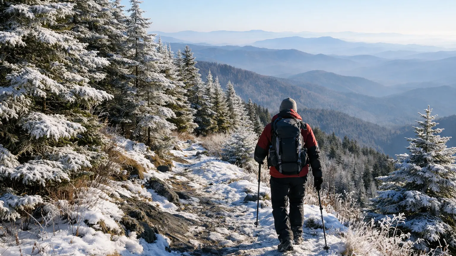
Winter changes the math on almost every trail in the Black Mountains. A route that’s a pleasant afternoon stroll in July can turn into an icy, wind-scoured slog in January, and the reverse is also true — some of the busiest summer trails become quiet, clear, and genuinely rewarding once the crowds thin out and the leaves drop. This page breaks down which verified trails near Mount Mitchell and Burnsville make sense for winter conditions, which ones demand real preparation, and which are worth saving for another season.
Winter-Ready Trails Near Mount Mitchell and Burnsville
1. Commissary Trail (2 mi one way; Easy)
This is one of the most forgiving options in the area during winter. An easy grade means less exposure to ice-slick descents, and its shorter length lets you get a feel for current conditions before committing to something bigger. It’s a solid choice if you want mountain scenery without the risk calculus of a strenuous climb in cold weather.
2. Campground Trail (0.4 mi one way; Easy)
Short, flat, and low-commitment, this is the trail to pick when you want a quick leg-stretcher near camp or the visitor area without wandering far into terrain that could ice over unexpectedly. It won’t fill a whole day, but it’s a dependable option when weather is questionable and you don’t want to gamble on a longer route.
3. Old Mitchell Trail (2 mi one way; Moderate)
A step up in effort from the easy routes, but still manageable if you’re comfortable checking conditions first. In winter, this trail tends to show you quickly whether the higher terrain is holding ice, since it connects into the upper mountain systems. Treat it as a conditions-check hike before deciding whether to push toward the summit routes.
4. Balsam Nature Loop / K.I.P. Track (0.7 mi loop; Moderate)
A compact loop that works well when daylight is short, which matters a lot in winter when the sun drops early behind the ridgeline. It’s moderate rather than easy, so expect some uneven footing, but the short distance keeps exposure to cold and wind manageable.
5. Mount Mitchell Trail (5.6 mi one way; Strenuous)
This is the marquee route in the area, climbing to the highest peak east of the Mississippi, and it is genuinely a different hike in winter. The strenuous rating isn’t just about distance — steep sections that are simply tiring in summer can become dangerous with ice or packed snow. This one belongs on your list only if you’re experienced with winter hiking, have proper traction gear, and have checked current conditions immediately before heading out.
6. Camp Alice Trail (0.5 mi one way; Strenuous)
Short in distance but strenuous for a reason — this connector trail gains ground quickly. In winter, that short strenuous stretch can be one of the more technical sections in the cluster if there’s any ice, so it’s worth respecting despite its brevity.
7. Black Mountain Crest Trail (11.3 mi one way; Strenuous) and Mountains-to-Sea Trail, Black Mountains section (22.9 mi one way; Strenuous)
Both of these are serious undertakings even in good weather, crossing multiple peaks above 6,000 feet. In winter, we’re including them here mainly to flag the honest reality: these are not casual winter day hikes for most people. If you’re an experienced winter backpacker or mountaineer-minded hiker, they can be spectacular — stark, quiet, and dramatic above the treeline. For most visitors planning a winter trip near Burnsville, these two are better admired from a distance or saved for a three-season attempt.
How We Ranked These
Exposure to elevation and wind. Trails that stay lower or more sheltered ranked higher for winter reliability, since the ridge-top routes take the brunt of Black Mountain weather.
Trail length relative to daylight. Winter days are short, so shorter trails like Campground and Balsam Nature Loop earned a practical edge simply because you can complete them without racing the sunset.
Terrain and footing. Easy and moderate trails with gentler grades were prioritized over strenuous climbs, since ice risk scales with steepness, not just distance.
Honest difficulty match. We didn’t rank the Crest Trail or the Mountains-to-Sea Trail highly for general winter visitors, because doing so would misrepresent what those routes actually demand in cold-weather conditions.
Parking and Trailhead Reality
Trailheads feeding into the Mount Mitchell Trail and the connecting network near the summit area tend to see the most consistent traffic even in winter, since Mount Mitchell itself remains a draw year-round. Don’t assume an empty parking area on a cold weekday morning means an empty trail later — conditions and access can shift quickly if a section of road gets icy or gated. Gravel and mountain access roads in this area can be affected by winter weather in ways that paved roads elsewhere aren’t, so check current conditions before you go rather than assuming your usual route in is clear.
Weather and Conditions
At elevations above 6,000 feet, winter weather can differ sharply from what’s happening in Burnsville itself. It’s common for lower-elevation trailheads to be clear while upper sections near the summit hold ice, wind chill, or lingering snow well after a storm has passed elsewhere. This is especially relevant for anyone considering Camp Alice Trail or the upper stretches of Mount Mitchell Trail, where a short, strenuous climb can turn technical fast. Always check current conditions specific to the higher elevations before committing to a summit attempt, and have a shorter, lower-elevation backup trail in mind — several of the easy and moderate options above work well for that purpose.
What to Bring
Traction devices for your boots are worth carrying even if the trailhead looks clear, since ice tends to show up unevenly along shaded or higher sections. Layered clothing matters more here than distance does — wind at elevation can make a short trail feel far colder than its mileage suggests. Bring more daylight buffer than you think you need; winter sunsets come early in the mountains, and trails that wind through forest can lose light even sooner than open ridgeline. For anything longer than the easy, short trails, treat this as a real backcountry outing: extra water, a charged phone, and a realistic sense of your own turnaround time.
Frequently Asked Questions
Is Mount Mitchell Trail safe to hike in winter?
It can be hiked in winter by experienced, well-prepared hikers, but the strenuous rating becomes more serious with ice or snow on the steeper sections. Check current conditions before attempting it, and be ready to turn back if conditions look questionable near the summit.
What’s the easiest trail near Mount Mitchell for a short winter walk?
Campground Trail and Commissary Trail are both rated easy and stay shorter in distance, making them the most practical choices when you want a low-risk winter outing without technical terrain.
Are the Black Mountain Crest Trail and Mountains-to-Sea Trail sections open in winter?
They aren’t closed by default, but their strenuous rating and high-elevation exposure make them a serious undertaking in winter weather. These are better suited to experienced winter hikers who’ve checked conditions carefully rather than a casual day trip.
Do trailheads near Burnsville get icy in winter?
Access roads and trailheads at higher elevations can hold ice even when lower areas around Burnsville look clear. It’s worth checking current road and trail conditions specifically for the elevation you’re heading to, not just the forecast for town.
Which trail is best if the weather looks uncertain?
Stick with one of the easy-rated options — Commissary Trail or Campground Trail — since their shorter length and gentler grade give you more flexibility to turn back early if conditions change.
If you want to compare every verified trail in this area side by side — filtered by difficulty, distance, and current conditions — browse the full WNC Trails directory at WNC Trails directory. Whatever you choose, check current conditions before you head out, especially anywhere near the summit where winter weather can shift fast.
Related Pages
- Backpacking Hikes Near Mount Mitchell
- Weekend Hikes Near Mount Mitchell And Burnsville
Want more routes in this area? See our complete guide to Mount Mitchell and Burnsville hikes.