Best Hikes Near Asheville NC: Locally Verified Trails for Every Level
Recommended Tools
Disclosure: This page may contain affiliate links.
- Hiking Shoes ” Check current pricing
- Daypack ” Check current pricing
- Trekking Poles ” Check current pricing
Western North Carolina has more great hiking than most visitors realize — and far more than any single “best hikes” list can fairly represent. The real challenge isn’t finding options; it’s knowing which trails are genuinely worth your time, accurately rated for your ability, and actually accessible when you plan to go. Most “best of” lists pull the same ten Instagram-famous routes and call it done. At WNC Trails, best means verified — every route on this list was walked by a local scout, rated against a consistent difficulty standard, and documented with the honest conditions, parking logistics, and seasonal notes that turn a good trail recommendation into a great day on the mountain.
Why the “Best Hikes Near Asheville” Lists You’ve Seen Are Incomplete
Search “best hikes near Asheville NC” on any major platform and you’ll find the same rotation: Max Patch, Graveyard Fields, Black Balsam, Craggy Pinnacle, Looking Glass Falls. These are genuinely excellent trails — but they represent a fraction of what the region offers, they’re rated by crowds rather than verified by local experts, and they come without the seasonal context, parking reality, or difficulty nuance that makes a recommendation actually useful.
Western North Carolina spans over 1,500 miles of maintained trail across Pisgah National Forest, Nantahala National Forest, the Blue Ridge Parkway, Great Smoky Mountains National Park, and multiple state parks. A “best hikes” list without a consistent verification standard and honest logistics isn’t a guide — it’s a starting point that leaves you to figure out the important parts on your own.
What WNC Trails Verifies for Every “Best” Recommendation
- ✅ Honest difficulty rating — calibrated against a consistent local standard, not crowd-averaged across users of all fitness levels
- ✅ Real trail conditions — surface type, seasonal hazards, stream crossings, and current status updated by local scouts
- ✅ Accurate distance and time — true round-trip mileage and realistic time estimates at a comfortable pace, not optimistic minimums
- ✅ Parking and access logistics — lot size, fee status, recommended arrival windows, overflow options, and road surface notes
- ✅ Seasonal availability — Blue Ridge Parkway road closures, permit requirements, and conditions that change the trail’s accessibility by time of year
The Best Hikes Near Asheville NC by Difficulty — Locally Verified
Rather than a single ranked list, WNC Trails organizes the best hikes near Asheville by difficulty level — because the best hike for a first-time visitor is a completely different trail than the best hike for an experienced trail runner, and treating them the same serves neither well.
Best Easy Hike: Max Patch Summit (1.4 mi RT | Easy | 360° Views)
The single most iconic easy hike near Asheville — a gentle open-meadow ascent to the 4,629-ft Appalachian Trail bald summit with completely unobstructed 360-degree mountain views. The effort-to-payoff ratio is unmatched on any easy trail in the region: under an hour of walking, some of the most photographed views in the Southern Appalachians. WNC Trails honest note: Weekend reservation required May–October (20-car limit strictly enforced); access road FR-1182 is unpaved with a rough 4-mile approach — passable for most vehicles in dry conditions. WNC Trails links to current booking portal and updates road conditions after rain events. Fee: Free.
Best Beginner Hike: Looking Glass Falls (0.1 mi RT | Beginner | 60-ft Waterfall)
The most accessible introduction to WNC trail scenery — a short paved path to the base of one of the most photographed waterfalls in the Southeast, with zero elevation change and no technical features. Suitable for all ages, mobility levels, and first-time visitors who want an immediate mountain experience without any hiking challenge. WNC Trails note: Free, roadside parking on US-276. Viewing platform can develop ice patches in winter — flagged in real time by local scouts. Distinction: This is the roadside overlook trail. The Looking Glass Rock summit trail (6.5 mi RT, strenuous) is a completely different route — a mismatch that catches dozens of visitors every season.
Best Moderate Hike: Black Balsam Knob (3.2 mi RT | Moderate | High-Country Bald)
The best moderate hike near Asheville for the sheer quality of what you earn — a wide, well-maintained Art Loeb Trail section to the 6,214-ft open bald summit of Black Balsam Knob with sweeping views of the Black Mountains, Cold Mountain, and the Shining Rock Wilderness. The climb is steady and never brutal; the summit is expansive enough to feel genuinely wild. WNC Trails logistics: FR-816 (Black Balsam Road) is unpaved — road conditions flagged by local scouts after rain events. Arrive before 8 a.m. on summer and fall weekends. Fee: Free — outside any Recreation Fee Area designation.
Best Hard Hike: Cold Mountain via Art Loeb Trail (10.0 mi RT | Hard | Iconic Summit)
The summit that every serious hiker near Asheville has on their list — 5,928-ft Cold Mountain, made famous by Charles Frazier’s novel and earned by nearly 3,000 ft of cumulative elevation gain from Deep Gap. A relentless series of ridge climbs through the Pisgah backcountry with a wide open bald summit rewarding every hard foot of the way up. WNC Trails timing note: Start no later than 6:30 a.m. in summer — the summit ridge is exposed and the afternoon storm window opens early. Water at mile 1.8 is the last reliable source before the top. Bail-out: Flower Gap saddle at mile 3.5 for those reading the climb wrong on the day.
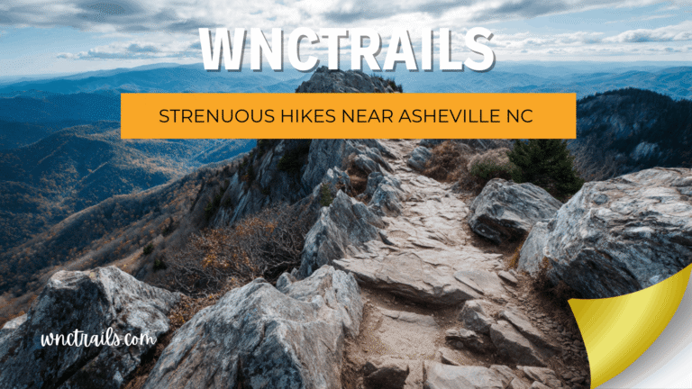
Best Strenuous Hike: Mount Mitchell via Commissary Trail (10.4 mi RT | Strenuous | Highest Peak East of Mississippi)
The most significant summit available from Asheville — Mount Mitchell at 6,684 ft, the highest point east of the Mississippi, reached via 3,600 ft of unbroken switchbacks through northern hardwood and boreal spruce-fir forest on the Commissary Trail. The serious hiker’s route versus the tourist summit road — same destination, completely different experience. WNC Trails seasonal alert: Ice and snow above 5,500 ft October through May; microspikes required — conditions flagged in real time by elevation band. Fee: Free day-use access at Black Mountain Campground trailhead.
Best Short Hike: Craggy Pinnacle (1.6 mi RT | Easy-Moderate | Alpine Summit)
The best short hike near Asheville for genuine alpine summit character — a rhododendron-tunnel trail through ancient heath balds to an open rocky crest above 5,500 ft with sweeping views from the Black Mountains to the Smokies. Under an hour from trailhead to summit and back. Best timing: Mid-June for rhododendron bloom (WNC Trails updates bloom status weekly in season); fall for clarity and color. BRP access: Road status updated in real time — closes seasonally and during ice events. Fee: Free — no day-use fee on the Blue Ridge Parkway.
Best Long Hike: Black Mountain Crest Trail (12.0 mi One-Way | Strenuous | High Route)
The best long hike accessible from Asheville by any objective measure — a one-way ridge traverse of the Black Mountain Crest visiting six of the ten highest peaks east of the Mississippi along an exposed ridgeline above 6,000 ft for nearly the entire 12 miles. Unmatched in the eastern United States for sustained high-altitude mountain character. WNC Trails logistics: Car shuttle required — GPS coordinates and parking documented for both trailheads. Water sources at miles 3.2 and 7.8; dry ridge sections in between. One meaningful bail-out at mile 6.5 (Mount Mitchell summit area). Fee: Free.
Best Hidden Hike: Fryingpan Mountain Tower (3.4 mi RT | Moderate | Fire Tower)
The best hike near Asheville that most visitors have never heard of — a steady climb through dense hardwood forest to a restored 1940s fire lookout tower at 5,340 ft with 360-degree panoramic views from the open cab 70 ft above the tree line. Virtually unknown outside local hiking circles and absent from most major trail directories. Crowd level: Very Low — local scouts have never encountered more than three other parties on this trail. Access: FR-476 unpaved final 2 miles; road conditions flagged after rain events on WNC Trails. Fee: Free.
How to Choose the Best Hike Near Asheville for Your Trip
“Best” is personal — and in Western North Carolina, the right trail depends on a combination of variables that no single list can resolve for you. Here’s how WNC Trails recommends thinking through the decision before you commit to a trailhead.
The 5 Questions That Find Your Best Hike
- 🦵 What’s your honest fitness level? Not your aspirational fitness level — your actual one, today, after a long drive. WNC Trails difficulty ratings are calibrated for real hikers in normal condition, not peak-performance estimates. Start where you are, not where you wish you were.
- ⏱️ How much time do you actually have? Factor in the drive (45–90 minutes from Asheville to most trailheads), parking time, and a buffer for the unexpected. A 4-hour hiking window is a short hike, not a moderate one. WNC Trails provides time estimates at a comfortable pace for every trail.
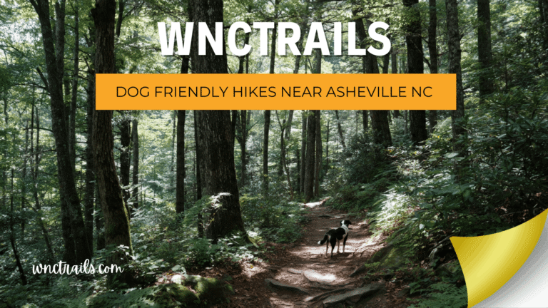
- 👨👩👧 Who’s hiking with you? A solo experienced hiker, a couple, a family with a 6-year-old, and a group of friends on a bachelor trip all need completely different trails. WNC Trails filters by audience type — beginner, kid-friendly, dog-friendly, and more.
- 🗓️ What season and day are you going? The best hike in October differs from the best hike in March — not just in conditions but in crowd levels, parking availability, and access road status. WNC Trails seasonal data takes all of this into account.
- 🎯 What do you want at the end of it? A waterfall? A summit view? A swimming hole? A sense of solitude? A historical site? WNC Trails categorizes trails by destination type so your effort matches your expectation.
Best Hikes Near Asheville by Zone: Where to Go Based on Where You’re Staying
| Zone | Drive from Asheville | Best Trail | Level | Standout Feature |
|---|---|---|---|---|
| Blue Ridge Parkway (North) | 15–25 min | Craggy Pinnacle | Easy-Moderate | Alpine summit, rhododendron tunnels, 360° views |
| Blue Ridge Parkway (South) | 40–50 min | Black Balsam Knob / Graveyard Fields | Moderate | High-country balds, dramatic waterfall basin |
| Pisgah National Forest | 30–45 min | Looking Glass Falls / Skinny Dip Falls | Beginner–Easy | Iconic waterfall, natural swimming hole |
| Hot Springs Corridor | 45 min | Max Patch Summit | Easy | 360° bald summit, Appalachian Trail |
| Black Mountains | 30–40 min | Mount Mitchell via Commissary Trail | Strenuous | Highest peak east of the Mississippi |
| South Asheville / Bent Creek | 15 min | Bent Creek Greenway | Easy | Flat, dog-friendly, free, close to the city |
| Chimney Rock / Hickory Nut Gorge | 45 min | Chimney Rock Summit Trail | Moderate | Granite gorge, 404-ft waterfall, summit views |
| Linville / Avery County | 60–75 min | Linville Gorge Loop | Hard–Strenuous | Deepest gorge in eastern US, river wilderness |
Before You Go: What WNC Trails Checks That Other Platforms Skip
The difference between a great hiking day near Asheville and a frustrating one often comes down to information that was available — but not where you looked. Here’s what WNC Trails monitors for every trail, every day, that major platforms don’t consistently track.
The WNC Trails Pre-Trip Intelligence Checklist
- 🛣️ Access road status: Blue Ridge Parkway seasonal closures, Forest Service unpaved road conditions after rain — updated within 24–48 hrs of significant weather events
- 🌊 Stream crossing levels: Flagged as passable, high, or dangerous after precipitation — critical for Catawba Falls, Linville Gorge, and other crossing-dependent routes
- ❄️ Ice and snow alerts by elevation band: Above 4,000 ft, above 5,000 ft, and above 5,500 ft — specific flags rather than generic winter warnings
- 🅿️ Parking lot capacity status: Crowd index by trail, recommended arrival windows, overflow options, and reservation portal links for permit-required trailheads
- 💰 Fee status: Current day-use fees, pass requirements, and recent changes to fee structures — updated annually at minimum and flagged within 30 days of any change
- 🚧 Trail closures: Storm damage, wildlife protection closures, and maintenance shutdowns — reported by local contributors within 24 hrs and verified by our scout team
How to Check Real Trail Conditions Before You Leave Asheville
One of the biggest beginner mistakes is relying on reviews posted months — or years — ago. Trail conditions in Western North Carolina change dramatically with the seasons, and sometimes within a single week after storms.
What WNC Trails’ Conditions Tab Shows You
- ✅ Date of last local verification
- ✅ Current surface conditions (dry / muddy / icy / flooded)
- ✅ Stream crossing levels (passable, high, dangerous)
- ✅ Seasonal closures (wildlife nesting, storm damage, road closures to trailhead)
- ✅ Parking status (open / full / fee required / seasonal closure)
No other directory in Western North Carolina provides this level of hyperlocal, time-stamped data. It’s the difference between a great day on the trail and a wasted drive.
Parking & Trailhead Access: The Details Big Apps Don’t Tell You
Finding the trailhead is half the battle in Western North Carolina. Many of the best waterfall hikes near Asheville are accessed via winding Forest Service roads, and popular lots can fill up before 8 a.m. on summer and fall weekends.
WNC Trails includes:
- 📍 GPS coordinates for every trailhead (not just the general area)
- 🚗 Parking lot size, fee information, and overflow options
- 🛣️ Road surface notes (paved / gravel / high-clearance recommended)
- ⏰ Recommended arrival times by season and day of week
How We Ranked the Best Hikes Near Asheville NC
For hikers in Western North Carolina, three criteria consistently matter most:
- Scenic Payoff (40%): Viewpoints, waterfalls, forest quality, and overall wow-factor. This matters most for those seeking memorable experiences and photo-worthy moments.
- Trail Experience & Difficulty (30%): Trail condition, elevation gain, length, and technical challenges. Important for matching the hike to your fitness level and available time.
- Access & Logistics (30%): Drive time from Asheville, parking availability, trailhead facilities, and navigation clarity. Key for planning and avoiding crowds or confusion.
Each hike below is scored 0“10 on these factors, then weighted for a final ranking. This approach ensures you can quickly shortlist trails that actually fit your trip goals.
| Hike | Scenic Payoff (40%) | Trail Experience (30%) | Access & Logistics (30%) | Weighted Score | Rank |
|---|---|---|---|---|---|
| Looking Glass Rock | 9 | 8 | 8 | 8.4 | 1 |
| Graveyard Fields Loop | 8 | 7 | 8 | 7.7 | 2 |
| Skinny Dip Falls | 8 | 7 | 8 | 7.5 | 3 |
| Catawba Falls | 7 | 6 | 6 | 7.0 | 4 |
| Mouse Creek Fall | 7 | 6 | 5 | 6.8 | 5 |
The Best Hike Near Asheville Is the One That’s Right for You — WNC Trails Finds It
Western North Carolina doesn’t have one best hike. It has the best easy waterfall trail, the best strenuous summit, the best short overlook, the best hidden gem, the best family trail, the best first hike, and the best full-day wilderness route — and each of them is best for a different person on a different day. WNC Trails exists to match you to the right one, with the verified conditions, honest logistics, and local knowledge that turns a trail recommendation into a trail you’ll actually remember.
Over 1,500 miles of verified trails. Every level, every season, every kind of hiker. That’s WNC Trails — and the best hike near Asheville is waiting in our database right now.
FAQs
- Are dogs allowed on these trails? All three allow leashed dogs, but check for seasonal restrictions.
- Is there a fee or permit required? None of these trails require a permit; Graveyard Fields is free, but parking fills early.
- When is the best time to hike near Asheville? Late spring through fall is ideal, but check Parkway status for Craggy and Graveyard Fields.
- Are these hikes suitable for winter? Looking Glass Rock is usually accessible year-round; the others depend on Parkway conditions.
If you want the best all-around mountain view close to Asheville, choose Looking Glass Falls. If your priority is a challenging, less crowded summit, choose Graveyard Fields Lower Falls. Next step: Check trail conditions and parking before heading out, and pack for changing mountain weather.
Explore every beginner-friendly waterfall trail in Western North Carolina — fully verified, always current.
🥾 Find your best hike near Asheville — browse every verified trail filtered by difficulty, distance, zone, crowd level & current conditions.
- Easy Hikes Near Asheville Nc
- Moderate Hikes Near Asheville Nc
- Blue Ridge Parkway Hikes
- Pisgah National Forest Hikes
👉 Browse All Trails on WNC Trails → | 👉 Check Today’s Trail Conditions →