Trail status (checked September 2026) — conditions change; confirm with the managing agency before you go.
- The Catawba Falls loop reopened after Hurricane Helene, but the upper viewing platform and the Wildflower Trail were still closed for repairs. Source: U.S. Forest Service
Pisgah National Forest has no shortage of trails, but a lot of them fall into one of two extremes: flat, crowded walks to a waterfall overlook, or knee-punishing climbs that eat a whole afternoon. If you want something in between — a hike that actually feels like a hike, with a real payoff at the top, but doesn’t require a full day of suffering — you’re in the right spot. This page pulls together the trails in Pisgah that are genuinely rated moderate, based on distance and elevation change, not marketing copy.
The Best Moderate Hikes in Pisgah National Forest
1. Mount Pisgah Trail (1.3 mi, Moderate)
This is the trail most people mean when they say “hike Pisgah.” It’s short — 1.3 miles one way — but it packs about 700 feet of elevation change into that distance, so it earns its moderate rating fast. The payoff is a 360-degree summit view that’s hard to beat for the time investment. If you only have a couple of hours and want a legitimate summit under your boots, this is the one to pick.
2. John Rock Trail (1.8 mi, Moderate)
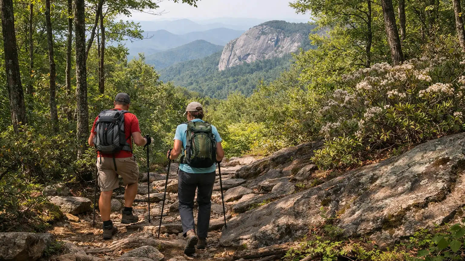
John Rock is a granite dome with a view over the fish hatchery, Looking Glass Rock, and Pilot Mountain. At 1.8 miles with roughly 750 feet of elevation change, it’s a steady climb rather than a scramble, and it rewards you with one of the better vantage points in the Pisgah Ranger District for the effort required. Good pick if you want scenery without committing to a full afternoon.
3. Looking Glass Rock Trail (3.1 mi, Moderate)
This is the longer, more demanding option in the moderate category — 3.1 miles with about 1,700 feet of elevation change. That elevation number matters: it’s more climbing than Mount Pisgah or John Rock in a similar or shorter distance, so plan for a slower pace and more breaks. The panoramic summit view at the top is one of the signature views in Pisgah, and it’s worth treating this as the “upper end” of moderate rather than lumping it in with the shorter trails.
4. Slick Rock Falls Trail (0.99 mi, Moderate)
Under a mile, but rated moderate for a reason — the terrain to the waterfall isn’t a graded path, and footing takes more attention than the mileage suggests. It’s a good choice if you want a moderate-effort hike that doesn’t eat your whole day, with a waterfall as the destination instead of a summit view.
5. Catawba Falls Trail Loop (3.5 mi loop, Easy to intermediate)
This one is officially rated easy to intermediate rather than straight moderate, but we’re including it because the loop version — which takes you past both the 205-foot lower falls and the 80-foot upper falls — has enough climbing on the upper section to feel more substantial than a typical easy trail. If you want something a notch below the four hikes above but still more engaging than a flat waterfall walk, this loop is the honest answer.
How We Ranked These
We didn’t just pull every trail tagged “moderate” and list it alphabetically. A few things factored into the order and inclusion above:
- Elevation change relative to distance. A 1.3-mile trail with 700 feet of climbing hikes harder than a 3-mile trail with 300 feet. We looked at the ratio, not just the mileage, when deciding how to describe effort level.
- Scenic payoff. Since this list is specifically for hikers who want more than a flat stroll but aren’t chasing a strenuous summit, we weighted trails with a clear destination — a summit view, a rock dome, a waterfall — over anything without a defined payoff.
- Consistency of the official difficulty rating. Where a trail’s rating was ambiguous (like Catawba Falls being labeled easy to intermediate), we said so directly instead of rounding it up to “moderate” just to pad the list.
- Realistic time commitment. All five of these can reasonably be done in half a day or less, which matters if you’re comparing this list against the longer, strenuous backpacking-style routes elsewhere in Pisgah.
Parking and Trailhead Reality
Mount Pisgah Trail’s trailhead sits right off the Blue Ridge Parkway, which means it’s easy to reach but also easy to get crowded — especially on weekends and during leaf season, when Parkway traffic itself can slow you down before you even reach the lot. John Rock and Looking Glass Rock both use trailheads in the Pisgah Ranger District off Forest Service roads, some of which are gravel; give yourself extra time if you’re not used to those roads, and don’t expect cell signal for directions once you’re off the main highway. Catawba Falls has a popular, well-marked trailhead, but it’s also one of the most visited waterfall hikes in the region, so early arrival helps on weekends. As always, check current conditions and any posted closures before you head out — forest service roads and lots can change access without much notice.
Seasonal Notes
Spring and fall are the sweet spot for most of these hikes. Fall in particular draws heavy traffic to Mount Pisgah and Looking Glass Rock because both summits offer wide views of changing leaves — expect trailhead parking to fill earlier than you’d think, sometimes by mid-morning. Summer works fine for all five trails but bring more water than you think you need, especially on the climbs to John Rock and Looking Glass Rock where there’s limited shade near the summit. Winter hiking is possible on these trails, but exposed rock sections — particularly near the summits of Mount Pisgah, John Rock, and Looking Glass Rock — can ice over even when the trail below looks clear. If you’re hiking after a freeze, check trail reports for ice before you commit to the upper sections.
What to Bring
None of these five hikes require permits or special gear, but a few things make a real difference. Trekking poles help on the steeper sections of Looking Glass Rock and Mount Pisgah, where the elevation gain is concentrated into a short distance. Solid footwear with grip matters more on Slick Rock Falls than the short mileage suggests, since the terrain near the falls isn’t a smooth path. Bring more water than feels necessary for the moderate trails with real elevation gain — Looking Glass Rock especially, given its 1,700 feet of climbing. And if you’re doing Catawba Falls as the full loop rather than just the lower falls viewpoint, treat it like a longer outing: it’s an easy start but the upper falls section adds real climbing later in the hike.
Frequently Asked Questions
What’s the easiest moderate hike in Pisgah if I’m still building up stamina?
John Rock Trail at 1.8 miles is a good starting point — it climbs steadily rather than steeply, and the distance is short enough to recover from if you’re not used to elevation gain yet.
Which moderate hike has the best view for the effort?
Mount Pisgah Trail is the standout here — 1.3 miles for a full 360-degree summit view is hard to beat anywhere in the forest.
Is Looking Glass Rock really moderate, or should I treat it as strenuous?
It’s officially rated moderate, but with about 1,700 feet of elevation change over 3.1 miles, it’s the hardest hike on this list. Treat it as the upper end of moderate and pace yourself accordingly, especially in summer heat.
Can I do Catawba Falls as a short easy hike instead of the full loop?
Yes — many hikers just walk to the lower falls and turn around, which keeps things easy. The loop that includes the upper falls is what pushes it toward intermediate effort.
Are any of these good for a quick after-work hike?
Slick Rock Falls, at under a mile, is the best option if you’re short on daylight, though the terrain near the falls still requires some attention to footing.
If none of these five quite match what you’re looking for, browse the full WNC Trails directory to filter every verified trail near Pisgah by difficulty, distance, and current conditions. Trail access and weather in this part of the forest can shift quickly, so check current conditions before you head out — and give yourself extra buffer time on gravel forest roads leading to the trailhead.
Related Pages
- Pisgah Hikes Near Asheville Nc
- Loop Hikes In Pisgah National Forest
Want more routes in this area? See our complete guide to Pisgah National Forest hikes.