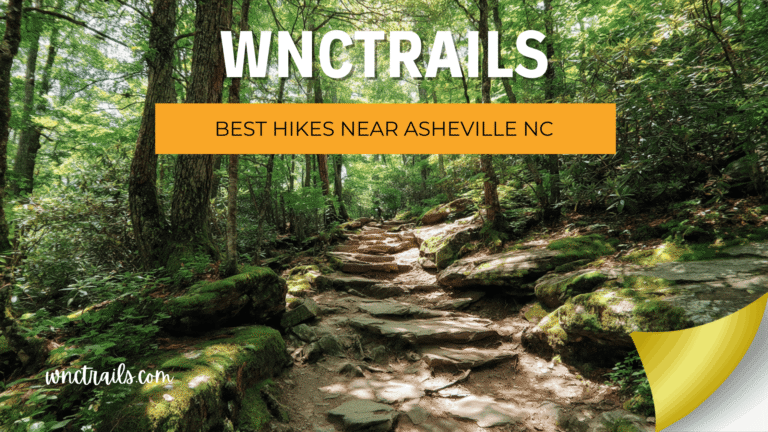
The Best Waterfall Hikes in Western North Carolina for Beginners (Locally Verified, Season-Ready)
Recommended Tools
Disclosure: This page may contain affiliate links.
- Hiking Shoes ” Check current pricing
- Daypack ” Check current pricing
- Trekking Poles ” Check current pricing
Planning the best waterfall hikes in Western North Carolina sounds simple — until you arrive at a trailhead expecting a leisurely stroll and find a steep, root-tangled climb that nowhere mentioned. It happens constantly. Trail apps pull ratings from thousands of users with wildly different fitness levels, leaving “easy” and “brutal” sitting side by side in the same review thread.
At WNC Trails, every hike on this list has been walked by someone who lives here — rated against actual WNC terrain, not a national average, and checked for current conditions before you read a word. No guesswork. No surprises at mile two.
Here are eight waterfall trails that genuinely deliver what they promise.
Overview
Why Waterfall Hike Ratings in WNC Are Different (And Why It Matters)
Before you open a trail app and pick the first “easy” waterfall hike you find, it’s worth understanding why difficulty ratings in Western North Carolina so often mislead visitors.
WNC is not flat mountain country. Even short trails can involve off-camber roots, wet rock surfaces, and sudden elevation changes that national platforms never flag. A trail rated 3.5 stars “moderate” might include two dozen reviews from experienced trail runners who found it relaxing and three from beginners who turned back at the halfway point. The average tells you very little.
The Problem with Crowd-Sourced Ratings
On most trail apps, difficulty is crowd-sourced — meaning hundreds of conflicting data points get averaged into a single label. There is no local calibration for WNC’s terrain, no seasonal adjustment, and no distinction between a trail in dry October conditions and the same trail after three days of April rain.
This became especially visible after Hurricane Helene in September 2024, when dozens of WNC waterfall trails were physically damaged or closed — but continued to show as open on national platforms for weeks. Visitors drove hours to trailheads that no longer existed as described.
How WNC Trails Rates Difficulty
WNC Trails uses a four-level system built specifically for this region. Every trail is physically walked by a local team member, rated against WNC terrain standards — not imported USFS categories — and updated after significant weather events or seasonal changes. When a trail earns an “Easy” rating here, it means a first-time hiker in reasonable fitness can complete it comfortably, in the current season, under current conditions.
That distinction is the whole point.
WNCT
Best Time to Visit: Seasonal Conditions for WNC Waterfall Hikes
WNC waterfall hikes change dramatically across four seasons. The same trail that is a straightforward spring afternoon can become a slick, flooded scramble in late winter or a parking nightmare on a July Saturday. Knowing when to go is as important as knowing where.
Spring (March–May): Peak Flow and Mud Season
Spring is the most dramatic time to visit WNC’s waterfalls. Snowmelt combined with spring rainfall pushes water volume to its annual peak — falls that trickle in August roar in April. The trade-off is trail surfaces. WNC trails get genuinely muddy after rain, and creek crossings that are knee-deep in a dry month can become impassable in a wet one.
WNC Trails publishes mud-season surface warnings on individual trail listings. Check the listing the night before you leave, not the morning you arrive.
Summer (June–August): Escape the Heat, But Plan Your Timing
Summer draws the largest crowds to WNC waterfall trails — for good reason. The cool microclimate near a 75-foot drop is a genuine escape when the valley is sitting at 90°F. Water levels drop but remain impressive at most popular falls. The real challenge is parking.
At DuPont State Recreational Forest, Looking Glass Falls, and Sliding Rock, lots fill before 9am on summer weekends. Weekday visits or arrivals before 8am are not optional advice — they are the difference between a peaceful hike and a frustrating one.
Fall and Winter: Fewer Crowds, Often Overlooked
October is arguably WNC’s most underrated month for waterfall hikes. Foliage frames the falls with colour, crowds thin significantly after the first cool weekend, and trails are typically in their best surface condition of the year. Winter brings ice formations at higher elevations — spectacular on a clear day, closed-road dangerous if you haven’t checked Blue Ridge Parkway access status before driving.
WNC Trails publishes monthly access updates through winter. Always confirm before making a long drive.
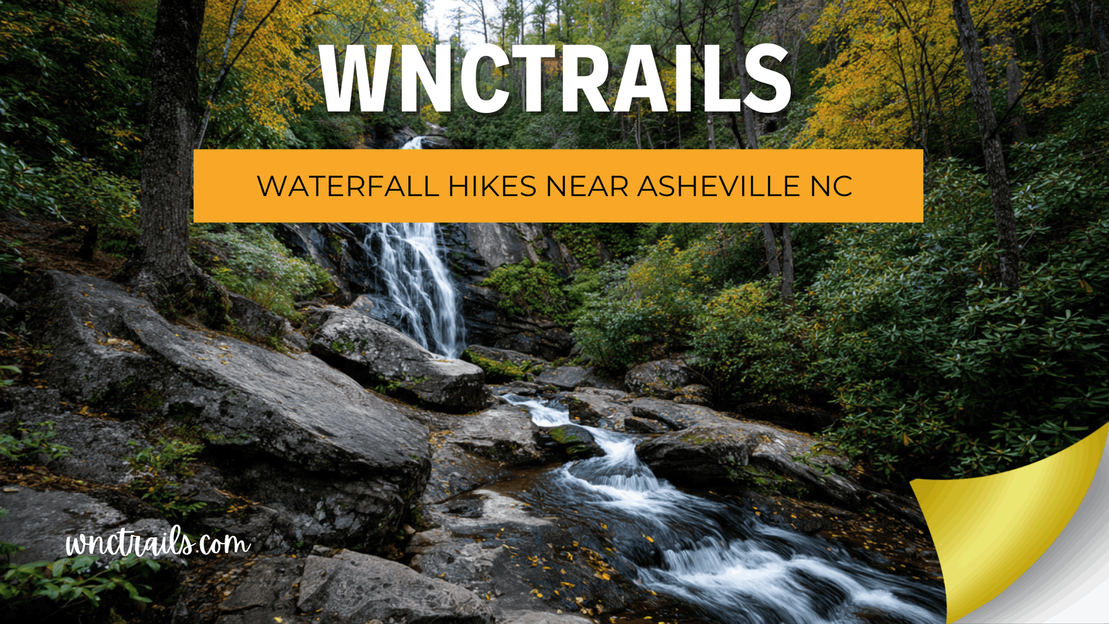
The 8 Best Waterfall Hikes in Western North Carolina for Beginners
Each trail below has been locally verified for difficulty, trailhead logistics, and current seasonal conditions. Ratings reflect WNC terrain — not national averages.
1. Looking Glass Falls — Pisgah National Forest
WNC Trails Difficulty: Easy / Accessible Distance: Under 0.1 miles · Elevation gain: Minimal
Looking Glass Falls is the most accessible waterfall in Pisgah National Forest — a 75-foot drop visible from a paved, ADA-accessible viewing area reached in under two minutes from the parking lot. This is the ideal first waterfall for visitors who want maximum visual payoff with minimal exertion, or for families with young children and pushchairs.
Trailhead: US-276 at Looking Glass Falls pullout. Pisgah National Forest day-use fee applies. Parking fills fast on summer weekends — arrive before 9am or after 4pm for a comfortable visit. Weekday visits in summer are significantly calmer.
Last verified: Spring 2026. Condition: Good. No access restrictions.
2. Hooker Falls — DuPont State Recreational Forest
WNC Trails Difficulty: Easy Distance: 0.5 miles round trip · Elevation gain: Negligible
The most beginner-friendly trail inside DuPont, Hooker Falls follows a wide, well-maintained path that is almost entirely flat. The falls themselves are a broad, photogenic drop into a swimming hole popular with locals in summer. In dry conditions, the path is suitable for pushchairs. Most visitors pair this with Triple Falls for a half-day DuPont outing.
Trailhead: Hooker Falls parking area off DuPont Road. Arrive before 9am on summer weekends. No permit required, but parking fills completely by mid-morning on Saturdays.
Last verified: Spring 2026. Condition: Good. Trail surface dry.
3. Triple Falls — DuPont State Recreational Forest
WNC Trails Difficulty: Easy-Moderate Distance: 2.2 miles round trip · Elevation gain: 300ft
Three distinct cascades visible from a single overlook make Triple Falls the highest photography payoff per mile in WNC. The trail involves a real but manageable climb on the return — most first-time hikers complete it comfortably in 90 minutes. The overlook platform is safe and well-maintained.
Trailhead: Hooker Falls parking area (same as above) or High Falls parking area for a slightly shorter approach. Trail surface can be slick after rain — traction footwear is recommended from March through May. Weekday visits are strongly preferred if parking is a concern.
Last verified: Spring 2026. Condition: Good. Post-rain surface caution in effect through April.
4. Graveyard Fields — Upper and Lower Falls, Blue Ridge Parkway
WNC Trails Difficulty: Easy-Moderate Distance: 3.2 miles for full loop · Elevation gain: 400ft
Graveyard Fields sits at 5,120 feet — noticeably cooler than valley trails even in midsummer, making it an excellent escape during hot weather. The full loop visits both Upper and Lower Yellowstone Falls through open meadow and stream-side terrain. Lower Falls is reachable in under a mile with minimal elevation change; the upper falls require the full loop.
Trailhead: Blue Ridge Parkway Milepost 418.8. The BRP access road can close without notice in winter and early spring — always check BRP road status at nps.gov/blri before driving. This is one of WNC’s most visited waterfall hikes; autumn weekends are extremely busy. Arrive before 8am if visiting in October.
Last verified: Spring 2026. Condition: Good. BRP open.
5. Catawba Falls — Old Fort
WNC Trails Difficulty: Easy-Moderate Distance: 2.5 miles round trip · Elevation gain: 450ft
Catawba Falls is one of the best first WNC waterfall hikes for out-of-state visitors driving in from Charlotte, the Piedmont, or the South Carolina upstate — the trailhead sits just off Interstate 40 at Old Fort. Two falls reward the effort: a large lower falls accessible to most hikers, and a more dramatic upper falls that requires a brief, optional scramble.
The trail was re-routed near the main creek crossing following storm damage in 2024. The new routing is clearly signed. Confirm current access at wnctrails.com before visiting, as conditions near water crossings vary significantly by season.
Last verified: Spring 2026. Condition: Good. Updated routing in place — check listing for current notes.
6. Skinny Dip Falls — Blue Ridge Parkway
WNC Trails Difficulty: Easy Distance: 0.4 miles round trip · Elevation gain: Minimal
One of the few genuinely swimmable waterfall hikes in WNC, Skinny Dip Falls drops into a series of natural pools cold enough to be refreshing even in late August. The trail is short enough for almost any fitness level. It is enormously popular with Asheville locals on summer weekdays, which is worth knowing before you plan a quiet morning visit.
Parking: The dedicated trailhead pull-off holds approximately 10 vehicles. Overflow parking is available at the Looking Glass Rock Overlook, 0.3 miles north — walk the shoulder or the parallel forest path to the trailhead. Do not park on the BRP carriageway.
Last verified: Spring 2026. Condition: Good. Swimming accessible.
7. Bridal Veil Falls — Highlands Area
WNC Trails Difficulty: Easy Distance: 0.2 miles walk-in · Drive-through also available
At 120 feet, Bridal Veil Falls is one of the most dramatic roadside waterfalls in the state. The walk-in path from the US-64 pullout is short, flat, and paved — suitable for all ages and fitness levels. A historic drive-through route allowed vehicles to pass behind the falls; road configuration has changed over the years, so use the walk-in access path to avoid a mist-soaked windshield on the wrong day.
Located near Highlands, NC — worth combining with Dry Falls (a short drive east on US-64) for a half-day waterfall tour of the Cullasaja Gorge corridor.
Last verified: Spring 2026. Condition: Good.
8. Lover’s Leap Falls — Hot Springs
WNC Trails Difficulty: Easy-Moderate Distance: 2.4 miles round trip · Elevation gain: 350ft
The trail to Lover’s Leap Falls passes through the Appalachian Trail corridor, giving first-time visitors an honest feel for what AT hiking in WNC involves — rooted, forested, and rewarding — without the full commitment of an AT day hike. Hot Springs is a genuine trail town with food and accommodation, making this an ideal base for a first WNC hiking weekend.
Trailhead: Hot Springs town trailhead off Bridge Street — free parking. Do not use the private commercial lot on the main street; it is not affiliated with trail access. Confirm the correct lot on the wnctrails.com listing before arrival.
Last verified: Spring 2026. Condition: Good. AT through-hiker traffic increases March onward.
What to Bring: Beginner Packing List for WNC Waterfall Hikes
WNC waterfall trails are short by mountain standards — but they are still mountain trails. These are the non-negotiables before you leave the car.
Water. A minimum of two litres per person. WNC summer humidity causes most visitors to underestimate how much they sweat on even a short climb.
Footwear with grip. Trail shoes or hiking boots are strongly recommended over running shoes or sandals. Waterfall approach paths are wet rock year-round — traction matters at the last 50 metres of every hike on this list.
A rain layer. WNC afternoon thunderstorms are routine June through August. They build fast and clear fast, but a lightweight shell keeps a 45-minute shower from ending your day.
Charged phone with offline maps. Cell signal is unreliable inside Pisgah and Nantahala National Forests. Download the relevant area on your maps app before you leave accommodation.
Check Conditions Before You Go
The single most useful thing you can do the night before any WNC waterfall hike is to check the trail listing on wnctrails.com. After significant rainfall, post-storm clean-up, or seasonal closures, our team updates condition flags before they affect you on the trail. Five minutes of checking saves a wasted three-hour drive.
For any hike on the Blue Ridge Parkway, also check BRP road status at nps.gov/blri — the Parkway closes sections without advance notice during poor weather.
Beyond the Beginner List: Waterfall Hikes to Grow Into
Once the eight routes above feel familiar, WNC’s waterfall country opens into something more serious. Rainbow Falls in Gorges State Park (7.2 miles round trip) rewards hikers willing to earn the view with a sustained climb to one of the tallest free-falling waterfalls in the eastern United States. Whitewater Falls, straddling the North Carolina–South Carolina border, is one of the highest cascades in the East and involves a trail system few visitors bother to fully explore. High Falls on the Green River runs through a gorge that most people driving US-176 have never stopped to find.
These are not beginner hikes — but they are exactly what the trail skills you build on this list prepare you for.
You Now Know What Most Visitors Don’t
Western North Carolina’s best waterfall hikes reward the hikers who show up prepared — with the right difficulty rating, honest trail conditions, and a parking plan that doesn’t end in a full lot at 9am. Every route on this list has been verified on the ground so you spend your trip at the falls, not troubleshooting it.
There are hundreds more routes where these came from. Pisgah, DuPont, the Blue Ridge Parkway, the hidden corners of Nantahala — WNC’s waterfall country runs deeper than any single list can hold.
Ready to find your perfect trail? Browse the full WNC Trails database at wnctrails.com — filter by difficulty, location, and current seasonal conditions to find exactly the hike you’re looking for. Or start with our locally verified waterfall trail listings and go from there.
The mountains are waiting. You just need a route you can trust.
Key Considerations
Choosing the right waterfall hike near Asheville depends on several factors:
- Trail Difficulty: Trails range from flat, paved paths to rugged, rooty climbs. Always check distance, elevation gain, and trail surface before heading out.
- Accessibility: Some waterfalls are visible from the road or require minimal walking, while others may involve creek crossings or steep sections. If accessibility is a priority, Looking Glass Falls and Hooker Falls are good options.
- Seasonal Conditions: Water flow is typically strongest in spring after rains, but trails can be muddy or slippery. Summer brings lush greenery, while autumn offers colorful foliage. Some areas may close in winter due to ice hazards or maintenance.
- Parking and Crowds: Popular trails can fill up quickly, especially on weekends and holidays. Arriving early or visiting on weekdays can help avoid crowds. Always park in designated areas and respect local regulations.
- Safety: Rocks near waterfalls are often wet and slippery. Stay on marked trails, supervise children closely, and avoid swimming unless signs indicate it is safe and permitted.
- Leave No Trace: Pack out all trash, stay on established paths, and avoid picking plants or disturbing wildlife. This helps keep trails beautiful for everyone.
Before setting out, check for recent trail reports or closures on official forest or park websites. Weather can change quickly in the mountains, so bring appropriate layers, water, and navigation tools.
Common Use Cases
Waterfall hikes near Asheville NC are popular for a range of outdoor activities and interests:
- Family Outings: Short, accessible trails like Moore Cove Falls and Hooker Falls are ideal for children and multi-generational groups.
- Photography: Early morning and late afternoon provide the best lighting for waterfall photos. Many falls are photogenic year-round, with mist and rainbows common after storms.
- Picnics: Several trailheads and waterfall areas offer picnic tables or scenic spots to enjoy a packed lunch.
- Fitness Hikes: Longer routes, such as the hike to Rainbow Falls in Gorges State Park, provide a more challenging workout for experienced hikers.
- Nature Study: The diverse ecosystems along these trails support wildflowers, ferns, mosses, and a variety of birds and insects. Interpretive signs at some locations add educational value.
- Cooling Off: In summer, misty falls and cool mountain streams offer natural respite from the heat. However, always check posted rules about swimming and wading, as conditions can be hazardous.
Whatever your motivation, theres a waterfall hike near Asheville that fits your needs and skill level. Trail maps and detailed guides are available at local visitor centers and online for additional planning.
Frequently Asked Questions
- How far are the closest waterfall hikes from Asheville?
Several popular waterfall hikes are within 30“45 minutes of downtown Asheville. Options like Looking Glass Falls and Moore Cove Falls are among the quickest to reach. - Are the trails suitable for young children or strollers?
Some trails, like the path to Looking Glass Falls, are stroller-friendly. Others may be too steep or uneven for wheels. Always review trail descriptions for accessibility details. - Is swimming allowed at area waterfalls?
Swimming is permitted at some locations, such as Hooker Falls, but is prohibited or unsafe at others due to strong currents, slippery rocks, or hidden hazards. Obey all posted signs and never swim above or directly beneath waterfalls. - When is the best time of year to visit waterfall hikes near Asheville NC?
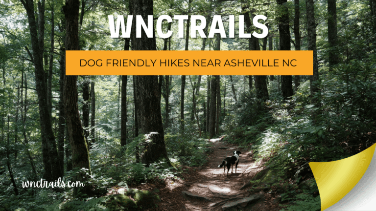
Spring offers the highest water flow and wildflowers, summer provides lush foliage and cooler forest temperatures, fall features colorful leaves, and winter can bring dramatic frozen falls. Each season has unique appeal, but always check weather and trail conditions. - Are dogs allowed on the trails?
Most public trails near Asheville allow leashed dogs, but some areas may have restrictions. Always clean up after your pet and keep them under control near cliffs or water. - Do I need a permit or have to pay a fee?
Most waterfall hikes near Asheville are free to access, though some parks may charge for parking or require permits for group use. Check current regulations before you go. - Where can I find reliable trail maps and updates?
Official forest service websites, local ranger stations, and reputable hiking apps are good sources for up-to-date maps and trail conditions. The WNC Trails website also offers curated guides and seasonal tips.
For those seeking memorable outdoor experiences, waterfall hikes near Asheville NC deliver both natural beauty and a refreshing escape into the Blue Ridge Mountains. With careful planning and respect for the environment, these trails provide enjoyment for hikers of all backgrounds and skill levels.