Trail status (checked September 2026) — conditions change; confirm with the managing agency before you go.
- Mount Mitchell State Park is open but reachable only from the Asheville side of the Blue Ridge Parkway while Helene repairs continue north of the park. A section of the Old Mitchell Trail (park office to the Camp Alice Trail junction) and several connecting Pisgah National Forest trails were still closed. Source: NC State Parks
If you’re looking for hard Mount Mitchell and Burnsville hikes, you already know the easy loops around the visitor center aren’t going to cut it. This part of the Black Mountains has some of the highest, most exposed, and most physically demanding terrain in Western North Carolina, and picking the wrong trail for your fitness level or the weather window you have can turn a good day into a miserable one. This page breaks down the trails in this cluster that actually earn the “strenuous” label, what makes each one hard in a different way, and how to prepare realistically. We’re not padding this list with moderate walks dressed up as challenges — if a trail here is listed as hard, it’s because elevation, exposure, distance, or terrain genuinely justify it.
The Hardest Trails in the Mount Mitchell and Burnsville Area
1. Mount Mitchell Trail (5.6 miles one way, Strenuous)
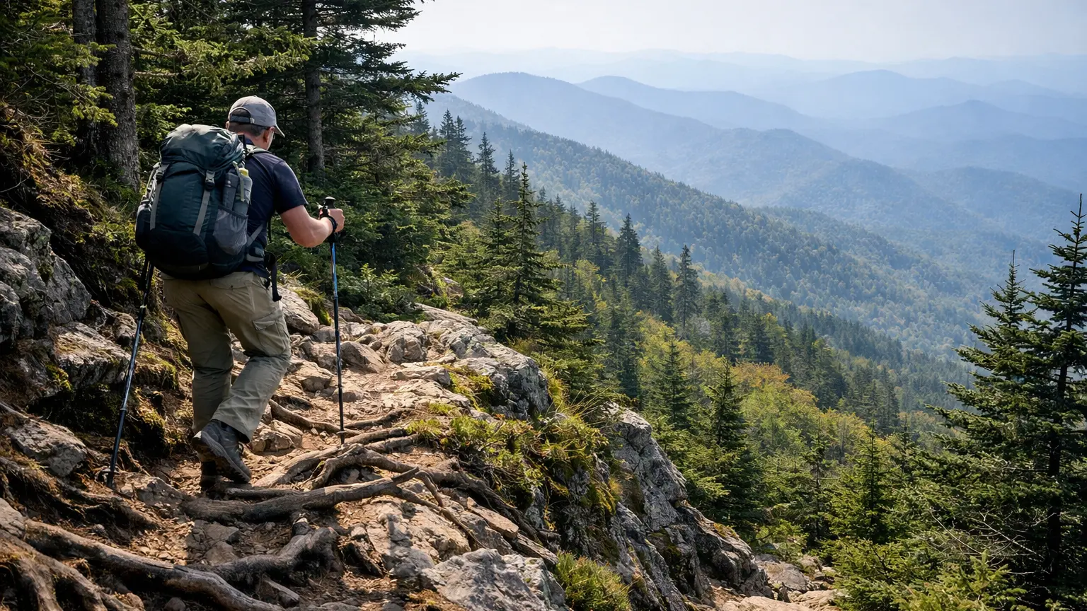
This is the trail most people mean when they say they’ve “done Mount Mitchell the hard way.” At 5.6 miles one way, it climbs to the summit of the highest peak east of the Mississippi, and the elevation gain over that distance is relentless — there’s no long flat stretch to recover on. What makes it worth the effort is the sense of actually earning the summit rather than driving up and walking a few hundred feet from a parking lot. Expect rooty, rocky footing for long sections and a real change in temperature and wind exposure as you climb.
2. Black Mountain Crest Trail (11.3 miles one way, Strenuous)
This is the big one. At 11.3 miles one way, the Crest Trail crosses multiple peaks above 6,000 feet, which means sustained high-elevation hiking with repeated climbs and descents rather than one summit push. It’s a serious undertaking for a day hike and often treated as a point-to-point or backpacking route by experienced hikers. The payoff is a string of high-elevation views and a genuine sense of traversing the spine of the Black Mountains, but this is not a trail to underestimate — weather changes fast up there, and the mileage adds up quickly with the elevation involved.
3. Camp Alice Trail (0.5 miles one way, Strenuous)
Don’t let the short distance fool you. Camp Alice Trail packs a strenuous rating into half a mile, which tells you the grade is steep and the footing likely rough for its length. It’s a useful option if you want a hard, short burst of climbing — for example, as a connector piece within a longer day that also includes Old Mitchell Trail or the summit trail — rather than a standalone hard hike. Hikers building a tougher loop in this area often use it to link sections rather than hiking it in isolation.
4. Mountains-to-Sea Trail (Black Mountains section) (22.9 miles one way, Strenuous)
This section of the MST is in a different category from the others on this list — it’s a long-distance strenuous route through the Black Mountains, not a single day-hike loop for most people. At 22.9 miles one way, it’s realistically a multi-day backpacking stretch or an extremely ambitious single-push day for very fit, well-prepared hikers. We’re including it here because it genuinely belongs in the “hard hikes” conversation for this area, but it deserves its own planning process — food, water, and overnight logistics — separate from a typical day-trip mindset.
How We Ranked These
We didn’t just pull the “strenuous” tag and call it a list. A few things went into how these are ordered and described:
- Sustained difficulty vs. short intensity. Mount Mitchell Trail and the Crest Trail demand sustained effort over miles; Camp Alice Trail is intense but brief. We separated these so you can match the trail to the kind of hard day you actually want.
- Distance-to-commitment ratio. The Mountains-to-Sea Trail’s Black Mountains section is technically “strenuous” but its 22.9-mile length changes the entire nature of the commitment compared to a 5.6-mile day hike. We ranked and described it accordingly rather than lumping it in as a casual day option.
- Elevation exposure. Trails that cross or approach peaks above 6,000 feet carry weather and exposure risks that flatter strenuous trails don’t. That’s a real factor in how hard a hike feels on the ground, not just what the mileage suggests.
- Real-world usability. We considered whether a trail works as a standalone hard hike or functions better as part of a longer route (like Camp Alice Trail), since that changes how you’d actually plan your day.
Parking and Trailhead Reality
Mount Mitchell State Park sees heavy visitation, especially around the summit area, and parking near the main trailheads can fill up faster than people expect, particularly on weekends. If you’re aiming for the Mount Mitchell Trail or planning to link it with Camp Alice Trail or Old Mitchell Trail, arriving early gives you a much better shot at a spot close to your starting point. For the Black Mountain Crest Trail and the Mountains-to-Sea Trail’s Black Mountains section, trailhead access points can be more spread out and less developed, so check current conditions and access details before you go rather than assuming a paved lot will be waiting for you.
Seasonal Notes
Elevation changes everything up here. Even when Burnsville and the surrounding valleys are mild, the higher sections of these trails — especially anything approaching the 6,000-foot peaks on the Crest Trail or the Mount Mitchell summit — can be significantly colder, windier, and icier than what you’d expect based on the forecast at the base. Fall brings leaf-season crowds to the more accessible trails, which can mean busier trailheads and more foot traffic on Mount Mitchell Trail specifically. Winter conditions at elevation can include ice and snow that linger longer than in the surrounding lowlands, which matters a lot on a trail like Mount Mitchell Trail or the Crest Trail where footing is already demanding. Always check current conditions before heading out, especially for anything above 6,000 feet.
What to Bring
For any of these hard hikes, layers matter more than almost anything else you pack — temperature swings between the trailhead and the higher elevations can be dramatic, even outside of winter. Sturdy footwear with real ankle support is worth it given the rocky, rooty terrain common to Mount Mitchell Trail and sections of the Crest Trail. Carry more water than you think you’ll need, since there’s limited reliable access along the longer routes like the Crest Trail and the Mountains-to-Sea Trail section. If you’re attempting the Mountains-to-Sea Trail’s Black Mountains section as a multi-day trip, that requires its own separate planning for overnight gear, food, and water resupply — treat it as a backpacking trip, not a long day hike, unless you’re an experienced ultra-distance hiker.
Frequently Asked Questions
What is the hardest hike near Mount Mitchell?
Based on the verified trail data for this cluster, the Black Mountain Crest Trail (11.3 miles one way, strenuous) and the Mountains-to-Sea Trail’s Black Mountains section (22.9 miles one way, strenuous) are the most demanding in terms of sustained distance and elevation exposure. Mount Mitchell Trail is also strenuous but shorter and more commonly done as a single day hike.
Can I hike to the summit of Mount Mitchell on a hard trail instead of driving?
Yes — the Mount Mitchell Trail (5.6 miles one way, strenuous) climbs directly to the summit and is the main option for hikers who want to earn the peak on foot rather than accessing it by road.
Is the Black Mountain Crest Trail doable as a day hike?
At 11.3 miles one way with multiple peaks above 6,000 feet, it’s a long and demanding day for most hikers, especially if done as an out-and-back or requiring a shuttle for a point-to-point hike. Fitness level, weather, and daylight hours should all factor into whether this is realistic for you on a given day.
Is Camp Alice Trail a good standalone hard hike?
It’s short at 0.5 miles one way, but its strenuous rating means the grade is steep for its length. Many hikers use it as a connector to build a longer, more varied route rather than treating it as a destination on its own.
Do I need backpacking gear for the Mountains-to-Sea Trail section here?
Given its 22.9-mile one-way length, this section is generally approached as a multi-day trip rather than a single day hike for most people, which means overnight gear, water planning, and food supply become real considerations rather than optional extras.
Ready to compare these against every other trail in the area? Browse the full WNC Trails directory to filter hikes near Mount Mitchell and Burnsville by difficulty, distance, and reported conditions at WNC Trails directory. As always, check current conditions before you head out — elevation and weather up here can change the difficulty of a trail more than the map ever will.
Related Pages
- Long Mount Mitchell And Burnsville Hikes
- Family Friendly Mount Mitchell And Burnsville Hikes
Want more routes in this area? See our complete guide to Mount Mitchell and Burnsville hikes.