DuPont State Recreational Forest gets crowded for a reason — it packs an unusual number of waterfalls, rock outcrops, and multiuse trails into one forest, and almost all of it is reachable without a brutal climb. The question isn’t whether DuPont is worth a visit. It’s which trail actually fits what you want out of the day: a quick waterfall stop on the way through Transylvania County, a longer loop to stretch your legs, or something dog- and kid-friendly that won’t turn into a three-hour slog. This guide breaks down the best DuPont State Recreational Forest hikes by what they actually deliver, using only verified trail data, so you can pick a route before you’re standing in a gravel lot trying to decide.
The Best DuPont State Recreational Forest Hikes
1. Hooker Falls Trail (0.4 mi)
This is the trail most people do first, and for good reason. At 0.4 miles and foot traffic only, it’s short enough to knock out in flip-flops but still ends at a genuinely photogenic waterfall with a swimming hole below it. If you’ve only got twenty minutes in DuPont, this is where to spend them.
2. Triple Falls Trail (0.4 mi)
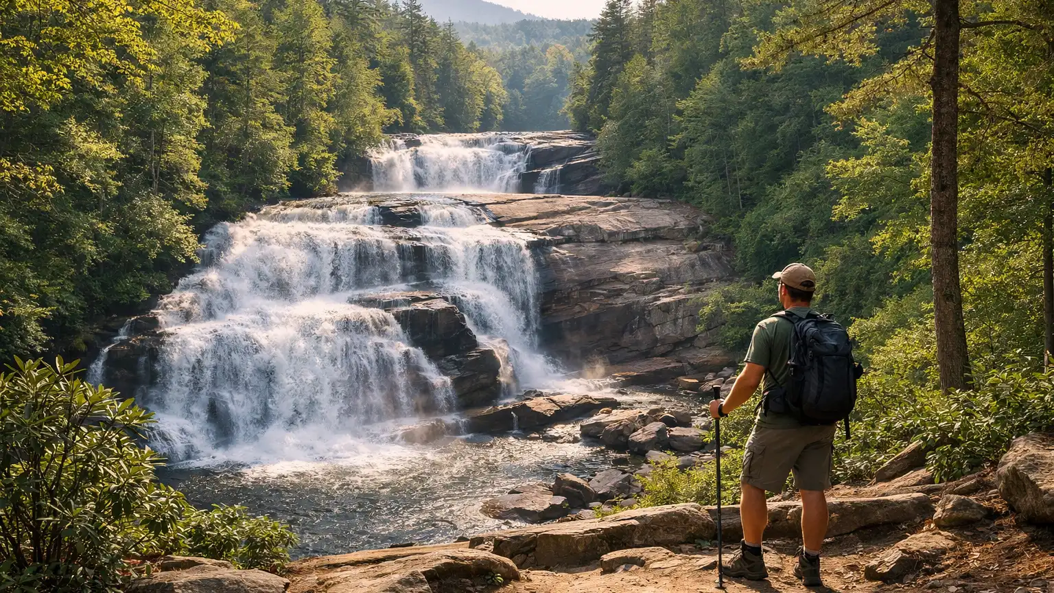
Also 0.4 miles, also foot traffic only, and arguably the most photographed waterfall in the forest thanks to its three-tiered drop. It connects easily to Hooker Falls, so most hikers treat these two as a single short outing rather than separate trips.
3. Grassy Creek Falls Trail (1.0 mi)
A step up in length at 1.0 mile, still foot traffic only. It sees noticeably fewer people than Hooker or Triple Falls, which makes it a solid pick if you want a waterfall payoff without the crowd standing next to you at the viewpoint.
4. High Falls Loop (approximately 2 mi loop)
At roughly 2 miles round trip, this loop is the middle-distance option for people who want more than a quick waterfall stop but aren’t looking for a half-day commitment. It’s a waterfall-focused loop, and the extra distance compared to Hooker or Triple Falls tends to thin out the foot traffic.
5. Bridal Veil Falls Road (0.6 mi)
A 0.6-mile route to another waterfall, distinct from the trail-only paths in that it follows a road corridor. It’s an easy add-on if you’re already in the area and want another falls without much extra walking.
6. Wintergreen Falls Trail (0.5 mi)
Short at 0.5 miles, and one of the quieter waterfall trails in the forest. If your priority is avoiding weekend crowds while still getting a waterfall on the itinerary, this is worth building into a loop with the other falls trails.
7. Cascade Loop (3.1 mi)
A 3.1-mile multiuse loop that gives you real distance without leaving the forest’s core waterfall zone entirely. It’s a good option if you want to hike, bike-share-friendly terrain, or just cover more ground than the short falls trails allow.
8. Corn Mill Shoals Trail (2.7 mi)
At 2.7 miles, this multiuse trail is a solid choice for hikers who want mileage without committing to the forest’s longest routes. It’s also useful for stringing together with other multiuse trails if you’re building a longer loop for the day.
These eight cover the range from a fifteen-minute waterfall detour to a half-day loop. If you want more distance still, Reasonover Creek Trail (3.5 miles) and Turkey Knob Trail (4.5 miles, usable as an out-and-back to the bridge closure 0.5 miles from the Pinnacle Mountain gate) are the longest options in the forest, though they’re multiuse routes without the waterfall payoff of the trails above. Big Rock Trail (0.9 mi) rounds out the shorter multiuse options if you want something brief that isn’t a waterfall trail.
How We Ranked These
We didn’t rank these hikes by popularity alone — a trail being busy on Instagram doesn’t mean it’s the best fit for your day. Here’s what actually drove the order above:
- Scenic payoff relative to distance. Hooker Falls and Triple Falls rank high because you get a full waterfall experience for a 0.4-mile walk. That ratio matters more than raw scenery alone.
- Crowd levels relative to accessibility. The most accessible trails are also the most crowded. We factored in quieter alternatives like Grassy Creek Falls and Wintergreen Falls for hikers who want the waterfall experience without the foot traffic.
- Trail type and use restrictions. Several of DuPont’s best-known waterfall trails are foot traffic only, which changes the experience compared to the multiuse trails that also see mountain bikes and horses. We noted this explicitly rather than lumping every trail together.
- Distance flexibility. We tried to cover the full range from under half a mile to multi-mile loops, since “best” depends heavily on how much time and energy you’re bringing to the forest that day.
Parking and Trailhead Reality
DuPont has multiple access points — Hooker Falls, Lake Imaging, Fawn Lake, and others — and which one you use changes which trails are quickest to reach. The Hooker Falls access area fills up fast on weekends and during leaf season, sometimes well before midday, since it’s the entry point for three of the most popular waterfall trails in the forest. If you’re aiming for Hooker Falls, Triple Falls, or High Falls Loop on a Saturday, plan on an early arrival or a backup plan. Some access roads into the forest are gravel, and while they’re generally passable in a standard vehicle, conditions can shift after heavy rain. Check current conditions before you go, especially if you’re driving something low to the ground or towing anything.
Seasonal Notes
Leaf season pulls serious crowds to DuPont, particularly to the waterfall trails clustered near Hooker Falls. If you’re set on hiking Hooker Falls Trail, Triple Falls Trail, or High Falls Loop during peak fall color, expect full lots and busy trail traffic — arriving early or hiking on a weekday makes a real difference. Winter brings a different set of considerations: waterfall overlooks and rock surfaces near the falls can ice over, and the longer multiuse trails like Cascade Loop or Corn Mill Shoals may have muddy or slick sections after rain or snowmelt. None of this means avoid DuPont in winter — it’s often quieter and genuinely beautiful — but check current conditions before heading to any of the waterfall-adjacent trails, since footing near moving water gets more serious when it’s cold.
Access Notes
A few practical details worth knowing before you commit to a route. The foot-traffic-only trails — Hooker Falls, Triple Falls, Grassy Creek Falls, and Wintergreen Falls — are not open to bikes or horses, which keeps them calmer but also means they’re the ones absorbing most of the hiker foot traffic. The multiuse trails, including Cascade Loop, Corn Mill Shoals, Reasonover Creek, Turkey Knob, and Big Rock, share the path with mountain bikers and equestrians, so stay aware on blind corners. If you’re planning to hike Turkey Knob Trail, note that the bridge is closed roughly half a mile from the Pinnacle Mountain gate — it’s still a usable out-and-back to that point, but it’s not currently a through-route, so don’t plan a loop around it without confirming current status first.
Frequently Asked Questions
What is the best short hike in DuPont State Recreational Forest?
Hooker Falls Trail and Triple Falls Trail are both 0.4 miles and foot traffic only, making them the quickest waterfall hikes in the forest. Most visitors combine both into a single short outing.
Which DuPont hike has the least crowds?
Grassy Creek Falls Trail (1.0 mi) and Wintergreen Falls Trail (0.5 mi) tend to see less foot traffic than the trails near the main Hooker Falls access area, based on general visitation patterns in the forest.
What’s the longest hike in DuPont State Recreational Forest?
Turkey Knob Trail is the longest at 4.5 miles, though a bridge closure roughly half a mile from the Pinnacle Mountain gate currently limits it to an out-and-back rather than a full through-route. Reasonover Creek Trail (3.5 mi) is the next longest option.
Are DuPont’s waterfall trails good for kids?
The short foot-traffic-only trails like Hooker Falls (0.4 mi) and Triple Falls (0.4 mi) are manageable distances for most kids, though the terrain near waterfalls can be uneven and rocks near the water get slippery — supervise closely near any overlook.
Do I need a permit to hike in DuPont State Recreational Forest?
Check current requirements directly before your visit, since access rules can vary by trailhead and time of year. We avoid guessing on fees or permit specifics here — confirm before you go.
Ready to plan your route? Browse every verified trail near DuPont in the WNC Trails directory, filterable by distance, difficulty, and current conditions, at WNC Trails directory. And whichever hike you pick, check current conditions before heading out — waterfall trails and gravel access roads can change fast after weather.
Related Pages
- Bike Friendly Trails In Dupont State Forest
- Best Dupont Hikes For Photography
Want more routes in this area? See our complete guide to DuPont State Recreational Forest hikes.