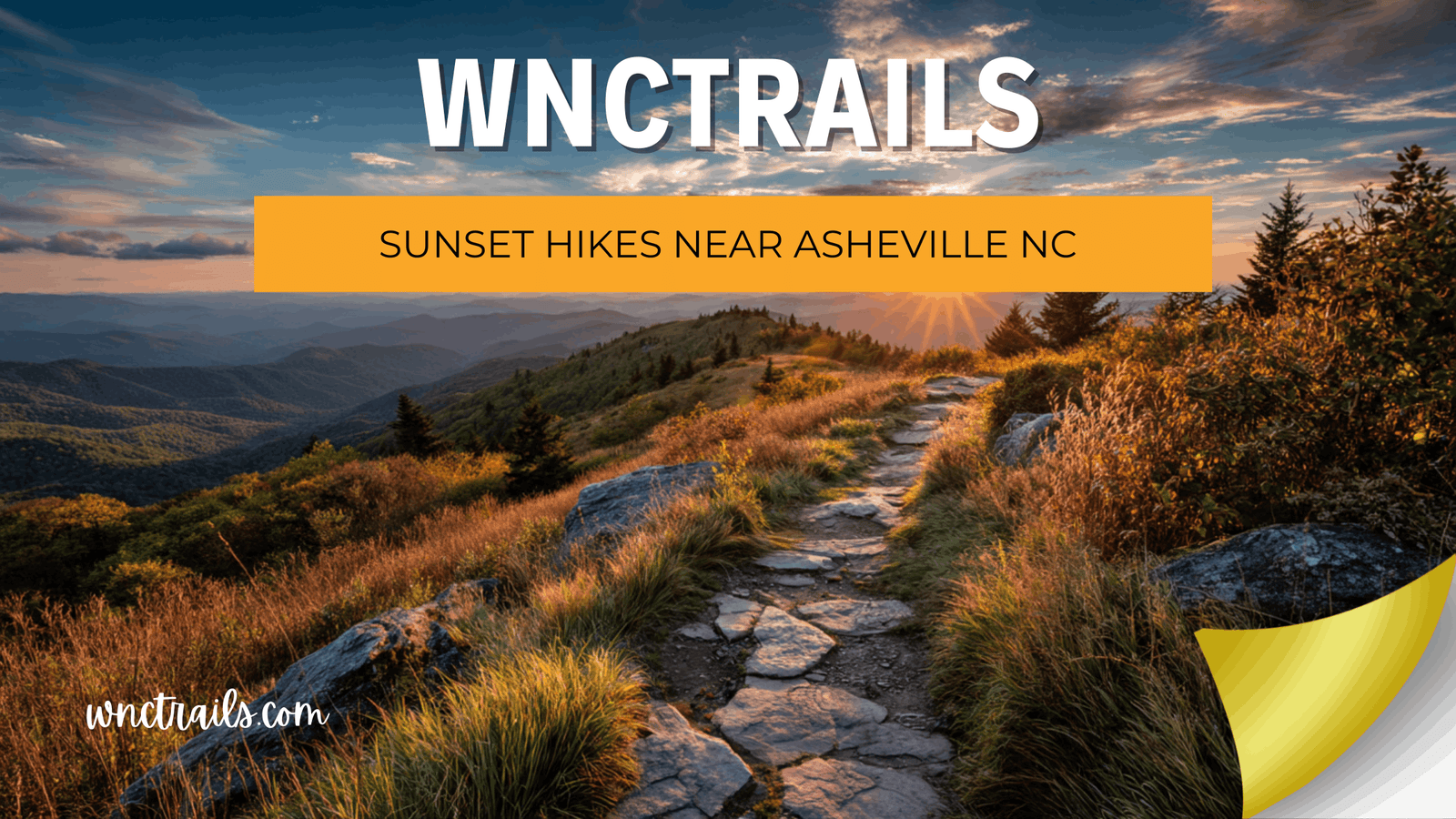
Watching the sun drop behind the Blue Ridge is one of the best reasons to hike near Asheville, but it comes with a timing problem: the same ridgelines and rock summits that give you the view also mean you’re walking back down loose rock, exposed roots, or narrow switchbacks with fading light. Some trails on this list are short enough to descend in near-dark with a headlamp and no real risk. Others have enough elevation change or rough footing that a sunset trip means planning your turnaround time carefully. This page breaks down which sunset hikes near Asheville NC are genuinely low-risk after dark, which require more caution, and what to actually bring so a beautiful evening doesn’t end with a twisted ankle on a rock ledge.
Best Sunset Hikes Near Asheville NC
1. Craggy Pinnacle Trail
This 0.7-mile trail is about a 20-minute walk to a 360-degree summit view, which makes it one of the most efficient sunset payoffs in the area. Because the round trip is short, you can time your ascent to arrive right before golden hour and still be back at the car with plenty of light left, or a short headlamp-lit walk if you linger for the last color in the sky.
2. Craggy Gardens Trail
A self-guided nature trail through a rhododendron bald with views toward Montreat and the Black Mountain Range, running 0.3 miles to the shelter or 0.5 miles to the picnic area. The moderate rating comes from some uneven footing rather than steep elevation, so it’s a reasonable pick if you want an easy out-and-back with a sunset view and minimal descent risk.
3. Max Patch Loop
Max Patch is a 360-degree grassy bald on the Appalachian Trail, reached by a short loop rated easy to moderate. There’s no tree cover to block the view in any direction, which is exactly why it’s popular for sunset — but it also means the small parking lot fills early, especially on fall weekends, so plan to arrive well before you actually want to start hiking.
4. Mount Pisgah Trail
At 1.3 miles one way, Mount Pisgah Trail is rated moderate to strenuous, with a steep, rocky second half leading to a summit view of the French Broad River valley. This one deserves real caution for a sunset trip: the rocky upper section is not somewhere you want to be picking your way down in full darkness, so budget enough buffer time to be off the steep part before the light is gone, even if that means leaving some of the sunset color behind.
5. Art Loeb Spur Trail
A short but strenuous 0.6-mile trail with about 200 feet of elevation change, leading to panoramic views reported up to 70 miles on a clear evening. The strenuous rating reflects the pitch of the climb more than the distance, so it’s manageable for a sunset outing if you’re comfortable with a steady, short uphill push and a headlamp-lit return.
6. John Rock Trail
This 1.8-mile trail with about 750 feet of elevation change ends at a granite dome overlooking the fish hatchery, Looking Glass Rock, and Pilot Mountain. The open rock summit makes for one of the better wide-sky sunset spots in the Pisgah Ranger District, but the elevation change means you should treat this as a hike that needs a real turnaround-time plan rather than a casual after-work walk.
7. Lookout Trail (Montreat)
Described as the most popular trail in Montreat, Lookout Trail is moderate to strenuous with mountaintop views at its peak. It’s a solid choice if you want a sunset hike that isn’t on the Blue Ridge Parkway and won’t compete with Parkway overlook traffic, though the moderate-to-strenuous rating means you should know your own pace before committing to a late start.
8. Lake Tomahawk Park Walking Trail
Not every sunset outing needs elevation. This 0.55-mile loop is the most-used amenity at Lake Tomahawk Park and is about as low-risk as a sunset walk gets — flat, short, and easy to finish even if you linger past the last light. It won’t give you a mountain panorama, but it’s a genuinely safe option on an evening when you don’t want to worry about descent conditions at all.
How We Ranked These
These trails were chosen and ordered based on three practical factors, not just how good the view is. First, descent safety after dark: trails with rocky, uneven, or steep sections near the summit rank as higher-caution picks, regardless of how good the payoff is. Second, realistic timing: shorter trails that let you reach the view close to sunset without a long approach are weighted favorably, since a long approach eats into your safety margin for the walk back. Third, crowd and access reality: a few of these, like Max Patch and the Graveyard Fields area nearby, are popular enough that parking becomes its own timing problem, which matters just as much as trail conditions when you’re trying to catch a specific window of light.
Parking and Trailhead Reality
Sunset hiking means arriving at trailheads during the exact window when everyone else has the same idea. Max Patch has a small lot that fills early, especially on fall weekends, and there’s no reliable overflow once it’s full. The Blue Ridge Parkway overlooks near Craggy Gardens and Craggy Pinnacle see similar pressure during peak color season, since drivers stop for the view and hikers are trying to park at the same pullouts. If you’re headed to any Parkway-adjacent trailhead for sunset, plan to arrive at least an hour before you want to start walking, and have a backup trail in mind if the lot is full — circling for a spot eats into the daylight you were counting on for a safe descent.
Weather and Conditions for Evening Hikes
Sunset itself moves earlier through fall and winter, which shortens your safety window even on short trails. A hike that felt comfortable to time in summer can leave you finishing in full dark by late fall if you don’t adjust your start time accordingly. Mountain weather also shifts fast near sunset — clear skies at the trailhead don’t guarantee clear skies at a summit a mile up, and wind picks up noticeably on exposed spots like Max Patch and the granite dome on John Rock Trail. Always check current conditions before you go, and treat any exposed overlook as colder and windier than the forecast for the valley below.
What to Bring for a Sunset Hike
A headlamp is the single non-negotiable item for any sunset hike near Asheville, even on the shortest trails — plan on using it for at least part of your walk back, not just as a backup. Bring more layers than you think you need, since temperatures drop fast once the sun is down, especially at elevation. Trekking poles are genuinely useful on anything with a rocky descent, like the upper half of Mount Pisgah Trail or the elevation change on John Rock Trail, where tired legs and dim light are a bad combination on loose footing. A charged phone with the trail route saved offline, plus telling someone your planned return time, covers the basics that matter most when you’re hiking with a deadline built into the itinerary.
Frequently Asked Questions
What’s the easiest sunset hike near Asheville if I don’t want to worry about the walk back?
Lake Tomahawk Park Walking Trail is the safest bet — it’s a flat 0.55-mile loop with no real descent risk, even if you stay past dark. Craggy Gardens Trail is a close second, with a short, gentle walk to a genuine mountain view.
Which sunset hike has the best payoff for the least effort?
Craggy Pinnacle Trail. At 0.7 miles to a 360-degree summit, it delivers one of the widest views on this list without a long approach or a difficult descent.
Is Max Patch worth it for sunset even with the parking situation?
The 360-degree bald view is one of the best in the region for sunset, but the small lot fills early, especially on fall weekends. If you want a reliable spot, arrive well before your planned hike time rather than timing your arrival to sunset itself.
Which trails on this list need the most caution for a dark descent?
Mount Pisgah Trail and John Rock Trail both involve real elevation change and rockier footing, so budget extra buffer time to be off the steepest sections before full darkness rather than counting on your headlamp alone.
Do I need a permit for any of these sunset hikes?
None of these trails require a permit based on current information, though group size and camping restrictions apply at Max Patch. Always check current conditions and any posted rules at the trailhead before you go.
If you want to compare these sunset hikes side by side, or filter every verified trail near Asheville by difficulty, distance, and current conditions, browse the full WNC Trails directory at /directory-category/trails-hiking/. As always, check current conditions before you head out, especially for anything involving elevation change or a timed descent after dark.
Related Pages
This guide is part of our best hikes near Asheville NC series, built only on officially verified trail data.